

Stovepipe
-
Posts
4,279 -
Joined
-
Last visited
Content Type
Profiles
Blogs
Forums
American Weather
Media Demo
Store
Gallery
Posts posted by Stovepipe
-
-
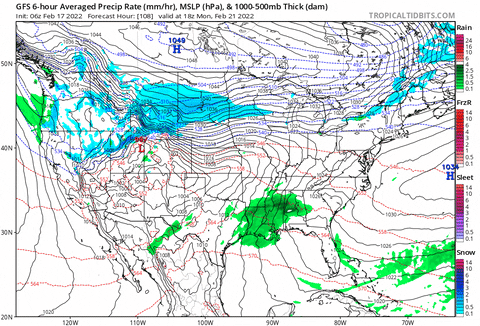
1 hour ago, Runman292 said:
Lol at "rarely looks at deterministic models".
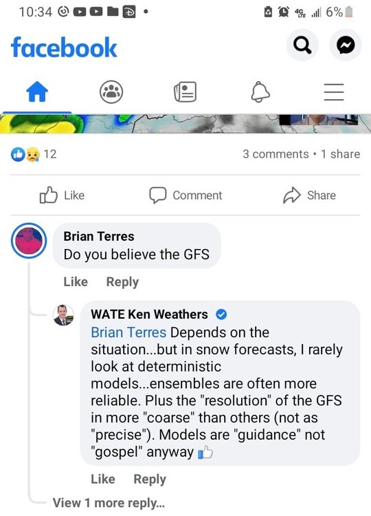
Super embarrassing frankly.

-
 2
2
-
-
-
Welp, I don't guess I'll be getting much sleep tonight. Been awhile since I got to stay up for a good storm. Beer and coffee it is!

-
10
-
-
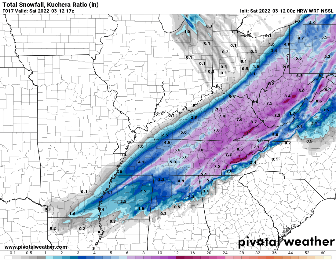
5 minutes ago, John1122 said:
Another of the hi-res Cams from 0z. Monster for nearly the whole forum area.

-
2
-
 1
1
-
 4
4
-
-
My mom sent some photos from Paris. Blizzard like conditions with the wind and it's piling up.
-
6
-
-
MRX lowered Knoxville's totals again. Now expecting a half inch tonight and an additional 1-2 tomorrow morning. That doesn't meet their stated warning criteria. Again, I'd like to know what they are seeing that we are not seeing.
-
2
-
 1
1
-
-
9 minutes ago, jrips27 said:
definitely a better run for most of y’all. Hell even gets an inch down my way
10:1 ratio
kuchera
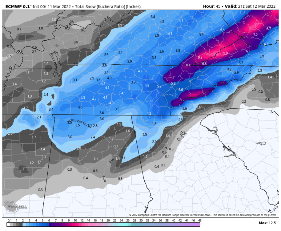
Much appreciated!


-
3
-
1
-
-
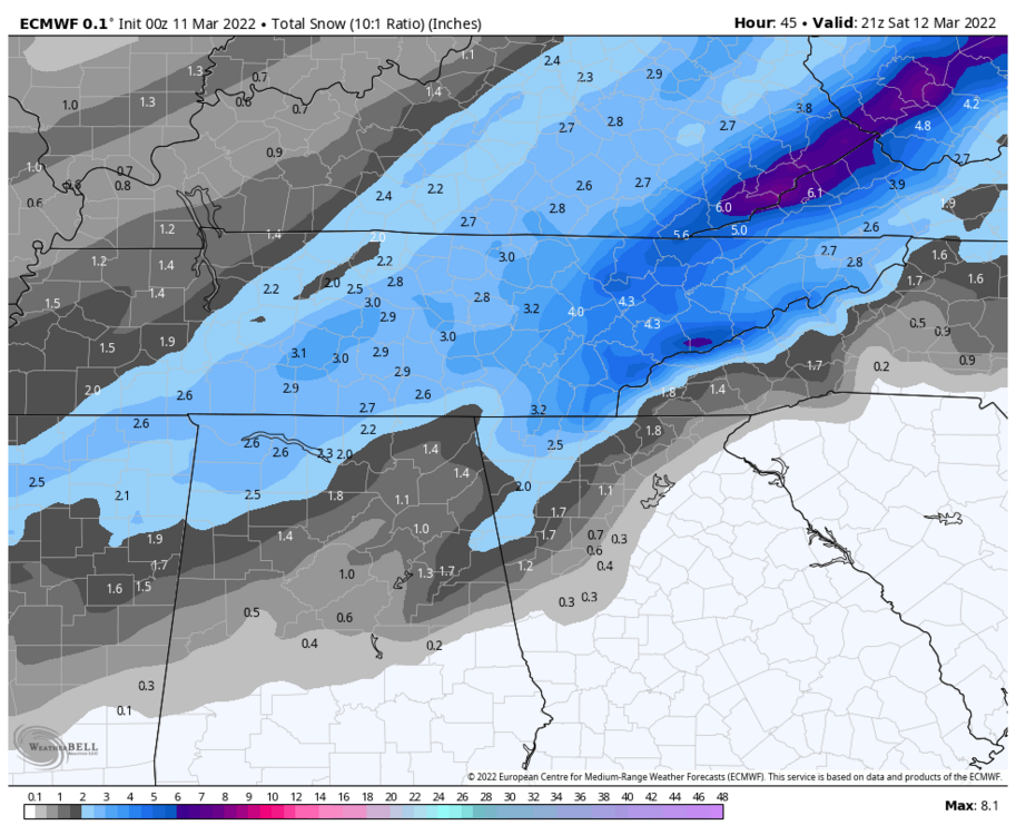
Anybody up for the Euro?

-
3
-
1
-
-
MRX have adjusted their expectations for Knoxville down, pray they don't adjust them further. This afternoon they were calling for 1-2 inches Friday night and an additional 1-2 inches Saturday. As of 11pm we see this:

Not even mentioning snow overnight Friday. So we went from 2-4 to 1-3. I'll never bet against them, but what are they seeing that we aren't?
-
5 hours ago, Holston_River_Rambler said:
The means, the means for the CMC, Euro, and GFS ensembles for the TN valley river systems are from 4.5 - 6.5 inches. I think flamingo man riding his floaty in front of the fellini Kroger was pretty much peak flood action in Knoxvegas in 2019. I think I was looking at the means that far out that year, so I'm going to go dredge up those posts and see how that looked. But lordy the 6z GFS gave me flashbacks with where the firehose was aimed. And it wasn't at fantasy range:
Fellini Kroger has it's own Twitter account lol.
https://twitter.com/FelliniKroger
-
5
-
-
1 hour ago, Holston_River_Rambler said:
I don't know that we had a storm thread for it (maybe I missed it) but the obs for this start on page 12:
That was a really fun event. Robert nailed it.
-
2
-
-
8 minutes ago, RawCrabMeat said:
This yellow band is absolutely amazing
Yep, it laid down about an inch of fluff here on top of the quarter inch or so we had from previous one. Glad it held together for you!
-
6
-
-
-
Beautiful moderate snow in west Knox. The current band got everything white quick.
-
6
-
-
Flizzard downtown!
-
2
-
-
3 minutes ago, Silas Lang said:
Good news for tomorrow. According to MRX:
Outside of the mountains on Monday, low temperatures
should be below normal levels given snow pack, even went below
guidance for the fcst.   Otherwise, expecting a cloudy typical
northwest flow day with light snow showers over the northern plateau
and central/northern valley with afternoon highs struggling to top
the freezing mark north of I40 (and any higher terrain across the
mountains/plateau), with low/mid 30s southward in the valley.  Given
these expecting temperatures, would expect lingering roadways
hazards due to remnant snowpack for much of the area that receives
ample snowfall tonight.
Interesting change of dialog from them.
-
I finally got under that second band and it's not living up to radar expectations relative to the previous one. Tiny flake flizzard stuff but can't complain. With minimal cold air to deal with this has been a win. I expect roads to not be that bad in Knoxville proper tomorrow. Side roads, all bets are off. It's pretty out!
-
3
-
-
My unofficial measurement is about an inch and a half on the ground and cars here south of Cedar Bluff. Even in between these bands it's coming down moderately with smaller flakes. Really covering the asphalt now. This next band looks to be even more fun. I'm pleasantly surprised, I did not expect this here.
-
5
-
-
Getting pasted in west Knox.
-
6
-
 1
1
-
-
2 minutes ago, RawCrabMeat said:
Excited for this band just to the west
Buckle up little Timmy, you're about to see some s***.

-
2
-
7
-
-
Snowing as heavy as it has all season here. Flakes aren't half dollars, more like dimes with a few nickels, but coming down heavily. Parking lots getting slushy. 32 degrees.
-
8
-
-
Helluva band moving into the valley now. I should be in it in 10 minutes or so. About a half inch so far.
-
5
-
-
The ground is getting white in west Knox. I hope it doesn't dry up soon. Coming down at a decent rate but flakes are smaller. 32.4 degrees.
-
6
-
-
Temp dropped from 34 to 33 quickly. Ground starting to whiten up a little a mile south of Cedar Bluff.
-
2
-


March 11th-13th Winter Weather Event. Winter's last gasp?
in Tennessee Valley
Posted
Awesome man, thanks for sharing those!