

Rd9108
-
Posts
3,461 -
Joined
-
Last visited
Content Type
Profiles
Blogs
Forums
American Weather
Media Demo
Store
Gallery
Posts posted by Rd9108
-
-
I think it was more so the wind and rain that made it miserable. Had a golf outing and I was freezing.
-
This system has reminded me alot of or big snow storm misses. Most of the counties below AGH have seen almost .5 already while AGH is like .04 or something really small.
-
I was just south of the Butler tornado warned storm right around Suncrest golf course. The sky looked crazy, luckily once I got onto 228 it cleared up but I guess I just missed that one.
-
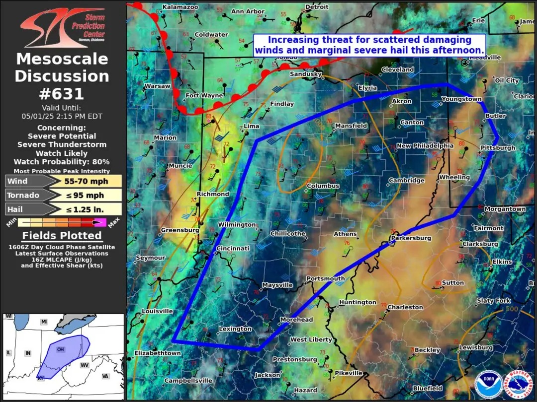
Another day and another chance for severe. Yesterday stayed west and east so hopefully the same happens. There's still lines and trees down all over the city.
-
Just driving around yesterday I saw a lot of trees that are about to fall but still hanging on. Hopefully the severe doesn't pan out.
-
-
2 hours ago, jwilson said:
Curious how much out-of-state help the power companies have employed for this. Due to the wide scope of the damage, it wouldn't surprise me much if things were shut down the rest of the week.
Well luckily mine came on just now. Looks like some of the major outages are being taken care of. The one main street by my house was closed so it looks like that was the culprit
-
Im afraid I won't have power until the weekend
-
22 minutes ago, Eskimo Joe said:
How did everyone fare today? Seems like the burgh got hit pretty hard.
200k+ power outages. 70+ mph gust recorded. Blew roofs off and destroyed trees and powerlines. Lived up to the hype unfortunately.
-
Hmm power out here. There's trees and power line and stop lights down everywhere. Looks like we have some more action back in Ohio but I'm assuming the worst is over.
-
Obviously it's now April but we can still see snow chances in April so I wouldnt be shocked if we see some accumulating snow.
-
 1
1
-
-
-
1 minute ago, RitualOfTheTrout said:
Not going to complain about missing a tornado. Lol
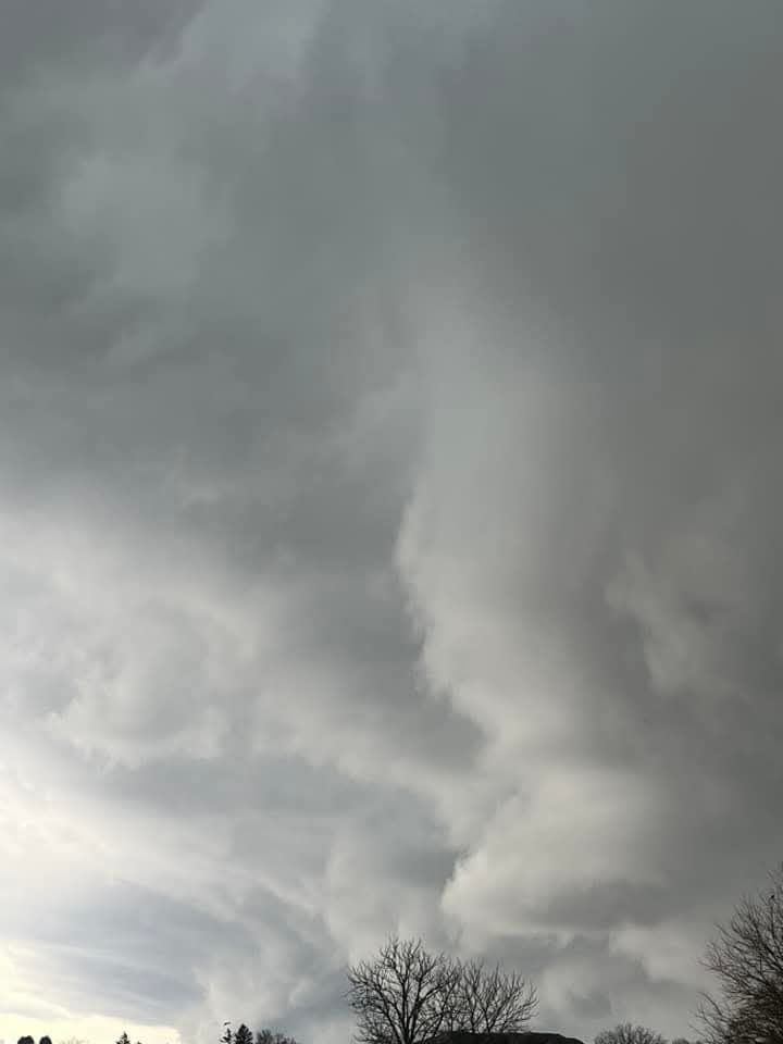
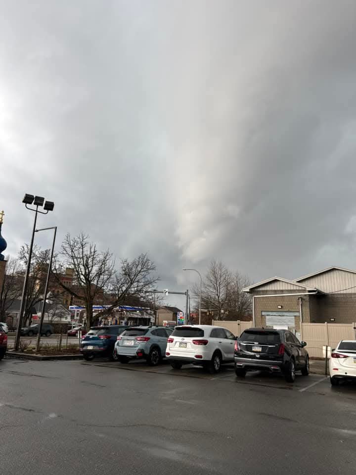
Still not sure what we saw. The clouds were moving so fast on approach so maybe it was an illusion of perspective or something, but it sure looked like a very broad area of rotation high up in the approaching cloud deck.
Won't forget this one for awhile!
Idk on the NWS people showed some ominous looking clouds so I wouldnt be surprised if what you saw was actually some rotation especially since the line became tornado warned just east.
-
28 minutes ago, RitualOfTheTrout said:
That cell that just went through here just got warned for tornado... Not suprised. My son and I were watching the cloud deck approach and I swear it looked like we could see the clouds rotating, or almost moving perpendicular to the storm morion, then all hell broke lose. May have just dodged a bullet.
.gif.5c23b980f5ece0af1190a3ca4a0cde6b.gif)
Looks like we just dodged a bullet. Id rather not deal with tornados. Although would like to safely see one, one day.
-
Just now, blackngoldrules said:
Getting some hail with this line.

Sent from my SM-S931U using Tapatalk
Yep some hail here for a brief minute.
-
Idk the line coming through now is pretty nasty.
-
Radar already firing up didn't realize we were getting severe today
-
1 hour ago, Burghblizz said:
Agree - and that’s in addition to the storm misses south. So most people have the perception of this being a fairly snowy winter. Heard a lot of grunts and groans last night when people saw it snowing.
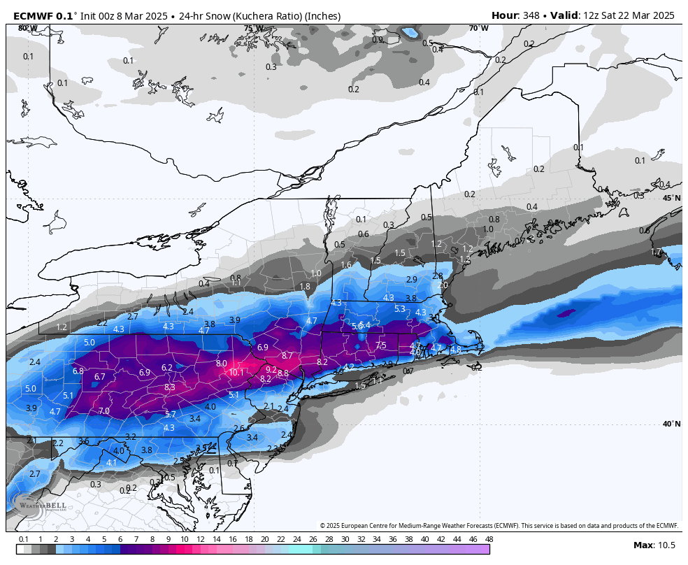
Who knows - maybe we pull a March miracle with a bigger one.
Next chance I'd say is the 20th time-frame. Various models are teasing snow possibilities then.
-
2 hours ago, Blizzard of 93 said:
The 0z Euro has a fantasy range snow chance this run, just 2 weeks away, Lol.
I am hoping for just 1 more to track before we are truly done this season.

Models seem to be keying on that time frame teasing different runs and solutions. Probably worth keeping an eye on but man 70s next week will be great.
-
 1
1
-
-
44 minutes ago, TheClimateChanger said:
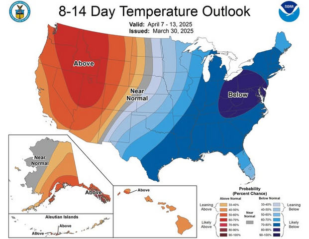
Wow, this looks brutal. It has been above normal 19 of the last 20 months at Pittsburgh, and this would make it 25 of 26. JB seems skeptical but smart money is probably on this happening.
Lmao two things, one Bastardi can't get shit right half of the time. Two that's a ridiculous forecast to even look at. We can't even predict a snowstorm 4 days out let alone what the temps will be like for the next 6 months. Odds are they will most likely be above normal since we seem to be in a cycle of above normal temps.
-
1
-
-
9 hours ago, TimB said:
And it’s gone.
Never trusted it. This winter the trend has been for an extremely fast flow which has just not allowed any of our arctic fronts to phase with southern energy. Seasonal trend is undefeated this winter.
-
9 minutes ago, jwilson said:
Not a lot of support from the ensembles, and right now it's the only model with this solution.
It's also shown a larger magnitude storm many times this winter in the mid-range. None have amplified as advertised. If we're under 72 hours and have some consistency, then I might get interested.
Everything has deamplified. I don't see how this one doesn't follow the seasonal trend especially whenever most other guidance is against the GFS.
-
Zero chance it happens guys. Sorry to burst your bubble. The seasonal trend has not been friendly for heavier synoptic storms north of the Dixon.
-
1
-
-
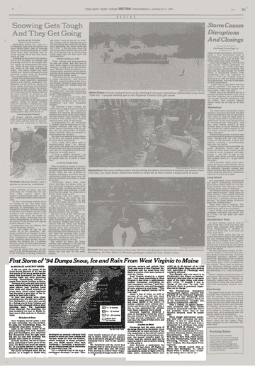
42 minutes ago, jwilson said:
Really hard to find info on that January 3, 1994, storm. I found a couple small clips on YouTube, including one from the Weather Channel that says Waynesburg measured 33" of snow - which seems insane - yet the storm isn't rated on the NESIS scale at all.
All I can think is the storm must have been quite localized, or Pittsburgh doesn't rate on NESIS. It's strange. I guess it was quite a minimal impact on all the main coastal cities so it dodges a rating and much historical acclaim.
I would love to see the orientation of that heavy snow axis because places were supposedly registering 4-6" an hour rates according to those clips. I did hit 4"/hour rates during the 2020 storm, but it only lasted about 20 minutes.
It's incredibly difficult to find any snow map or info on the storm since it mostly was localized to our area. The big cities did not get hit. Not to mention that 94 seems to be known for the record cold wave.
-
1
-


Pittsburgh Summer? 2025
in Upstate New York/Pennsylvania
Posted
I know you guys complain about underperforming temps all the time but fuck this. Its hot and miserable.