

beanskip
-
Posts
1,946 -
Joined
-
Last visited
Content Type
Profiles
Blogs
Forums
American Weather
Media Demo
Store
Gallery
Posts posted by beanskip
-
-
18z GFS a bit warmer and further north as the low is on approach, but the CAD does its thing as the storm kick into gear and it actually ends up colder both aloft and at the surface for I-85 folks.
-
 1
1
-
 1
1
-
-
18z GFS through 48 -- low a little faster, CAD a whisker weaker.
-
Biggest change in NAM is that it pushes precip through much faster -- it's all over for round 1 from CLT metro area down to GSP at 0z Monday.
-
18z NAM (six characters you really should never type) more robust with precip at 66 hours vs. 12z. run.
-
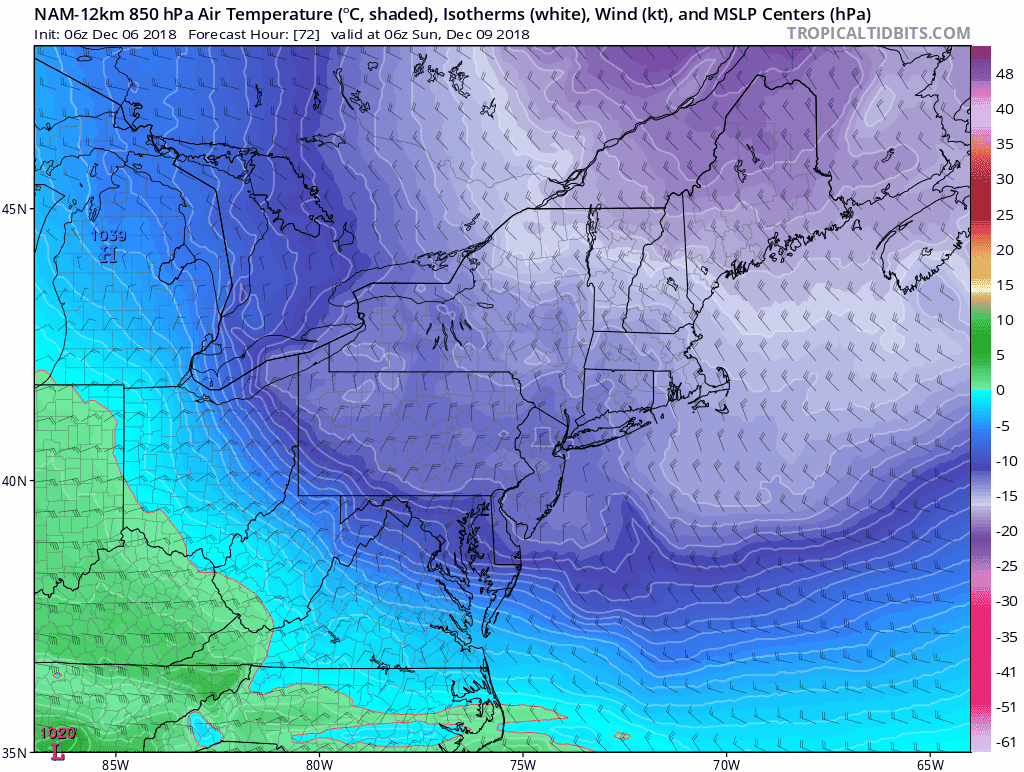
Well, at 72 hours I guess I would call it similar to yesterday's 12z run. 850 temps are pretty close (a little lower in Upstate/extreme NE GA, a little higher east of Charlotte).
Surface low is ENE of yesterday's 12z position, but the low placements have been wonky with the transfer to hard to tell.
-
Just now, Wow said:
850 temps are at or colder however
And looks better at 48 hours as well.
-
2
-
-
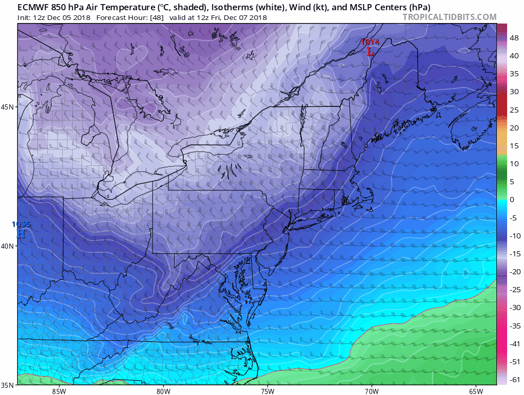
Well, it's early in the run, but at 24 hours, Euro showing less cold air intrusion somewhat similar to 12z NAM.

-
1
-
-
Submitted without comment.
-
3
-
-
Stays colder all the way through the run -- and wetter, too (vs. 6z). Would get CLT/GSP corridor back in the game big time, if it verifies.
-
1
-
-
Oh my goodness, FV3 even colder than 6z run over Carolinas at 850mb -- 72 hours.
-
1
-
-
Interesting ... FV3 shows 5h closed feature over Tenn/Ark/Mo. border that wasn't there on two prior runs and doesn't exist on GFS or NAM.
-
Just now, RTPGiants said:
Where do people get the FV3 when TT is stuck?
You have to click around on TT to different panels. Sometimes the Radar is stuck, but the 850 temps/MLSP moves ahead.
-
12z FV3 very similar to 6z -- HP maybe even nosing in a bit more. Good run through 66 hours at least.
-
1
-
-
First real change vs. 6z comes at 84 hours where the low being closer to the coast, it would appears, causes WAA to scour out the wedge faster.
-
Really, there are fine details, but this is about as consistent as a model run can be vs. its prior run, esp. given complex pattern.
-
And then at 60, it's colder than 6z run and the surface low is in a nice spot just offshore of Pensacola.
-
1
-
-
12z GFS oh-so-slightly warmer at 850 level at NC/SC border through 54 -- but margin of error stuff.
-
5 minutes ago, tramadoc said:
Look at all the lemmings cliff jumping and climbing back up only to jump again with each successive model run.
.And look at the lemmings who want to ignore lousy runs and pretend everything is roses.
I'm not jumping off a cliff. Hell, i don't even LIVE in the affected area. I'm certainly not going to let one NAM run change my view of the storm. But pretending like it's not an awful run, especially in an area that is supposed be the NAM's only strength, is foolish. And given that there were subtle warming trends in the 0z suite, it definitely could be a piece of this amazing puzzle we're all trying to put together.
-
4
-
 1
1
-
-
Just now, eyewall said:
And here we go. That is not a good look at all.
Agree. And you could see it coming overnight as all the models were less impressive with the CAD. Plenty of time to play catchup, but pretending like this NAM run is a significant change from its prior runs (and not just out at 84 hours, but in the 48-60 hour range) is not a winning play.
-
This may be the main culprit.
-
1
-
-
This better be a blip.
.thumb.gif.4f9fe9c42b82c9cbfb0bbe02ea0c2ed4.gif)
-
1
-
-
Also significant. This is the model that's supposed to sniff out thermal profiles first right?
.thumb.gif.1c07490970dad7a058f90778c854d5f1.gif)
-
1
-
-
This seems significant.

-
1
-
1
-
-
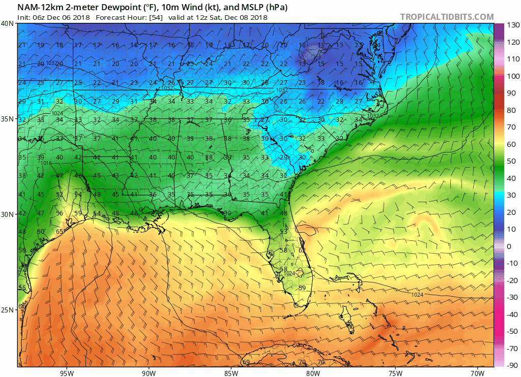
While DP's are less impressive, the 850 0c line is a bit further south at 42 hours -- NAM looks more suppressed overall.
EDIT: That was at 39 hours, not 42.
At 42, the ground gain is given back and it's very close to 6z run.

.gif.05e709f2e198f5670732f8a5fc129748.gif)
.gif.a24fecd82782268af7ec4407f9c62794.gif)
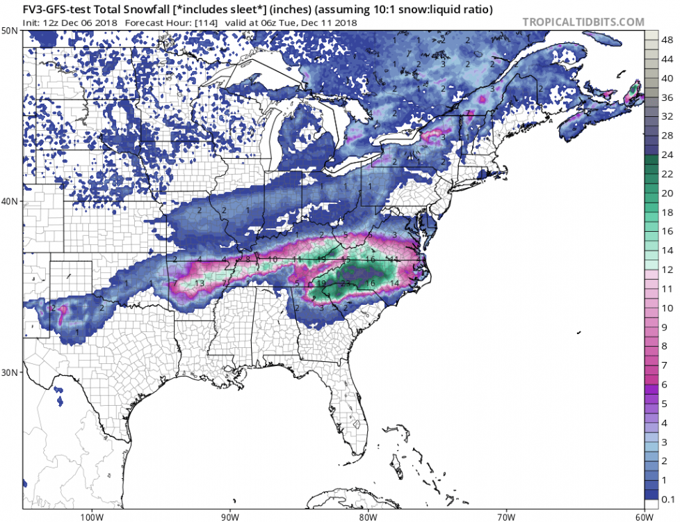
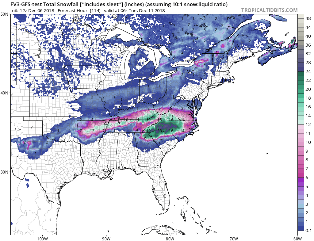
December 8-10, 2018 Winter Storm
in Southeastern States
Posted
And the 18z GFS is the gift that keeps giving. Whereas the 18z NAM was all done for CLT to GSP corridor at 0z Monday, the GFS slows things down and 850s crash -- still wintry.