

CT Valley Snowman
-
Posts
5,102 -
Joined
-
Last visited
Content Type
Profiles
Blogs
Forums
American Weather
Media Demo
Store
Gallery
Posts posted by CT Valley Snowman
-
-
Friends of mine moved from Palmer, MA to Canton, IL about 30 miles SW of Peoria last year. They've been learning the whole Midwest severe thing firsthand. i was updating them today as sirens were going off.
-
 3
3
-
-
Storms firing in ENY.
-
93 and feelin free.
-
 1
1
-
 1
1
-
-
91 and steamy.
-
1
-
-
Stein of a month so far. Only about .10
-
1
-
-
Heat advisories are up. Bring it on.
-
1
-
 1
1
-
-
Nice light show here as well. Getting grazed with the rain.
-
Not expecting much but it is raining with thunder here.
-
3
-
-
Warning now heading towards Wiz/ Wolfie.
-
1
-
-
Storm is weakening just WNW of here. Meh
-
1
-
-
Storm riding the CT/MA border may slip N towards Agawam. Could be a hair too S here.
-
There's some non severe cells now in N Litchfield county, hoping to just get a drink at this point.
-
Might get the ole 7-10 split here.
-
1
-
-
A dissapointing 86 with the cloud cover but it was well modeled. Hoping for some good bangers later.
-
Did any official stations hit 90? Didn't make it here with the cirrus. No heatwave this go around.
-
88 so far for a high. 87 currently. Hoping to hit 90.
-
57 and raining now. Craptastic.
-
1
-
 1
1
-
-
15 years ago today was the most insane severe weather day I have ever experienced. June 1. 2011.
-
3
-
-
Brutal day. 44, rain and wind. Congrats to those seeing snow or big-time winds because without it there's is no redeeming quality to today's weather. It's just awful.
-
27 minutes ago, vortex95 said:
I am surprised there is not more talk about the weekend event. You know how rare these kind of events are in May? And as I said, omega blocks are how you do it this time of year. People like CoastalWx seem to fail to appreciate atypical/rare wx events since it ruins great outdoor weather or the like! In other words, as one example, "if it's not the cold season, I don't want snow!" Or more precisely, "if it's not IMBY, I don't care!" LOL. Grousing all the time seems to be SOP.
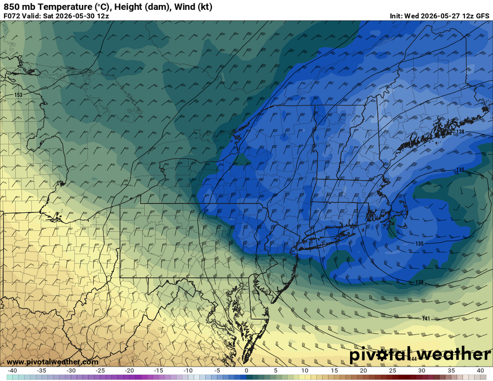
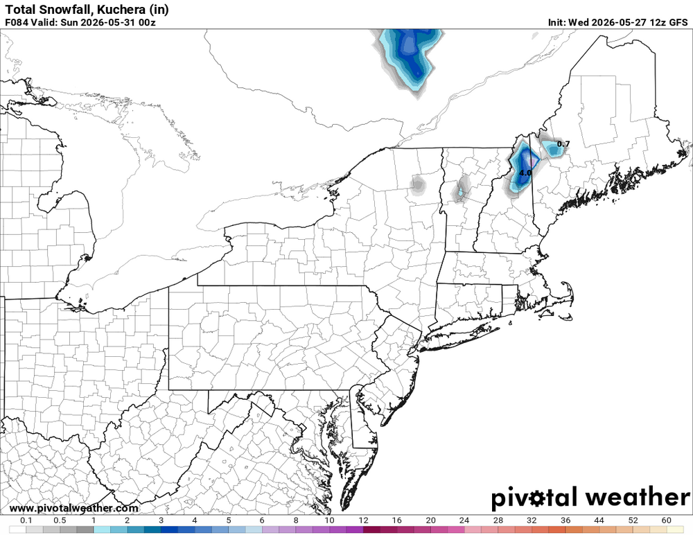
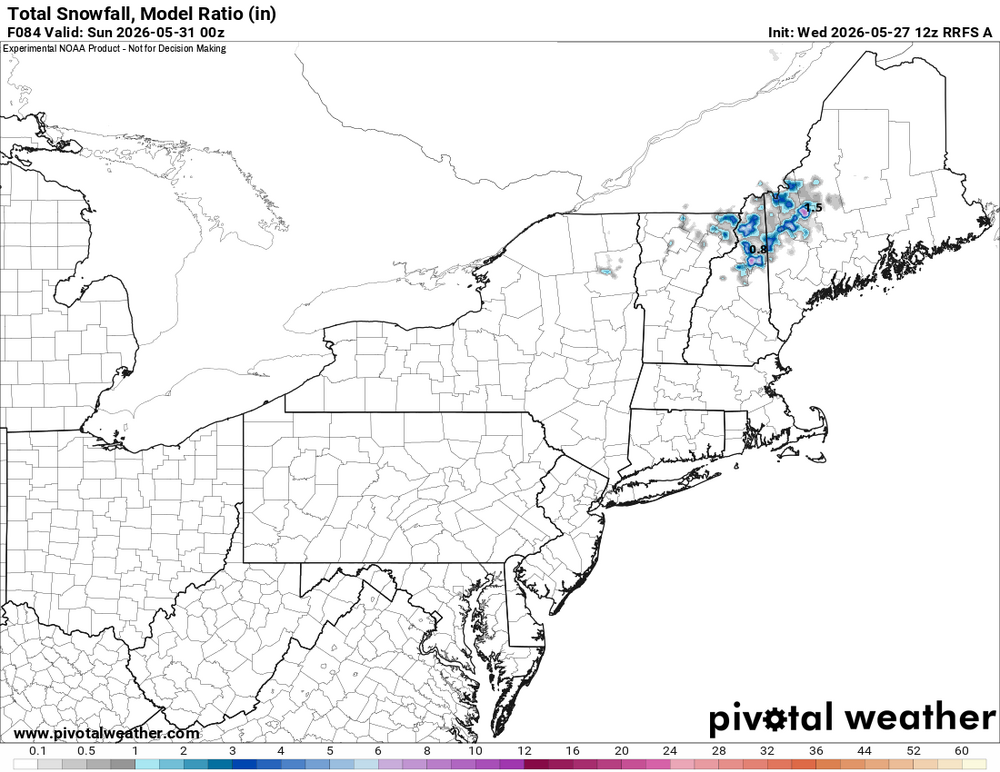
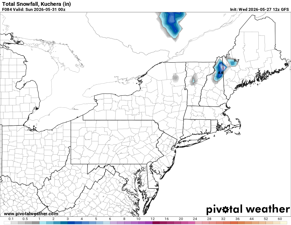
GFS and RRFS explicitly show accums in nrn NH/NW 4-8" at the higher elevations. Look at the 850 temps valid 12z Sat. That's *cold* and colder than previous runs (as low as -4 C). The 500 low passes directly over the area for max dynamic cooling. Not something to just ignore.
Also, and this is huge this time of year, the heaviest precip occurs during the overnight late Fri-early Sat. Every degree counts this time of year for snow. We are talking about say a 0.5 F deg difference in avg temp of the lowest 2000 ft here could mean just a mix of rain/snow or heavy snow w/ rapid accumulation. So being at night given the strong sun angle this time of year (a factor even when thick clouds are present) matters a lot.
And given how borderline the temps are, this often results in a very fickle precip type situation. When the precip gets heavier, it goes to all snow, and it lightens up, and goes back to rain. It will be something that needs to be watched very closely in real-time. The "surprise" factor is high here.
And you don't need an event like May 9-10, 1977 for the fun 'n games. Look at May 18, 2002. Omega block was much farther N and the 500 cut off center was no where near NEUS. We are also talking later than any other snow event here in the last 60 years, later than 1967, 1977, and 2002.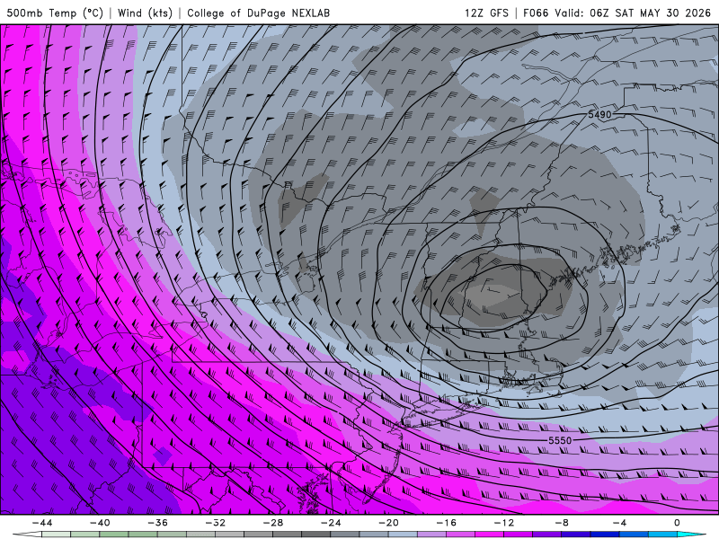
I think if the snow line actually got down to more habitable locations vs high peaks it would draw some more people in, but yes it is meteorogically interesting.
-
2
-
-
BDL 84, BAF 84, CEF 89?. Seems a bit warm.
-
1
-
2
-
-
I wasn't home enough to measure and report all events this season, but I'm pretty sure I was around or just over 50", maybe 51", which jives with the 50.3 just to my NW in MA. Solid season for sure, but to be this far north in CT and be at pretty much the state minimum is pretty unfortunate.
-
1
-
-
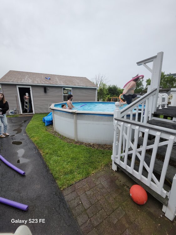
Crazy kids. Lol. 55 and raining.
-
2
-
4
-
1
-
-
raining west side of E Windsor FTL.


Junorch obs and discussion 2026
in New England
Posted
Another complex of storms to the SW. The rich get richer.