ILwxchr
-
Posts
97 -
Joined
-
Last visited
Content Type
Profiles
Blogs
Forums
American Weather
Media Demo
Store
Gallery
Everything posted by ILwxchr
-
Winter 2018-19 Medium/Long Range Discussion
ILwxchr replied to snowlover2's topic in Lakes/Ohio Valley
yeah 'id be concerned about a possible cold core or high shear/low cape event if that pans out. -
Winter 2018-19 Medium/Long Range Discussion
ILwxchr replied to snowlover2's topic in Lakes/Ohio Valley
The only big storm I remember that winter here was the Valentines day storm. We got quite a bit of snow with that one. I think 03-04 was the worst winter aside from '11-12, hardly any snowfall in both winters. The '11-12 winter was especially terrible, the only thing that made it tolerable toward the end was an early severe season, but then the drought set in...... -
Winter 2018-19 Medium/Long Range Discussion
ILwxchr replied to snowlover2's topic in Lakes/Ohio Valley
I'd argue that probably the last time was maybe December2009 or 2010? (I remember the big one in 09 very well). We had a couple good hits here in 2013 in Northwest Illinois...but yeah the last few Decembers have been pretty disappointing. 2016-17 we got our biggest snowfall of the winter on Dec 4th (6") and hardly anything the rest of the winter. I think that was the first January (2017) that we didn't record any snowfall, I remember Chicago setting a record. Hopefully we can go back to the days of 2010-11 or 2013-14....nothing super huge but enough to keep us on our toes and not bored. -
Correction....my best chase was in Illinois with 8 tornadoes. Iowa for a second on #2 on 7/19. And I dunno if this year sucks anymore from a chasing standpoint for me, but statistics wise yes lol.
-
Yeah this year sucks. My best day was in Iowa. If that tells you anything. I actually think this weekend's blizzard was my favorite "chase" ha ha.
-
Winter 2018-19 Medium/Long Range Discussion
ILwxchr replied to snowlover2's topic in Lakes/Ohio Valley
Wouldn't be surprised to see a small window of freezing rain potential on Saturday morning. Models could be under-estimating snow depth and thus overdoing surface temps. Its something to keep an eye, probably won't know until it becomes a short term situation. One of friends at DVN was telling me he was concerned for icing locally in Eastern Iowa/Northwest IL, especially further northwest. -
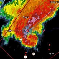
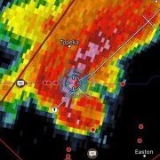
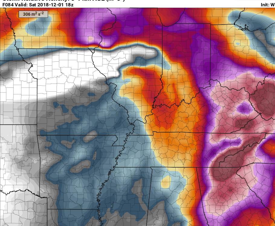
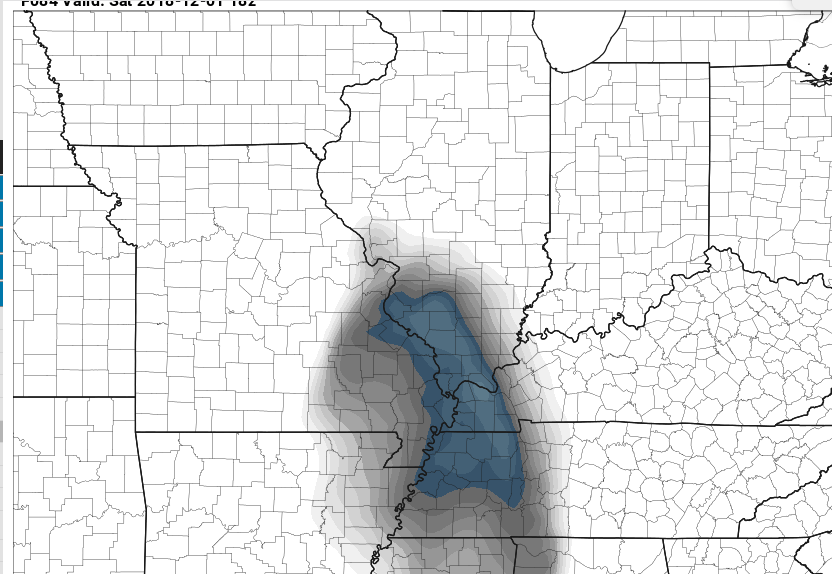
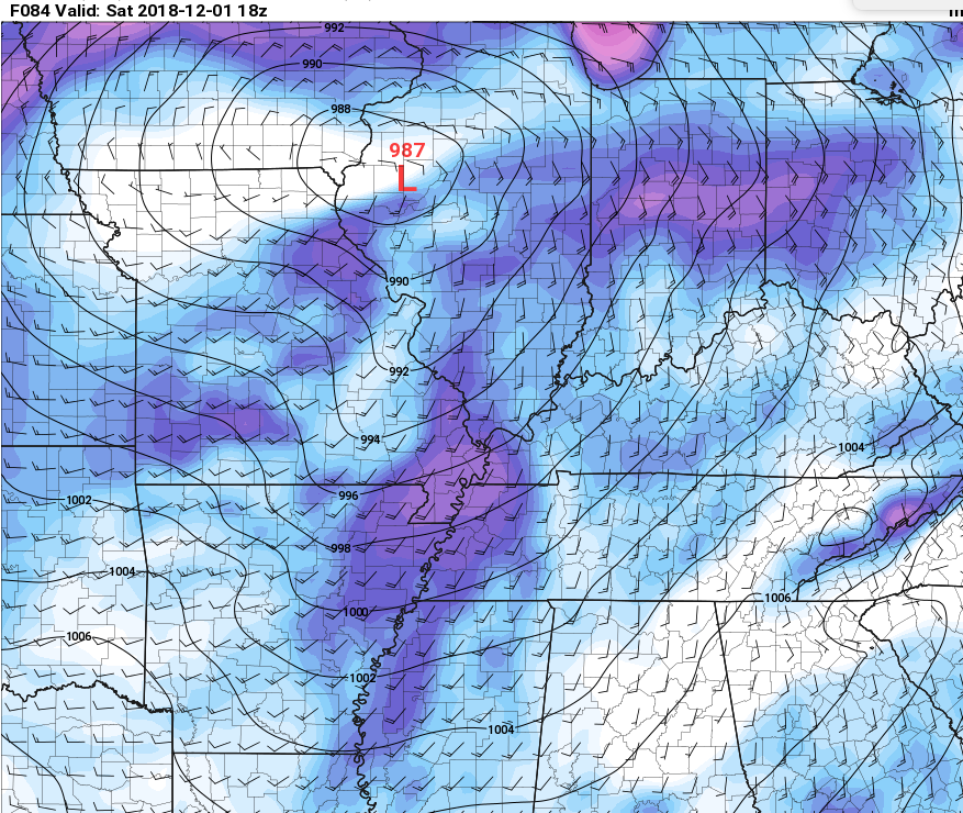
Not sure how many people are paying attention to Saturday. There could be some severe weather in this sub-forum, at least parts of Southern IL along with a possible ice/snow event in North Central Iowa. IMBY I look to see mainly lame ole rain. The ole trustworthy 84 hour NAM already showing some CAPE building into Southern IL at 18z on Saturday. I have a feeling this may be a tad too far south based on what the GFS is showing. The Euro has it even more northwest with a surface low of 984mb near Omaha, NE.. Seems like perhaps the Euro wants to occlude the low faster. Either way I think we see quite a bit of rainfall, which on top of the deep snow pack we just got (heavily water filled too) could spell some flooding issues. Here are a few graphics off the latest NAM showing severe potential (SBCAPE, 0-1km SRH etc). Not to often you expect severe storms on almost December 1st in Illinois.
-
Reminds me of 12/1/2006 albeit further northwest on that cut off.
-
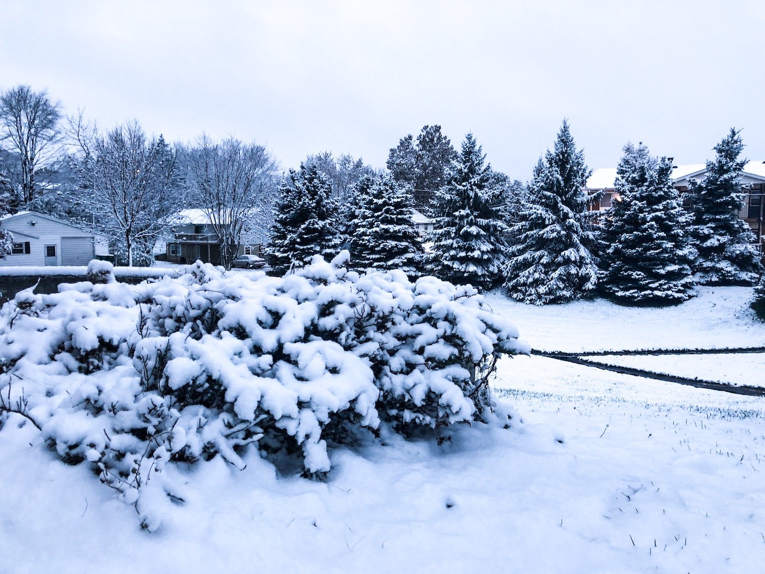
Quad Cities airport up to 18.4" of snowfall this month and for the winter (record). We picked up some light snowfall this morning up here, so maybe add 0.1 or so to that. Very impressive for so early in the season. Not even December 1 yet.....hope we get crushed in December lol.
-
Nov. 25th-26th Midwest Snowstorm Potential
ILwxchr replied to Malacka11's topic in Lakes/Ohio Valley
Interstate 74 between the QC and Galesburg is still at a standstill right now. Unbelievable. I imagine still some blowing snow out there in wide open Henry County, IL. It'll probably be Tuesday afternoon before I can make it back down toward Galesburg and especially Macomb. 67 north out of Macomb is still very bad along with most McDonough and Warren county roads according to my EMA source.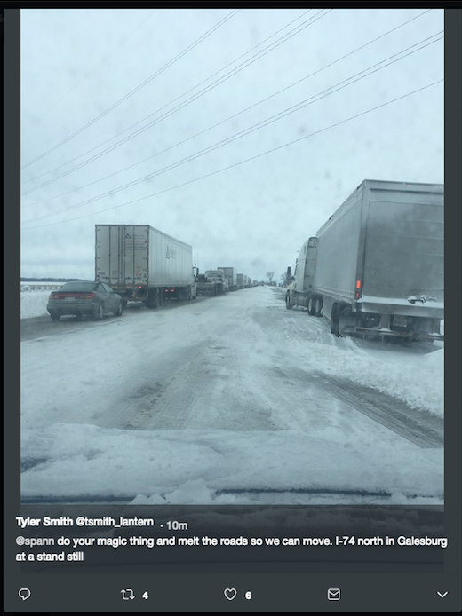
-
Winter 2018-19 Medium/Long Range Discussion
ILwxchr replied to snowlover2's topic in Lakes/Ohio Valley
GFS/Euro advertising another potential storm system next weekend. Not sure we will have the snow we did with this one but shows a low track that is of similar direction. Worthy of watching. -
Nov. 25th-26th Midwest Snowstorm Potential
ILwxchr replied to Malacka11's topic in Lakes/Ohio Valley
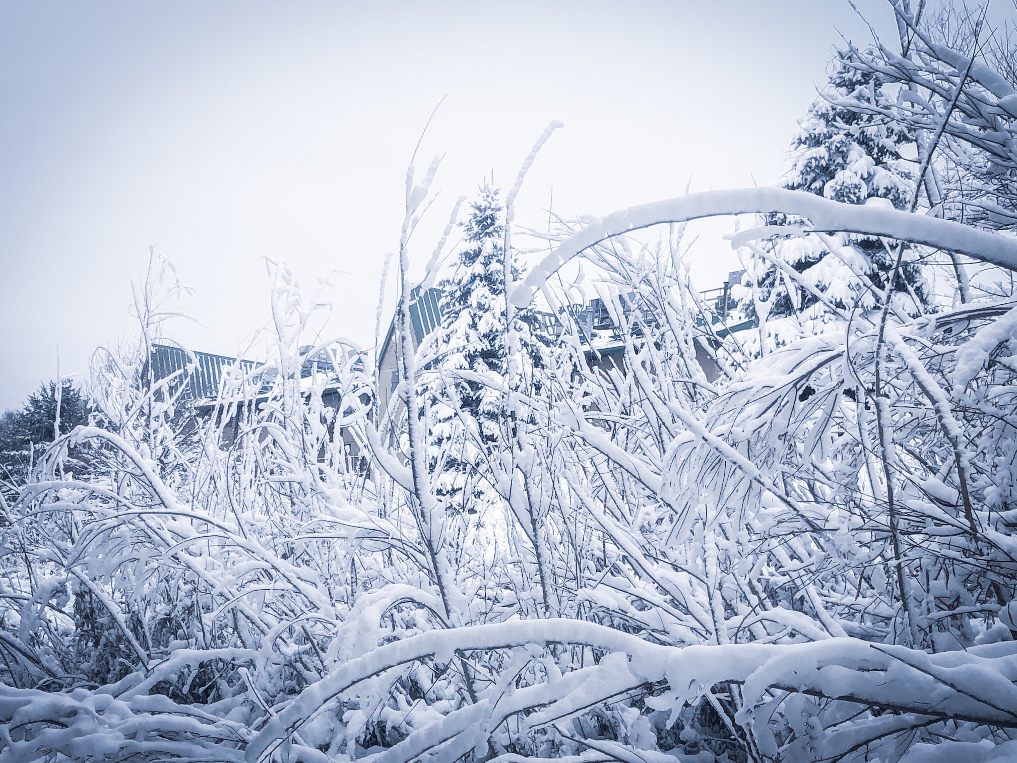
A lot of fallen and sagging trees this morning from the heavy snow. I took averaged measurements and came up with 14.0" for my location N of Davenport. Looks like the QCA airport received 13.8" officially, so not too far off. From what I understand this is their biggest November storm on record breaking the previous record of 9.9" on the November 2015 storm (Moline, IL). At least that is what I was told. Surprisingly though not a lot of photo ops, but I already fell on ice and hurt myself, so I came back inside lol.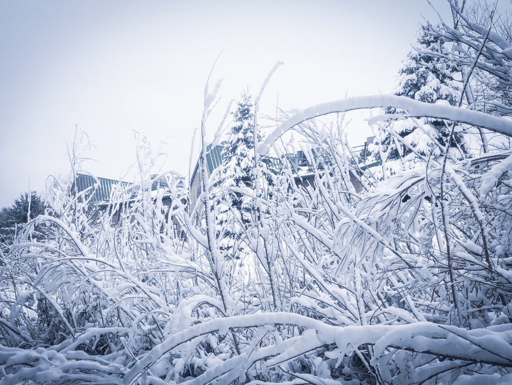
-
Nov. 25th-26th Midwest Snowstorm Potential
ILwxchr replied to Malacka11's topic in Lakes/Ohio Valley
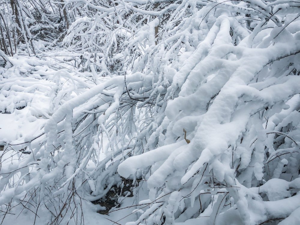
Snow is coming to an end north of Davenport. Still have light snow falling on the back edge of this band but the wind is actually starting to pick up again. Visibility is an issue still in open country. I'm sure tomorrow morning will yield a lot of good photo ops, but I'm also certain I won't feel like cleaning the rest of my car off or venturing out onto bad roads lol. -
Nov. 25th-26th Midwest Snowstorm Potential
ILwxchr replied to Malacka11's topic in Lakes/Ohio Valley
I had 11" with that as well north of Davenport at my moms apartment (3/24/18). GHD2 in 2015 I only got 8.8", ended up south of the main band. My mom didn't live in the cities yet, so didn't really think about "chasing" the event lol. That March 2018 event was a fun event, saw a lot of thundersnow here. -
Nov. 25th-26th Midwest Snowstorm Potential
ILwxchr replied to Malacka11's topic in Lakes/Ohio Valley
Yeah its really bad. I'm from Galesburg and a friend of mine is stuck in the country and I'm up here and its just not a good situation. Officials know about everything that is going on, but just nothing anyone can do right now because the conditions are so bad. -
Nov. 25th-26th Midwest Snowstorm Potential
ILwxchr replied to Malacka11's topic in Lakes/Ohio Valley
A lot of power outages too in the Galesburg/Macomb area. Multiple power poles snapped in McDonough county. I believe they pulled the plows as well but don't quote me on that. -
Nov. 25th-26th Midwest Snowstorm Potential
ILwxchr replied to Malacka11's topic in Lakes/Ohio Valley
67 is closed from what my buddy who works with the EMA told me, multiple plows and state police stuck. Several of my friends also got stuck in town too. Heard a report of 6.5" so far southeast of Macomb. My instructor also backed that up saying 67 is a no go. 74 is also a no go from QC to Galesburg. -
Nov. 25th-26th Midwest Snowstorm Potential
ILwxchr replied to Malacka11's topic in Lakes/Ohio Valley
WIU is closed tomorrow, so I don't have to worry about making my commute back until Tuesday afternoon. Nice to have an extra day off. Couple 14 inch reports up just north of me where that death band was earlier today. I went out and attempted my best and got several measurements between 12 and 14 inches at 8:30 north of Davenport, IA. Hard to be accurate with strong bursts of wind and snow still ripping hard. Guessing we will end up with another couple inches before its said and done. Depending on how fast the back edge pivots around...figured someone would end up with 15 inches out of this. Best snowstorm I've seen since 2/1/2011 anyway. I'm satisfied. -
Nov. 25th-26th Midwest Snowstorm Potential
ILwxchr replied to Malacka11's topic in Lakes/Ohio Valley
Yeah its really ripping hard here too, probably some of the hardest of the day along with strong winds. Can't really see across the street lol. Heck of a storm for late November. I'll take one or three of these every year haha. -
Nov. 25th-26th Midwest Snowstorm Potential
ILwxchr replied to Malacka11's topic in Lakes/Ohio Valley
Just made it back home. Top 5 snowstorm of my lifetime. I chased in Eastern Iowa in that band that was stationary most of the afternoon and there was around a foot of snow on the ground when I left, the wind picked up incredibly as I was heading home and I got hit with 50 mph wind gusts and saw some thundersnow north of Davenport around sunset....felt like I was in a tropical storm/hurricane for a bit there. Saw a couple reports of 13" so far in Eastern Iowa, which matches up well with what I saw. Still ripping hard here in the QC. I tried to make it back to Galesburg tonight but the smart move was to just stay in the cities and not even attempt the drive home. Will be interested to see the final snowfall map. I got an average of about 9 inches outside my mom's apartment north of Davenport here around 6pm. Official obs are lower though, so who knows. Snowfall measurement is fickle, add in a blizzard, and its impossible. -
Nov. 25th-26th Midwest Snowstorm Potential
ILwxchr replied to Malacka11's topic in Lakes/Ohio Valley
Blizzard Warnings coming for DVN area southeast of Savanna, IL soon. -
Nov. 25th-26th Midwest Snowstorm Potential
ILwxchr replied to Malacka11's topic in Lakes/Ohio Valley
Blizzard Warnings going up for Adams County, IL on the north end of LSX county warning area. Starting to get some graupel to mix in here in Davenport. Going to head up toward Park View area shortly once the new products drop to see what is going on. Iowa City already looks pretty snow covered. -
Nov. 25th-26th Midwest Snowstorm Potential
ILwxchr replied to Malacka11's topic in Lakes/Ohio Valley
Agreed. Their afd mentioned the more southern track and stronger low pressure. They said they increased grids to 40 knots (50 mph). I don't see why they wouldn't upgrade to blizzard warning based on that. -
Nov. 25th-26th Midwest Snowstorm Potential
ILwxchr replied to Malacka11's topic in Lakes/Ohio Valley
MD out for blizzard conditions now. ILX said they are coordinating with other offices on potential headline changes. Not sure if that means upgrade to blizzard warning or not. -
Nov. 25th-26th Midwest Snowstorm Potential
ILwxchr replied to Malacka11's topic in Lakes/Ohio Valley
True. I'm greedy and want both haha . But if I had to choose, I'd choose the all-out blizzard conditions. I'm a huge wind fan.