Tekken_Guy
-
Posts
141 -
Joined
-
Last visited
About Tekken_Guy

Recent Profile Visitors
1,358 profile views


-
The GFS's big cutting down on the forecasts seems to say otherwise.
-
I think the NWS might be too bulish. Recent GFS indicates numbers might land closer to the 10-12 range.
-
I'm in western Essex County. Do you think we'll get to Jonas 2016 numbers here? Also high high are blackout risks in my part? The only large scale blackout I can recall from a snowstorm is October 2011.
-
I am not seeing any evidence of another cooldown next week.
-
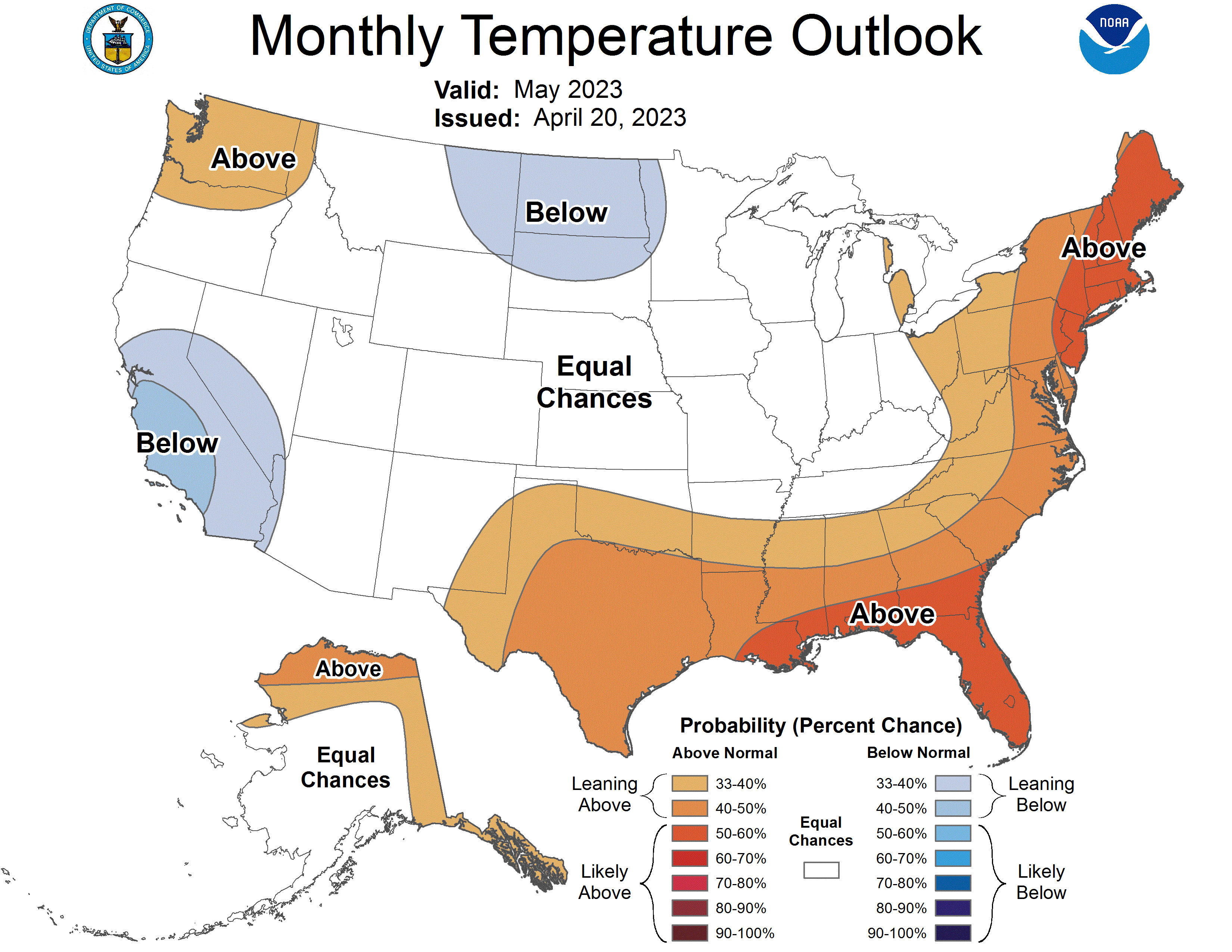
Does that mean May is likely to be below normal, or possibly cooler than April?
-
I’m cautiously optimistic we’ll be warm again in Week 2 of May. If we’re lucky the pattern will break by next Thursday.
-
Yeah this is typical. Last year April 14 was almost a 90-degree day. Didn’t crack 80 again for a month, or even 75 for three weeks. Warm-ups this time of year are usually very fleeting. Cooldowns on the other hand generally last much longer.
-
Is it possible we fall slightly below the record of 2010?
-
As of right now, I’m sensing that we move out the BN range sometime around May 4-5.
-
The BN pattern in May could last like 3 days before shifting to more seasonal. I can’t see this holding for more than two weeks.
-
I think you got that backwards. Next week will be the big cooldown and it returns to normal as May arrives.
-
I'm starting to get the feeling we might not break the record for warmest April. Next week could shave 2-4 degrees off the average and tomorrow was supposed to provide a buffer.
-
Wasn't it supposed to hit 80 tomorrow?
-
We likely needed that warm day to lock in the warmest April record. Now there’s a very strong chance 2010 keeps it, especially if it stays below 60 for most of next week.