

CCHurricane
-
Posts
363 -
Joined
-
Last visited
Content Type
Profiles
Blogs
Forums
American Weather
Media Demo
Store
Gallery
Posts posted by CCHurricane
-
-
2 minutes ago, ice1972 said:
CC says its still snow out there........go james!!!
Mix/Rain approaching MV and entering Nantucket Sound. Flakes are noticeably heavier and thicker. Trying to hold on!
-
Cape is getting creamed right now. Not great ratios and mixing should begin over the next 60-90 minutes...but heavy stuff and great radar imagery nonetheless.

-
Mixing has begun to overtake Nantucket. Will be interesting to see when an eventual mix/sleet occurs on Cape Cod. Most short range models were targeting 3-4AM.

-
Central Cape Cod up to ~4 inches.
FWIW 0z Euro really amps up precip totals north of MA boarder into central and southern VT and NH.
NAM did a great job showing this trend and sticking with it across what was really the past +8 model runs.

-
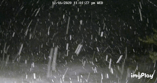
View from the webcam down on the south facing beaches of Cape Cod
-
 5
5
-
-
Flurries beginning in Hyannis down on Cape Cod.
Will be interesting to see how long the warm ocean air and coastal front can be kept at bay.
-
14 minutes ago, USCAPEWEATHERAF said:
I don't buy turning to rain even here in Harwich, MA, I mean sleet for a bit, sure, but not rain. The entire column cools rapidly after warming slightly above 700mb.
If this storm was in January or February, perhaps. Have to remember ocean temps are running ~10 degrees above that.
Lower level warming at the surface will be no joke and hard to combat.
-
10 minutes ago, SouthCoastMA said:
That's fair, and likely correct. I'd be happy with 4-6" at this point
Right!? Was looking pretty solid for SE Mass up until last night. We should be used to this by now though.
-
5 minutes ago, SouthCoastMA said:
The euro is still solid here. Glad it's in my camp and not the NAM and CMC
Unfortunately I would take Euro 10:1 output with a grain of salt down here near the canal and on the Cape. While cold aloft, surface temps look to be running north of 35. Will be hard for meaningful accumulation to happen at those temps, probably closer to 5:1.
-
1
-
-
Feel free to share your thoughts on the attached map from both a meteorological perspective and design/appearance.
I'd expect amounts once you get to NH to be a bit higher tbh, haven't come up with a clean way to represent it on the map just yet.

-
1
-
 1
1
-
-
18Z NAM looks like an great run, a bit further east down near the Carolina's, but looks to make a pinwheel move as a bit of energy is left behind causing a due north move from 35N to 40N. Ends up tucking in south of Cape Cod with a nice precip field explosion.
-
Long way to go before that can be tested... I just saw a 12-18" graphic...
Haven't been able to watch the local stations up here but last night there was alot of 6-12 being thrown around...We stay all snow, which is a real possibility on the upper cape, and we push 18-24.
-
My father-in-law is alone in Dennis. Couldn't get him to leave and come up and stay with us, he's over 80. Hope you both don't lose power.....
Having grown up on the Cape, I can almost say with a certainty that most of the Cape will be without power come the AM. 12-18 inches of heavy wet paste + 70mph gusts is not a good recipe.
-
Rad returns in the MA and S of LI have abruptly begun a west drift if not movement, and I'd argue that the 700 and 500 mb sfc are in processes of closing at this time. They will only deepen going forward.
meanwhile, heavy band approaching the Cape and SE
I really think all the major mets will bust low with the Cape. Already approaching 2 inches.
-
Oh def. forecasting nightmare sometimes
What town you posting from on the cape!?
I'll be getting reports from the town of Barnstable on the Cape. I'm actually up in the city of Boston now so this will be a fun one to watch! I personally think the Cape will surprise on the upside (just like in 2005) with Boston getting fluff supported 20-28.
-
How so?
they have 14 to 18 on W part of cape then 10-14 down the spine of cape thru N Harwich (Along route 6) to almost CHH, seems like they tried to put as much detail into that as they could
We are all pulling for you James.
I was on the Cape for the blizzard of 2005. Watched the Boston stations the NIGHT of the storm as snow was falling and they were still calling for 8-16 with a changeover to rain. We ended up with 36 inches...Nothing is set in stone IMO and I truly believe the Cape is the hardest location in the United States for snowfall forecasts. This storm could be anywhere from 12-26 inches tonight and I truly believe its a 50/50 call.
-
This thing is going to be a bomb for Cape Cod and the Canal up through Plymouth County.
-
Euro rolling.
-
I'm puzzled by the lower totals for the Cape - at this stage. There's no indication in any model other than the old Euro that there will be anything must mostly snow for about 50/70% of the Cape. Indeed it looks like a 15-25" type deal even here.
Even the WSI RPM model is showing a modest 16+ for the Cape. It's unforunate that Cape Cod is lost in the shuffle with the Boston Mets (see blizzard of 2005)...but it seems like they are taking the GFS temps (which everyone knows has a warm bias) and running with it.
-
I think I have a shot to beat the 25" I got in that one....maybe even Nemo's 27"
#1 Is April '97...only 30-spot of my life.
Here's NAM Output for Hyannis down on the Cape. All precipiation falling as snow. Total QPF 2.75.
SFC 850 SFC SFC 700 6 HR 500 1000 TMP TMP PRS RHU RHU QPF HGT 500 (C) (C) (MB) (PCT) (PCT) (IN) (DM) THK SUN 7P 25-JAN 1.6 -10.3 1011 51 1 537 529 MON 1A 26-JAN -2.2 -9.4 1017 66 19 0.00 539 526 MON 7A 26-JAN -2.6 -8.8 1019 76 65 0.00 541 526 MON 1P 26-JAN -0.3 -5.8 1018 83 87 0.00 543 529 MON 7P 26-JAN 0.9 -5.8 1014 91 93 0.09 544 533 TUE 1A 27-JAN 0.8 -4.6 1006 98 97 0.44 542 538 TUE 7A 27-JAN 0.1 -5.6 994 97 99 0.83 534 539 TUE 1P 27-JAN 0.9 -5.9 989 94 82 0.70 528 537 TUE 7P 27-JAN 0.0 -8.7 991 93 63 0.39 526 533 WED 1A 28-JAN -3.4 -8.9 999 91 99 0.20 526 527 WED 7A 28-JAN -6.4 -12.0 1007 88 91 0.09 531 525 WED 1P 28-JAN -3.9 -9.9 1012 86 86 0.01 537 527 WED 7P 28-JAN -1.5 -9.2 1017 77 55 0.00 540 526 THU 1A 29-JAN -3.8 -8.0 1020 74 4 0.00 541 525 THU 7A 29-JAN -5.9 -7.1 1023 83 8 0.00 545 527
-
The cape might be a crazy spot for this one...
This could be the Blizzard of 2005 all over again...aka, boston mets discounting snows on the Cape, only to scramble at the last minute and jack up accumulations, or just refuse to acknoledge the fact that we got 3 feet of snow (I'm looking at you Pete Bouchard, called for 8-16 with a changeover to rain, ended up with 36).
Time and time again there's too much model hugging when it comes to rain/snow lines over the Cape with these historic storms (and I'm not just saying that b/c I live there as I'm in the city now). As the LP bombs out heavy banding makes it very hard for temps to actually climb above freezing and change precip (look at 850mb temps and you'll see exactly what im talking about).
Canadian and NAM have Cape as Jackpot with 28-34. This one will be interesting...

Dec 16-17 obs/nowcast thread
in New England
Posted
You just learn to accept it over time. And yet there have been a decent number of storms in recent memory where the Cape has outperformed the rest of the region and more heavily followed metro areas. The good ole’ Cape Cod special.
30-36 inches with the Blizzard of January 2005 was a once in a lifetime storm so that made and continues to make everything worth it.