

dseagull
-
Posts
310 -
Joined
Content Type
Profiles
Blogs
Forums
American Weather
Media Demo
Store
Gallery
Posts posted by dseagull
-
-
1 minute ago, Metasequoia said:
FWIW - NAM outside of its useful range, looks more promising. I still don't like the placement of that high though.
Hey, at least the H placement depicted in most scenarios will yield a heck of a windstorm with the gradient. Not a long duration storm though, so not a true Miller A Nor'Easter.
-
13 minutes ago, Hurricane Agnes said:
CMC isn't as far west as the GFS but has the same near-Apps runner concept. Euro appears to be showing the same although looks further east than the others. Could be still seeing mid-range noise. I don't think this will settle down until we get a little closer.
Appreciate the feedback. I know that physical sampling is less important now, with the reliability and scoring of satellite sampling, but I still hear my old man's voice saying, "look at where the energy came ashore and follow that line of latitude..."
That notion deserves about the same level of merit as "red sky in the morning...," but fundamentals seem to be coming together with this storm. Going to be a monster, regardless. Wish we had a true block in place, and confluence set-up from the ocean storm.
-
 1
1
-
-
2 minutes ago, Hurricane Agnes said:
Pittsburgh special!
Such a strange track, that I'm having a hard time believing the evolution of this system. I'd welcome the windshield wiper effect at this point. Do we end up with an inland Appalachian solution? Lots to reflect on with hard 180 model sways. Should be fun.
-
1
-
-
6 minutes ago, clskinsfan said:
But I do think a slider is off the table.
Now you've gone and done it... lock in the slider.
-
 1
1
-
-
High pressure wayyyy off to Eastern north Atlantic. Wow.
-
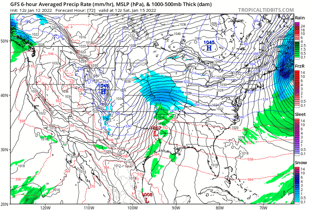
Is it safe to assume that the models overdid the blocking pattern that we were looking at 36-48 hours ago? The SW that we orginally had our eyes on is diving 24-30 hours later than what we anticipated. Ocean storm must have been (still is) the wild card.
-
The ocean storm and lack of confluence are the primary drivers of this scenario, correct?
Could a faster and deeper SW bring this storm further off the coast? I'm trying to digest and learn exactly how we went from squashed storm suppression to inland runner over 12 hours yesterday. This wasnt a sampling issue.
-
2 minutes ago, JTA66 said:
Still nearly a week out, so I'm not going to sweat the details. Just happy to have such a strong storm signal at this range.
Incredibly interesting to watch most models, besides the GFS make a 180 from suppression to Rain for I95 east, in just 12 hours. Kind of raises some red flags. When will the energy from the S/W be over land and sampled? Tomorrow night?
-
3 minutes ago, Paleocene said:
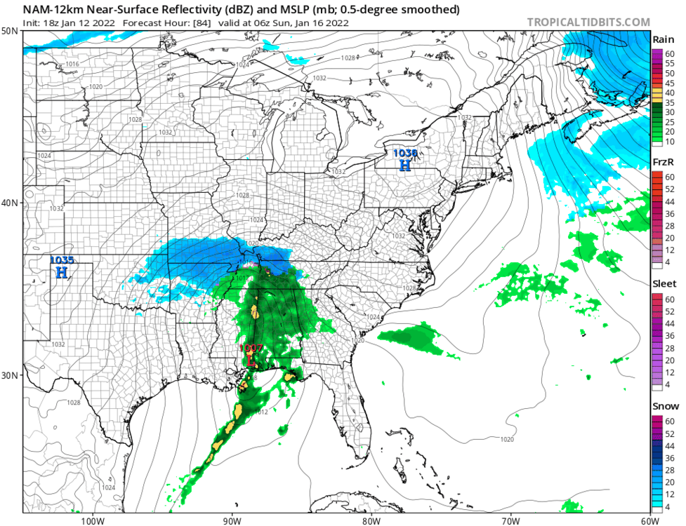
Surface freezing line basically parallels 95 at hour 138 (06z mon)

I'm having a difficult time believing the eastern seaboard from ACY to Central FL has similar temperatures at this hour. It is only the middle of January, but I don't recall seeing these numbers verify too often with this setup.
-
 1
1
-
-
14 minutes ago, uncle W said:
January 11th 1991 in Brooklyn...
Thank you. I feel old... those vehicles...ah, I miss simpler times.
-
1
-
-
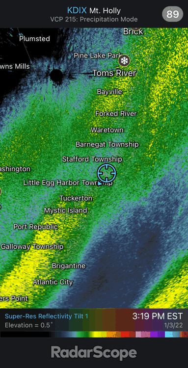
Hovering at 32.8 on Barnegat Bay. Front yard still has a sad layer of 1-2 inches, but this was the snow pack that just couldn't hold on. If you have a crazy hunting dog, the snow is a wonderful thing if you want a clean dog and house. If you have mud instead of snow, life is miserable trying to keep things clean.
Bring the freeze on!
-
36 minutes ago, mattie g said:
Aaaaaand…ignored.
Must be a first...getting ignored in a banter thread. Sorry to trigger you. I only post when offering OBS from Barnegat Bay ttpicallty, a location that is very relevant for the MA threads... go easy, guy.
While clamming on the blowout low tide today, the surface water temp was 33.7 predawn and warmed to 35.1 at 1300. The flood tide brought in water to 42.7 and sxhoolie stripers are still running out front. Point being, the nearshore ocean temps have dropped 2.5 degrees in 5 days up here, despite some eddies being washed into the nearshore. An amazing amount of warmth to work with still off the delmarva. Fun times in this pattern. Have a good one.
-
1 hour ago, Ralph Wiggum said:
Dare I say....I kinda miss TWC circa 1987-1995ish. Actual mets, some extremely extremely advanced mets (Stu Ostro, John Hope, Paul Kocin, Dave Schwartz, etc etc). Actually delved into atmospheric sciences and taught and took time to explain and weren't just on camera celebs. I know that outlet tends to get ripped by weenies near and far....but that was a much simpler time and we were at the mercy of the long range forecast they did once or twice an hour. Good stuff. The coverage of the 93 and 96 storms on there....epic.....just epic.
Spent many an hour staring at TWC, longgggg before it succumbed to the scourge of BS that is modern TV.
Hold onto those memories. Nostalgia is a wonderful thing, even if it means a power mullet, 80s stash, and awkward TV persona! Good times indeed.
-
1
-
-
28 minutes ago, Ralph Wiggum said:
But it snowed twice within 5 days and neither event was modeled out past 96 hrs. It's all rainbows and unicorns on guidance looking far ahead....until it all falls apart in a fiery blowtorch inferno under 5 days. I love tracking a MECS for 10+ days....well, honestly it's exhausting by the time the storm gets here. I would rather a ho hum pattern where we sneakily back into several modest events than a carrot dangling and pulled away at the last minute. But thats me. But like any gambler will tell you, you need to play big to win big... so there's that.
2009 and 2010 delivered those sharp upticks in guidance that satisfy the inner weenie even in old timers. Call it nostalgia, but those were the systems that reminded me of somewhat elicited surprise in the 80s and 90s, because that was what we had to work with, model wise.
I'd go back to the days without smart phones and reliable internet in a second. The element of surprise and lack of communication was a beautiful thing.
...memories are a wonderful thing.
-
5
-
-
55 minutes ago, stormtracker said:
I’m rooting for Jan 1987
Amen. My first memorable storm and the year I became a merchant mariner.
-
1
-
-
1 hour ago, Yeoman said:
Don't worry - school will still be closed
Hey, if we close for a sniffle, we shall close for a whiffle...lmao...Poor kids
-
Word for word what I was thinking while reading through this thread.

-
1 minute ago, WestBabylonWeather said:
Can we lock this in please

Amen!
-
1
-
-
23 minutes ago, wishcast_hater said:
Thank you. That's the best thing I've seen this year!
-
2
-
-
58 minutes ago, North and West said:

.I miss those days. Still watch the 96 blizzard coverage for nostalgia.
-
3
-
-
39 minutes ago, EasternLI said:
6z eps is tightening up the spread a bit.

That is a thing of beauty. A lot of members have it bombing out, but it's moving awfully fast. If we had blocking, this would be doozey.
-
2
-
-
9 minutes ago, eduggs said:
Can you squeak out another .1" to get to 9"?
May have, but already left my backyard station. Manahawkin looks to maybe have 10 from what I am hearing. Somers Point apparently has over a foot. Cant confirm. Somebody will jackpot with 13-15. Had some great rates south of me for 5 plus hours.
-
28.3/31. BARNEGAT NJ. Tapering flurries. Ended up with 8.9 inch avg over 3 boards. Wind made this storm tricky and I did no interval measurements. Have some 2.5-3' drifts in my marina back yard. Over performing storm for my areas and points south, if you eliminated the outlier runs with northern QPF.
Without the last 2 pivot bands, I would have sat around 5 inches. Interesting scenario and fun to watch. Should be interesting to go back and look at last night's mesos, today's, and tomorrow's.
I'm fascinated with watching how one storm may or may not carve the path for another in the same general pattern with similar connections. I-95 special?
-
2
-
-
12 minutes ago, Blizzard-on-GFS said:
I live on a marina as well. Gotta figure out how to downsize pics to post here. Have some impressive 3 foot drifts over lawn furniture. Wind tunnel effect coming down the lagoon.
Good storm. May have another 20 min to hald hour to pick up another half inch or so.


East coast storm targets our subforum Noon Sunday-3PM Monday 1/16-17/22 with significant impact potential for heavy snow/heavy rain, a period of gusts 45-60 MPH along the coast with possible coastal flooding Monday morning high tide.
in New York City Metro
Posted
That's some pure-blood snow-loving emotion right there. I feel ya. But you will over perform. Enjoy the dynamics. Heavy wind storm incoming