
Chinook
-
Posts
9,583 -
Joined
-
Last visited
Content Type
Profiles
Blogs
Forums
American Weather
Media Demo
Store
Gallery
Posts posted by Chinook
-
-
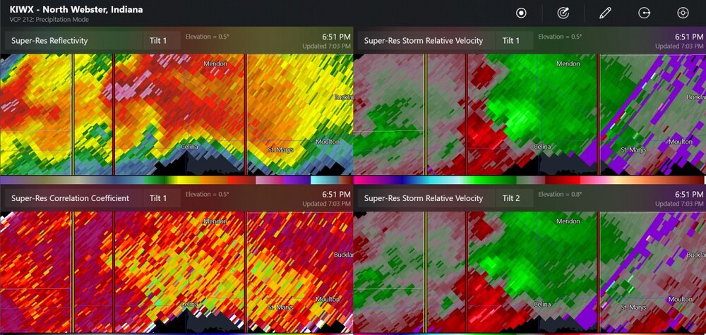
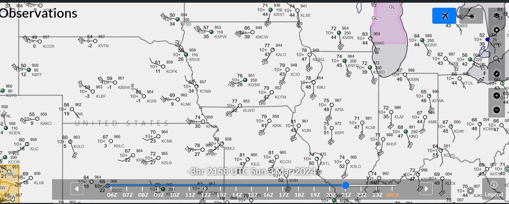
east of Celina OH now
QuoteAt 711 PM EDT, a confirmed large and extremely dangerous tornado was
located near St. Marys, moving east at 45 mph.This is a PARTICULARLY DANGEROUS SITUATION. TAKE COVER NOW!
HAZARD...Damaging tornado.
SOURCE...Emergency management confirmed tornado. Auglaize County EMA
reported a tornado producing damage. -
this was a tornado W of Celina
-
One of my family members had to go to the basement.
-
Toledo got 1.57" today with frequent lightning at times. I think I saw some small hail, but it didn't cover the ground much.
-
 1
1
-
-
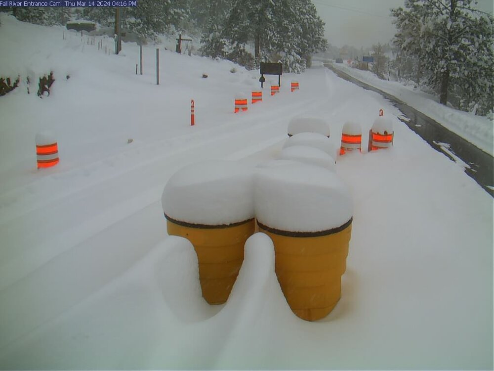
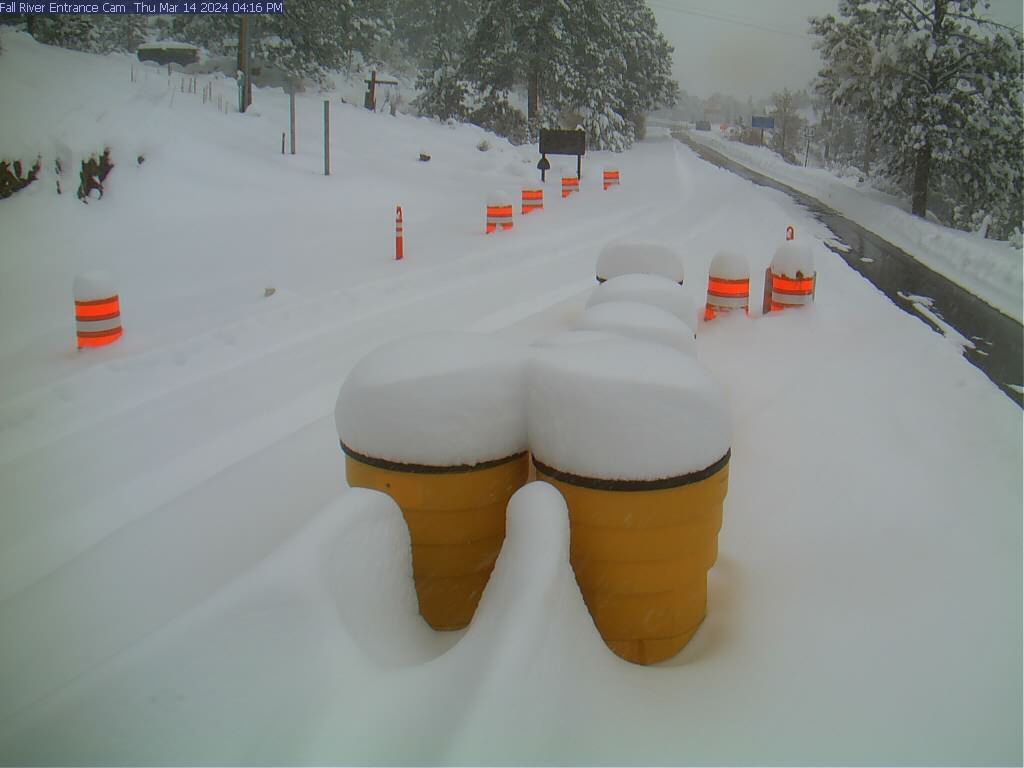
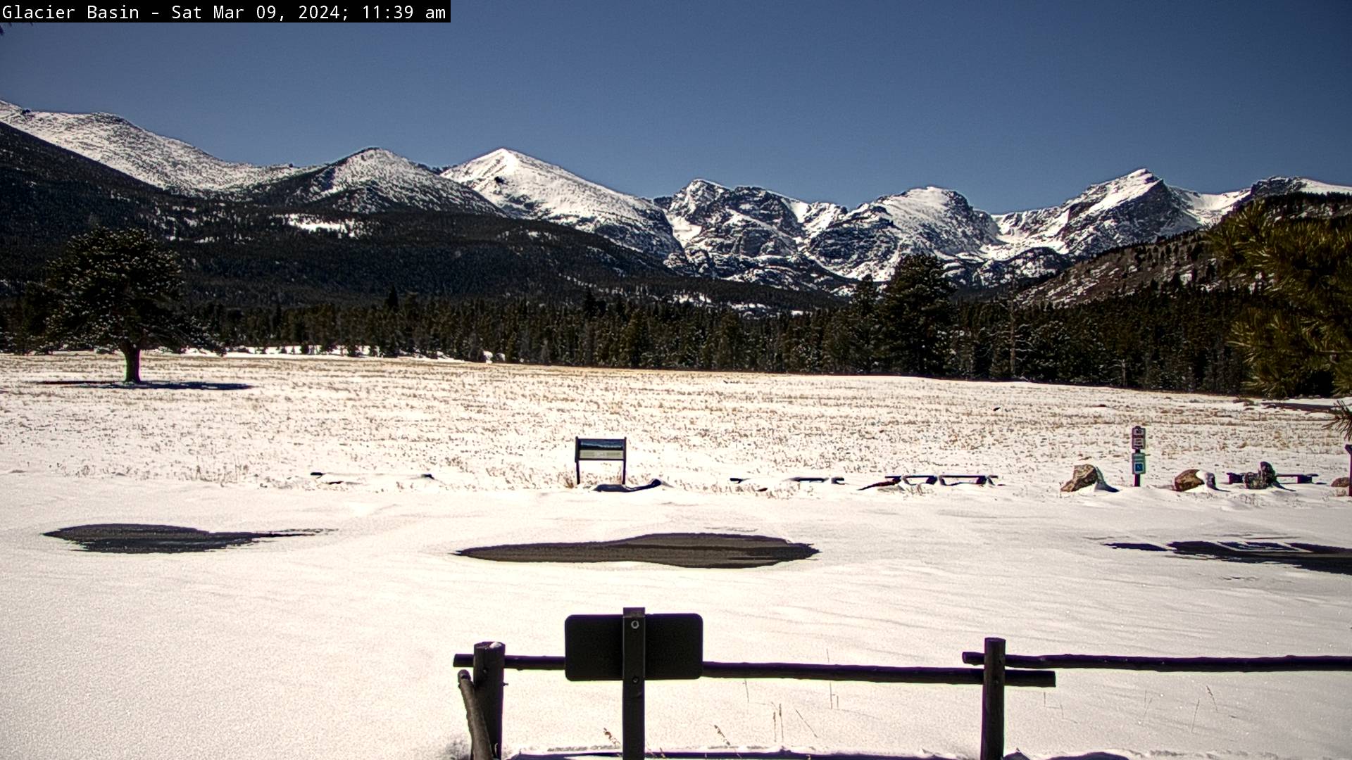
this webcam usually has no snow
-
tornado warning 2 counties south of Fort Wayne. Most indicators say 2"-3" hail
-
I would have thought there would be a bit more discussion of tornado warnings near STL. Otherwise, one tornado warning south of Fort Wayne right now.
-
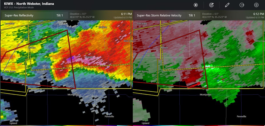
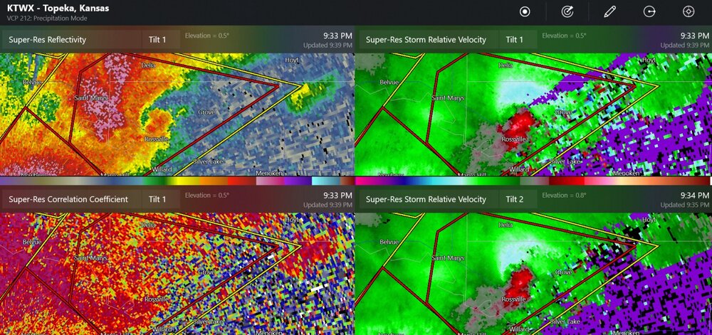
new confirmed tornado at Hoyt
QuoteHAZARD...Damaging tornado and baseball size hail.
SOURCE...Weather spotters confirmed tornado northwest of Hoyt.
IMPACT...Flying debris will be dangerous to those caught without
shelter. Mobile homes will be damaged or destroyed. Damage
to roofs, windows, and vehicles will occur. Tree damage is
likely. -
this was a tornado by a spotter report
-
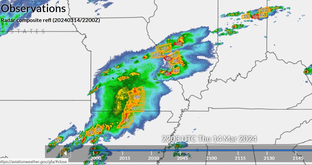
a couple of possible tornadoes now
-
I think this was the highest of the measured wind speeds
-
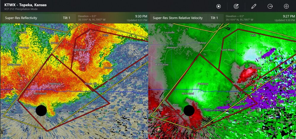
A few storms developing near Topeka's radar look like they could get going into supercell mode.
-
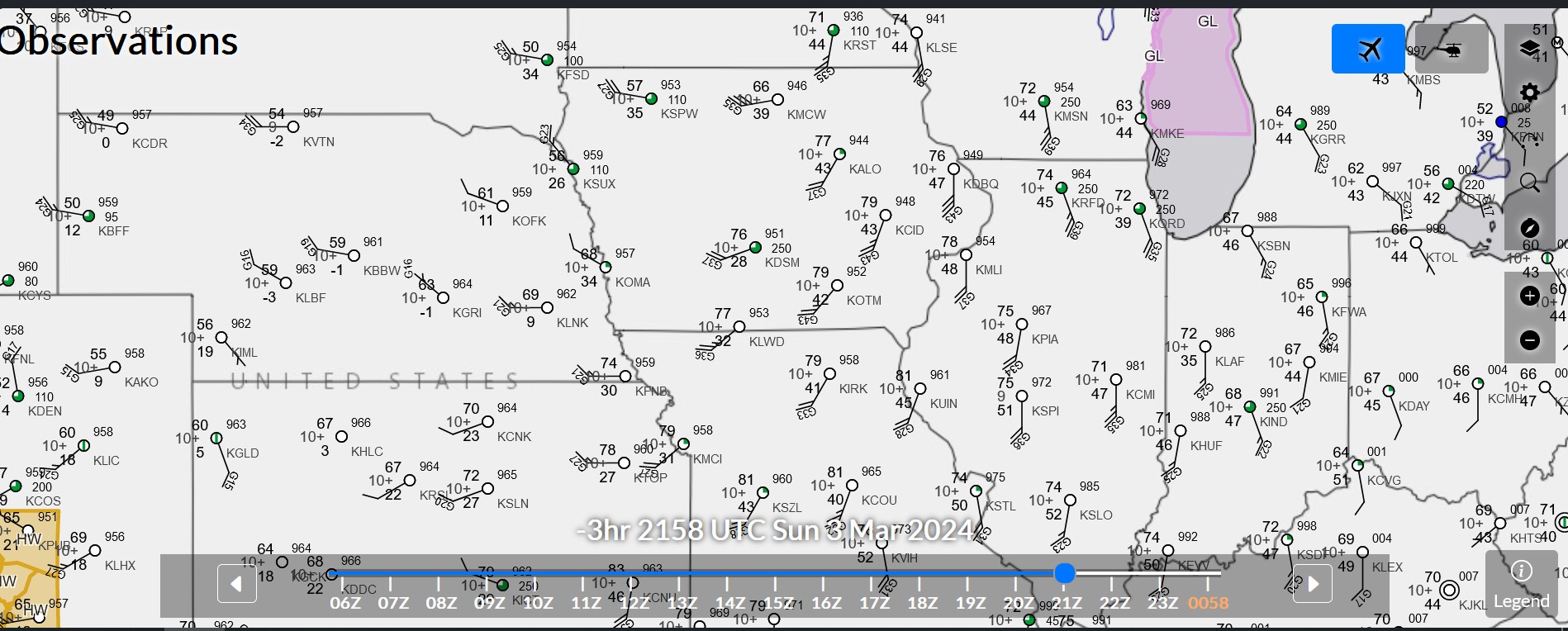
current NWS map
-
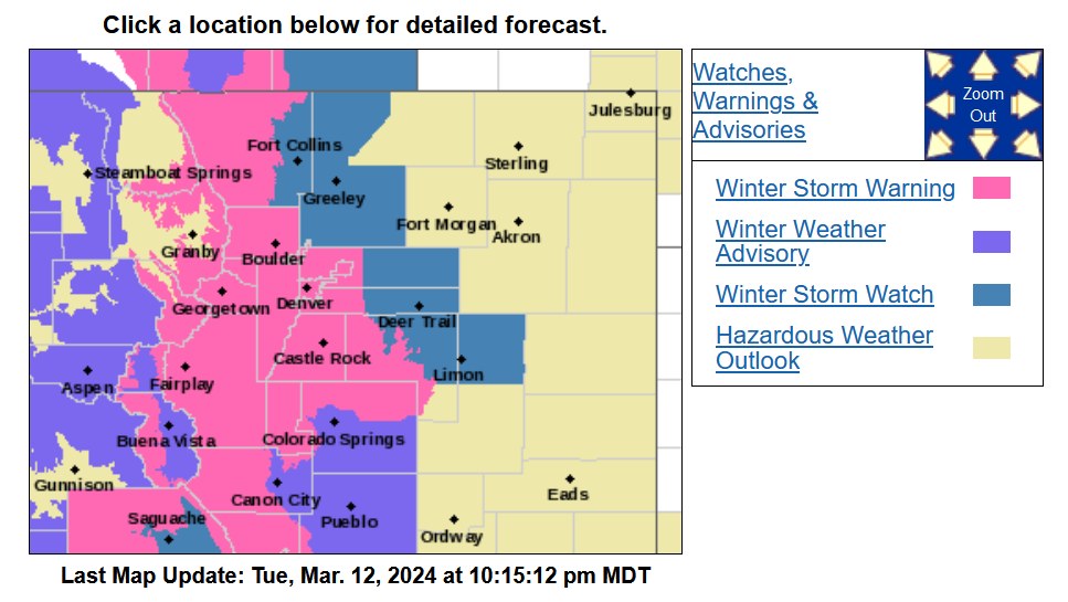
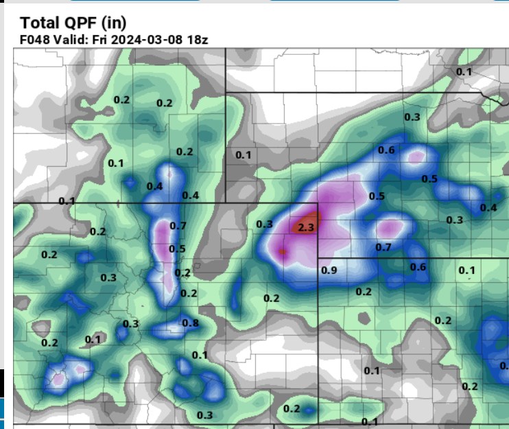
The NWS has 1" to 1.5" QPF for most of the area, and currently the temperatures at 5000 ft could be 32-40 degrees as it is snowing, or raining, and 32-34 degrees late at night on Thursday morning. Certainly some version of a winter storm watch will be incoming.
QuoteWe have opted for a Winter Storm Watch across the Front Range mountains/foothills this afternoon, where confidence is highest, and will wait at least another forecast cycle or two before trying to fill in the rest of the forecast area with watches/warnings/advisories. Again - the bottom line here is to be prepared for a significant winter storm this week
-
I wonder how much snow is just under the trees, just beyond the meadow.

-
3 hours ago, ValpoVike said:
The Euro and GFS are both showing a good storm for the second half of next week for the foothills with the Euro QPF coming in at 1.5"+ and the GFS is bonkers with widespread 3"+ totals. It would be right on time for our big March events, so fingers crossed.
I'm sure there will be a lot to talk about in the future. The GFS has a shortwave with some snow at hour-108 and then there's more snow after that. The 500mb low will roll around the Four Corners area, I think. But like I say, that one is more than 100 hours in the future.
-
clouds cleared off just for me, in March, with east wind. what is this madness?

-
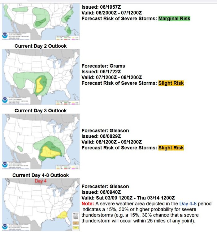
Friday night could have an enhanced risk for tornadoes
-
Snow with a weak disturbance, with winter storm watches/winter weather advisories above 6000 ft
-
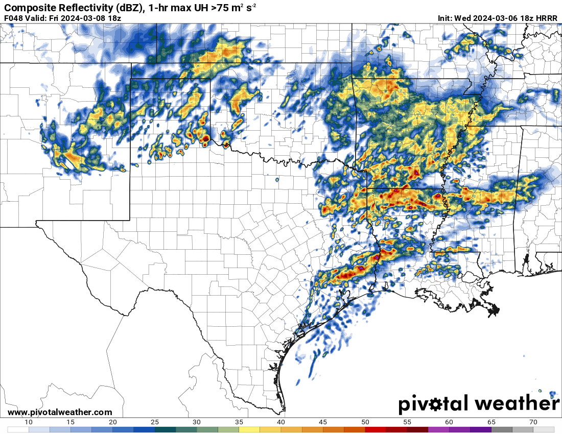
Severe weather outlooks for this week: Honestly I'm not sure what so say regarding this. I don't think a lot will get going tomorrow in the daytime. There should be more severe activity popping up from 12z to 18z Friday, along with up to 65 kt of shear in Louisiana at that time. The GFS shows high storm relative helicity in Mississippi.

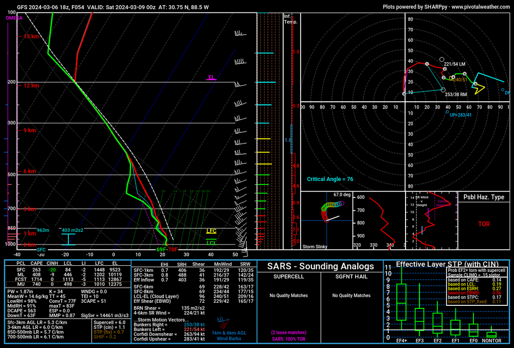
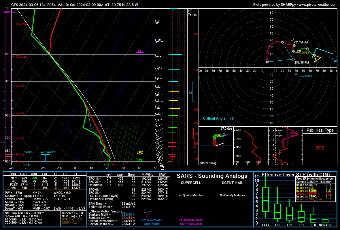
This is a sounding near Biloxi for Friday with low-CAPE, high humidity
-
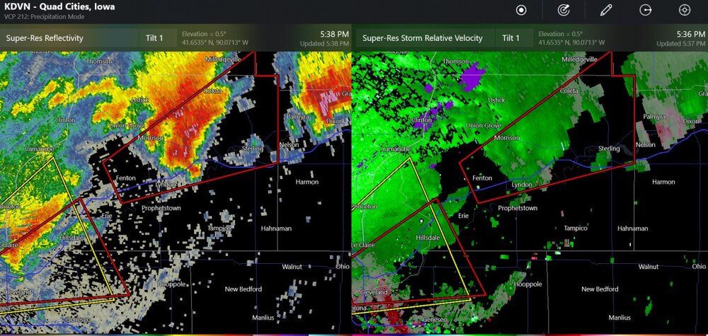
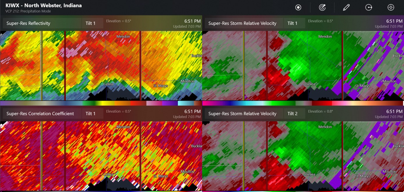
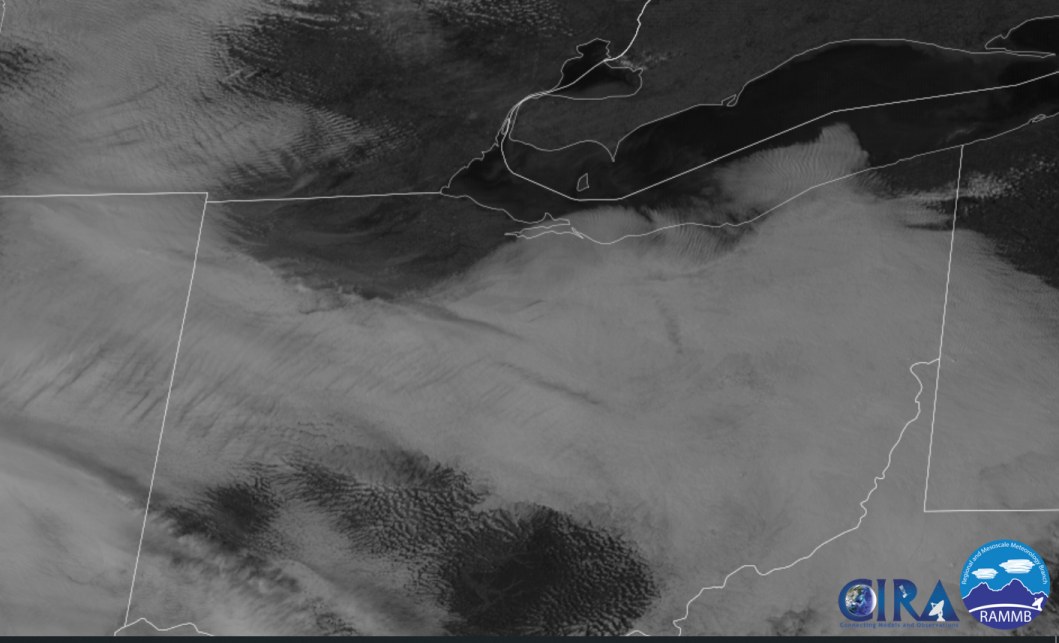
quick increase in reflectivity at Dixon
-
another two tornado warnings (almost right at Cyclone77's place) and also an unwarned cell to the east
-
it's too nice
-
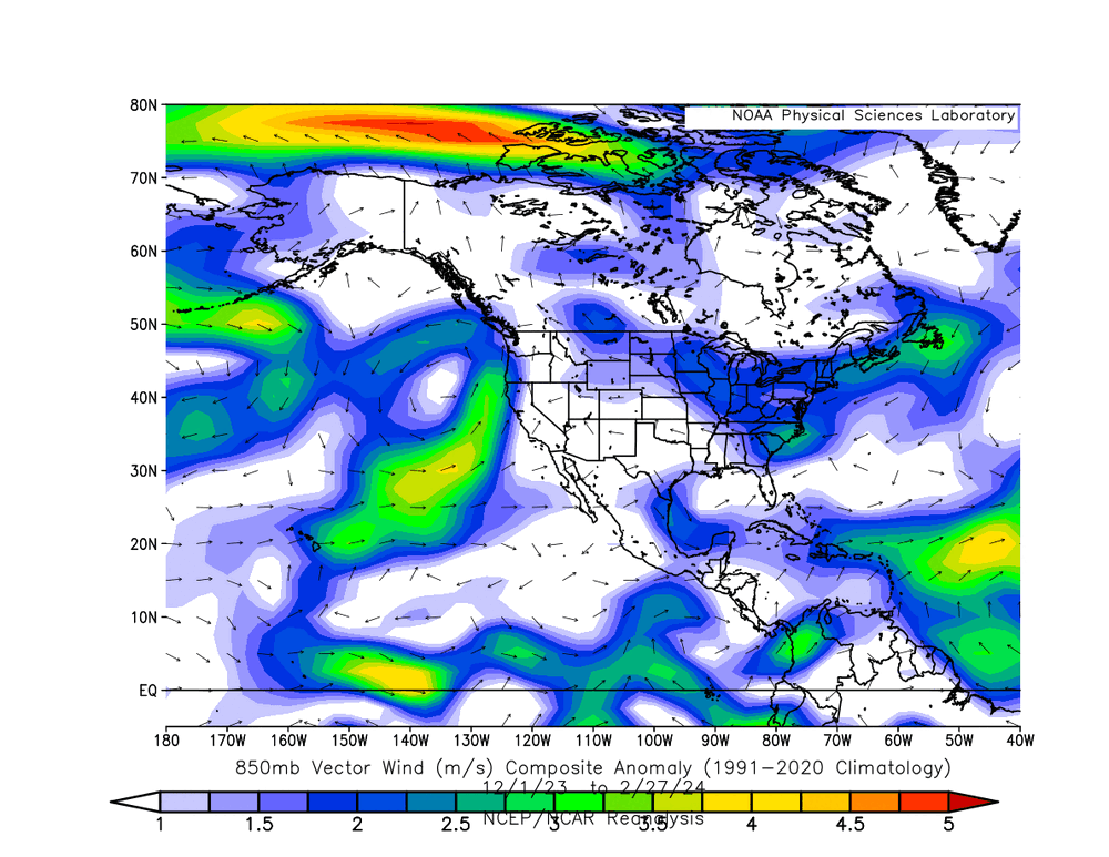
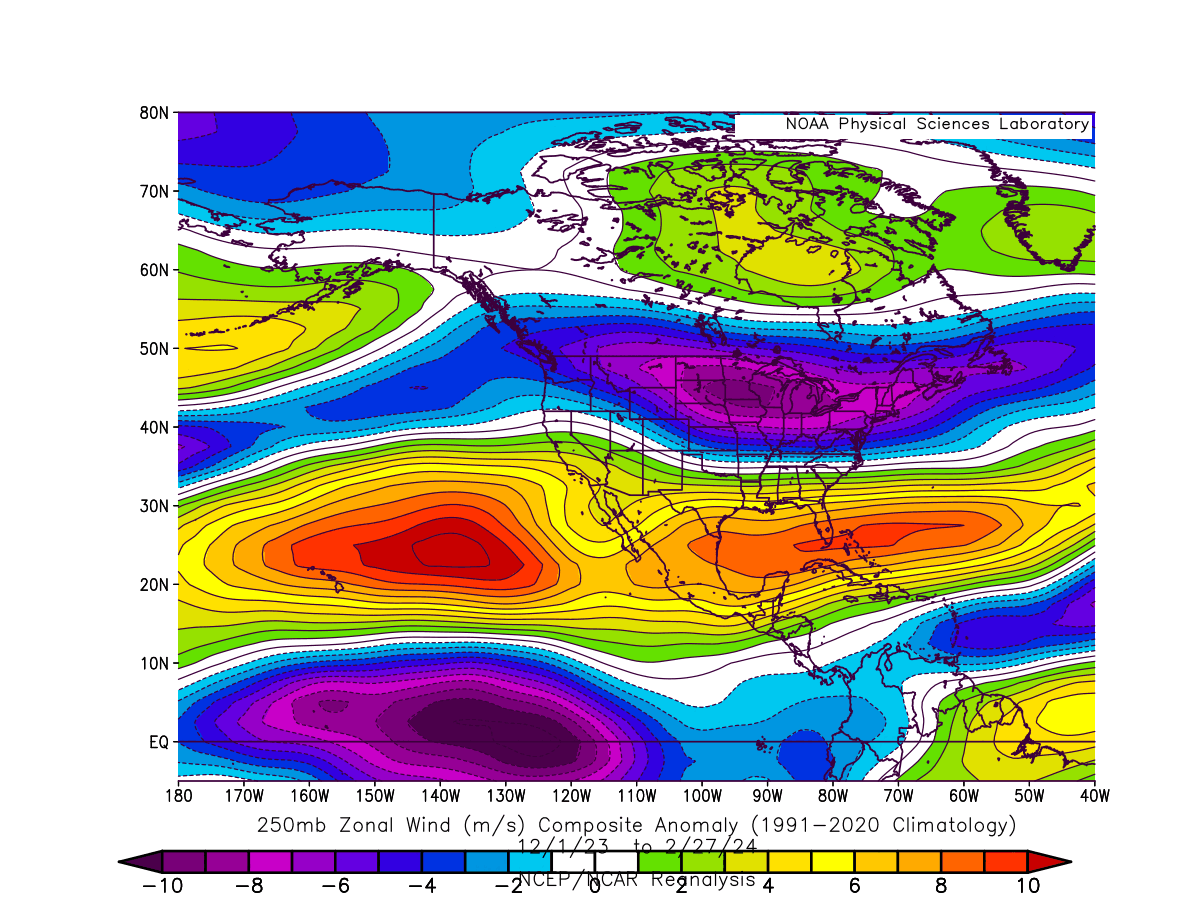
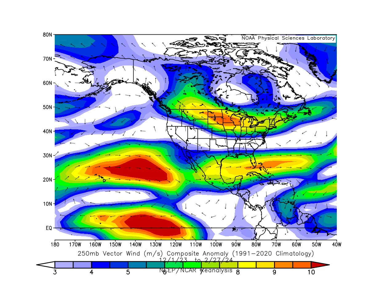
I posted these images in the El Nino discussion. This shows the subtropical jet stream did most of what it was supposed to do. There are also some abnormally westerly winds near the equator, with a component of the wind transporting the moisture to California. (westerly winds at the equator should be happening in the West Pacific.)


-
1
-


2024 Short/Medium Range Severe Weather Discussion
in Lakes/Ohio Valley
Posted
This was close to my family member. I will eventually get some sort of update from the locals...