

dryslot
-
Posts
60,968 -
Joined
-
Last visited
Content Type
Profiles
Blogs
Forums
American Weather
Media Demo
Store
Gallery
Posts posted by dryslot
-
-
13 minutes ago, powderfreak said:
Those are the official boards. Best type of snowboard you can have. I love those things at the mountain.
It has a 2'x2' aluminum white base, And that's actually an aluminum flag pole that i had a sign store do the graphics.
-
 2
2
-
-
Just now, FXWX said:
Where did you get that particular snow stick???
I had it made.
-
Just now, DotRat_Wx said:
So basically snow is caked on to one side of the radar site causing this issue... Who can drive down with a bucket truck and wipe it off?
I would go but its snowing 1-2"/hr.
-
10 minutes ago, Lava Rock said:12 minutes ago, Deck Pic said:Eustis, -SN, 32. Maybe an inch so far.
Cool. Nice to have someone reporting from that area
There just passing thru.
-
18 minutes ago, STILL N OF PIKE said:
Friend in Medway concurs she's in "pound town" with 3-4" in 2 hours
And she is ok with that?
-
 5
5
-
 1
1
-
-
6 minutes ago, dendrite said:
Not sure why that didn’t loop. Trying on the phone now.
Is that me with the sled?

-
1
-
-
Dam, Lights are flickering now, Charging everything up, But were armed and ready.

-
4
-
-
1 minute ago, OceanStWx said:
Took our first power hit just a few minutes ago.
On CMP's website, Cumberland County outages are spiking right now.
-
Winds are picking up as well now, Starting to see some saggy branches on my pine tree

-
6 minutes ago, dendrite said:
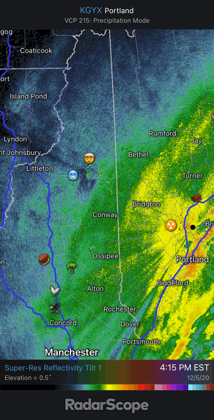
That’s brightbanding around the radar. As long as GYX, and vicinity, is 32-33° there’s going to be a lot of oranges and reds sitting over dryslot’s head.
Sitting right at 32/31°F.
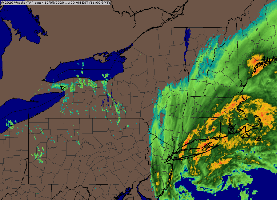
Special Weather Statement National Weather Service Gray ME 213 PM EST Sat Dec 5 2020 MEZ012>014-018>022-033-052215- Southern Oxford-Interior Cumberland Highlands-Androscoggin-Interior York-Interior Waldo-Southern Franklin-Southern Somerset-Kennebec-Central Interior Cumberland- 213 PM EST Sat Dec 5 2020 ...An area of heavy snow will affect Kennebec...northwestern York... northwestern Waldo...southern Oxford...Androscoggin...southeastern Somerset...northwestern Cumberland and southeastern Franklin Counties... At 212 PM EST...An area of heavy snow was near Turner. The heavy snow was nearly stationary. Locations impacted include... Lewiston, Augusta, Waterville, Farmington, Fairfield, Bridgton, Fryeburg, Mechanic Falls, Skowhegan, Naples, Pittsfield, Oakland, Turner, Rumford, Gray, Madison, Jay, China, Litchfield and Clinton. This includes Interstate 95 between mile markers 69 and 81, and between mile markers 109 and 156. This also includes... Sebago Lake, Pleasant Mountain, Burnt Meadow Mountains, Long Lake, and Albany Mountain. * Visibilities will drop quickly to less than a quarter mile in this area of heavy snow. * Snowfall rates of 1 to 2 inches per hour are occurring in this area of heavy snow. Icy roads are possible as the snow melts on the roads then quickly refreezes. LAT...LON 4354 7096 4424 7101 4468 7018 4497 6933 4473 6927 4473 6921 4469 6920 TIME...MOT...LOC 1912Z 157DEG 2KT 4418 7028 $$ Legro-
1
-
-
1 minute ago, tamarack said:
Which stubbornly resists much northward movement. Should that continue, I see a significant bust, 12-18" becoming maybe 6-8 (which still ain't too shabby for 1st week DEC.) 1/2"/hr isn't going to get our depth anywhere near the forecast. Still time, however.
Just looked at the 18z Nam for here and its spitting out ridiculous amounts over my head of 24"+, Kuchie totals are 18"+
-
1
-
-
1 minute ago, powderfreak said:
Your area is looking really, really good right now, ha. Jelly. If you are already snow that is a lot of moisture feeding into that. Those radar echoes are legit just north/west of the radar site.
Its just rotating in of the GOM, Its been snow for 2hrs or so, SN, 32/31°F
-
1
-
-
Just sitting here under this band.

-
1
-
-
Look like 1" so far

-
1
-
-
Some never learn, Have the scanner on cars in the ditch everywhere.
-
1
-
-
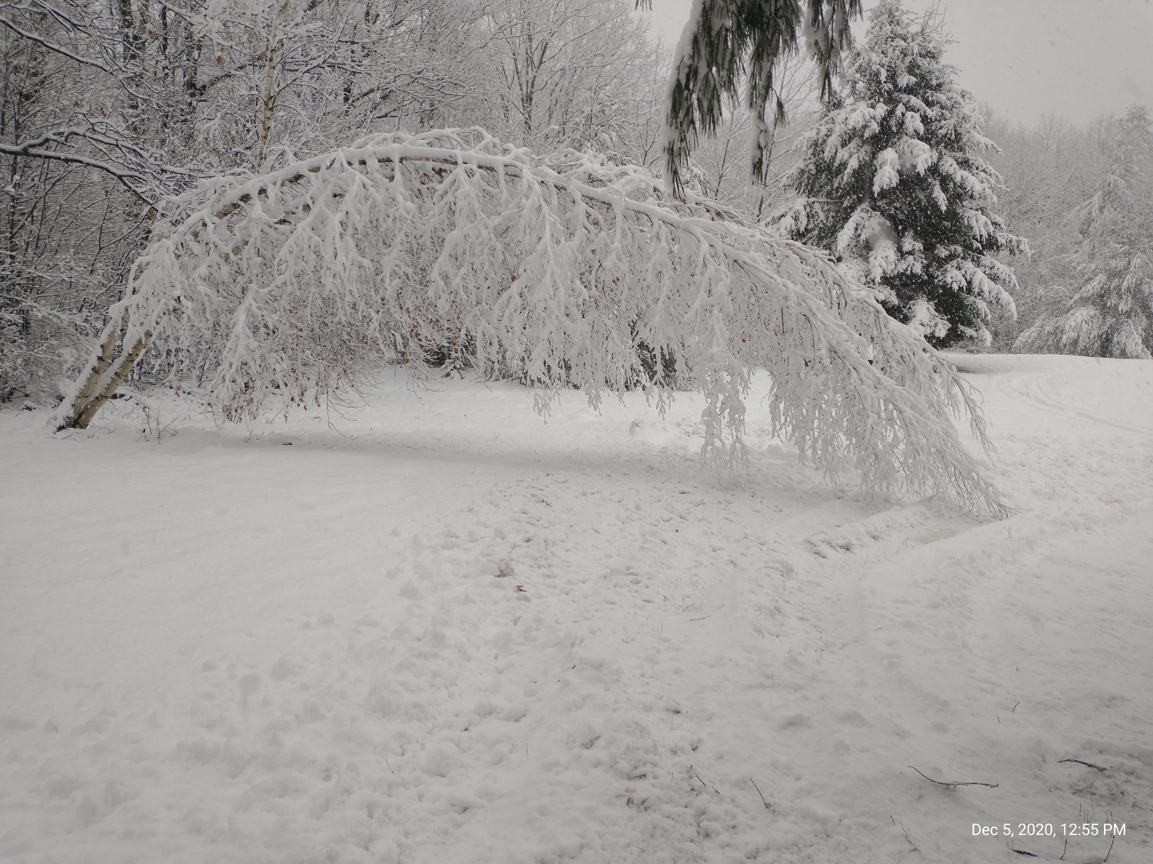
45 minutes ago, Whineminster said:
Is this what you call a Birch bending blue bomb?
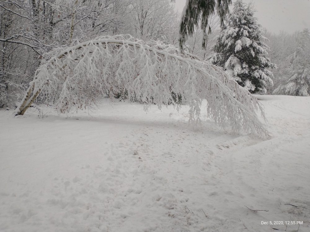
That's an official "Birch Bender"
-
1
-
-
-
12z Euro just hammers here.

-
3
-
-
8 minutes ago, ORH_wxman said:
Metrowest is going to get a lot. Big power problems are in store.
Just NW of that band here and its producing.
-
Accumulating quick with these flakes.

-
Parachutes here SN, 32/31°F

-
Over to all snow now 33/32
-
1
-
-
1 minute ago, RUNNAWAYICEBERG said:
Certified weenie when it’s more important to track snowstorms and post maps then prep for the storm itself. Imagine if we did that for a hurricane lol.
Ha ha well it ran into hunting season too so priority’s
-
Cat paws mixing in, Trying to get the chains on the John Deere tractor.


December 5-6, 2020 Storm Observations and Nowcast
in New England
Posted
SN and blowing snow, Up to 3", 32/31°F.