

dryslot
-
Posts
58,668 -
Joined
-
Last visited
Content Type
Profiles
Blogs
Forums
American Weather
Media Demo
Store
Gallery
Posts posted by dryslot
-
-
Hopefully the winds pick up here soon. Been meh so far.
-
1 minute ago, Damage In Tolland said:
They have phones . You just post from phone like rest of world
Flip phones?
-
-
3 minutes ago, dendrite said:
Are those hog panels? I need some of those for a grapevine trellis.
Yes, They generally work well but in this case no, I use them for a trellis in the garden, Tractor Supply has them.
-
 3
3
-
-
Looks like I’ll have plenty of work to do, Thought the carport would’ve been the one to collapse
-
1
-
 1
1
-
-
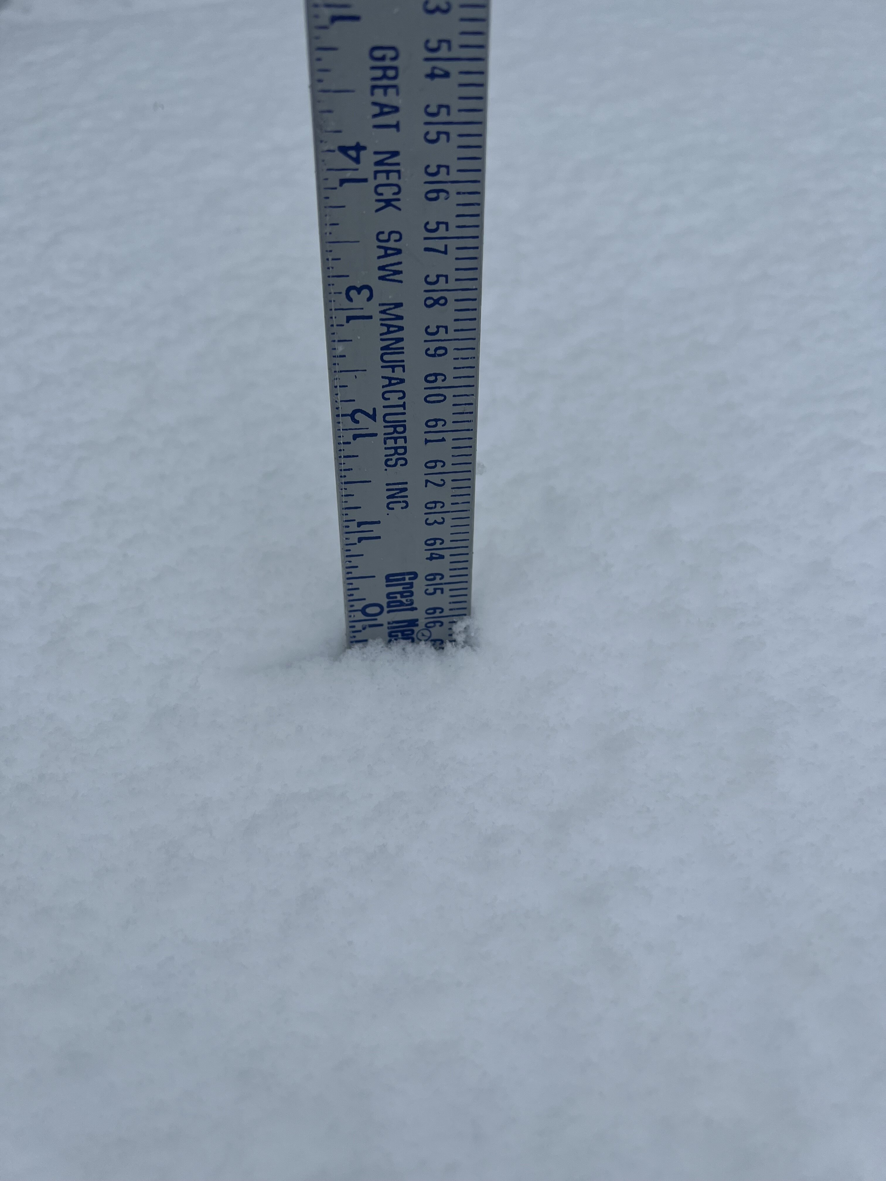
Was thinking about picking up a Lunnenburg ruler next year to take measurements.

-
 6
6
-
-
-
1 minute ago, tamarack said:
Didn't CMP outages reach 400k on Dec 18? Nobody in our general region had power; we ran the genny just over 100 hours.
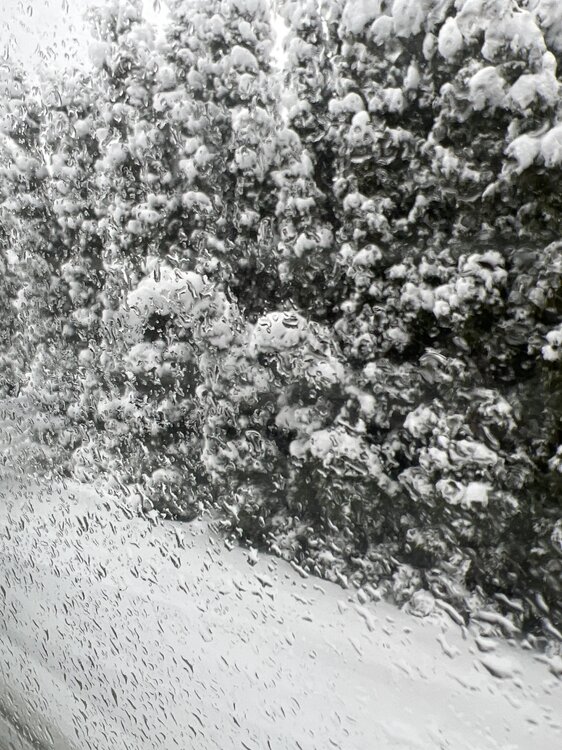
Had 8.5" and 0.87" LE by 7 AM, maybe 1/2" since as a stripe of nothing from the NH line to Newport was parked along Rt 2 for several hours. It's moved a bit north but still only light SN here, with occasional gusts approaching 30. Trees are loaded up to about 30 feet then wind-emptied above there. May yet reach the low end of the 12-18 forecast.
Yes, But i was referring to last weeks, This will have prolonged outages too.
-
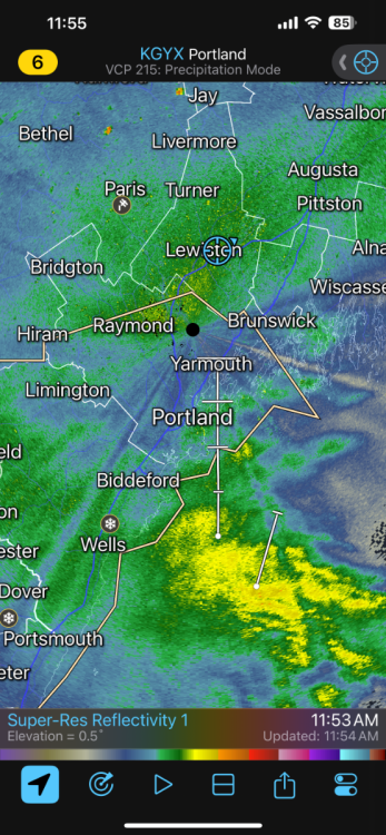
That band just keeps building here, Over 10" now
.thumb.jpg.784f469045f441447a105f67c6dfe028.jpg)
-
1
-
-
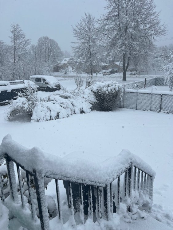
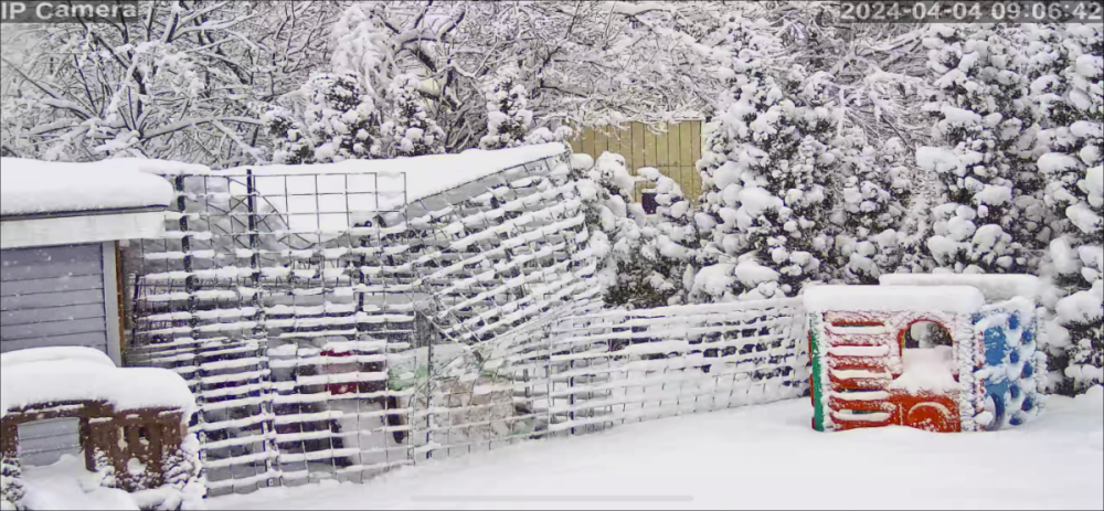
My junipers are on the ground.
-
2
-
-
1 minute ago, Lava Rock said:
I might have made a mistake coming to work. Want to make sure I'll be able to get back home without a bunch of trees or limbs down. It wasn't that bad coming in. When's the convection expected if it moves in?
If it gets here, The next couple hrs
-
1
-
-
3 minutes ago, Ginx snewx said:
Cobb is useful but again can be screwy if UVVs are sketchy. This storm isn't over up north by a long shot. Serious invt
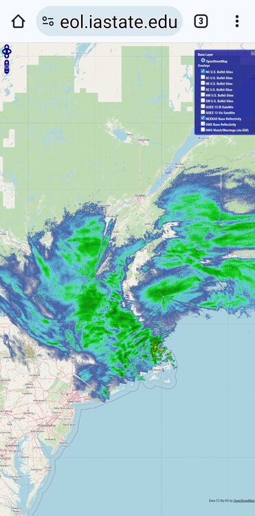
It s going to get interesting if that convection in the GOM rotates in here.
-
These heavier rates are bringing the winds down to the surface now.
-
Just now, Lava Rock said:
gonna be days w/out power. Dec storm we were out nearly 3 days.
And those were localized outages, This is widespread.
-
276,000+ without power, Probably will crack 300,000.
-
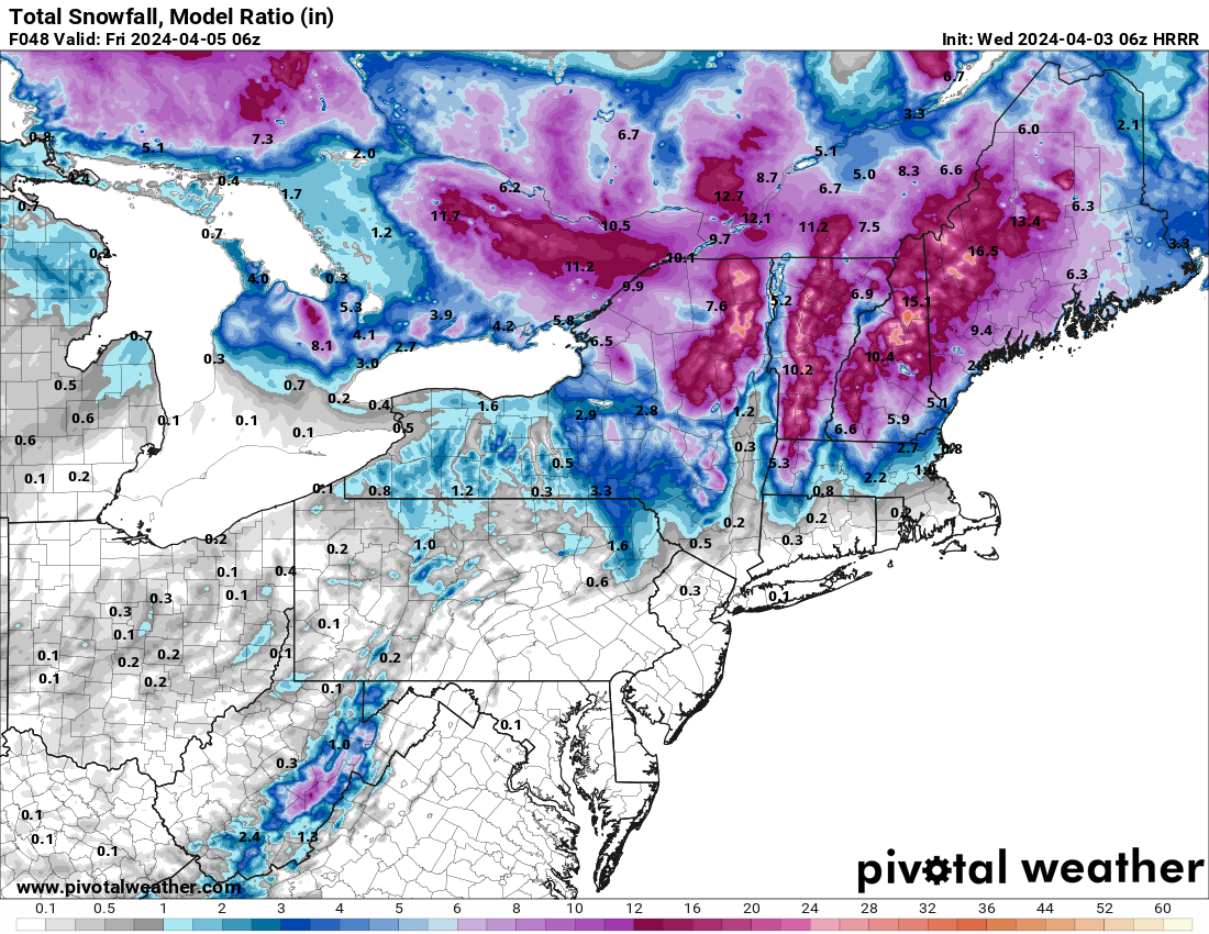
2 minutes ago, Ginx snewx said:
Best I have found are those model derived. Here is HRRR from 6 Z Wed

Were at that now for here.
-
KLEW 041256Z AUTO 04014G21KT 1/2SM SN FG OVC005 00/M01 A2960 RMK AO2 CIG 004V009 SLP033 P0001 T00001006 FZRANO
-
-
Over 243,000 with out power now and climbing.
-
3 minutes ago, OceanStWx said:
Like many products, good in some areas, not in others. It was terrible around here, with forecasts of 2-3" but we're easily 6+ OTG away from the coast even with compaction.
Yeah, Not good here either.
-
1 minute ago, SouthCoastMA said:
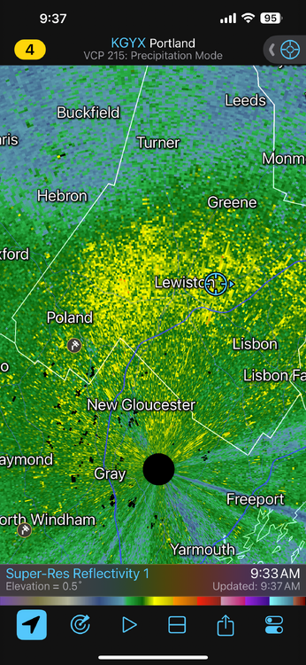
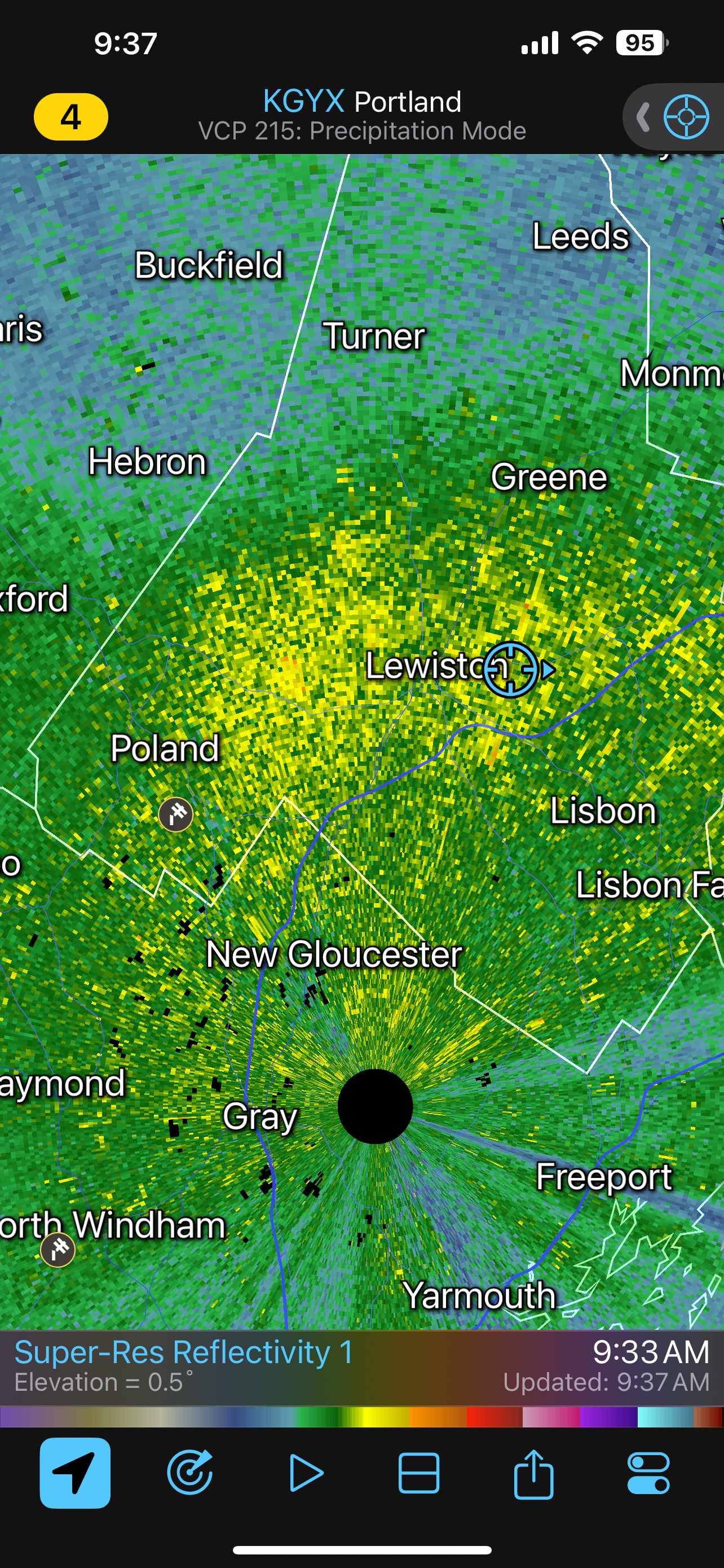
radar still looks solid over Lewiston..what you got?
Were over 9" right now
-
1
-
-
Alright.

MEZ020-041300-
Androscoggin-
Including the cities of Greene, Lewiston, Sabattus, Wales, Minot,
Turner, Auburn, and Livermore Falls
748 AM EDT Thu Apr 4 2024

...WINTER STORM WARNING REMAINS IN EFFECT UNTIL 8 PM EDT THIS
EVENING...

.TODAY...Snow with a slight chance of thunderstorms this morning,
then snow this afternoon. Patchy blowing snow. Visibility one
quarter mile or less at times. Additional snow accumulation of 6 to
10 inches. Highs in the mid 30s. Northeast winds 20 to 25 mph with
gusts up to 45 mph. Chance of snow near 100 percent.
.TONIGHT...A slight chance of sleet in the evening. Patchy blowing
snow in the evening. Snow and rain. Additional snow and sleet
accumulation around an inch. Total snow accumulation 11 to
15 inches. Lows in the lower 30s. Northeast winds 15 to 20 mph.
Gusts up to 40 mph in the evening. Chance of precipitation
90 percent.
-
1
-
1
-
-
Just now, Damage In Tolland said:
Do you ?
I have it
-
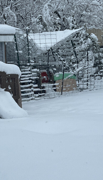
My arbors are not liking this
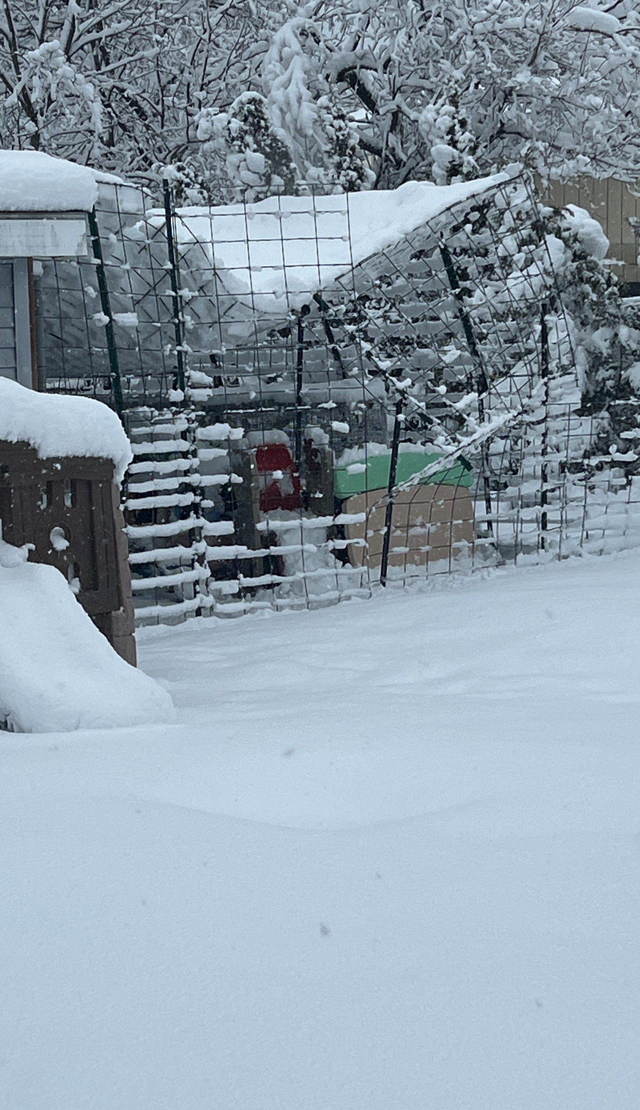

.jpg.6990997c26c566115499e9a54884569e.jpg)


Significant Miller B Nor'easter Apr 3rd-4th OBS
in New England
Posted
GFS had that there.