

backedgeapproaching
-
Posts
3,771 -
Joined
-
Last visited
Content Type
Profiles
Blogs
Forums
American Weather
Media Demo
Store
Gallery
Posts posted by backedgeapproaching
-
-
90% of valley here in SVT pretty much wiped clean...quite a furnace yesterday..most spots were 50Fish most of day into the evening.
Took a few pics when I was out earlier...can't even do an *unofficial* white xmas in most spots around here..


-
1 hour ago, dryslot said:
Need full coverage, White Christmas *CANCEL*
Ha..well just going by the *official* guidelines, which I'm pretty sure is 1".
If Gene wants to call that a white Christmas, sounds good to me..or got a patch under a spruce..sure why not.
-
 1
1
-
-
1 hour ago, wxeyeNH said:
Merry Christmas everyone, Happy Hanukkah to me. I don't know if I qualify for a White Christmas?. Last year we had snowpack from early November through till spring except like this year we had a few days of grass showing through right around Christmas.

Hmmm, that would be close to offically verifying a white xmas. I think its 1" averaged throughout your yard.
-
MWN is crazy...I mean this explains it, but what a task trying to accurately measure snow there as I'm sure OceanSt knows...
We have had multiple people ask us how snow is measured up here on the summit. Getting accurate snow measurements becomes increasingly difficult as the winds increase. We have a precipitation can that is placed on the summit in a slightly sheltered, but also open location with the summit to the northeast and the Sherman Adams building to the west to help slow the winds somewhat. The can is also placed far enough away so that drifting snow would not affect the precip can in any sort of way. The top of the can is about four feet off the ground to prevent as much blowing snow as possible from getting into the collection area. There is also a lip around the edge that helps slow down the falling snow so it would fall right into the can. In strong winds, the snow will still blow right over the can or get pulverized into ice crystals from hitting the side of the can so the snow is denser and compressed. This results in lower values for total snowfall but will melt down to an accurate liquid water equivalent, unless little snow actually fell into the can from extremely high winds. In the case where the amount of snow seems completely unrealistic (sometimes far too much or far too little due to very high winds and blowing snow) snowfall is estimated by the observers on duty.
Every 6 hours, we go out and switch precipitation cans and bring the can inside to measure the snow. We start to measure the snow as soon as it gets inside to prevent any loss due to melting. When the depth is measured, at least 10 points are measured at the bottom of the can due to snow falling unevenly into the can. If there were strong winds then much of the snow could have piled up on one side so taking an average of the 10 points will be much closer to the actual amount that fell.

-
 1
1
-
-
24 minutes ago, powderfreak said:
A ton? I don’t know much about that climo but I also don’t feel like they are ripping out 4-8” lake effect and upslope events with regularity....or maybe just no one mentions it. I could see more 1-3” type squalls but I’ll definitely start to pay more attention if they get a ton of snow from that.
Obviously Scott, Ryan, Kevin, Will, Ginx, etc know much more about that micro climate, but I'm just not seeing it after radar watching the past few years in that area.(Mainly because i was curious after looking at the COOP data) I feel like its a sliding scale of Great Upslope in the N Greens then decent moving down to SVT, OK in the Taconics/Berks in ENY, Western MA and then the scraps in NW CT.
Maybe I'm way off here. I think we have a few posters in that general area? Maybe not at 1300-1400ft.
-
2 hours ago, Damage In Tolland said:
It’s mainly due to Lake effect. They get several of their own private snowstorms each winter from lake effect
There is no way some rogue lake effect streamers can explain the Norfolk CT COOP snow totals. Its kind of crazy looking at their totals. They only have 1 season above 100" the past 20 years. But from 1944-1998 they AVERAGED about 100" per year. That's a good sample size being 50+ years. I think most considered the Norfolk COOP date pretty pristine?
Serious question, as somewhat that didn't grow up in NE, how could they have averaged that much over that time period? I know they have some good elevation (1300ft?) But they don't seem to get much Upslope?(correct me if I'm wrong) So mainly synoptic with some lake effect streamers, squalls sprinkled in. 100" average is a lot for a non lake effect/non uplsope spot.
The baroclinic zone shift for whatever reason to river east in recent decades?
-
Impressive 9.5" up in Morgan i saw on Cocorahs.
-
2.9" here. Somewhat of a underachiever based on last minute model guidance.
Oh well, looks nice with everything covered again. On to the squalls tomorrow and to see how they shake out.
-
2 minutes ago, borderwx said:
6”.
That's awesome. Euro had some thin cirrus clouds run after run for NVT and the jack for all New England ends up near the Canadian border. Nice fronto bands up there for you guys.
-
11 minutes ago, alex said:
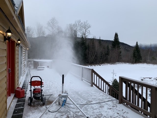
Heavy snow falling on my deck in preparation for the shoot
Lol. Is this going to be a national TV spot? Or is print?
-
25 minutes ago, CoastalWx said:
We Lucy. Perhaps all the convection played a role.
ALY was hinting at that earlier in their AFD regarding the increase in QPF for their zones:
This is possibly related to the latent heat from the
Deep South storms building the downstream ridge and enhancing lift
from the equatorward entrance region of the strong jet
-
That is pretty nuts what was going on up in NVT last night. We had some squalls here and roads were snow covered on my way to Stratton yesterday, but nothing more than a few tenths it looked like...maybe 1/2" at best. Nothing at home, just barely a dusting.
Event tomorrow looks pretty meh. OceanSt and also ALY mentioning pretty poor snow growth, coupled with the fact the most qpf is south. Taking the under on ALYs forecast of 4" here.
-
14 minutes ago, alex said:
Downsloping??? I wish, at least it'd be dry. It's raining from Florida to the St Lawrence. That'd be one big area of downslope!!!
")
More worried about downsloping on Tue/Wed but we'll see. December to remember my a$$
I meant in the fact that the temps were up a bit at that that time. I think when she posted that last night the temps were in the mid 30s with rain while dendrite and Gene were in the upper 20s to around 30F even though they are south of you and remember Gene posting even a little snow obs. There seemed to be some downsloping and compressional warming going on near you guys even with the precip. Downsloping doesn't always mean dry with no precip(obviously there will be less), I downslope here and still get a good amount of precip during some events gusting to 40-50mph at times.
At that same time it was 36F here and gusty on the western slopes and 30F on some east slope spots last night I'm SVT.
But, yes everyone is raining up through Canada for most of this event. I guess the downsloping post didnt make sense without context
-
41 minutes ago, #NoPoles said:
Rain

Welcome to the world of downsloping..
-
21 minutes ago, J.Spin said:
From discussions here and elsewhere, I recall that at points in the past, observations were made right in Burlington proper, closer to the lake, vs. where they are now out by the airport a few more miles inland. There’s certainly less snow accumulation (at least in the fall and early winter when the lake is warm) right down by the lake front, so that’s a possible contributor. I’m not sure when the location change happened, but PF might have some insight into it.
Yea I know the BTV temp thing is talked about a lot by PF and recall people talking about site changes. That makes sense being that close to the warm lake could cut down early in the season with accumulations. But only 2 times above 90" in 70+ years? Who knows what really was happening back in the days of yore. Maybe it really was a long, long long relatively non snowy period..lol. Most likely there is some other explanation.
-
Totally random question--but whats up with BTV going 73 years without reaching 100" between 1892-1965? Siting issue or measuring techniques? I mean they only made it to 90" twice during that whole span. Doesn't seem possible.
From 1965 to current (54 years) they hit 100" 10 times and 90" 12 times. I guess that's why people talk about historical records not being homogeneous.
https://www.weather.gov/btv/historicalSnow
-
1 hour ago, #NoPoles said:
I have the uncanny ability to need to get gas for my car on the coldest and most absurdly windy days...I think that's my special power

We have one full service station here in town..I definitely frequent it more often in the cold season.
-
1
-
-
Damn..DDH gusted to 50mph last hour. Almost calm here all day.
-
Upslope 38F rain..sweet.
-
BTV AFD..some nice
 disco...ha. Awesome though for you guys and resorts up North.
As of 1236 PM EST Saturday...Report from nws employee at local
resort in the northern Green Mtns continues to indicate light
snow with some accumulation occurring. Have continued to mention
likely pops with total daytime snowfall accumulation of an inch
or two possible from Mansfield to Jay Peak. The localized BTV
snow machine is having difficulties finding the off switch,
which is not a bad thing, especially when some are having fun
with product testing. Otherwise, flow becomes unblocked this
aftn and depth of moisture decreases by 21z, which will result
in decreasing areal coverage of snow shower activity. No
significant changes to crnt fcst.
-
1
-
-
49 minutes ago, J.Spin said:
Event totals: 5.3” Snow/0.16” L.E.
Details from the 6:00 A.M. Waterbury observations:
New Snow: 1.7 inches
New Liquid: 0.02 inches
Snow/Water Ratio: 85.0
Snow Density: 1.2% H2O
Temperature: 17.4 F
Sky: Light Snow (2 to 8 mm flakes)
Snow at the stake: 8.0 inches
85-1..not bad.
Ive always wondered...When do you sleep? 12am and 6am obs every day?
-
Looking like 3-3.5" new without measuring yet.
Its funny how these little systems can sometimes cause the biggest road issues. Roads were a mess around town, saw multiple spin outs and poor Minivan from NJ struggling up a hill just spinning the front wheels.
-
1
-
-
29 minutes ago, powderfreak said:
Good luck this afternoon dude. Gonna be a bit too far south for up here.
Thanks. About 1" down now.
Taking the kiddos up to Bromley tomorrow for first time this season, nice to have a little refresher.
-
Radar looking good for 2-4 I think.
-
1
-


NNE Cold Season Thread
in New England
Posted
Holding to meager "pack" at home..especially compared to most of town.