

ILSNOW
-
Posts
1,433 -
Joined
-
Last visited
Content Type
Profiles
Blogs
Forums
American Weather
Media Demo
Store
Gallery
Posts posted by ILSNOW
-
-
7 minutes ago, cyclone77 said:
Euro back to trolling the poor souls of northern IL/southeast IA.


Garbage model
-
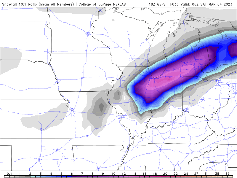
18z GEFS for those getting the snow enjoy.
-
 1
1
-
-
9 minutes ago, A-L-E-K said:
lol
Right. Clearly the NAM is onto something and will prove correct making the Euro, GFS, GEM,RGEM, ICON,JMA, NAVGEM and JMA all wrong.
and 18z HRRR

-
 1
1
-
 2
2
-
-
best Model and this is the lower snow depth output. What a joke!!!

-
1
-
-
1 minute ago, Chicago Storm said:


.thanks
-
1 minute ago, Chicago916 said:
With a mean like that, there must be some crazy, impossible totals on some of the ensemble members through NE IL.
Maybe RC or Chicago Storm can share if the have it.
-
1
-
-
12z EPS

-
1
-
2
-
-
good luck to folks south and east of here enjoy !!!!

-
3
-
-
12z NAM apparently didnt get the message. Why is this model even around any more. We are within 24 hrs of a potential storm and most models have no precip in the Chicago area and this model has a 13 inches . It should be replaced by a dart board. At 18z is will go from 13 inches to 0.

-
so Chicago goes from WSW to partly sunny highs in the low 40's!!!!!
-
Euro caves

-
3
-
-
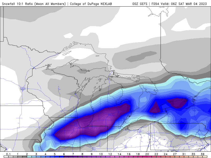
0z GEFS
-
1
-
-
NAM hasn’t gotten the south and east memo (YET)

-
2
-
-
4 minutes ago, Chicago Storm said:
update: back to miss south stank.
Would love to see EPS if you can share
-
1
-
-
Euro goes south and east

-
6
-
-
2 minutes ago, Malacka11 said:
The GEFS looks even better than 12z..
yes the mean remains NW of the op run
-
1
-
-
Chicago NWS snippet
Forecast soundings have continued to show that a rain and snow would
be the dominant precipitation types with a sharp gradient separating
the two p-types across the area. Recent trends have stared to hint
at the idea that areas north and west of I-55 would be the most
favored for snow and potentially heavy snow as the aforementioned
enhanced forcing interacts with it. Given that surface temperatures
are forecast to be around freezing the snow would likely be a wet
snow with ratios on the order of 8:1 to 9:1. While it is still too
soon to narrow down the exact location of where this heavy snow band
would set up it is looking like areas under this band could see
accumulations in excess of 3 inches which would lead to hazardous
travel conditions during the day on Friday, but especially during
the afternoon hours.
-
2 minutes ago, A-L-E-K said:
needs 2 happen
looks like the NAM from the old days when we would always get 1 huge run before it came back to reality.
-
18z NAM snow depth

and Kuchera

-
is this good!!!!!

-
12Z EPS

-
1
-
-
-
6z Euro

-
1
-
-
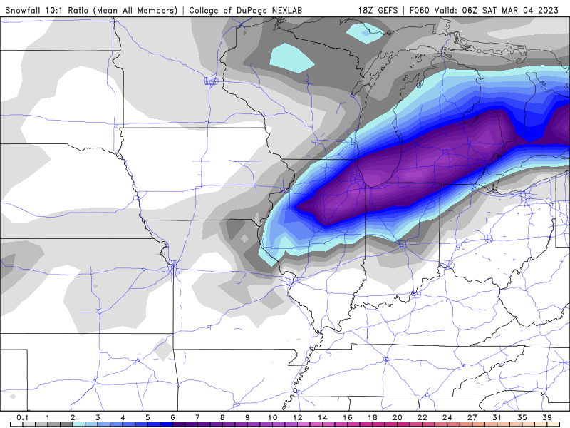
GEFS follows the op run

March 9-10 Winter Storm
in Lakes/Ohio Valley
Posted
yep nice to look at the NAM (Never Accurate Model)