

sarcean
-
Posts
206 -
Joined
-
Last visited
Content Type
Profiles
Blogs
Forums
American Weather
Media Demo
Store
Gallery
Posts posted by sarcean
-
-
Wondering how Snowshoe, WV might fare. Some of the (clown) maps are calling for some high totals in the WV mountains - even the RLX NWS is calling for a 1 in 10 chance of 12".
-
-
.NEAR TERM /THROUGH TONIGHT/...
As of 211 PM Friday...

Upgrade to Winter Storm Warning for Forsyth... Guilford...
Davidson... Randolph... Alamance... Orange... and Person
Counties into Saturday afternoon...
Based on satellite, radar, and observational data including heavy wet snow upstream from Jackson to Birmingham to much of western NC (locally already 5-8 inches)... we will upgrade our Northwest Piedmont to a Winter Storm Warning (2-4 inches of wet snow), some locally higher totals possible. The battle of the cold air (very marginal) with surface temperatures just above freezing, and warmer air aloft intruding into mainly eastern NC (or as far west as potentially Greensboro and Lexington this evening), with an initial warm ground have been greatly limiting snowfall accumulations thus far. However, as we lose insolation with nightfall, most guidance suggests snow will continue (very wet) through near sunset, with a potential lull in some areas early to mid evening, before increasing again later tonight. Storm totals of 2-4 slushy inches are possible with locally 5 inches just north of the urban areas of Winston- Salem to Greensboro, and around Roxboro. Roads should be wet to slushy, especially on bridges and overpasses. -
Saw NWS upgraded to Winter Storm Warning for Greensboro/Winston
-
 1
1
-
-
1 minute ago, bargainmusic said:
Still snowing in Winston-Salem but I am not seeing anything sticking anywhere outside my window.
It is 33 in Greensboro and 34 in Winston so it will start sticking very soon.
-
4 minutes ago, DopplerWx said:
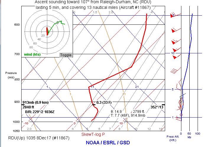
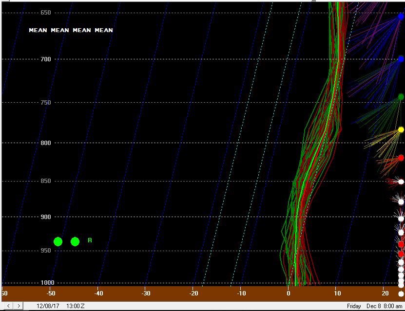
also this should scare you if you have visions of clown maps dancing in your head, models may be underdoing the warm nose (imagine that)
RDU flight observed sounding vs SREF from last night. Notice shallow warm layer from 900-1000mb and the tiny warm nose just before 800mb. It’s as if it was trying to tell us something!
To the surprise of no one who follows snow storms in our region.
-
2
-


December 8-10, 2018 Winter Storm
in Southeastern States
Posted
I'm liking what I'm seeing but ....
48 HR Rule - NEVER trust ANY model showing snow in the SE past 48 hours