

The Ole Bucket
-
Posts
513 -
Joined
-
Last visited
Content Type
Profiles
Blogs
Forums
American Weather
Media Demo
Store
Gallery
Posts posted by The Ole Bucket
-
-
42 minutes ago, SolidIcewx said:
Damn right! It’s funny to see the others in that thread be the ones to put out the dumpster fire. At least over here we are happy with a 6-10. This thread would go nuts over a 2 footer from DVN to DTW. Not referring to the upcoming event just a generalization
Let me just say that people cliff jumping over getting 33 and rain is part of the fun.
And then when the rare overperformer happens, everyone is beyond thrilled and backslapping.
I had more than my fair share of total climo screw jobs when I lived in Charlottesville. The thread has to be so fine to get through the needle there, but when it happened, it was GLORIOUS.
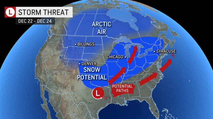
Looks like OH is gonna get bombed unless the track goes haywire here. And while I doubt the STL region gets 8” like the some modeling says right now, I will be more than overjoyed to simply get a few inches and have a White Christmas and serious cold for the first time since I was a kid and lived in MN and WI!
-
 2
2
-
-
25 minutes ago, StormChaser4Life said:
And gfs the polar opposite, dusting for all. Lol
Watching the Mid Atlantic sub cheer on the GFS while we and the plains sub are pulling for King Euro is pure tracking entertainment.
-
1
-
 4
4
-
-
If it's any consolation, the west track results in a pretty good paste job for my backyard

-
Watching this sub do PBP for an 18z run of the GFS a week out from the storm gives me a great appreciation for what y'all have going on here.
Not that my newfound comrades are bad.. but it's so much quieter in those two subs even when we have something to track!
-
8
-
-
1 minute ago, NWAflizzard said:
Yeah. Nice GFS run compared to this morning. Canadian had a snowier solution too. Need to check the ensembles and see if they are looking more promising. Thanks stormdragon for that link. White Christmas would be great.
CMC has rain changing over to snow. Low forms in central IL, sweeps up to Lake Superior, stalls and bombs out to 977.
-
Well that run delivers a White Christmas for like 3/4 of this subforum... and measurable snow on Christmas Eve for central MS and AL.
Now we just need to amp it up.
My former comrades in the Mid-Atlantic sub are going wild
-
Half the subs on this forum are gonna go wild after watching the 12z run.
-
Accuweather with its usual very precise forecasting here.
-
1
-
3
-
-
Storm is at least still there. Wild divergences this far out are to be expected.
"Glad to be in the game" as they say in the Mid-Atlantic sub.
-
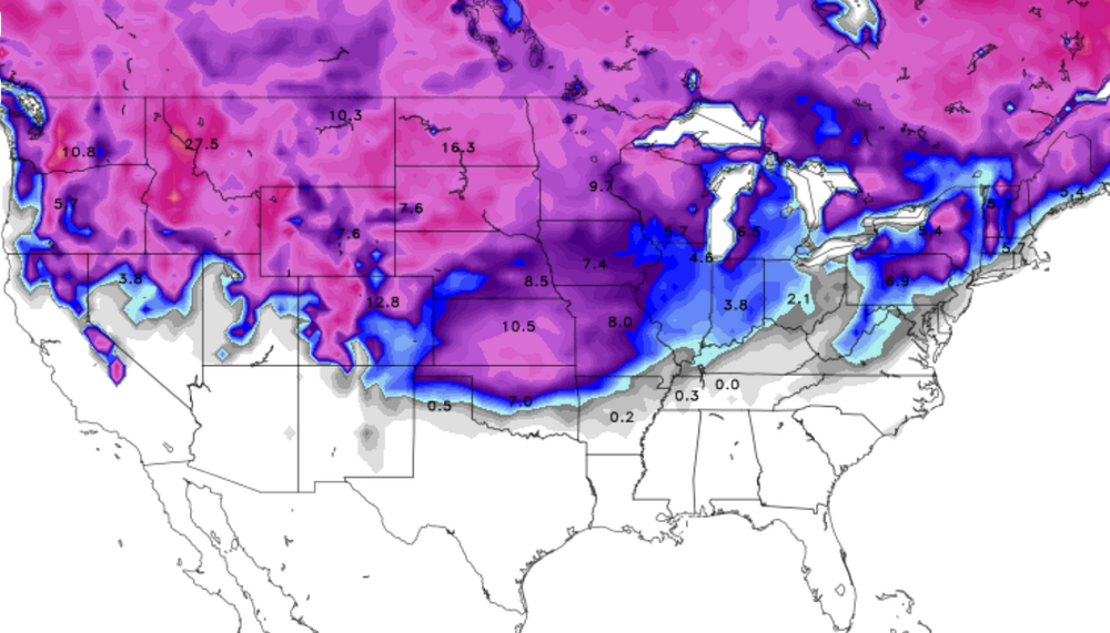
Lock this total snow depth up and throw away the key for 9AM CT on Christmas morning.
-
Okay you guys be reasonable and realistic and more or less ignore the precip on the models.
Meanwhile I'm going to lock up this 12z GFS run that gives me 3-4" of snow IMBY on Dec. 23 and single-digit lows on Christmas Eve as absolute Gospel.
-
1
-
2
-
-
52 minutes ago, roardog said:
This could be the earliest reference to sun angle on record. If your location can’t handle a late January sun angle, you’re pretty much screwed. lol
For legal purposes, that was mostly a joke.
The Mid-Atlantic forum is constantly making jokes about sun angle eating up their snowcover.
-
1
-
-
Most of the snow was scorched by sun angle yesterday. A few pockets still out there I guess.
NWS gives us a shot at 1-2” tonight but temps later today don’t look great for accumulation IMO. If only it was here *now* since we are struggling to get to 20 at the moment!
Also, just laughing at this week’s temp forecast. Not supposed to exceed the freezing mark Friday. And this seems just miserable for most folks this time of year..
WednesdayMostly sunny, with a high near 39. West wind 7 to 14 mph, with gusts as high as 22 mph.-
1
-
-
NWS has splashed a few WWAs for this storm. I have my doubts about this storms performance.
Still, it’s 19F right now IMBY here in Ste Gen.
Real January weather before Thanksgiving. Can’t ask for much more than that.
-
1
-
-
10 hours ago, Jebman said:
It's gonna be! Mid Atlantic is gonna get absolutely demolished by snow and frigid cold.
To your point, if this stretch actually is the pattern for winter, it’s gonna be wild everywhere. Fingers crossed.
Right now at 5am CT it’s 21F here in southeast Missouri. The next forecasted high at 50F or above is… Nov. 23.
It never got above freezing yesterday!
Hearty people here, many farmers, so no one complained, local festival went on as planned.. but they were all shocked too. Hasn’t been an early snow like this in 15 years.
And we might get another inch or two tomorrow night!
-
1
-
-
1 hour ago, Chicago Storm said:
Two issues with that… Most guidance did show snow that far north, and most guidance did show the potential for more snow than offices down there were forecasting, was was ranging from no snow up to 0.5”.
On the flip side…There was very little support among guidance for anything really over 3” or so. So nonetheless, that band of 4-8” is still a surprise in the end.
There was actually an event like this, which I believe may have been last winter, down in East-Central Illinois. It also occurred overnight/early morning, and dropped a localized/unexpected area of 6”+ snow.Yeah I was expecting a dusting to a covering.
Woke up to 3-4 inches. Farmington MO got 6.
-
4
-
-
NWS STL laughing at taking that L
folks in our area are waking up to a winter wonderland this morning, with as much as 6" of snow on the ground. We're just as surprised as many of you are, so we wanted to let you know what happened. Boiling it down: 1) the snow was further north than expected, 2) the snow was much more intense than expected, 3) the warm ground was not enough to overcome the heavy snowfall rates.
-
1
-
-
NWS STL has a sense of humor.
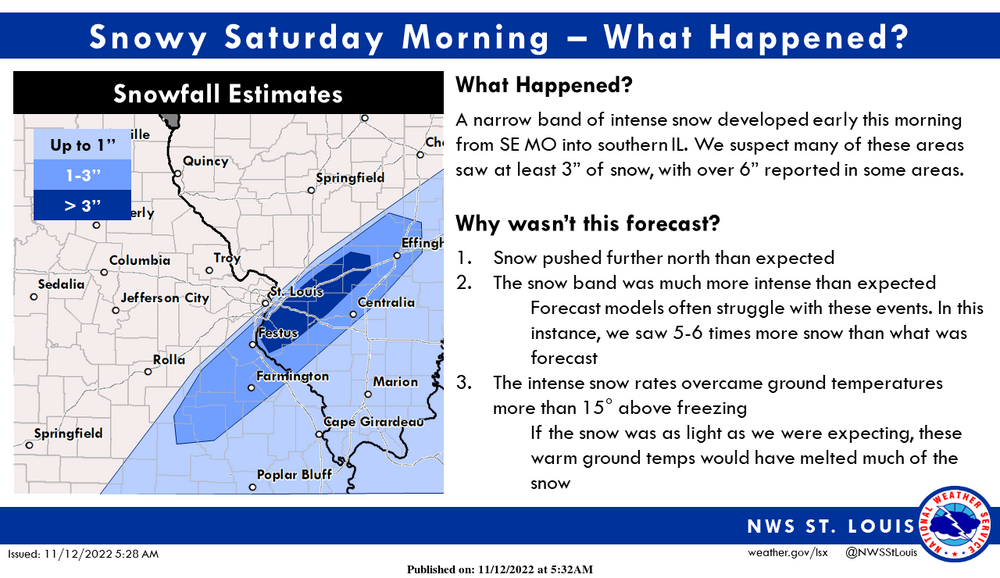
Some folks in our area are waking up to a winter wonderland this morning, with as much as 6" of snow on the ground. We're just as surprised as many of you are, so we wanted to let you know what happened. Boiling it down: 1) the snow was further north than expected, 2) the snow was much more intense than expected, 3) the warm ground was not enough to overcome the heavy snowfall rates.
-
And quick greetings again from the western bank of the Mississippi (literally.. we live a mile from a levee) where the forecast definitely undershot the potential of the disturbance swinging through the middle of the country and ushering in actual fall and a winter preview. The front should be headed your way later today.
Probably a good 2-3” out there.

-
12
-
-
Definite overperformer. Flurries still going here after about 1.5 inches.
EDIT: I am bad at eyeballing in this new environment! Measured almost 3 on the sidewalk just now. Got a short burst of light-to-mod to greet the kiddos this AM.
Back to flurries now (6:15)
-
4
-
-
Saw the potential for the first flakes of the year tonight in my new home... and made me nostalgic for this part of the forum. I wish y'all the best this upcoming winter. Make it an overperformer!
-
3
-
-
For tonight, a wave rotates through the base of the upper trough
across Texas and Oklahoma and toward the Mississippi River. This is
expected to spread some light precipitation eastward through the
overnight period. It`s looking increasingly likely that the far
southern part of our forecast area will get in on at least some
light precipitation associated with this overnight. The temperature
at all levels will be below freezing, with the forcing for this
precipitation being generated at 700 MB and above. Thus snow will be
the precipitation type expected. With a significant amount of dry
air beneath this forcing layer, we expect that overall amounts will
be held down somewhat with snow ratios not being very efficient.
That said, the likelihood of at least some snow has increased, and
at this stage we expect that a dusting of snow is likely across
southeast Missouri into southern Illinois with up to 1 inch
possible. Some snowflakes could fall as far north as St Louis,
although accumulations that far north are unlikely. This will exit
quickly to the east Saturday morning as the upper trough axis shifts
east.

Saturday will likely be the coldest day of this air mass as the
core of the cold air will be over our region. Highs will only make
it into the 30s with lows Saturday night falling off into the
teens to low 20s. Surface high pressure moving across the area
will lead to good radiational cooling conditions, so some
typically colder spots could be even colder.
-
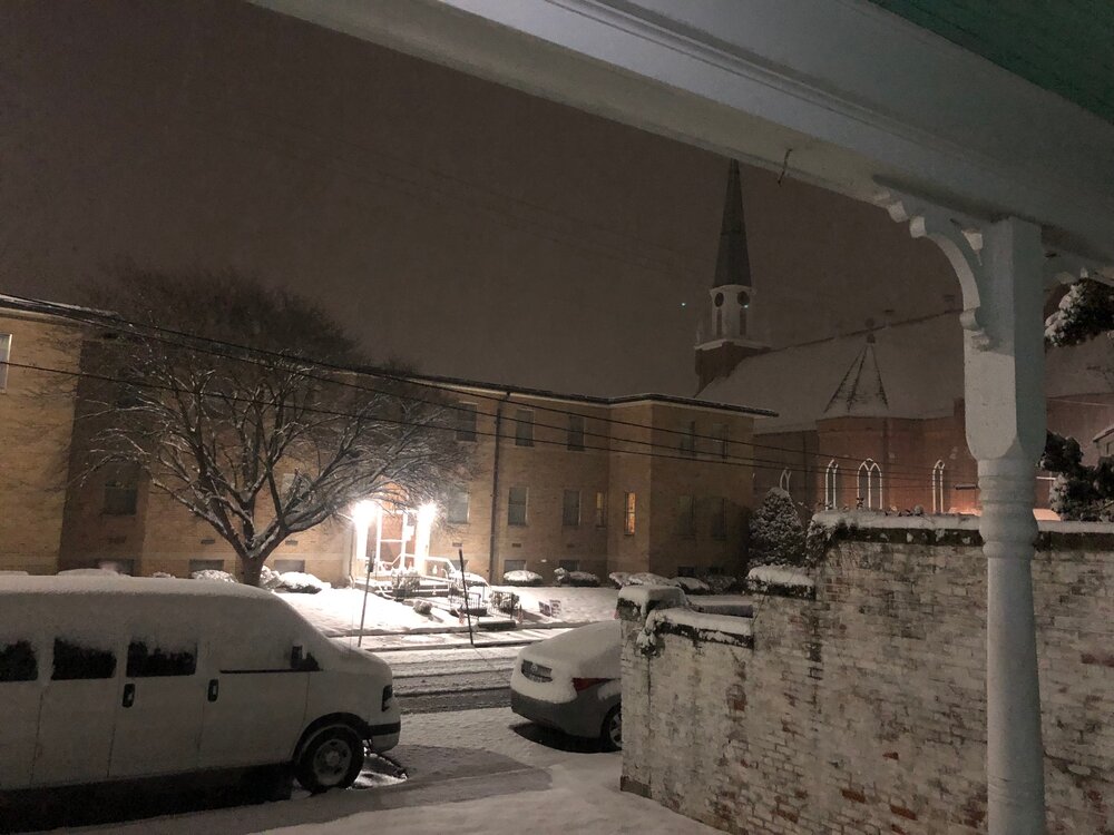
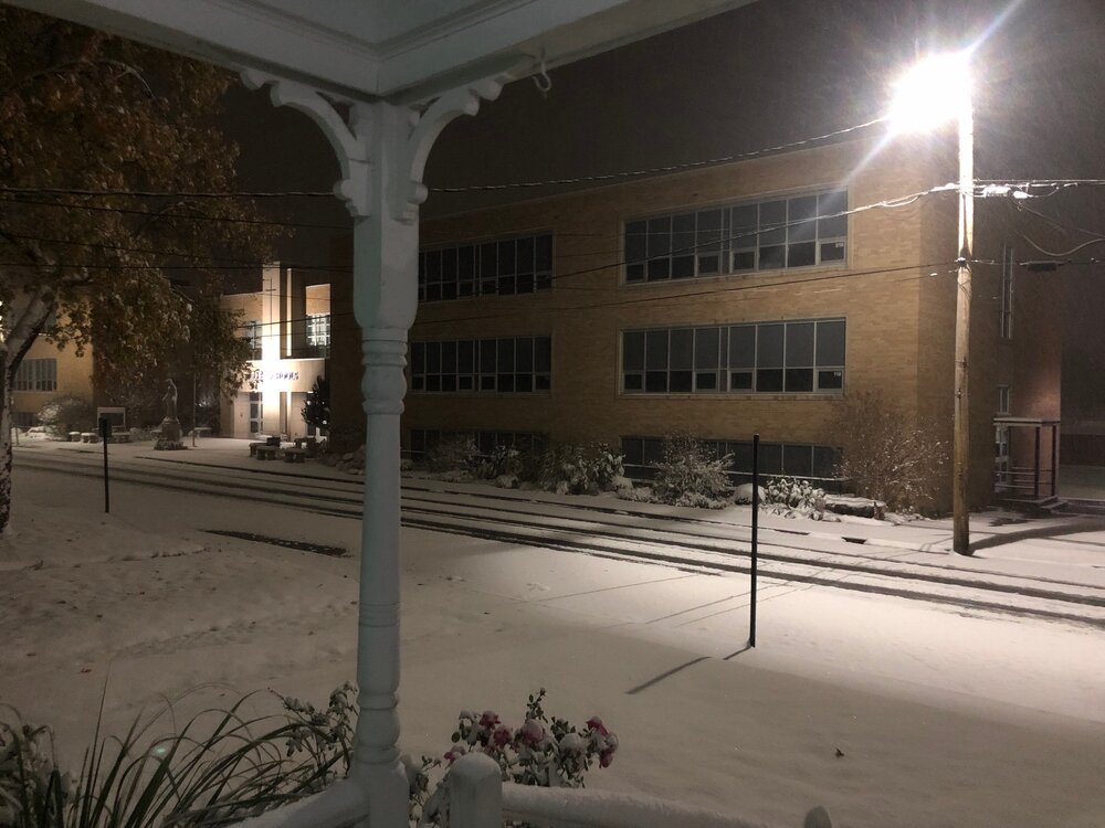
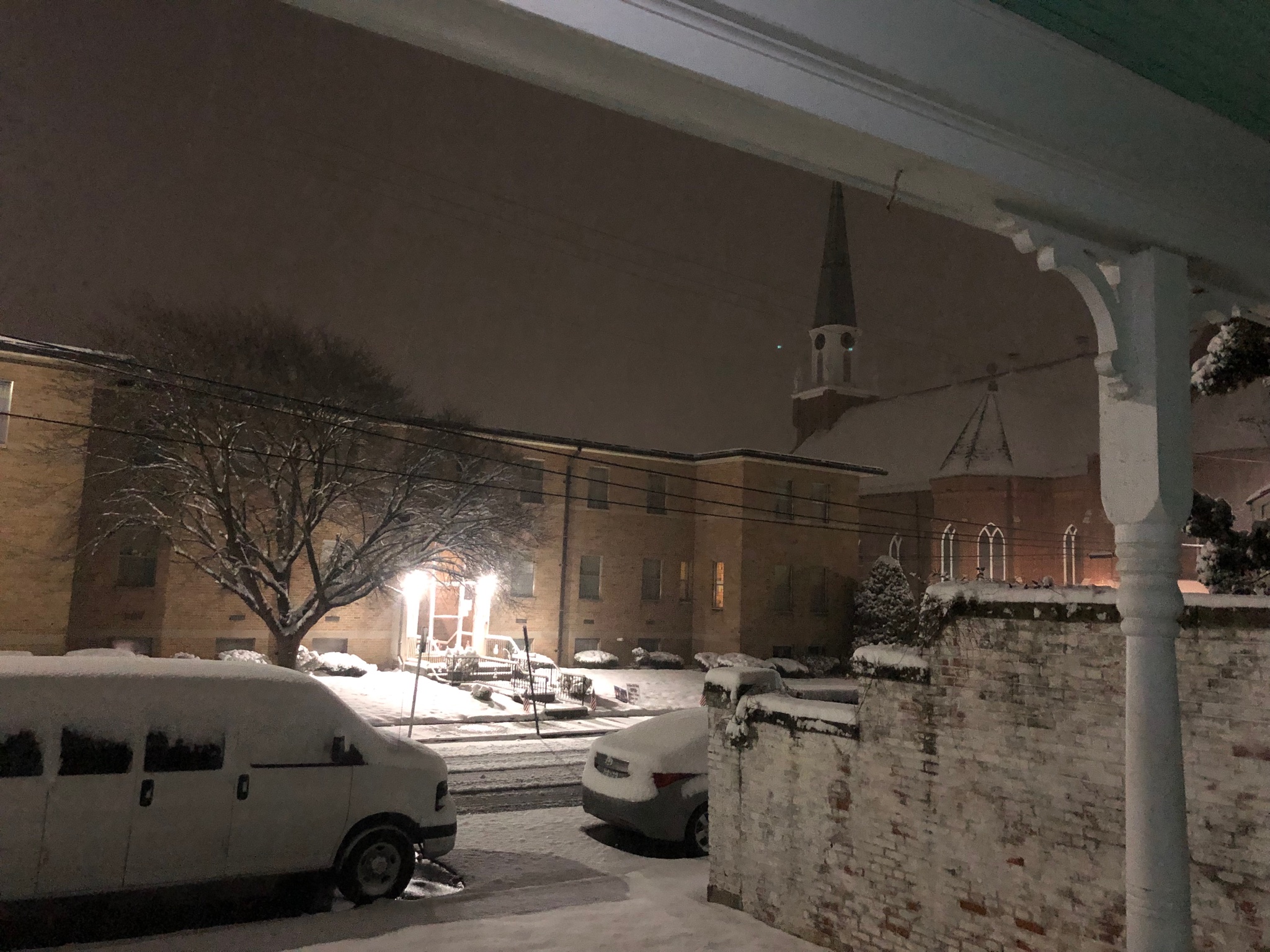
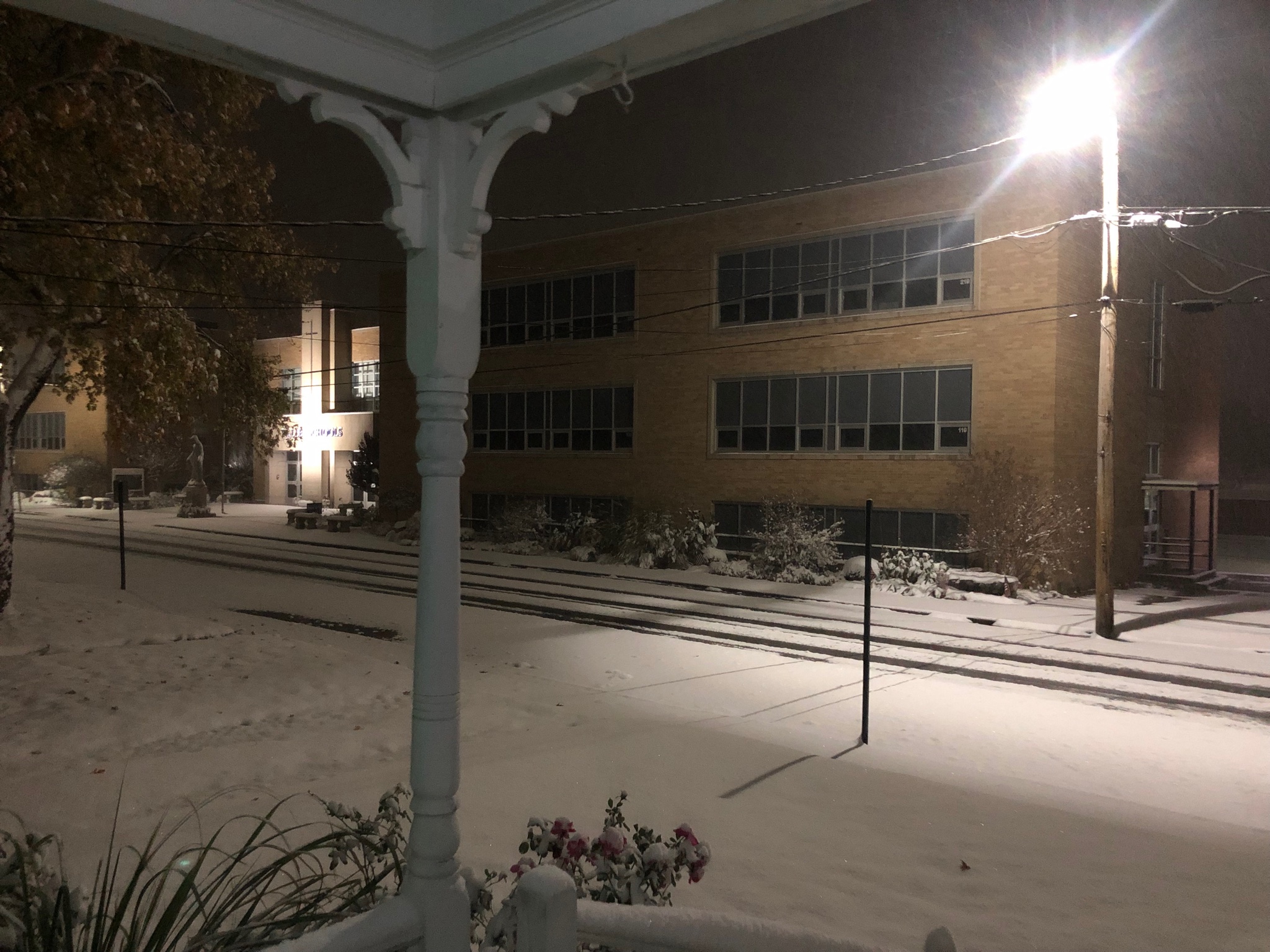
Colleagues report, and showed me via video.. accumulating snow in Staunton.
This image provided by local news of conditions there:
-
6
-
-
46 minutes ago, TSG said:
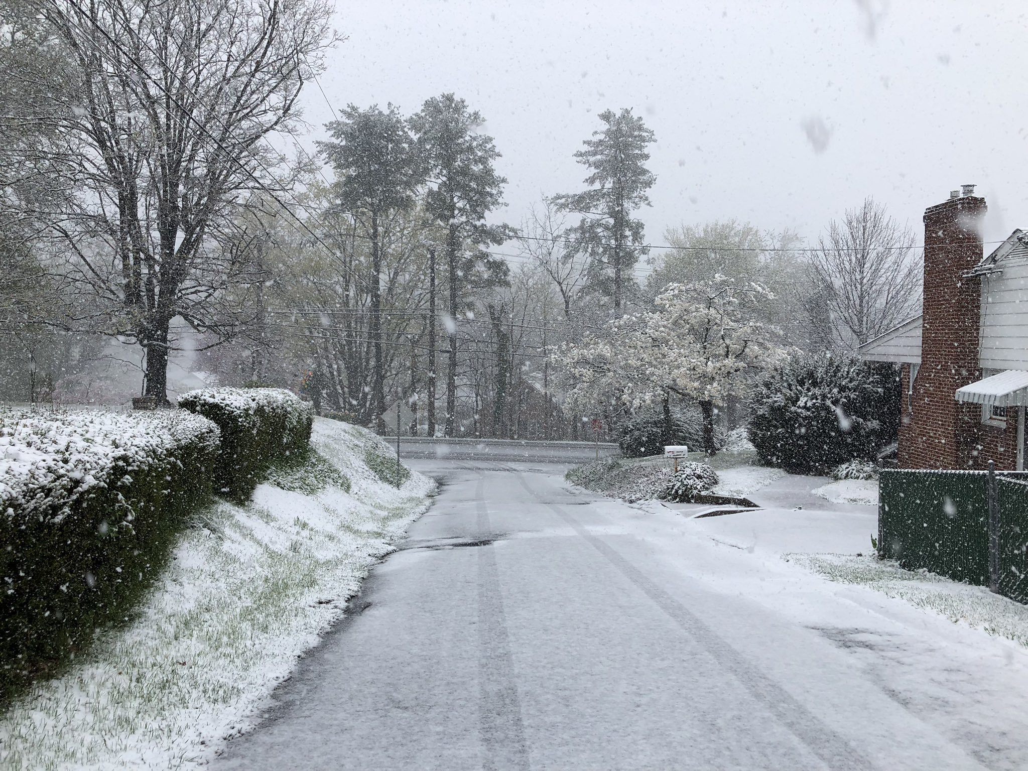
Wow it is miserable in Cville. I think we're all or mostly rain at this point but the temp was 40 when I left for work and has only gone down.
35/34 at 11:30
It's the perfect day for a funeral.
In a staggering coincidence, I had to help set up for a funeral today (not related to us).
-
 1
1
-


MO/KS/AR/OK 2022-2023 Winter Discussion
in Central/Western States
Posted
Hugging panel 26