

The Ole Bucket
-
Posts
513 -
Joined
-
Last visited
Content Type
Profiles
Blogs
Forums
American Weather
Media Demo
Store
Gallery
Posts posted by The Ole Bucket
-
-
It's going to be just disgusting across much of central VA it seems. I guess maybe we'll get a nice freeze over with it? I dunno. Rooting for folks to the north who missed the earlier storms to get plastered.
Absolutely laughing at the 6Z GFS that verbatim gives CHO 9.9" according to Kuchera. No way in the world that happens.
LOL the 10:1 has us at nearly 12". Clearly drunk.
-
Orange from Sterling? That's a downgrade for the Piedmont..
-
 1
1
-
-
Just now, Ji said:
that max is now over leesburg...it will be in CHO by Wed am
Score
-
4 hours ago, yoda said:
Euro does drop 0.15 to 0.25" of ice across the region after the snow... down towards CHO and just SW of EZF its lights out ice
Ah just what I wanted was a half-inch of ice... or more.
I guess this is revenge for dodging any impact from the last storm.
-
If you all want a taste of winter, come down to CHO. Snow is compacted and now has a small layer of ice on it... still a few inches though.
Roads are very driveable because all ZR and sleet fell during the day.
It’s an icy and snowy wonderland for the first time in years.
-
 1
1
-
-
Absolutely pelting sleet in CHO
-
A few pingers mixed in with -ZR. Not a breath of wind.
Putting a glaze on everything. Gonna be hard to see the ice on many trees though with all the snow on them..
-
1
-
1
-
-
Love how we have been reduced to rooting for sleet.
-
2
-
-
Trees were snapping all throughout our area.
-
This forecast is for significantly LESS ice than what Charlottesville got earlier in the year.
Dec 16-17 was almost entirely ice here.
-
Pixie dust persists in CHO. Allegedly some freezing drizzle possibly out there, which actually I would not mind as it could glacier us up a little bit.
But begging the weather gods to get rid of the ice storm potential coming up.
-
1
-
-
First time I had to legit shovel my car out since December 2018
-
1
-
-
41 minutes ago, AceDoc said:
Glen Allen, which is north and west of Richmond. (Just north of the oft mentioned Short Pump.) 30 degrees. Moderate and steady snow. 4.2 inches at 330 AM. Areas west (Goochland, Louisa) note some 5 inch snowfall areas. Not bad at all, so far! HRRR seemed to be on to something.
Looks like vindication for DT!
I can confirm it’s definitely something like 4-4.5 in Charlottesville. Love how we almost hit warning criteria after LWX decided against it and we busted HIGH for once.
-
2
-
-
33 minutes ago, NorthArlington101 said:
Best snow of the day right now. Big flakes mixed in with the smaller ones. I'd guess 0.5" an hour rates.
Seems exactly right. Parked for an hour and when I came out.. a fresh coating on the car that needed brushing.
-
1
-
-
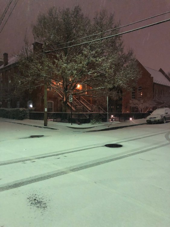
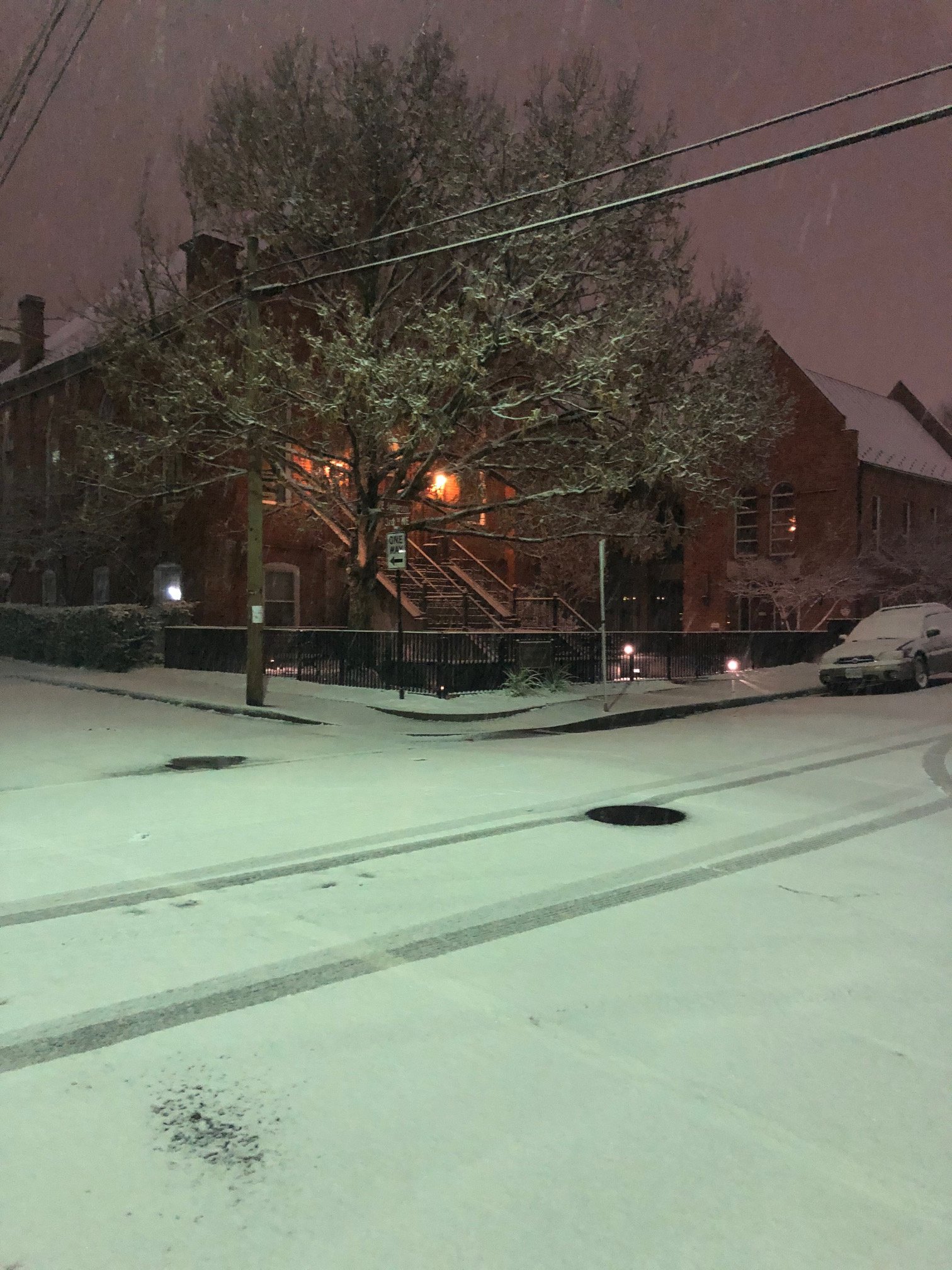
Prolly an inch in Charlottesville. Very nice, tranquil, beautiful and not too disruptive.
A shot of the synagogue downtown.
-
8
-
-
Also, grass, deck and tops of cars are all white now here in Charlottesville.
And Sterling thought the precip would not begin until 5pm. A rare case of Charlottesville being early on precip.
-
4
-
-
3 minutes ago, NorthArlington101 said:
GFS says DC will see measurable snow.

Spreads the wealth AND puts me at 4.5"?!
Lock it in.
-
 1
1
-
 1
1
-
-
Tiny flakes but now definitely moderate snow in CHO.
-
1
-
-
Yeah the thing that I'm most excited about is the surface temperature finally caving.
-
1
-
-
8 minutes ago, TSG said:
Lol. I think there's more central VA forum members than a lot of you realize
We're just usually quiet because we're always fringed.
-
Just now, TSG said:
Def more than -SN at this point
Yeah this is a bit unexpected. Bare ground, mulch starting to gather some white. Temperatures don't look like they will want to move for awhile though. Will have to wait for sunset.
-
That is absolutely brutal for NOVA and DC. Oh man.
-
1
-
-
Well that was quick. Now mostly snow. Just very wet though. Still 33F.
-
1
-
-
Mixed precip falling at a steady rate now.
And I mean everything. Snow, sleet and rain.
February 18/19th Storm Potential
in Mid Atlantic
Posted
That's a hit across the entire forum... except Short Pump/RIC.
And it's all in like 6 hours.
Would be some really insane rates.