J Paul Gordon
-
Posts
1,791 -
Joined
-
Last visited
Content Type
Profiles
Blogs
Forums
American Weather
Media Demo
Store
Gallery
Everything posted by J Paul Gordon
-
6"+ here. On top of the 12-15" left over from the last two storms, it looks nice. 27/26. light to moderate snow now here. Looks like the end of it is on us now. Any amounts for those who were under that band? Gotta be more than twice what we got here. Glad for them. Happy for us. A nice white layer must practically cover New England from top to bottom.
-
Glad to hear you are finally getting your snowstorm James. Looks like a lot of us in SNE are happy. Always glad when the Cape snow lovers get in on the game.
-
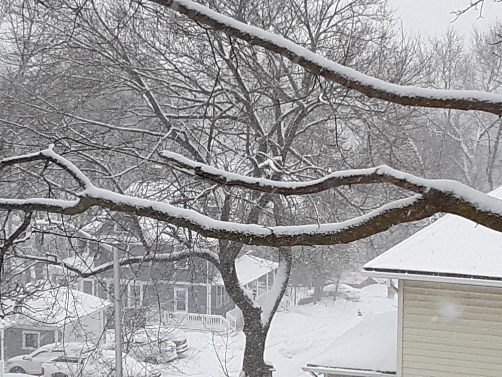
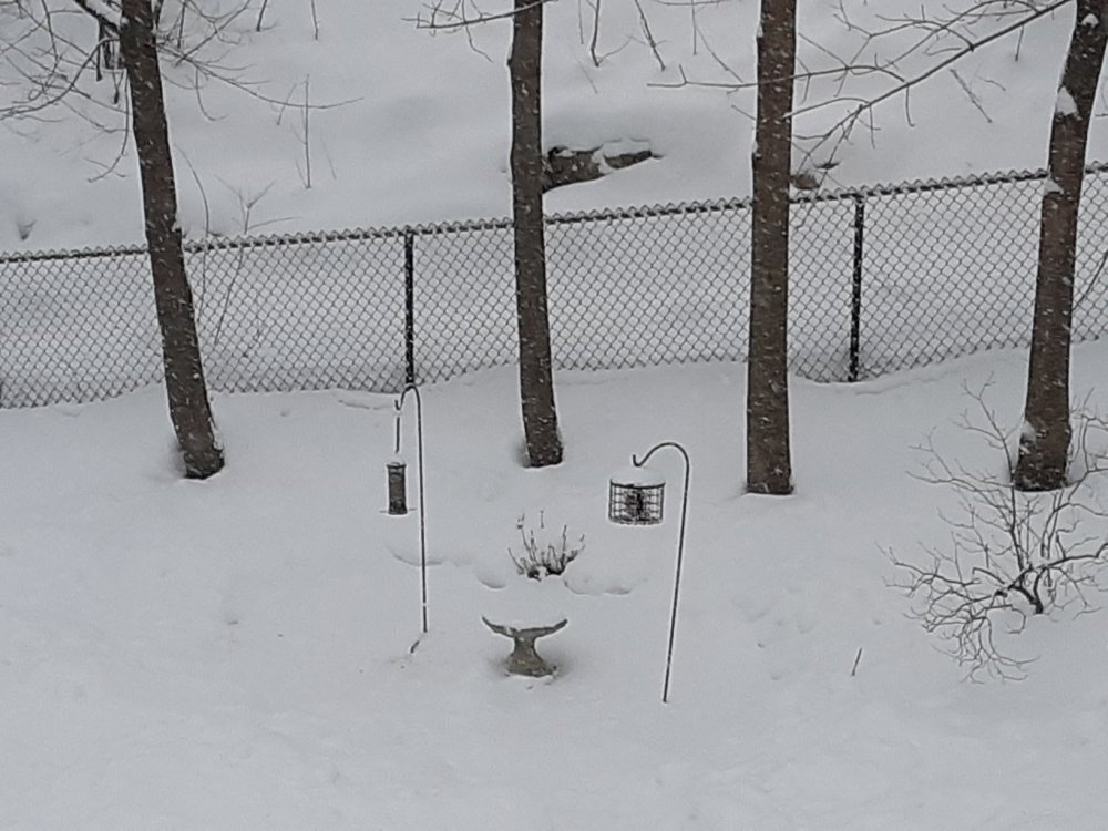
Some pictures from about 30 mins ago here. Snow seems to be getting heavier now. Birds have been crowding the feeder off and on all day. The local hawks are grounded.
-
Are you still up on Winter Hill? Not more than a couple of miles as the crow flies from me.
-
26/24. Eyeballing a couple of inches. Nice steady moderate snowfall. Nothing too crazy here but low visibility. Figuring small flake size and fog explain accumulation. Nice refresher.
-
26/22. Snow, visibility about a quarter mile. Flakes are tiny. Less than an inch new. Snow started just before 11 here.
-
27/12 here with moderate snow. Looks like cancelling was the right thing to do regardless of amounts. Wouldn't want people out on the roads an hour from now.
-
Quick Hitter Coastal Threat, Feb 7-8th
J Paul Gordon replied to The 4 Seasons's topic in New England
Its the people who miss out on something important to them that matters, not the damn snow. Emotionally, I could care less about the forecast fail or the amount of snow on the ground. Its fun when it works out and just fine when it doesn't. But like elections, forecasts have consequences. Not blaming anyone (God, mets, luck, whatever). BTW, drive on up and take a ride around beautiful Worcester County next week. We should still have plenty left on the ground if you don't. -
Quick Hitter Coastal Threat, Feb 7-8th
J Paul Gordon replied to The 4 Seasons's topic in New England
And it looks like we cancelled for vapors. Snow after noon 1-3 inches. Figures. Time to retire. -
Quick Hitter Coastal Threat, Feb 7-8th
J Paul Gordon replied to The 4 Seasons's topic in New England
When does BOX update their snowfall maps? -
Not snowing here either.
-
Quick Hitter Coastal Threat, Feb 7-8th
J Paul Gordon replied to The 4 Seasons's topic in New England
Hate these cancel/no cancel storms on a Sunday. I cancelled for tomorrow. Let's hope I'm not regretting it when less than an inch falls before 2 PM. -
Quick Hitter Coastal Threat, Feb 7-8th
J Paul Gordon replied to The 4 Seasons's topic in New England
All of the above--as long as the storm is close enough. -
Quick Hitter Coastal Threat, Feb 7-8th
J Paul Gordon replied to The 4 Seasons's topic in New England
I'm going to hazard an overproducer vs. under here in Worcester. Just a feeling that slightly better QPF and 15:1 ratios will help us. Maybe a bit like the proverbial Dec 29, 2012 event. -
Quick Hitter Coastal Threat, Feb 7-8th
J Paul Gordon replied to The 4 Seasons's topic in New England
2013 storm brought .57 water equivalent and 9.3 inches of snow here in Worcester. Looks like a lot less QPF for here this time. -
Quick Hitter Coastal Threat, Feb 7-8th
J Paul Gordon replied to The 4 Seasons's topic in New England
any Met maps? -
Quick Hitter Coastal Threat, Feb 7-8th
J Paul Gordon replied to The 4 Seasons's topic in New England
Are the BOX maps worth looking at? Seems like a rather broad area of 6"+ snows with a more in the interior o SE Mass. -
Quick Hitter Coastal Threat, Feb 7-8th
J Paul Gordon replied to The 4 Seasons's topic in New England
Looks like 4-6 here (Sunday), if I'm reading things right. Hope James can cash in a bit down on the Cape My 90 yo father in law would kill me, if he heard that lol. He lives in Dennis. Does this thing have potential for a widespread warning (even at low level) outside of 495 and N of the pike? -
27/26 fog and "snizzle". Wind is still roaring. From the looks of things outside and from 25 years in this house, I'd throw out 18" at least. On the east side of the city on Green Hill. Elevation 660'.
-
27/26 S+ Good night Irene. We'll have to see what morning looks like, but if we can avoid any rain or paste, that will be great. Been quite a storm.
-
How about everyone gets to share the joy? With a huge jack down your way (my father in law will not be pleased, though, lol).
-
27/25 visibility down to maybe 200 yards.
-
27/25... S+, haven't gone out since I shoveled around 5. There was about 6" at that point. A lot more since but with the wind it is hard to tell.
-
26/24 fierce wind and very heavy snow right now.
-
In a perfect world we'd have one 4-8 inch snow fall every three or four days. The fluffy kind, no wind, gentle rates. Sorry to be off topic. Been b----ing about the amounts predicted for here just because I'm getting old and find lifting the wet stuff a bit scarier than just a few years ago. Sorry to be off topic. 25/23 SN, windy but not too ferocious for my neighborhood.