BBasile
-
Posts
2,195 -
Joined
-
Last visited
Content Type
Profiles
Blogs
Forums
American Weather
Media Demo
Store
Gallery
Everything posted by BBasile
-

E PA/NJ/DE Winter 2025-26 Obs/Discussion
BBasile replied to LVblizzard's topic in Philadelphia Region
Temps this cold without any weather suck. But they can be refreshing, and sometimes, beautiful. And a -6°F wind chill is always better than a treadmill. lol..thumb.jpg.1763eabe382ffb732fc6f19a9d2d6b98.jpg)
.jpg.38b88c82a9f8dc3b28c253c6ed3339a4.jpg)
.jpg.38235b1d76836079b7193326b74c7500.jpg)
.thumb.jpg.b2888d729c05d11da5bc7cd3a2b9a437.jpg)
-
E PA/NJ/DE Winter 2025-26 Obs/Discussion
BBasile replied to LVblizzard's topic in Philadelphia Region
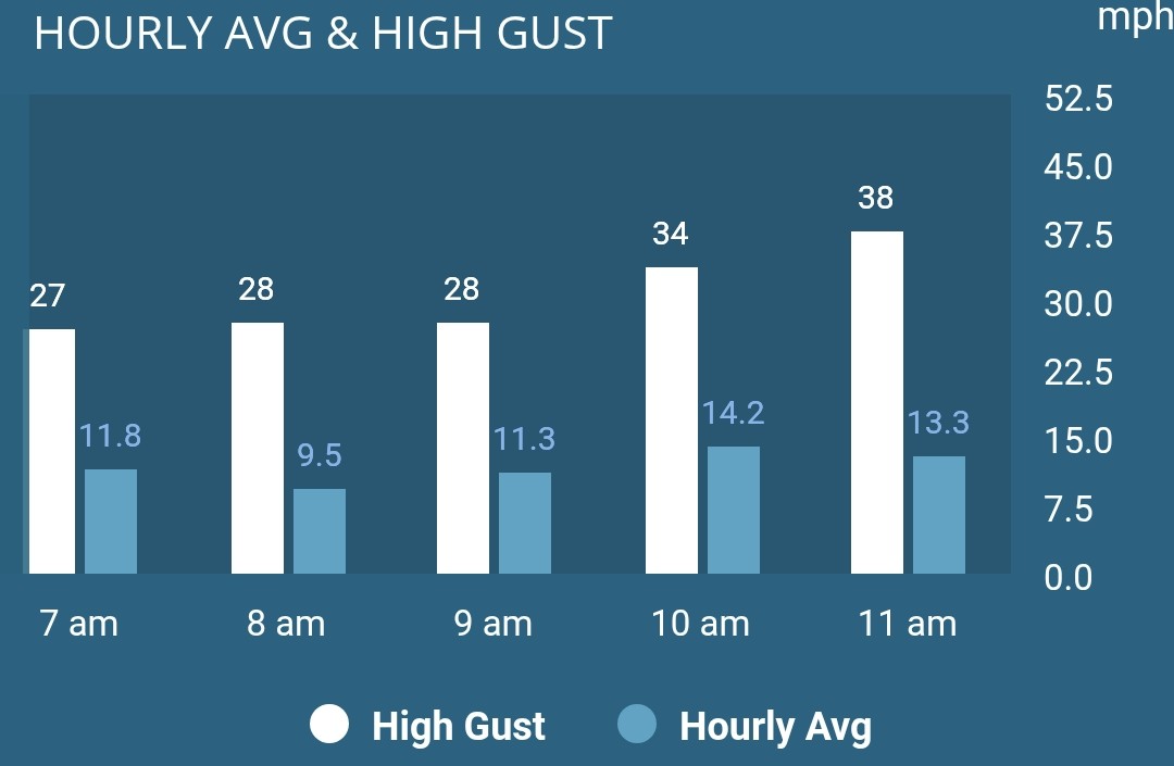
Gusts are still increasing. Temp down to 12.6F with chills down to -5F.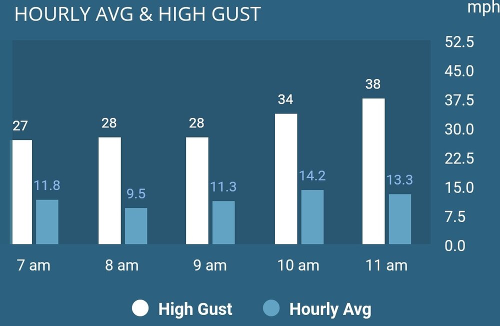
-
E PA/NJ/DE Winter 2025-26 Obs/Discussion
BBasile replied to LVblizzard's topic in Philadelphia Region
Getting nastier out there by the minute.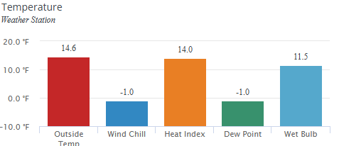
-
E PA/NJ/DE Winter 2025-26 Obs/Discussion
BBasile replied to LVblizzard's topic in Philadelphia Region
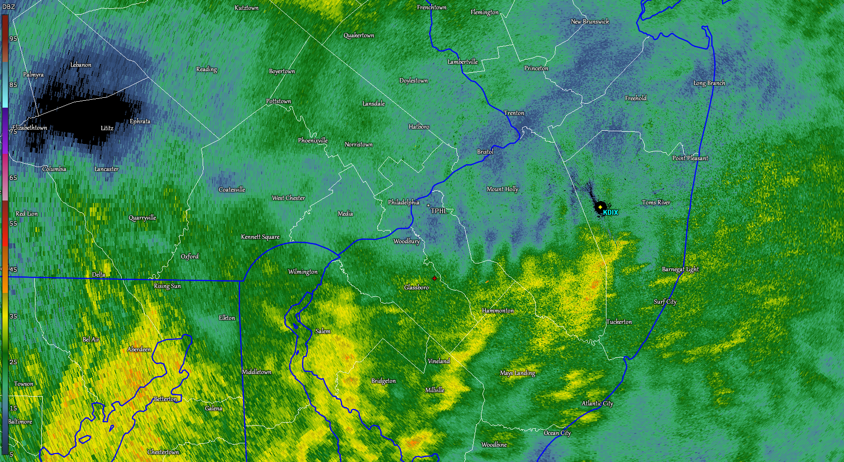
Was out for a run and got caught in that squall. That was a wild 10 minutes. Visibility was probably only 600 feet or so. Temp is down 5F in the last hour to 20F..thumb.jpg.7fdcdac697ade9afc51ed87a9f1e55bc.jpg)
-
E PA/NJ/DE Winter 2025-26 Obs/Discussion
BBasile replied to LVblizzard's topic in Philadelphia Region
Just hit 32F for the first time in 9 days. -
E PA/NJ/DE Winter 2025-26 Obs/Discussion
BBasile replied to LVblizzard's topic in Philadelphia Region
I'm assuming the whole state is just shut down?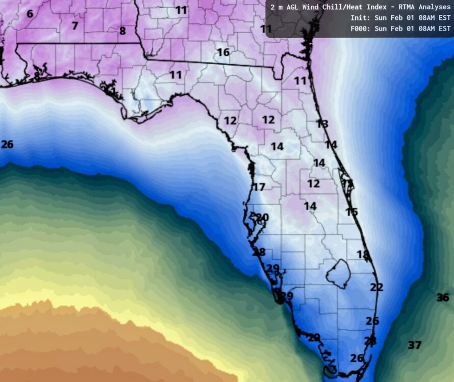
-
E PA/NJ/DE Winter 2025-26 Obs/Discussion
BBasile replied to LVblizzard's topic in Philadelphia Region
Had 4 snow blowers break at work today. The three inches of compacted sleet were not messing around. -
The warm nose in question...

-
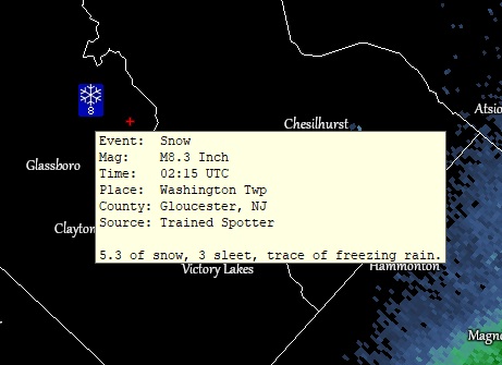
8.3" total snow/sleet. 5.3" snow / 3" sleet. Trace of ZR. Right in Mt Holly's range. Well done, Mt Holly. Fun storm to track, witness, measure, and converse about here. Congrats everyone! Edit: Extra props to Mt Holly for being super quick posting that report. Dang.
-
At 8" of snow/sleet. 21.6F. There's a nice crunchy layer on top of the snow. Snow, sleet, and freezing rain in a photo.
.thumb.jpg.048e96fc0f9ca4a10133fa8cf9169a3c.jpg)
-
My bad. I meant NAM. HRRR has me at 36F when it's actually 22. lol
-
Definitely have ZR mixing with IP now. HRRR was on it. 24.5F
-
2.5" of sleet now. Snow/sleet up to 7.8". Still all sleet. 24.2F
-
Not seeing that ZR yet, but... King NAM FTW! And people want to replace it? lol
-
Damn. I must be lucking out. Still all IP here. Looks like @Kevin Reilly was on to something earlier. On a positive note... The AFC game is turning into a slop fest.
-
Yeah, could have been huge without the sleet. Still a great winter storm, though. It's been like 15 hours of frozen precip now.
-
Damn. That's a temp gradient. I'm only at 21F.
-
Where are you at in Williamstown? I'm in Turnersville near the Pike and it's still all IP.
-
This sidewalk was shoveled about 30 minutes ago. At least a 1/4" of sleet now. And a 7 ft mound to stick around into February.
.thumb.jpg.ac334ca1684fd3596e9a1993a5e0c0a7.jpg)
.jpg.613bf0c3325c3b110d705c6c4724b4bc.jpg)
-
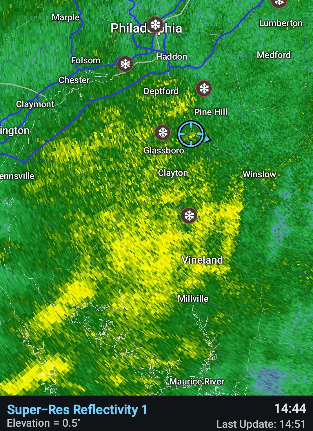
Looks like it has lightened up over you. Under some heavier returns here with no clearing. The HRRR does have some ZR by 7 PM for whatever it's worth.

-
Didn't realize that there was weather elsewhere today. lol Well, that's fun, too!
-
Same same. Surprised to see that.
-
0.7" of sleet at 2:45. Makes the snow/sleet total 6.0". 19.5F
-
The sleet under these returns looks like sheets of rain. Sheets of sleet. Wild.

-
His snow mound is gonna be an iceberg after this week.