BBasile
-
Posts
2,302 -
Joined
-
Last visited
Content Type
Profiles
Blogs
Forums
American Weather
Media Demo
Store
Gallery
Everything posted by BBasile
-

E PA/NJ/DE Summer 2026 Obs/Discussion
BBasile replied to PhiEaglesfan712's topic in Philadelphia Region
Just like Mexico! You got this, brotha! -
E PA/NJ/DE Summer 2026 Obs/Discussion
BBasile replied to PhiEaglesfan712's topic in Philadelphia Region
Didn't break 100F, didn't get any rain... but I'll watch the sun set on active convection any time!.thumb.jpg.093d9ea54f2008007c468085dabe8868.jpg)
-
E PA/NJ/DE Summer 2026 Obs/Discussion
BBasile replied to PhiEaglesfan712's topic in Philadelphia Region
Actually didn't reach 100F today. Heat index still peaked at over 118F, though. The moisture never mixed out. Dp was basically 76-78F all day.
-
E PA/NJ/DE Summer 2026 Obs/Discussion
BBasile replied to PhiEaglesfan712's topic in Philadelphia Region
100+ on the barrier islands is nuts. -
E PA/NJ/DE Summer 2026 Obs/Discussion
BBasile replied to PhiEaglesfan712's topic in Philadelphia Region
Can this moisture mix out already? Even just a little.
-
E PA/NJ/DE Summer 2026 Obs/Discussion
BBasile replied to PhiEaglesfan712's topic in Philadelphia Region
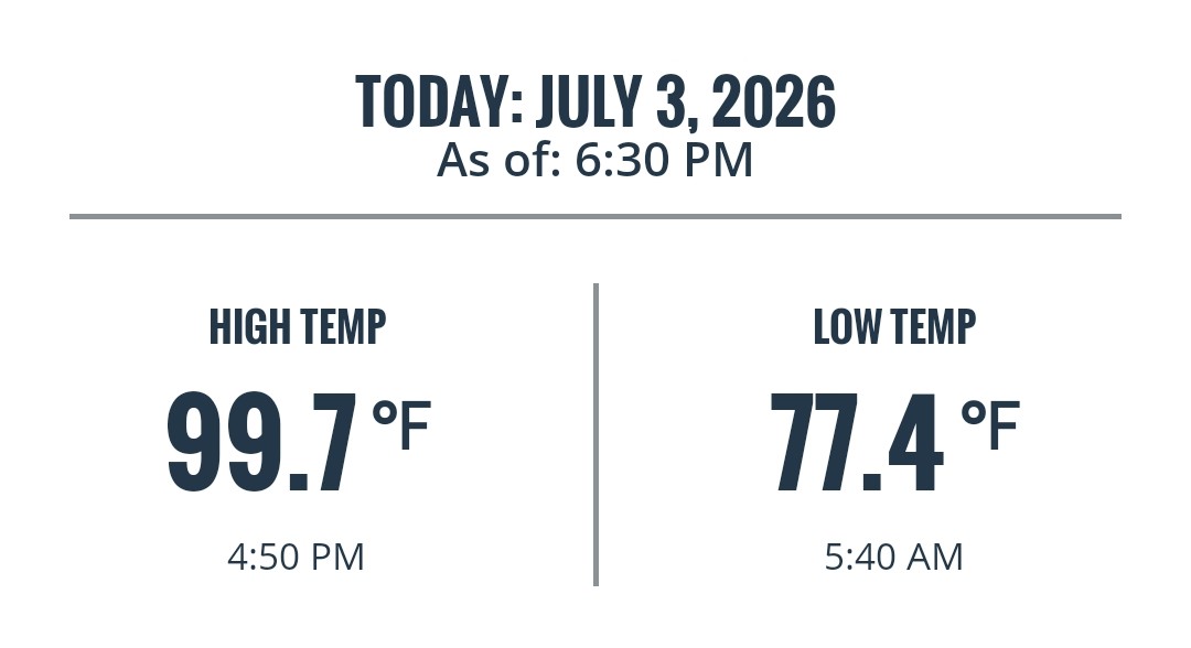
Low was 77.4F. Already back up to 87.4 with a 99F heat index. -
E PA/NJ/DE Summer 2026 Obs/Discussion
BBasile replied to PhiEaglesfan712's topic in Philadelphia Region
Ridiculously high stats from today; Temp: 100.4F Dew: 80.8F Heat index: 118.5F -
E PA/NJ/DE Summer 2026 Obs/Discussion
BBasile replied to PhiEaglesfan712's topic in Philadelphia Region
Most of the country is ablaze right now.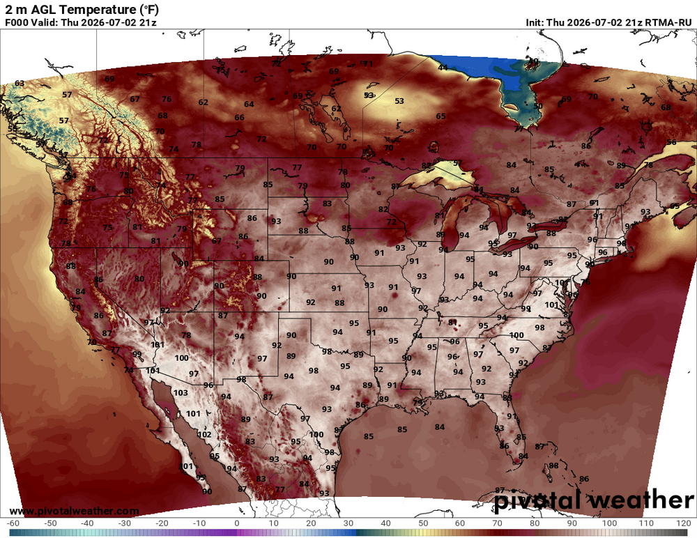
-
E PA/NJ/DE Summer 2026 Obs/Discussion
BBasile replied to PhiEaglesfan712's topic in Philadelphia Region
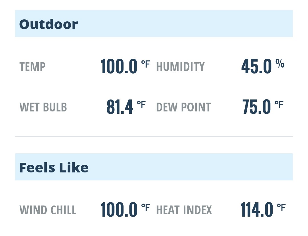
Temp peaked at 100.4F. It's at 100.0F now, but the dew point went back up so the HI is now 118F. -
E PA/NJ/DE Summer 2026 Obs/Discussion
BBasile replied to PhiEaglesfan712's topic in Philadelphia Region
Just cracked 100F.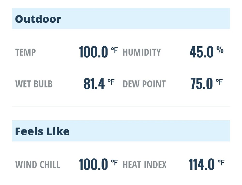
-
E PA/NJ/DE Summer 2026 Obs/Discussion
BBasile replied to PhiEaglesfan712's topic in Philadelphia Region
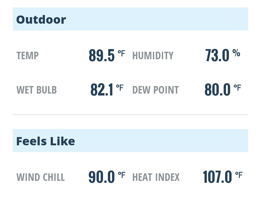
Already disgusting. That dew point!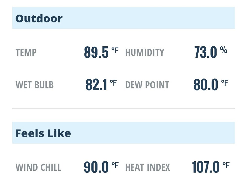
-
E PA/NJ/DE Summer 2026 Obs/Discussion
BBasile replied to PhiEaglesfan712's topic in Philadelphia Region
lol, I wish. -
E PA/NJ/DE Summer 2026 Obs/Discussion
BBasile replied to PhiEaglesfan712's topic in Philadelphia Region
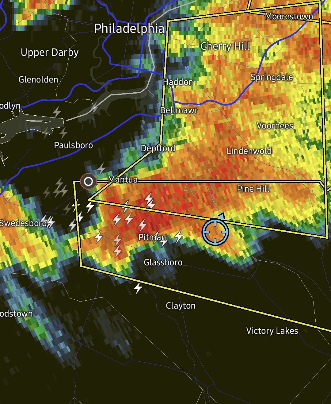
Time lapse of that FF warned storm that just moved through Philly at sunset. With some fireworks for good measure. -
E PA/NJ/DE Summer 2026 Obs/Discussion
BBasile replied to PhiEaglesfan712's topic in Philadelphia Region
Ended up with 2.20" ST putting June at 3.07". -
E PA/NJ/DE Summer 2026 Obs/Discussion
BBasile replied to PhiEaglesfan712's topic in Philadelphia Region
Up to 0.14" on the day. 66.6F -
E PA/NJ/DE Summer 2026 Obs/Discussion
BBasile replied to PhiEaglesfan712's topic in Philadelphia Region
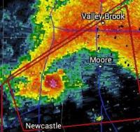
Short time lapse of the storm rotation. The rain was moving in quickly so I could only get a few minutes of recording, unfortunately. Ended up with 1.91" of rain. -
E PA/NJ/DE Summer 2026 Obs/Discussion
BBasile replied to PhiEaglesfan712's topic in Philadelphia Region
Great dynamics. The wind completely flipped. -
E PA/NJ/DE Summer 2026 Obs/Discussion
BBasile replied to PhiEaglesfan712's topic in Philadelphia Region
Just checked the drone time lapse. Definitely some good rotation. Getting 7"+ per hour rates. Rotation moved right over me. Wind flipped 180° almost instantly. Great storm!.thumb.jpg.99aed7c78f52afb71024ff034df175da.jpg)
-
E PA/NJ/DE Summer 2026 Obs/Discussion
BBasile replied to PhiEaglesfan712's topic in Philadelphia Region
Looked like there may have been a wall cloud from my view through the drone. Hard to tell, though. Guess I'll find out in a few.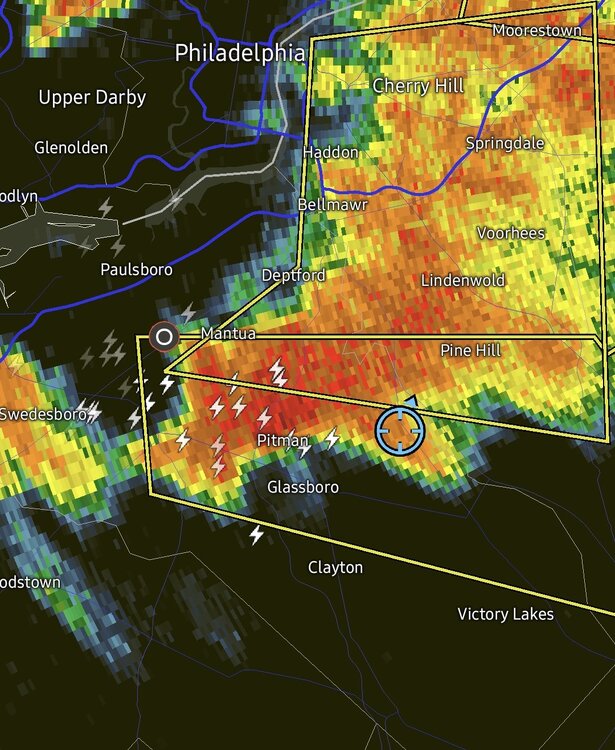
-
E PA/NJ/DE Summer 2026 Obs/Discussion
BBasile replied to PhiEaglesfan712's topic in Philadelphia Region
Picked up 0.67" overnight. Up to 0.86" for June. -
E PA/NJ/DE Spring 2026 Obs/Discussion
BBasile replied to PhiEaglesfan712's topic in Philadelphia Region
Ended up with 3.01" for the storm total rainfall. Beautiful weather today now that the holiday weekend is over. 76F -
E PA/NJ/DE Spring 2026 Obs/Discussion
BBasile replied to PhiEaglesfan712's topic in Philadelphia Region
1.21" today. 2.86" storm total thus far. -
E PA/NJ/DE Spring 2026 Obs/Discussion
BBasile replied to PhiEaglesfan712's topic in Philadelphia Region
0.53" on the day so far, 1.45" for the storm. -
E PA/NJ/DE Spring 2026 Obs/Discussion
BBasile replied to PhiEaglesfan712's topic in Philadelphia Region
Went to the Phillies game today and then got chased back into Jersey by that line of storms. The pollen blowing around was insane. Getting onto the Walt Whitman, I couldn't even see the other side of the bridge through it..thumb.jpg.dff646a418e56b0f987cc3a3db674a4f.jpg)
.thumb.jpg.88c7633d63ed833c36a1b876ee8121ae.jpg)
-
E PA/NJ/DE Spring 2026 Obs/Discussion
BBasile replied to PhiEaglesfan712's topic in Philadelphia Region
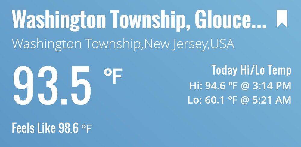
94.6F today. No, thanks.