
BBasile
-
Posts
2,273 -
Joined
-
Last visited
Content Type
Profiles
Blogs
Forums
American Weather
Media Demo
Store
Gallery
Everything posted by BBasile
-

E PA/NJ/DE Summer 2025 Obs/Discussion
BBasile replied to Hurricane Agnes's topic in Philadelphia Region
Just had a quick shower that dropped 0.17". Temp is still 83 with a dew of 78. -
E PA/NJ/DE Summer 2025 Obs/Discussion
BBasile replied to Hurricane Agnes's topic in Philadelphia Region
0.15" of rain today. 78F -
E PA/NJ/DE Summer 2025 Obs/Discussion
BBasile replied to Hurricane Agnes's topic in Philadelphia Region
Ended up with 0.18" overnight. -
E PA/NJ/DE Summer 2025 Obs/Discussion
BBasile replied to Hurricane Agnes's topic in Philadelphia Region
Just had some rain. 0.02". No flooding yet. -
E PA/NJ/DE Summer 2025 Obs/Discussion
BBasile replied to Hurricane Agnes's topic in Philadelphia Region
Masochist. lol -
E PA/NJ/DE Summer 2025 Obs/Discussion
BBasile replied to Hurricane Agnes's topic in Philadelphia Region
It's currently disgusting outside. 89F with a dew of 78. Heat index of 103. Temp did hit 90.8F a while ago. Another flood watch. What will I get this time? lol -
E PA/NJ/DE Summer 2025 Obs/Discussion
BBasile replied to Hurricane Agnes's topic in Philadelphia Region
Ended up with 0.40". That flooding in North Jersey is insane. -
E PA/NJ/DE Summer 2025 Obs/Discussion
BBasile replied to Hurricane Agnes's topic in Philadelphia Region
I would love to learn! -
E PA/NJ/DE Summer 2025 Obs/Discussion
BBasile replied to Hurricane Agnes's topic in Philadelphia Region
Had a small something skim by. Picked up 0.15" so far and heard some thunder. Another flood watch, another miss. -
E PA/NJ/DE Summer 2025 Obs/Discussion
BBasile replied to Hurricane Agnes's topic in Philadelphia Region
Its always Vineland/Millville. They never miss. -
E PA/NJ/DE Summer 2025 Obs/Discussion
BBasile replied to Hurricane Agnes's topic in Philadelphia Region
Necesitamos más, por favor. Gracias. -
E PA/NJ/DE Summer 2025 Obs/Discussion
BBasile replied to Hurricane Agnes's topic in Philadelphia Region
Still waiting for my turn! lol. Picked up 0.46" which is, oddly, exactly the same as yesterday. So, 0.92" over two days is great, especially for all the brown foliage, but... I am requesting mayhem. Just once this year? -
E PA/NJ/DE Summer 2025 Obs/Discussion
BBasile replied to Hurricane Agnes's topic in Philadelphia Region
Just an example of why some locations measure more rain than others (mine) lol -
E PA/NJ/DE Summer 2025 Obs/Discussion
BBasile replied to Hurricane Agnes's topic in Philadelphia Region
Well, it's raining. -
E PA/NJ/DE Summer 2025 Obs/Discussion
BBasile replied to Hurricane Agnes's topic in Philadelphia Region
Still looking decent on radar and dronedar. Keep it coming! -
E PA/NJ/DE Summer 2025 Obs/Discussion
BBasile replied to Hurricane Agnes's topic in Philadelphia Region
Umm... Yep. We're good. -
E PA/NJ/DE Summer 2025 Obs/Discussion
BBasile replied to Hurricane Agnes's topic in Philadelphia Region
Good stuff! It does look like it's intensifying into Jersey. Regardless, the whole line is looking pretty damn good. I want mayhem, but I'm okay with beneficial rainfall, too. Lol -
E PA/NJ/DE Summer 2025 Obs/Discussion
BBasile replied to Hurricane Agnes's topic in Philadelphia Region
Yes! I'm jealous as hell. Just don't get flooded... Or struck. -
E PA/NJ/DE Summer 2025 Obs/Discussion
BBasile replied to Hurricane Agnes's topic in Philadelphia Region
Eat it up! Enjoy, you lucky SOB!! -
E PA/NJ/DE Summer 2025 Obs/Discussion
BBasile replied to Hurricane Agnes's topic in Philadelphia Region
Maybe not? Point remains, though. -
E PA/NJ/DE Summer 2025 Obs/Discussion
BBasile replied to Hurricane Agnes's topic in Philadelphia Region
Third time is the charm, right? Three flood watches can't equal less than .5"?? -
E PA/NJ/DE Summer 2025 Obs/Discussion
BBasile replied to Hurricane Agnes's topic in Philadelphia Region
This. But even with some with fairly steady rainfall, like with stratiform events, the rainfall totals can vary over short distances. I use all my local Davis stations on Weatherlink, and more often than not, the totals are at least a bit different. And the stations are all within a few miles of each other. -
E PA/NJ/DE Summer 2025 Obs/Discussion
BBasile replied to Hurricane Agnes's topic in Philadelphia Region
Ended up with a much needed 0.46". Maybe some more today? The odds should be getting better, right? -
E PA/NJ/DE Summer 2025 Obs/Discussion
BBasile replied to Hurricane Agnes's topic in Philadelphia Region
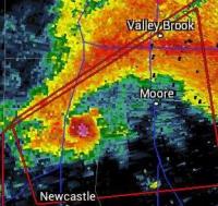
-
E PA/NJ/DE Summer 2025 Obs/Discussion
BBasile replied to Hurricane Agnes's topic in Philadelphia Region
The sky is glowing! Have 0.35" of rain so far. I'll take it!


