

T. August
-
Posts
3,728 -
Joined
-
Last visited
Content Type
Profiles
Blogs
Forums
American Weather
Media Demo
Store
Gallery
Posts posted by T. August
-
-
Just now, Terpeast said:
Oof, that eps run
What’s the news? Wxbell has 06z
-
Is there really a storm until the same wsw has been posted 14 times?
-
 5
5
-
-
Just now, TSSN+ said:
Definitely one of the worst model performances I’ve seen in a while.
Well, different evolution at this point but the GFS did actually show a hit 7 days ago.
-
Might be the first decent gradient storm of the season. Like maybe an inch here with 4”+ in NW Harford County.
-
26 minutes ago, DDweatherman said:
Yep, and 2-4” for N and parts of CMD on 0z Euro. Made a nice south move. Doesn’t have heavy stuff like the other media over s pa/n Md but a nice swath.
Verbatim it shows all of that accumulation occurring within a 3 hour period of time. At 34° lol. 1-2”/hr is one way for it to stick at least.
-
GFS 30-40 miles south with accumulation
-
12k nam was a step back lol. Could have just been a difference in precip orientation.
-
Eps south a little… are we doing it???
-
1
-
-
If we could fall into 1-2” from this, that would be wild.
-
1
-
-
9 minutes ago, Stormchaserchuck1 said:
Nobody's into it, but we get some wrap around flurries Tuesday on the 0z NAM. Low pressure is really strong, 980s mb right when it exits the coast off of Ocean City.
Not that it means much but it’s a little more than flurries for the northern areas. Maybe 1-2” in the favored spots.
-
Through 36 euro is a lil more diggy, but a hair faster. Not sure how that will translate.
-
Euro gonna be telling
-
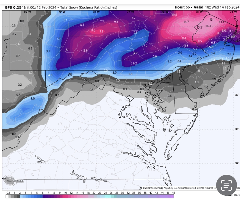
GFS coming north at 42, I regret to report.
-
It sucks, but gefs shifted north too. Not a whole lot but it didn’t hold from 18z.
-
1 minute ago, DDweatherman said:
Maybe I looked at the wrong map, if so I apologize for bad info. I am mobile so I haven’t loaded up maps.
seeing the snow axis bullseyeing NYC I assumed it was south a bit.
No worries. Accumulation didn’t even reach SNE on 12z.
-
1 minute ago, DDweatherman said:
 Someone post the 12z to 0z comparison
Besides a few areas, the snow axis unfortunately did shift north by 50+ miles
-
Just now, yoda said:
0-3 so far
Bro what about the nam
-
Just now, DDweatherman said:
Or the rest of the 0z models maybe?
It was a joke, however we are most certainly off to a bad start. ICON was the most north it has been since this threat emerged, and the GFS couldn’t hold. I’m not saying it’s dead but we are not moving in the right direction at the moment. 18z was better across the board.
-
06z will be telling
-
18z NAM would have been salvageable I think. It’s not worth showing though.
ninja’d
-
7 minutes ago, Eskimo Joe said:
I like the orientation of the accumulation in the later runs.
-
2
-
-
4 minutes ago, WinterWxLuvr said:
It’s better. The UKIE was better. The Canadian was better.
If we could slow it down a hair. The stronger slower solutions were the ones that worked.
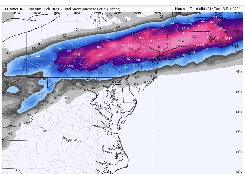
Canadian was close to something decent honestly. I am thinking euro ens will be south. It’s kind of funny how the op GFS is now close to the worst outcome after being the first to come south.
-
Wow ukmet way south. It’s a shame it’s beyond dry lol. It’s weird how as the op GFS keeps going north, its ens is shifting south. What is the reason for that?
-
6 minutes ago, MDScienceTeacher said:
Not sure if anyone has it faster but the low is maybe 50 miles further south at 84 hours
End result for the DC/Baltimore area isn’t much different from 12z, but you are correct. We are moving in the right direction, with light accumulation now showing up near PSU.

2024 Valentines Day Who the Hell Knows - Comeback Thread
in Mid Atlantic
Posted
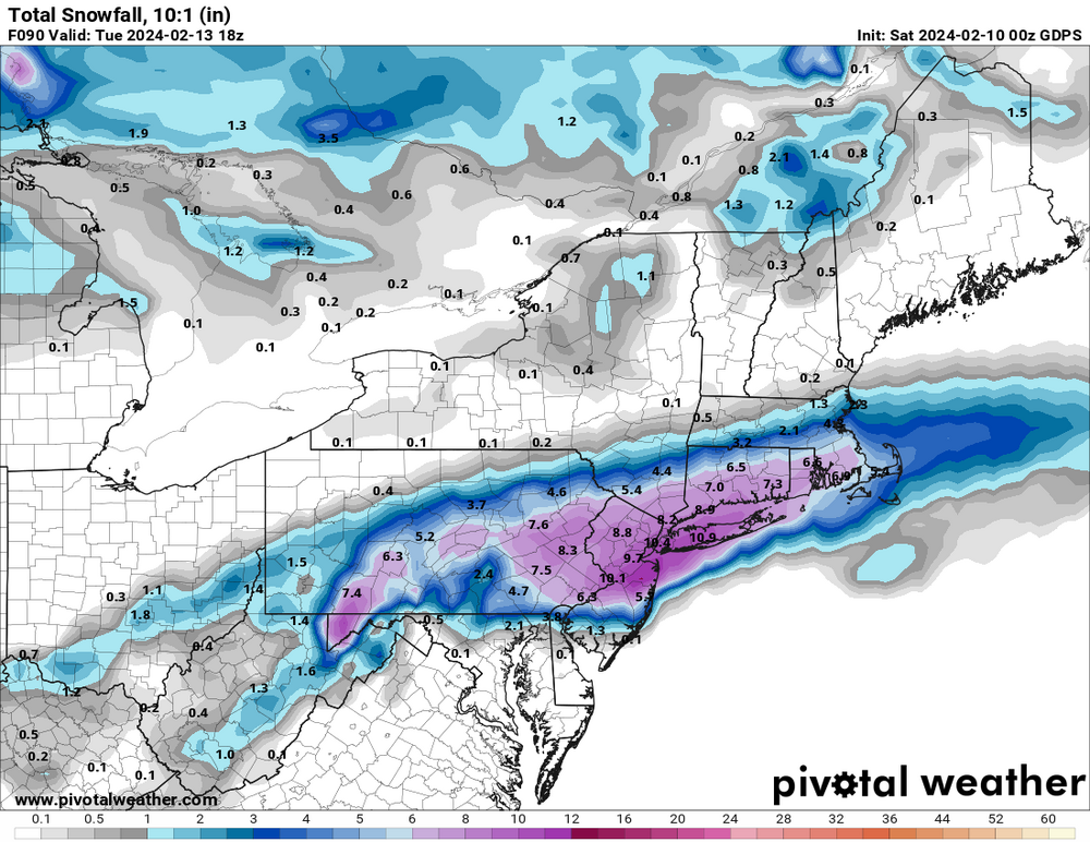
N. Jersey lost 14” on the 3k nam. Lol we might lose this to the south.