mitchnick
-
Posts
26,407 -
Joined
About mitchnick

-
You don't change your underwear every day?
-
Keep in mind that those probability maps don't predict actual temps, just the likelihood of above or below normal. The Euro weeklies, of course, do...for what they're worth since they change every day. Lol https://charts.ecmwf.int/products/extended-anomaly-2t?base_time=202508230000&projection=opencharts_north_america&valid_time=202509010000
-
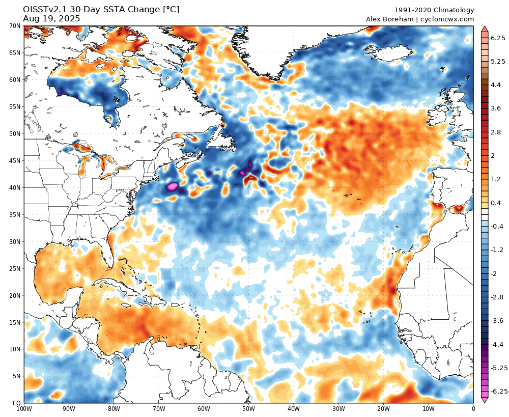
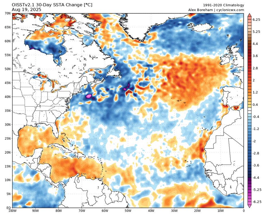
Cyclonicwx.com offers a 30 day change map fwiw.
-
That 500mb anomaly map looks like the latest Euro seasonal.
-
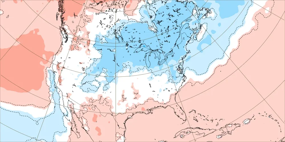
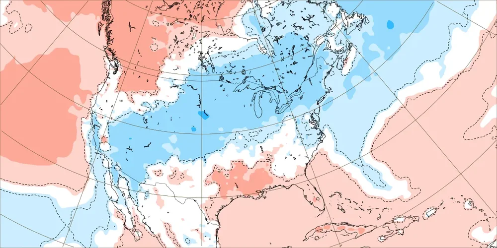
The last forecast for the week of 8/25 off the weeklies and it turned out to be the coldest forecast of all!

-
Here's another great one. Incredible camera resolution. If you're on your phone, be sure to turn it horizontally for a full screen view. https://avalonpier.com/piercam/
-
There's the pro version and weenie version right there! Lol
-
Assuming it is, they're never exactly the same and small variations can make a big difference with the final results.
-
Lots of NC live cams at this link. https://www.surfchex.com/cams/hatteras-web-cam/
-
As previously mentioned, it will likely not technically reach a Niña (5 consecutive tri-monthly SSTA of -.5C at ENSO 3.4), but other measurements like MEI and RONI likely will. So it shouldn't be overwhelming.
-
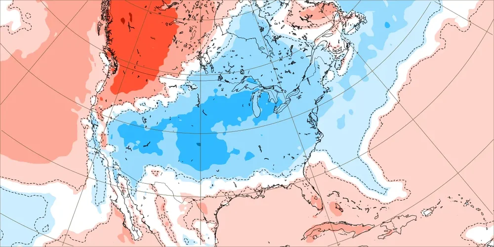
An update from yesterday's run for week of 8/25 fwiw.
-
It's whatever Joe Bastardi says it is! @snowman19
-
I know some memorable winters were on the heels of decent ACE numbers, but I thought I read somewhere, could've been on this Board, high ACE numbers are no guarantee for a decent east coast winter either. From what little I've paid attention to hurricane activity as a clue to east coast winters, it seems a large number of recurves was a better indicator if you're looking for a decent east coast winter. Is that right? Anyone?
-
I was wondering the same thing, but since I really don't follow the tropics, I didn't bother to ask. But since you do follow the tropics Larry, what's your guess on the number of points Erin will add to the ACE?
-
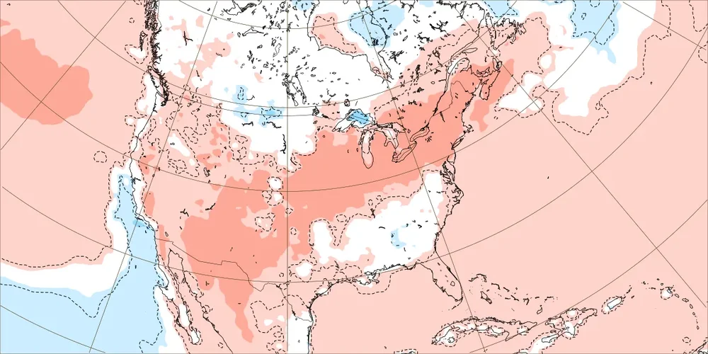
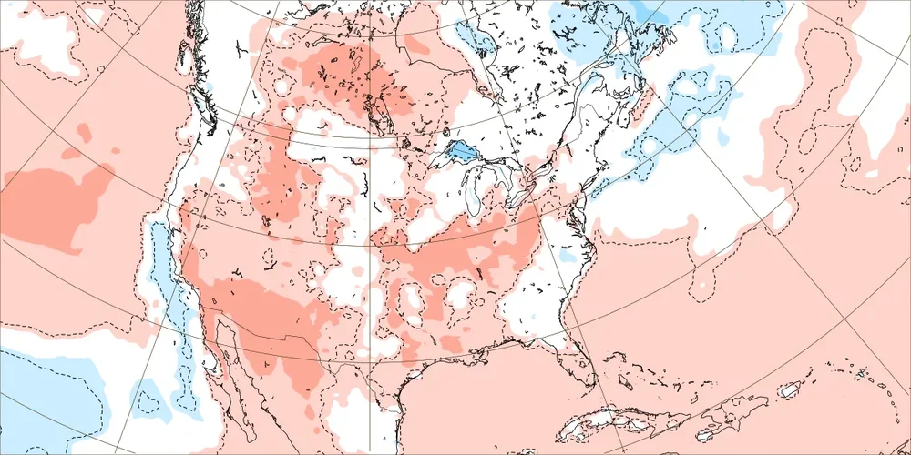
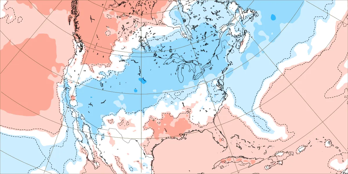
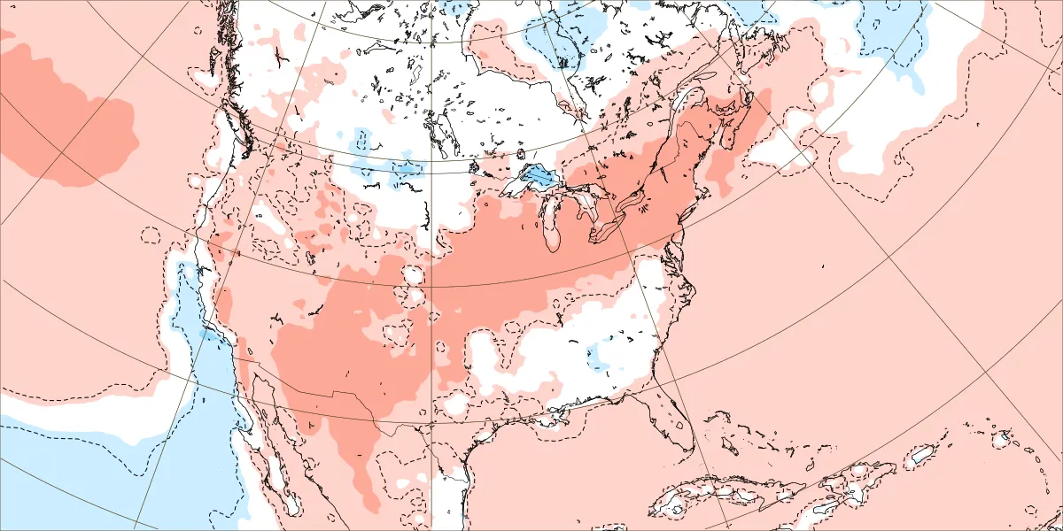
Interesting change of events on the weeklies for the last week of August starting on the 25th. Top map is from the 8/3 run, middle map is from last Friday, the 8th, and the bottom map is from yesterday. Could be fun if this kind of trend continues thru winter on the weeklies...or suck (for some) if it goes the other way.