
Ice Sunday Night?

Entry posted by thunderman ·
1,734 views
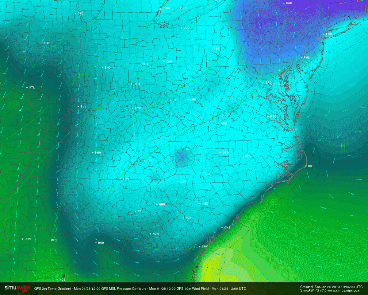
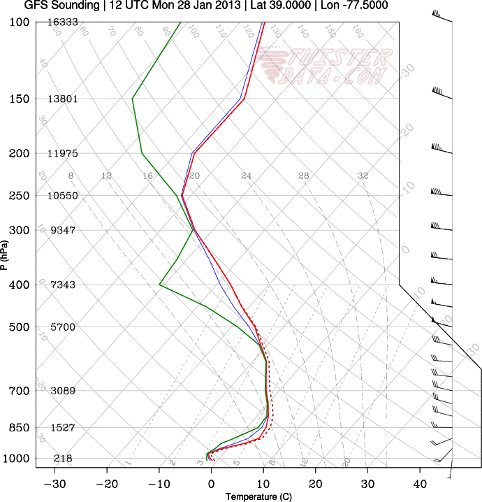
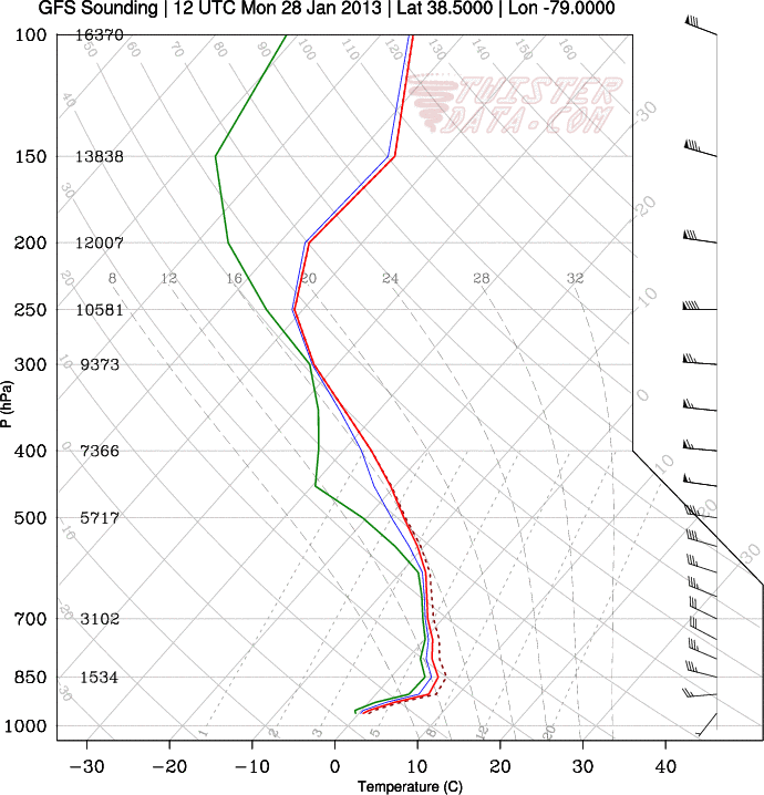
A warm front associated with the next system out west will cross the area Sunday night/Monday. The associated precipitation is expected to be very light ... with well under 0.25" very likely. Cold air at the surface looks marginal, with upper 20s at the lowest and with southerly flow around high pressure to the East, that will be kicked out fairly quickly IMO. Any precipitation that does fall will be in the form of sleet and freezing rain initially, with precipitation after roughly 13z likely falling as just plain rain. Soundings are also hinting at some dryness around/below h85, so that may end up being a limiting factor early on (when the ice threat is).
I wouldn't expect too much from this event ... though given the potential for freezing rain early in the event, many of us may get a freezing rain/winter wx advisory out of it. This would be for elevated surfaces primarily, 80% of the roads should be fine.
Sorry guys, not feeling this one. Out west though across the MS River Valley/parts of the deep south could get interesting on the severe weather side of things ... maybe even a few 'naders!
12z GFS for early Monday morning:
Sterling, VA GFS Sounding:
KSHD (Staunton/Harrisonburg, VA) GFS Sounding:
0 Comments
Recommended Comments
There are no comments to display.
Create an account or sign in to comment
You need to be a member in order to leave a comment
Create an account
Sign up for a new account in our community. It's easy!
Register a new accountSign in
Already have an account? Sign in here.
Sign In Now