
First Decent Severe Event of The Season?

Entry posted by thunderman ·
1,494 views
I eluded to the severe weather threat briefly in my more board centered post on the freezing rain/sleet potential a bit ago, but I thought that it deserved its own post given that it may be first real large (on an area scale) event.
Area of interest is to the right of a line from the Akrlatex region to southern Indiana/Illinois to Western TN to the Gulf.
The same synoptic trough out west that helps to setup our boundary will also be responsible for driving a low from the central plains up towards the Great Lakes. As this low develops and moves East, flow in the warm sector/around the high to East will setup a funnel of moisture inland off the Gulf, with a large area of the Mississippi river valley and Deep South seeing sufficient moisture return to support deep moist convection.
Accent along the cold front and ahead of the upper level trough, sufficient moisture return, and open/lengthy hodographs will work to produce an environment conducive to squall line/QLCS development. Given the track of the low and the factors above, a widespread damaging wind event is possible … along with some tornadoes, given the open and spread out nature of hodographs ahead of the front and low LCLs.
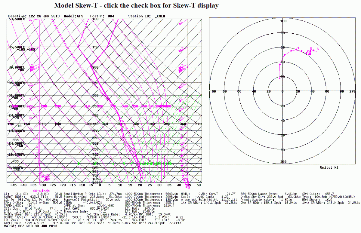
KMEM sounding for 00z Wednesday just as a sample of environment ahead/along front:
0 Comments
Recommended Comments
There are no comments to display.
Create an account or sign in to comment
You need to be a member in order to leave a comment
Create an account
Sign up for a new account in our community. It's easy!
Register a new accountSign in
Already have an account? Sign in here.
Sign In Now