Search the Community
Showing results for tags 'flurries?'.
Found 3 results
-
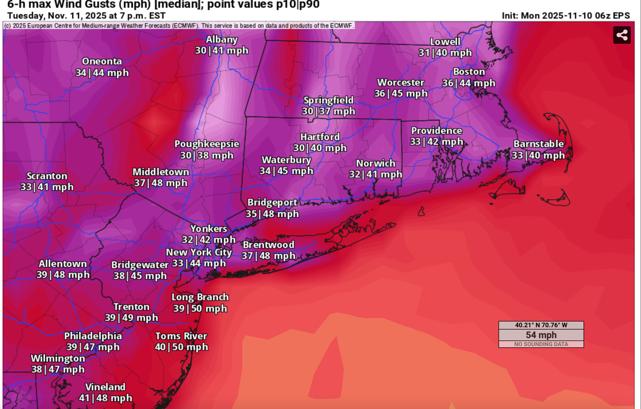
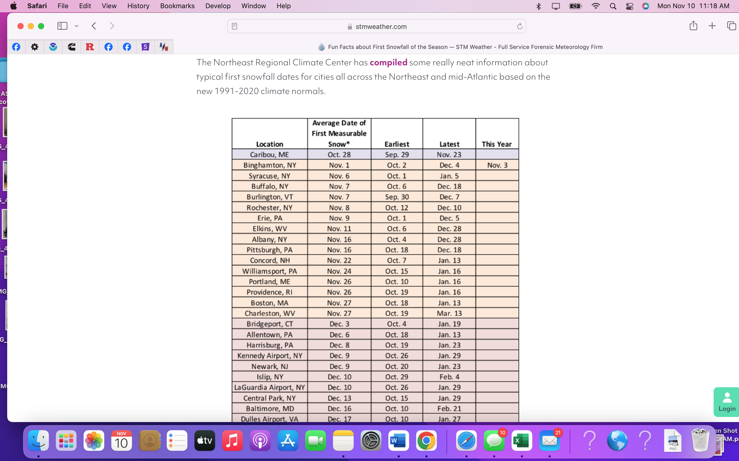
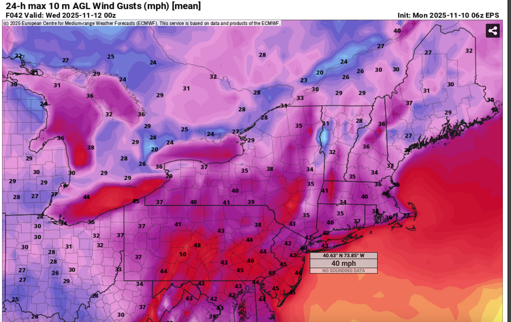
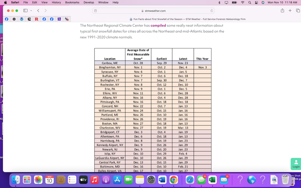
 For fun, since we have modeled guidance posts the past several days of a deep highly anomalous cold unstable trough passage Tuesday. Momentum transfer via the NAM FOUS BL Wind hreshold of 27 kt and the Richardson Number as viewed on Bob Harts web pages, suggests winds do not exceed 45 MPH . However ECMWF EPS suggests marginal gusts 45-50 MPH southern part of the NYC subforum midday spreading into the NYC-Long Island and ridges above 1000 feet late in the day or evening. Impact mainly air travel and possibly isolated or scattered broken branches impeding traffic here and there. Of greater interest to the NYC subforum is the likelihood of flurries or even scattered light snow showers moving across the forum area including NYC-Li midday-afternoon. Could this be CP's first trace of snow for the 25-26 winter? 06z/10 EPS range via prob 10% (high gust) and 90% (low gust) 06z/10 median wind gust (marginal) and First measurable snow history Posted fina 1218PM/10 (0718z/10
-
Thread for anyone who wants to track highs in the 20s and possible flurries. This isn’t medium range anymore.