

White Gorilla
-
Posts
2,685 -
Joined
-
Last visited
Content Type
Profiles
Blogs
Forums
American Weather
Media Demo
Store
Gallery
Posts posted by White Gorilla
-
-
3 minutes ago, White Gorilla said:
You know me too well...
") . But, if we can't join em....
. But, if we can't join em....
-
3 minutes ago, Wannabehippie said:
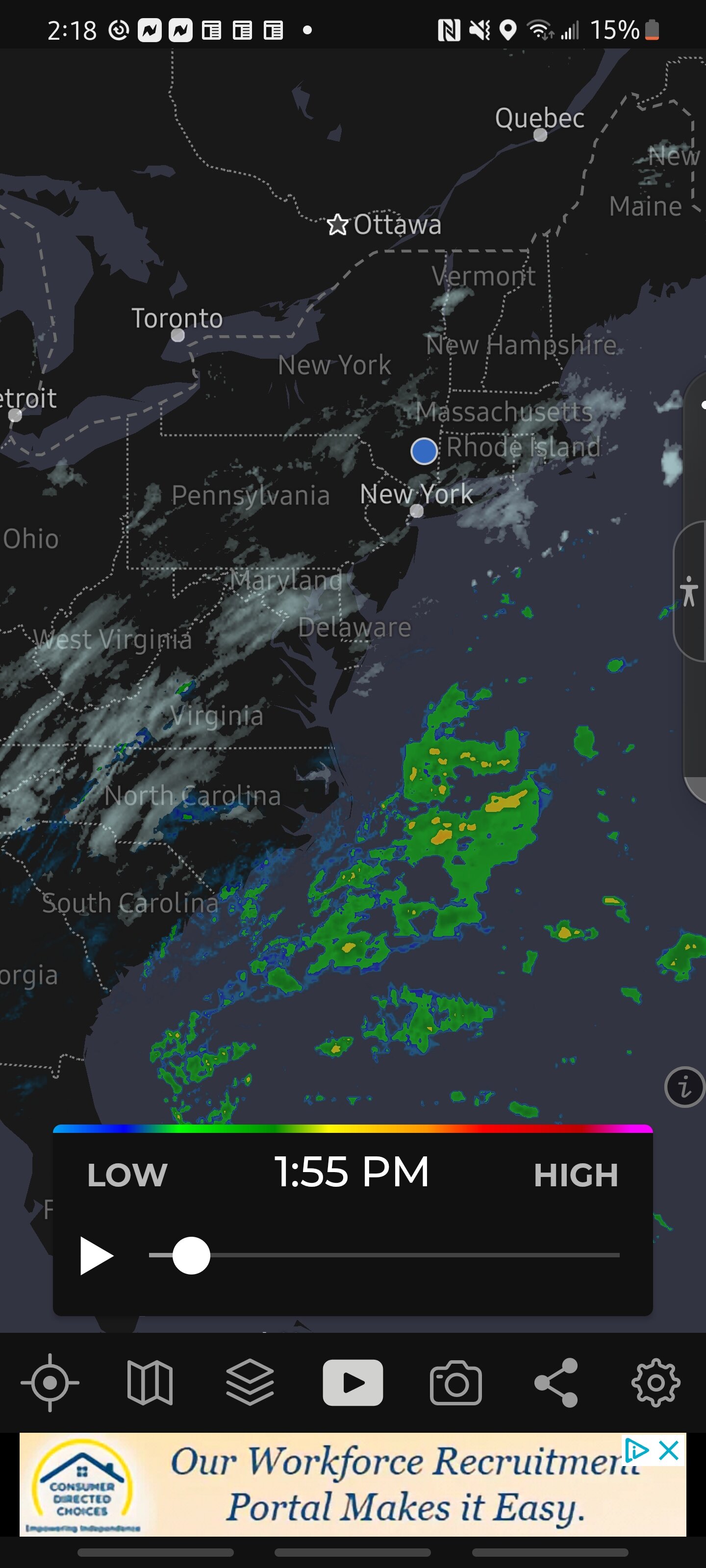
Time to watch models is over. It is now time to watch radars, satellite loops. Let us hope we all get a good thump of snow tonight in to tomorrow. From the looks of things, we will get a lot of melting by mid week.
Snow melt and possible more snow around Feb 8
-
I am good with 3-6. My "disappointment" has faded. Nice snowy Saturday upcoming. Enjoy.
-
Jet dynamics look amazing
-
 2
2
-
-
-
18Z HRRR

-
6
-
-
7 minutes ago, JustinRP37 said:
And we also could still be. The two lows is interesting but may not be correct.
If this doesn't work out as well, we will have more blue bomb opportunities in Feb and March
-
1
-
-
-
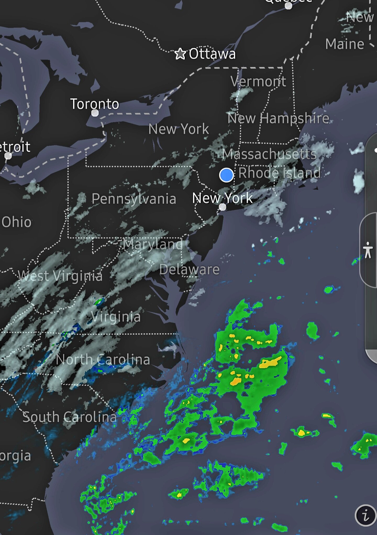
Nice radar development off the Carolinas
-
1
-
-
Would warmer SSTs influence earlier close off and western low strength? A factor the models don't factor in?
-
4 minutes ago, NYC10023 said:
on the bright side at least we have the temps in place and aren't stressing bout the rain/snow line.
Yeah, enjoy the cold storm, that mix stress will arrive in Feb and March
-
2
-
-
4 minutes ago, hudsonvalley21 said:
Early evening, and not so much the models, it will be location of the low and development.
Nowcasts replacing forecasts
-
1
-
-
Everyone, enjoy a nice snowy and cold Saturday tomorrow no matter how much you get. We will be dreaming of a day like tomorrow 6 months from now when we are sweltering under high dews.
-
2
-
-
4 minutes ago, Juturna said:
Time for people to jump off the ledge again. Could be bad data, initialization, the double barrel making it chase the more east low which may not even exist. It's nowcast/shortrange time and let the pieces fall where they may.
The run to run swings are just not healthy lol, take a blend.
Watch that upper low tonight and see when it closes off. The key!
-
1
-
-
As much as I want more snow, I will still be happy with 3-5 inches up here in Dutchess. Will be a beautiful scene.
-
2
-
-
4 minutes ago, USCG RS said:
Given current OBS - Euro does not appear to be lining up. Unless I am just wishing here.. Can someone else confirm I am not crazy ?
Has the trough gone neutral yet?
-
1
-
-
3 minutes ago, dseagull said:
Not convinced of any global shorts... This is eerily similar to the 2018 setup. Baking in the sun here on BB in ocean county, nj. Waiting for feedback result error. This system was always going to be a nowcast. Everything looks the same to me still. Going to look through and see what changed, but it still looks almost perfect for coastal and 20 mile differentials for banding. This coastal is about to explode.
Coastal gonna go postal
-
1
-
 1
1
-
-
It doesn't mean the Euro is correct. It could be, but let's factor in other data sources
-
4
-
-
15 minutes ago, CPcantmeasuresnow said:
35 inches in Highland Mills my favorite storm of all time.
I believe we were the jackpot area for that one in Orange County, the Monroe trained spotter came in with 34. There were places in the Catskills that were in the 40-50 inch range. I think Monticello recorded 38.
Of course what made it extra special was most of New England getting rain the whole time. I still feel guilty for taking such pleasure in that to this very day.
I would love a repeat of that.
-
1
-
-
If only the upper low could close off farther south and west
-
Did someone here in the interior forget to pay the snow bill and now reduced snow service this weekend ?

-
Fringe city.. I feel like there's a huge party out there and we are not invited.

-
2
-
-
-
I have a feeling late Feb or March will deliver a foot plus for us here in the interior woods, a reduced version of March 2017. Just a hunch and some Nina climo thrown in.
-
1
-

Interior NW & NE Burbs 2022
in New York City Metro
Posted
I will enjoy whatever snow I can get with this, but will be glad it's over soon. Tracking fatigue.
Wondering what Feb and March have in store for us interior peeps. Maybe WE will bullseye in a storm for a change.