

White Gorilla
-
Posts
2,674 -
Joined
-
Last visited
Content Type
Profiles
Blogs
Forums
American Weather
Media Demo
Store
Gallery
Posts posted by White Gorilla
-
-
11 minutes ago, bluewave said:
I would be happy with the warmer Euro and GEM for our area since I am not a big fan of ice.

Yes, rain over ZR anyday. We will have our snow chances next week and beyond.
-
 1
1
-
-
18 minutes ago, Northof78 said:GFS is a combo of ice, sleet, and 2-4” snow....pretty nice move south from yesterday of about 75/100 miles...

We shall see if other models latch onto a south trend with the cold. This graphic gives I84 up here 8-10 inches of snow and sleet. Long way to go with modeling.
-
4 minutes ago, HVSnowLover said:
It may be overdone for 0Z GFS is a pretty brutal icestorm for almost the whole subforum.
If that comes to fruition, I pray it is more PL than ZR
-
3 minutes ago, Brasiluvsnow said:
I wish I had gotten a foot instead of 5 inches that said it was a very good storm for NYC
Your 5 inches is my foot. I only got 2.
-
1
-
-
14 minutes ago, nycwinter said:
we had a cold january.. weather is a revolving door fen has to be warmer then average..especially in the era of climate change..
I get that, but still doesn't explain things in the short term. But if it's just reverse psychology, ok, I can vibe with that

-
 1
1
-
-
14 minutes ago, SnoSki14 said:
My expectations for Feb particularly first 3 weeks are really low so if we get any snow it'll be a huge win.
I remain positive for the Feb 20 - March 15 period.
Why the low expectations? Curious your meteorological reasoning
-
3 hours ago, HVSnowLover said:
This one is not as likely to be as wild as the last one, first of all we already have snowcover so there is less desperation and also the upside potential is not nearly as high.
Still hungry where I live for a big snow. Every event where I am has been 3 inches or less so far.
-
2
-
-
11 minutes ago, Northof78 said:

A long way to go. The eventual outcome will likely be different than this modeled solution.
-
2 hours ago, EasternLI said:
Not really looking to in depth at things right now. But my take just looking over the ensembles 500mb this morning. Is that this coming week we are in transition. Before a colder looking pattern could possibly take shape again with ridging near the west coast into Alaska. This isn't some extended torch look to me and could be potentially cold. Might dig a bit deeper in coming days. Just feel like we went through a marathon watching this last storm lol.
.thumb.png.73774150fce417eb4315b0366f7baefa.png)

I will be ok with normal temps in Feb given climo as long as we have an active storm pattern. Snow wlll be falling more or less.
-
1
-
-
13 hours ago, Juliancolton said:
Verification based on closest reports from Albany and Upton PNS and NWSChat:
HPN (Armonk): 8.4" (+1.6)
SWF (Gardnertown): 4.0" (-0.5)
MGJ (3 WSW Middletown): 3.5" (+0.6)
POU (4 SSE Poughkeepsie): 2.5" (-0.9)
Should have tightened up the gradient a bit, but not bad.
Not bad at all!!
-
8 minutes ago, HeadInTheClouds said:
12Z Cmc has also trended colder. Give area frozen precip after initial rain.
I like the trends so far.
-
4 minutes ago, White Gorilla said:
So close and yet so far.. I love the little snow I have and the wintry look and feel, but man, I was hoping the 2015 and 2016 fringe jobs were behind us for good.
-
29 minutes ago, Juliancolton said:
Little bit of a band taking shape just east of the NY/CT border. Danbury probably approaching 1"/hr rates. With the low jetting off to the NE now I don't think there's much room left for westward progress of heavier snow.

So close and yet so far.. I love the little snow I have and the wintry feel, but man, I was hoping 2015 and 2016 were behind us for good.
-
I will enjoy whatever snow I can get with this, but will be glad it's over soon. Tracking fatigue.
Wondering what Feb and March have in store for us interior peeps. Maybe WE will bullseye in a storm for a change.
-
1
-
-
3 minutes ago, White Gorilla said:
You know me too well...
") . But, if we can't join em....
. But, if we can't join em....
-
3 minutes ago, Wannabehippie said:
Time to watch models is over. It is now time to watch radars, satellite loops. Let us hope we all get a good thump of snow tonight in to tomorrow. From the looks of things, we will get a lot of melting by mid week.
Snow melt and possible more snow around Feb 8
-
I am good with 3-6. My "disappointment" has faded. Nice snowy Saturday upcoming. Enjoy.
-
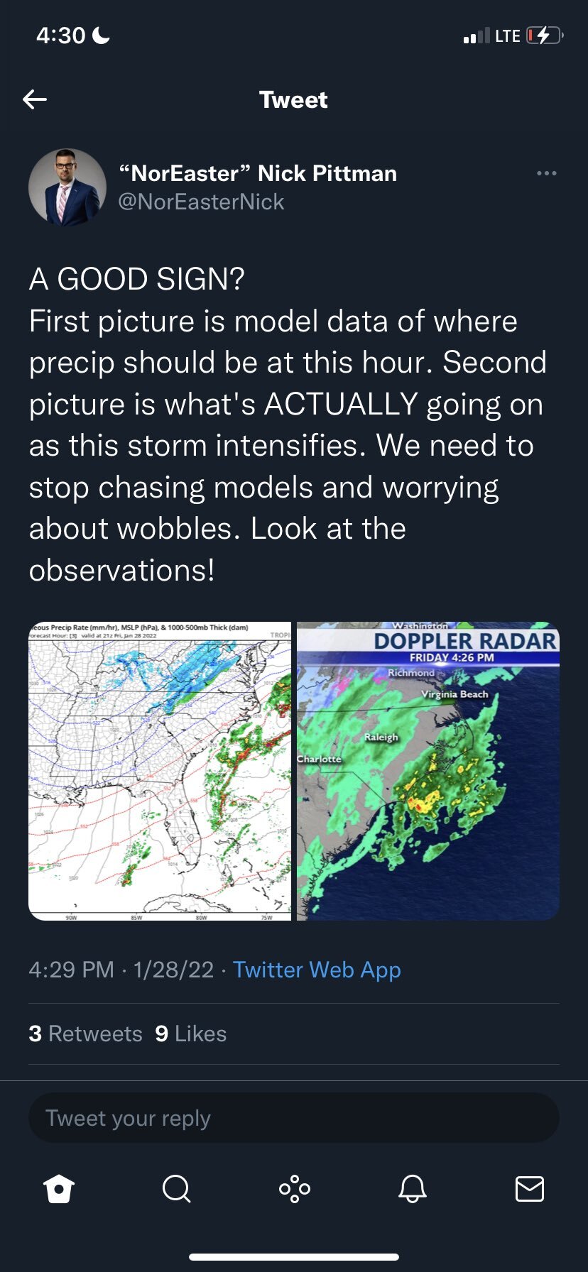
Jet dynamics look amazing
-
2
-
-
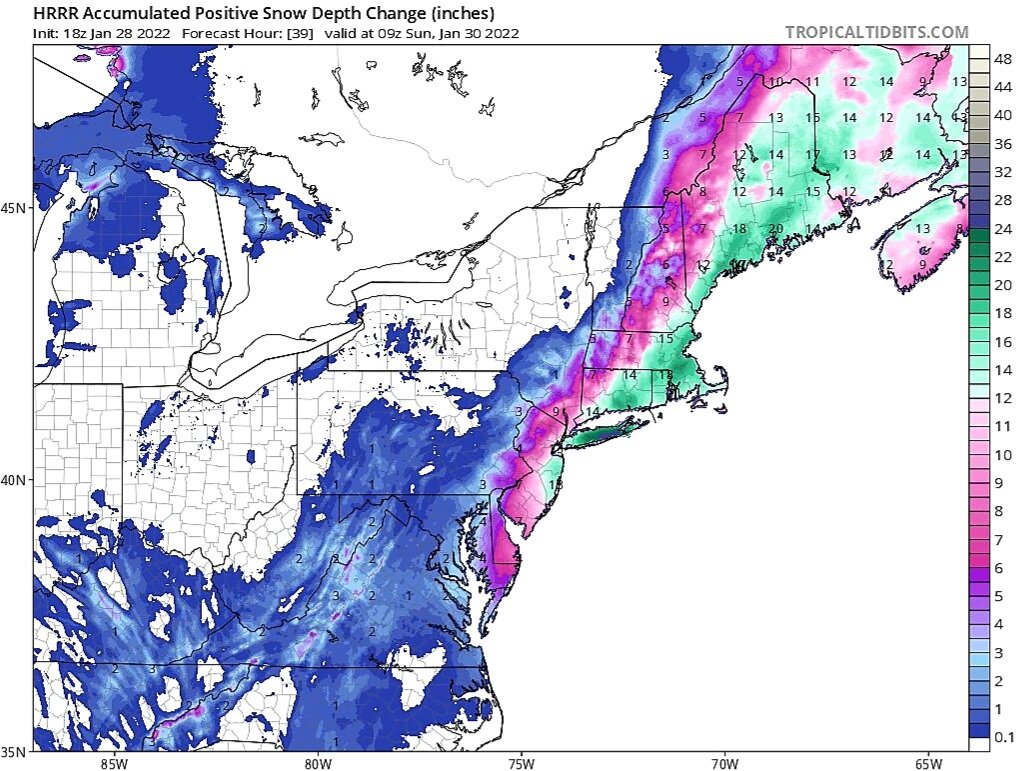
-
18Z HRRR

-
6
-
-
7 minutes ago, JustinRP37 said:
And we also could still be. The two lows is interesting but may not be correct.
If this doesn't work out as well, we will have more blue bomb opportunities in Feb and March
-
1
-
-
-
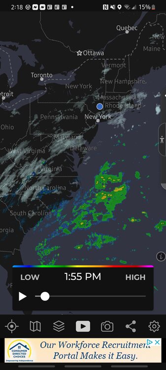
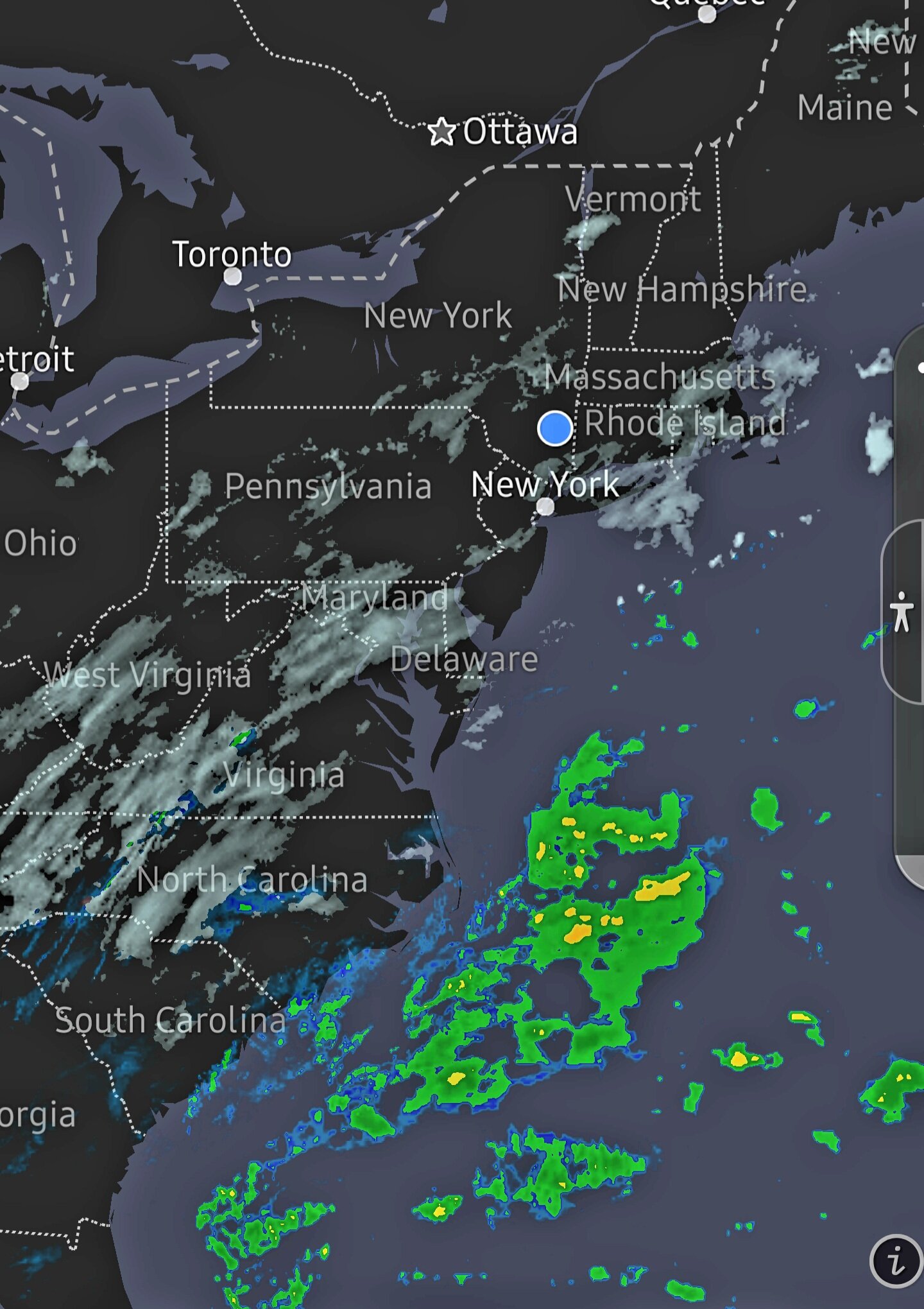
Nice radar development off the Carolinas
-
1
-
-
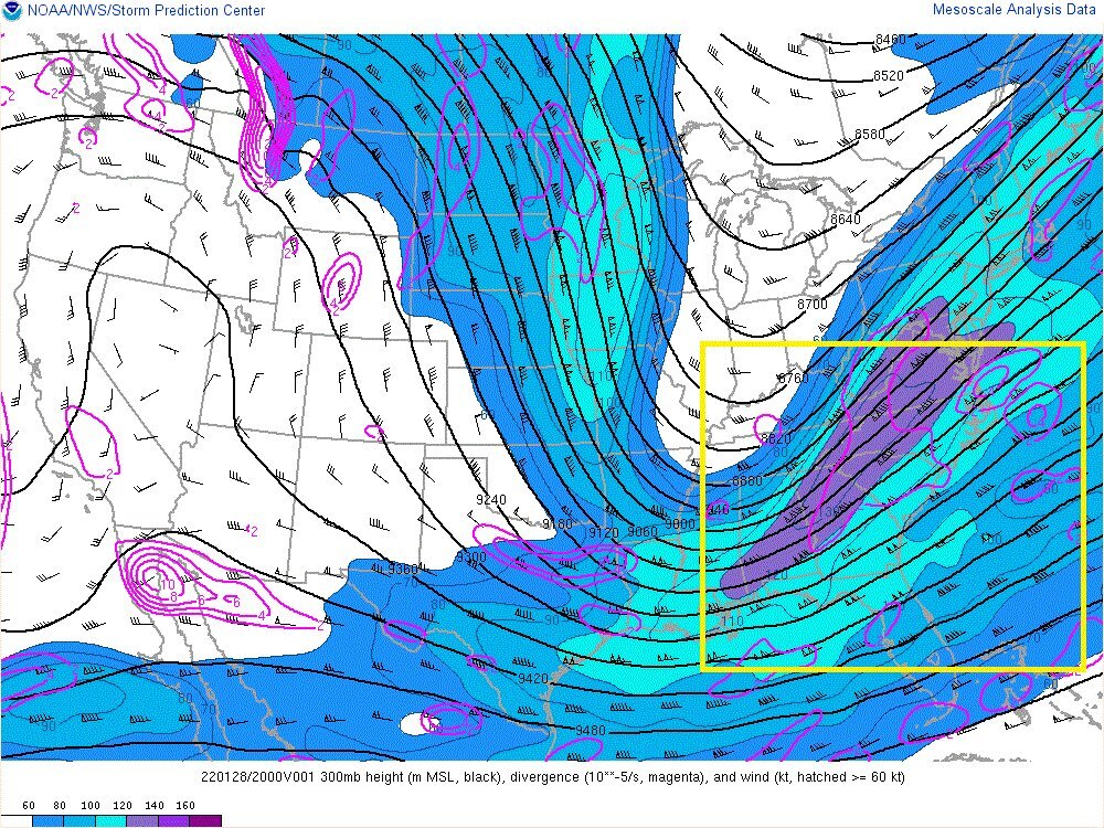
Would warmer SSTs influence earlier close off and western low strength? A factor the models don't factor in?

.png.8c53a8111ddfae561ade8872a6c87646.png)

February 3-4 significant icing event for the interior, some sleet/snow possible. Coast mostly rain.
in New York City Metro
Posted
Better shape in terms of warmer rain or colder snow?