
YetAnotherRDUGuy
-
Posts
403 -
Joined
-
Last visited
Content Type
Profiles
Blogs
Forums
American Weather
Media Demo
Store
Gallery
Everything posted by YetAnotherRDUGuy
-
Southeast Sanitarium - A Place to Vent
YetAnotherRDUGuy replied to Jonathan's topic in Southeastern States
Haha, yea it took me almost 5 years, but the dark side of the force is strong. You growing up in Winston and now residing in the snow desert of Wake now makes sense as to how you got bitter. I wonder what CR's excuse is? Lol. I grew up in High Point. Was always jealous of Winston's storm totals, but never got too worked up about it. Why would I? WS would get 4-5'' and HP might get 2-3''. (I'm generalizing of course, but that to me is a typical storm amount for the area) Those totals were to be expected because that's climo right? It seemed rare that WS or GSO would get snow and we wouldn't. But the Triangle and neighboring locales seem much more prone to being feast or famine, as I described before. The rain/snow or ice/snow or even rain/ice line just always seems to be around here--resulting in high deviation in impacts over short distances. Yea yea, I know the line between the haves and havenots has to be somewhere. But why does it always have to be around here? That last paragraph sounded a little bitter. I'm only going to get worse, aren't I? -
Southeast Sanitarium - A Place to Vent
YetAnotherRDUGuy replied to Jonathan's topic in Southeastern States
BTW, on another note.. I moved here about 5 years ago from the Triad. When I first started lurking these boards, I admit I didn't quite "get" the doom and gloom mentality of you Triangle posters. All this whining about warm noses and BL issues and always being on the line. I'd just shake my head at all the meltdowns/bittercasting and felt there was a little too much drama being generated. Blah blah blah. "It's gonna turn to rain! It always does, you just watch! Whaaa!" The fact there was so many of you didn't help. (Which BTW let to me choosing my username, lol) But I'm finally starting to get it now. I mean, every single one of these storms screws somebody around here. Every. Time. I've seen CH and Durham get nearly nothing while Mebane gets 5-6''. Another time I've seen CH and Durham get about that amount w/ N Raleigh getting a sloppy mess. And I won't even talk about those of you in S Wake, who I can't figure out why you're even here except that you must be addicted to pain. Why else would you put yourselves through this winter after winter? TL;DR, I'm starting to get why some of ya'll complain so much. -
Southeast Sanitarium - A Place to Vent
YetAnotherRDUGuy replied to Jonathan's topic in Southeastern States
I'd rank the St. Louis free throw meltdown in the tourney as particularly painful. Admittedly I'm a UNC fan, but tend to pull for State in the tourney (because I'm weird). It was a slow, methodolical, torturous loss. The fact it was done using a strategy similar to what Valvano used on teams during the '83 title run just made it that much more awful. In fact, that game reminds me a little of this storm. Big lead for awhile, and then a slow but deliberate trend of the warm nose making a comeback. You saw it coming, but you didn't want to believe it. But deep down, you knew it probably would. -
Southeast Sanitarium - A Place to Vent
YetAnotherRDUGuy replied to Jonathan's topic in Southeastern States
I'd love to see 5''-6'' of sleet/concrete. That stuff would last for almost 2 weeks. No power outages. Epic sledding potential. As long as it's not plain ol' rain, then I say bring it on! -
Southeast Sanitarium - A Place to Vent
YetAnotherRDUGuy replied to Jonathan's topic in Southeastern States
Fair enough! That's not too far from these parts. Looks like I'm heading up 501 to do some snow chasing this weekend. -
Southeast Sanitarium - A Place to Vent
YetAnotherRDUGuy replied to Jonathan's topic in Southeastern States
Lol, I saw you sneak in the 24'' up there. I can't tell where that is. Congrats Roxboro?? -
Southeast Sanitarium - A Place to Vent
YetAnotherRDUGuy replied to Jonathan's topic in Southeastern States
#stoptheNWtrend #ClassicGSOTrack #weneverlearn -
Southeast Sanitarium - A Place to Vent
YetAnotherRDUGuy replied to Jonathan's topic in Southeastern States
Hahaha. Can we trust that model?? I've heard it's got bad run to run consistency. -
Southeast Sanitarium - A Place to Vent
YetAnotherRDUGuy replied to Jonathan's topic in Southeastern States
Besides the French, German, Canadian, UK, & Japanese models is there any other ones we can drag out? If there's an Australian 00z model showing jackpot for RDU, I wanna know about it. -
Southeast Sanitarium - A Place to Vent
YetAnotherRDUGuy replied to Jonathan's topic in Southeastern States
I love it when the non-serious/banter thread is just as informative (if not more so) than the main discussion thread. -
Southeast Sanitarium - A Place to Vent
YetAnotherRDUGuy replied to Jonathan's topic in Southeastern States
That's not funny, because that will probably happen. Or maybe it IS funny, because of the same reason. It's gonna be a long 48 hours... -
Southeast Sanitarium - A Place to Vent
YetAnotherRDUGuy replied to Jonathan's topic in Southeastern States
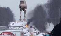
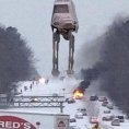
Yes sir! I thought they did a great job recreating the look of the original trilogy. Seeing the walkers again was also a treat. Won't say much more because I'm afraid I'll create spoilers. Be interesting to see how it holds up years from now. -
Southeast Sanitarium - A Place to Vent
YetAnotherRDUGuy replied to Jonathan's topic in Southeastern States
Lol. I agree. I also like the one with the staypuff marshmellow man. I consider it a close 2nd. -
Southeast Sanitarium - A Place to Vent
YetAnotherRDUGuy replied to Jonathan's topic in Southeastern States
YetAnotherColdRain ??? -
Southeast Sanitarium - A Place to Vent
YetAnotherRDUGuy replied to Jonathan's topic in Southeastern States
First question about soil temps in the storm thread. It's starting to get real, ya'll. -
Southeast Sanitarium - A Place to Vent
YetAnotherRDUGuy replied to Jonathan's topic in Southeastern States
For the Triangle, looks like we can stop worrying about if there would be a NW trend. Now we can start worrying about mixing issues. Wooooooo! -
Southeast Sanitarium - A Place to Vent
YetAnotherRDUGuy replied to Jonathan's topic in Southeastern States
I've seen the JMA mentioned a few times. I bet that one still shows a doozy. And if it doesn't, then who cares? It is the JMA after all.. -
Southeast Sanitarium - A Place to Vent
YetAnotherRDUGuy replied to Jonathan's topic in Southeastern States
Wait, isn't there a Para NAM too? Double the chances of getting NAM'ed. -
Southeast Sanitarium - A Place to Vent
YetAnotherRDUGuy replied to Jonathan's topic in Southeastern States
Sigh..ain't that the truth. And a good reminder a NW trend tends to be much more beneficial to those on the 'good' side of I-85 in SC/NC/VA than those of us on this side. I'd much rather miss this storm because it's supressed than being just outside of the transition zone and getting rain at 33. But nature doesn't care what I think. We'll just have to wait and see what she does. How about #slightNWtrendFTW ?? Would that work? -
Southeast Sanitarium - A Place to Vent
YetAnotherRDUGuy replied to Jonathan's topic in Southeastern States
#NWtrendFTW -
Southeast Sanitarium - A Place to Vent
YetAnotherRDUGuy replied to Jonathan's topic in Southeastern States
All joking aside, here are some random thoughts FWIW: 1) Suppressed storms do tend to trend a little NW as we get to the event. 2) Everybody wants snow in their backyard, and some (not all) tend to be biased towards forecasts/solutions that deliver it. 3) It wouldn't be a bad thing for a storm to miss central/west NC and give GA/SC the goods. If I and others in my area complained/whined too much about those to our south getting snow, we'd be no better than those in the MA complaining when we get snow instead of them. -
Southeast Sanitarium - A Place to Vent
YetAnotherRDUGuy replied to Jonathan's topic in Southeastern States
NOOOOOOOOOOOOOO! You take that back!