

aggiegeog
-
Posts
1,145 -
Joined
-
Last visited
Content Type
Profiles
Blogs
Forums
American Weather
Media Demo
Store
Gallery
Posts posted by aggiegeog
-
-
Some snow is possible tomorrow north of I-20 in higher precip rates areas. Accumulations are unlikely with temps in mid to upper 30s.
-
1 minute ago, Ed, snow and hurricane fan said:
700 mb freeze line
I see that now haha
-
55 minutes ago, weatherextreme said:
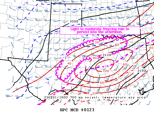
Odd but that freeze line is well NW of the actual freeze line.
-
27 and light freezing in Lindale for past few hours.
-
 1
1
-
-
Candian is only model that has tps in NE TX correct right now. 27 in Lindale, around 1" QPF expected today. Most models want to quickly get us above freezing which I am seriously questioning. Maybe we touch 33 this afternoon. I think an additional 0.5" of ice is possible here.
-
1
-
-
Finally got power back on in Lindale. Today we got maybe 0.2" of ice and some sleet mixed in. Temps rose to around 32 or a tad above but are back in upper 20s again now. Oncor reporting major damage in this area. Much more damage expected tomorrow.
-
Ground white now from sleet shower, that should make freezing rain surface accretion rates increase
-
 1
1
-
-
Water vapor imagery shows the upper low sitting over SoCal pumping in a constant stream of moisture directly out of the EPAC ITCZ. We will stay wet with little to no break until the upper low ejects over us later this week. The surface cold also will not break until then so expect current temps to persist until Thu. The surface cold will temporarily be replaced with cold from above Thu which cold bring some snow. Warm up and dry out starts Friday.
-
1
-
-
2 hours ago, weatherlover said:
Any live storm chasers that are covering the storm right now?
I know Reed is in DFW, I'm sure there are others
-
Upper 20s and thunder freezing rain in Lindale.
-
1 hour ago, vwgrrc said:
On the flip side, 0z HRRR seems lowered the amount of ice in Dfw by a lot. At least for tomorrow! I find it hard to understand why models are so struggling with this at close range.
We are dealing with ripples in the jet coming through Mexico. We have no upper air data for the models to initialize on down there. I would still bet on Pacific moisture producing though there be winner and losers as always.
-
2
-
-
24 minutes ago, vwgrrc said:
Agree. Monday is supposed to be light. 18z RDPS is showing even more FR for the metro now. I'm not familiar with this model but that's concerning if other 18z come in similarly.
Rdps has been my go to for many years for winter storms. Its the hi Res Canadian.
-
Tyler still has not rose above 32 today. Fell to 32 around midnight and won't likely reach 33 until Wed maybe even Thu. All of that while now under a Flood Watch in addition to the winter storm warning. Not sure I have seen that combo before.
-
1
-
-
Its bad out there this morning. Elevated surfaces are ice covered across much of the state.
Freeze line from Austin to College Station to south of Tyler to Texarkana. This is significantly further south than even the cold models had.
SHV likely needs to add a tier of advisories another row of counties south of the warnings.
-
1
-
-
6 minutes ago, vwgrrc said:
Also I was too focus on Tuesday the entire time and just now realized 0z NAM has FR even on Thursday?? That's insane.
Yep, though I am still on the bandwagon of Thursday being more of a snow event. If that upper low stays closed than I am hopeful that we can end this mess with a couple inches of snow.
-
1
-
-
For Tyler area the NAM has us bullseyed. HRRR is all rain here. NAM is typically too dry but solid on temps.
-
1
-
-
2 hours ago, vwgrrc said:
definitely jugged my memory on that one. but i think the forecasted ice accu was a lot higher back then. this one shouldn't be too bad!
Qpf of 1 to 2 inches is plenty to cause huge ice problems with temps in upper 20s as it appears DFW will see.
-
1
-
-
This is starting to spark memories of 12/2013. Not good at all.
-
1
-
1
-
-
DFW and points west looking like a skating rink most of this week. NE TX is more borderline given the Ouachita Mountain shadow but I think they will also join the party by Monday night and especially late Tuesday into Wednesday. Some snow possible Thu if surface stays in mid 30s.
-
1
-
1
-
-
Some north of I-20 will see heavy snow today. Most likely near Red River East West of I35. Flurries down to I-20 east of I35, West of I35 snow could fall south of I35.
-
I love when we get powder, its so rare down here.
-
Snow showers and freezing drizzle are verifying across North Texas this morning.
-
Front is stretches from near Tulsa through OKC down to near Wichita Falls and to south of Lubbock. Temps in 30s and 40s ahead of front quickly falling into teens and single digits behind with snow showers.
-
The long awaited front is marching down the Plains today. This afternoon the front has led to 25 degree 5 minute drops and 40 degree 30 minute drops. Higher res models are highlighting a chance for freezing drizzle in the cold air tomorrow.
MO/KS/AR/OK 2023-2024 Winter Discussion
in Central/Western States
Posted
Today's model trends are pretty incredible for the Southern Plains next week. Early week is analogous to 12/24/2009 with a very dynamic storm and enough cold air for possible blizzard conditions for N TX and OK. That is just the first in a line of storms that could lay down a thick blanket of snow all the way down the Plains. We will rapidly recover from the warm December and soon see a normal or above snowpack.