
MIstorm97
-
Posts
363 -
Joined
-
Last visited
Content Type
Profiles
Blogs
Forums
American Weather
Media Demo
Store
Gallery
Posts posted by MIstorm97
-
-
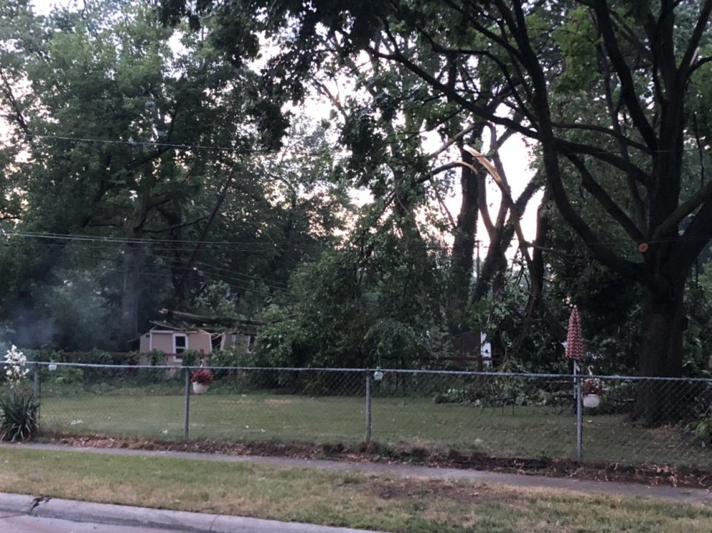
I work for the City of Royal Oak. Man was there a ton of tree damage to clear from last evening’s storm. Trees on cars, trees on houses, huge limbs down, many instances of wires down, the works. It was certainly a localized significant microburst. Got some decent lightning too last night, as seen below. So far today’s storms are avoiding Royal Oak, and considering there’s still a few days of cleanup left, I’m okay with that.

-
 6
6
-
-
25 minutes ago, Stebo said:
Yeah you are too busy playing your alternate persona

Hey now
")
That microburst ended up causing some decent tree damage in Royal Oak. Numerous limbs down and some wires down. 60mph gusts it is then.

-
1
-
-
13 minutes ago, Powerball said:
The lake breeze front off Lake St. Clair clashed with a nice outflow boundary from storms in the Tri-Cities earlier, giving us a nice drenching t'storm right now.
Was sitting in the perfect spot along the Berkley/Royal Oak border. Had a solid inch or so of rain and 50-60mph gusts for a few minutes. Over 3000 customers without power in Royal Oak. There were some real close CG strikes too. I was loving it but my dog sure wasn’t

~~
Also oops haven’t been here in a hot minute. Never posted my story/pics from the Edenville Dam and Sanford Dam failures on here and I probably should
-
2
-
-
3 hours ago, Stebo said:
Issue is that it sounds like normal year to year maintenance was lacking recently which is dangerous with an old earthen dam like that. They also own the Sanford Dam and its the same situation there.
Yeah talking with homeowners on Wixom Lake, it was lacking maintenance. It also was being neglected with the water level and not much thought was put to draining until it was too late.
-
1
-
-
All I can say is wow. I was at Wixom lake and the Edenville dam when it failed. Luckily I was just upstream. Had to still promptly evacuate. I never want to have to be evacuated from a dam failure again. Saw incredible flooding scenes all day across Mid Michigan. Video will of course be coming later.
-
I did chase C and E IA on Thursday along the warm front. Tracked a monster HP supercell, but it remained like 10 miles north of the front on the cool side. Still, it provided some nasty skies and tried to catch the boundary and wrap up a couple times. The third picture is the closest it got. I will be out for sure tomorrow, and maybe Monday in Ohio if the system slows down even more.


-
10
-
-
There looks to be a decent minisupercell/tornado threat tomorrow from E IL into N IN and NW OH. Plentiful low-level cape along with good wind profiles should get some spinners going.
-
50 minutes ago, Hoosier said:
Looks like there could be some junk lingering through late morning if not into the afternoon around here. But there is a nice reservoir of relatively steep mid level lapse rates advecting in during the afternoon/evening so I am less concerned about the lingering junk than I otherwise would be. Overall setup appears to have potential to evolve into a respectable damaging wind event with time.
The LLJ should be strong enough too tomorrow to help aid in recovery from morning convection. I've seen worse setups, that's for sure.
-
3 hours ago, RogueWaves said:
Guessing the summer of 1816 featured a bunch of freakish situations like that. Plummeted to 27F here last night before the cloud deck rolled in and temps shot back up for a while before falling to freezing again towards morning. Freeze Warning in effect but temp is still a comfy 35F attm
A little batch of clouds is trying to ruin Detroit's chance of hitting the record low or even getting below freezing. Sitting at 36F currently.
-
1
-
-
MCV coming out of the Southern Plains storms today, plus ample low level instability, could make for some fun times tomorrow. SPC has a 5% tor across C to NC IL back into KS. Morning convection could obviously kill the day, but it may also lay a boundary that further enhances low level SRH and generates better hodo shapes. Grungy/HP supercells may be the supercell mode with not ideal venting up top, but with how the low-levels are looking, definitely could be a few tors out there. I'll be chasing unless morning convection ruins the setup.
-
1
-
-
Another interesting stat from this event is regarding the high temperatures and snowfall. After Detroit recorded a trace of snow this morning, the high today got up to 60F. That means twice during the 5 day stretch of snow, the high temperature still hit or exceeded 60F (61F on 5/10, followed by 0.5" of snow hours later) while the day also recorded snowfall.
-
1
-
-
4 hours ago, michsnowfreak said:
You honestly cannot make this up. Detroit was on the way to a record low when all of a sudden an unforecast deck of clouds and snow flurries decided to develop and roll through from 5-7am. The overcast kept the temp steady at 34゚ for hours, but it added another trace of snow to this crazy May. Ann Arbor actually reported 0.1" of snow this morning. So this is now 5 days in a row Detroit has recorded snow
 . In fact, previously no snow had ever been recorded on May 11th or 12th.
I really put the jinx on it. Have another chance tonight to get a record low. The record for May 13th is 30F from 2013, the last time we got below freezing in May before 2020. With clear skies and a complete decoupling this time, we *should* be able to at least hit the record. Chance of even getting a hard freeze, which would be the latest on record. Thanks for typing out all the records/oddities from this cold wave. Was going to do it myself today, but saw you already did!
-
1
-
-
On 4/24/2020 at 5:16 PM, michsnowfreak said:
I would be remiss if I didnt update this post lol.
Im ASSUMING snow is done, first flakes on Oct 31st and last on Apr 22nd....an average snow season in the end which came about ANY way but average. Flakes should resume flying in 6 months.
 May decided that was just unacceptable. Time to update this thread again
-
1
-
 1
1
-
-
Going to try for one more record low in Detroit. The record for May 12th is 32F in 1934. The current temp is 34F, with light winds and mostly clear skies. Should be able to drop at least a couple degrees more.
-
1 hour ago, michsnowfreak said:
great pics. What city was the video with the accumulation that looked close to 2"?
Chesterfield, New Haven, and Richmond were those areas.
-
1
-
 1
1
-
-
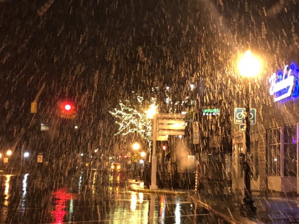
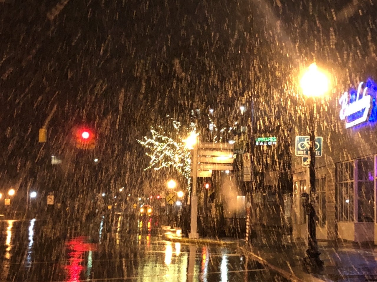
What a night it was last night. Was watching guidance and saw some was attempting a flip to snow about 24-36hrs before the event. I figured if there was enough dynamic cooling coupled with increasing CAA and the loss of solar heating, that snow was certainly possible. Seeing parts of Chicago switch to snow in the daytime yesterday gave more confidence that we’d flip to snow. Sure enough, the flip happened. The snow became moderate to heavy and stuck to elevated surfaces. The precip switched over quicker, and lasted as snow longer, in northern Macomb and St Clair Counties. Here, a couple inches of snow fell, even getting a slushy accumulation on the concrete and roads. As mentioned in other posts, it’s a rare and historic snowfall. This cold wave is one to remember.
Video:


-
4
-
-
Detroit tied the daily record for May 10th with 0.5" of snow. This also puts Detroit at the 4th snowiest May on record!
-
2
-
-
1 hour ago, michsnowfreak said:
Sister is getting accumulation in st clair shores JUST northeast of Detroit. I may have to stay up. Some of Detroits northern suburb webcams are just nuts

I had to go check this out. Pics and video coming but wow a solid 1-2” at least between Chesterfield and Richmond.
-
30dbz rippage and it’s almost May 11th
-
4
-
-
34 minutes ago, MIstorm97 said:
Rain is mixing in with some snowflakes in Berkley. Other places across Oakland County are also reporting a mix
Flipped to all snow. Incredible for Mother’s Day
-
 1
1
-
-
Rain is mixing in with some snowflakes in Berkley. Other places across Oakland County are also reporting a mix
-
Some of the hi-res guidance shows a flip to snow tomorrow night in the Detroit area. Would be a heck of a way to close out Mother’s Day this Manuary. In the meantime, here’s some full res pics from yesterday’s snow squalls.


-
6
-
-
Detroit is down to 28F as of 2:53am, so the record low of 29F for May 9th has been broken. Need to drop 3F more to tie the record low min for the month of May.
-
59 minutes ago, michsnowfreak said:
I decided to take a little nap and I woke up to several text about how heavy it was snowing lol. Luckily I saw the snow this morning. It's funny how something you see so frequently for months turns into such a novelty and is so noticed by everyone once its May lol.
We just had a heavy squall move through. Actually very briefly left a coating on the grass. Seen snow from Halloween to basically Mother’s Day this season
-
1
-


July 2020 General Discussion
in Lakes/Ohio Valley
Posted
Weenie band in the form of rain this time. Just got a Flash Flood Warning for the Detroit area.