

SouthCoastMA
-
Posts
6,424 -
Joined
-
Last visited
Content Type
Profiles
Blogs
Forums
American Weather
Media Demo
Store
Gallery
Posts posted by SouthCoastMA
-
-
Just now, Baroclinic Zone said:
finally lightening up.
Same. Accumulations are likely over at this point.
-
I'm curious about the lower cape up to PTown. They must have several inches given the radar over the past few hours
-
Prob 4"+ here..haven't measured since 930am though. Still coming down moderately
-
Best snow of the storm so far
-
About 3".. maybe we will hit 4" but looks to be sliding east
-
Model algorithms aren't used to running in an 80s environment.
Snowing here..rain must be just south
-
8 minutes ago, DomNH said:
I’d sell 12-16 hard. Jack zone is going to be 6-10’’ IMO.
Agree
-
1 minute ago, STILL N OF PIKE said:
Thru 6z Nam looks more disjointed with that east convective blob taking over
The vortmax looks a bit stronger to me. It's a few millibars stronger by 9z
-
1 minute ago, Baroclinic Zone said:
Still looks like BOX is taking the slow uptick in totals. Think we see another bump up later. WSW and 4-7" totals? 6-10".
Agreed.or 7-11"
-
2 minutes ago, wxsniss said:
12z RGEM definitely not as coked out as 6z, but still a big hit (i.e., warning) for eastern SNE...
12z on right
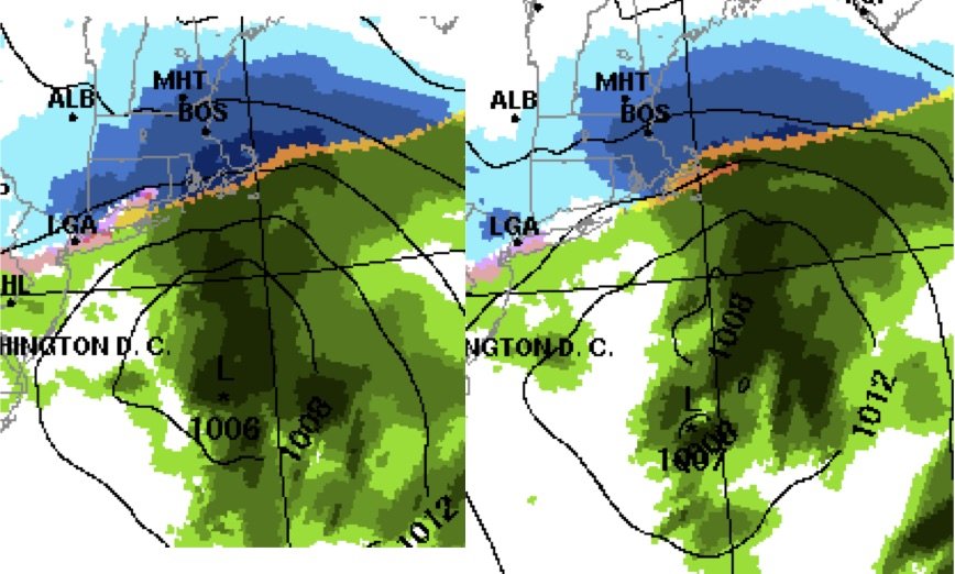
Trend so far at 12z has been to tug this further east...
Yeah that's not a good trend if it continues..you could see how the heavier amounts could slide east over the ocean or over extreme east coastal MA.
-
Advisory event on the NAM..the models can't seem to pin down the strength of the SLP
-
Just now, 78Blizzard said:
Ukie 0°C line gets up to BOS at hr 36 and then collapses SE.
There will be some dynamical cooling going on with this system. With a closed 700mb low off the coast, we shouldn't have too much issue staying snow
-
Just now, ORH_wxman said:
The big 18z GFS solution for Saturday sort of partially phased with the late lakes s/w and it helps suppress heights out ahead of the Monday threat..... so this run is gonna be flatter than 12z.
Yeah looks a bit flatter at 78. Any additional melts can cease until 00z
-
Its 10mb stronger..rather have that than a 1011mb turd wave.
-
1 minute ago, dryslot said:
Several shots of that or on the rocks usually work pretty well, Just ask Jerry.
Good call.. I may be pounding the Crown Monday..but even a bit of front end snow would be ok with me
-
Take the highest output of the snowiest model.then multiply by 2. We can up the forecast if necessary
-
I still haven't figured out the most effective method for jackpotting yet: meh'ing (tblizz) or melting (Scooter). The former might hold the crown at the moment
-
I'd consider a front ender with a few inches a win. Especially if Saturday pans out. I just dont see rain making it as far north as the Euro has it
-
Good hit. I think most of coast might be ok..not sure about Jimmy yet
-
Although the euro has sucked lately..I believe it had this storm far in advance of the other models
-
GFS is a nice hit 6"+
-
Saturday looks legit here. Not worried about Monday yet
-
3" very light snow
-
Radar looks decent here and 2-4" seems doable. 2 hour delays being hoisted for tomorrow morning already
NE snow event March 4th
in New England
Posted
Looks good to me..which means queue the bridge jumpers