olafminesaw
-
Posts
4,602 -
Joined
-
Last visited
1 Follower

About olafminesaw

- Birthday 08/05/1995
-
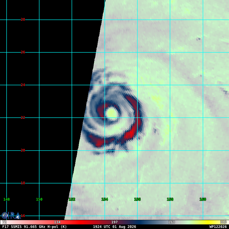
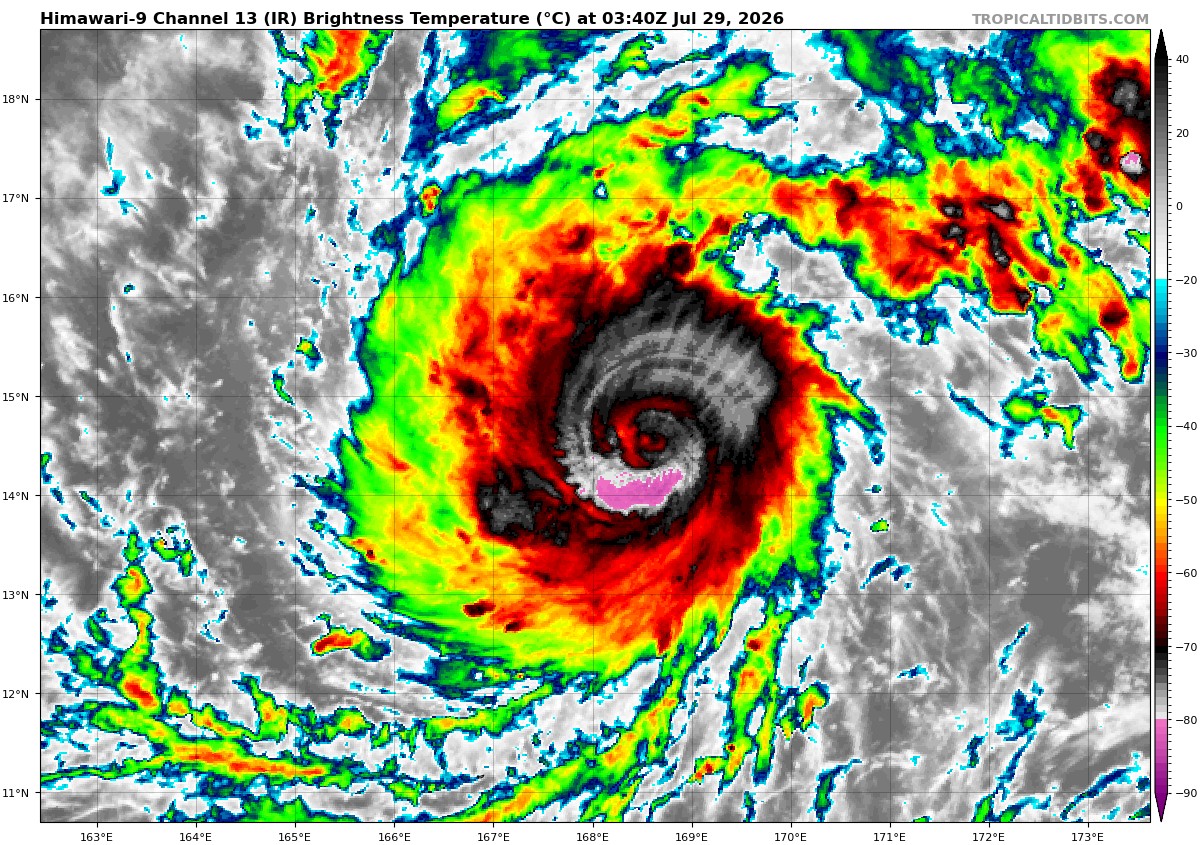
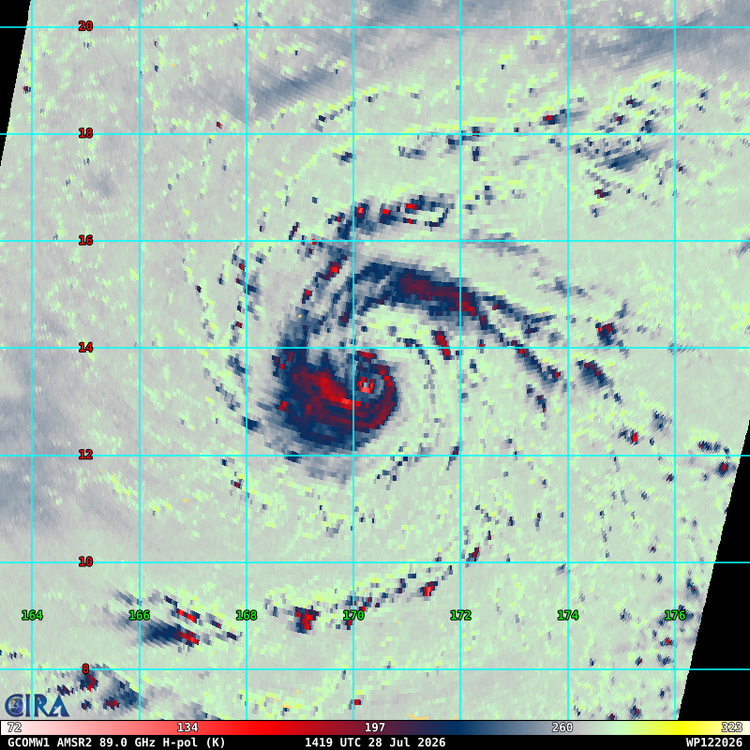
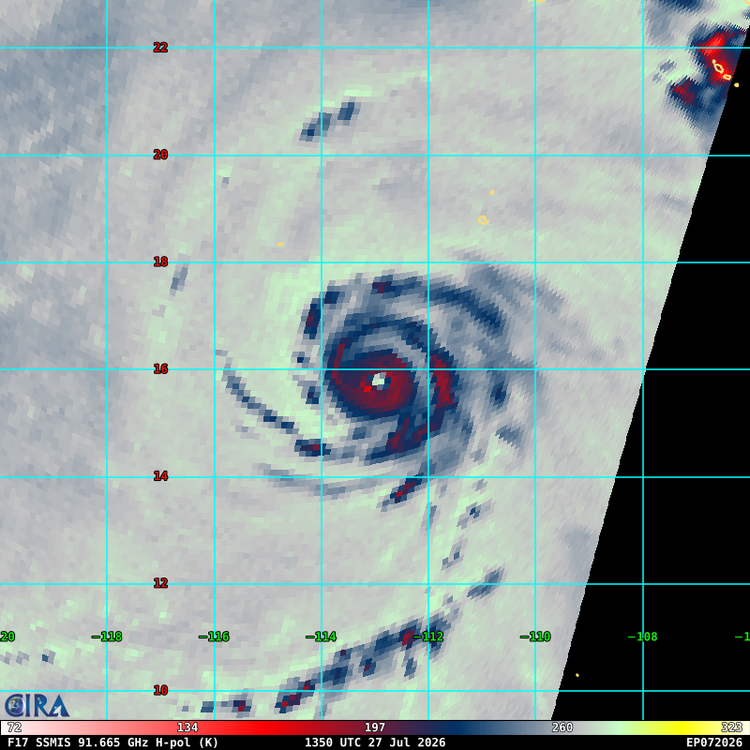
 ERC #3 very much under way. Any idea what the record is for most ERCs? Gotta think four would be near impossible
-
The unstable air advected Eastward and the cap was broken. Don't see that too often around here, much more common in the plains
-
Dewpoint hit 77 at the airport, highest since 2021
-
-
Even with sun the atmosphere has stabilized considerably over central NC
.gif.c095f45f06dfe178c837a7b80f63c0be.gif)
-
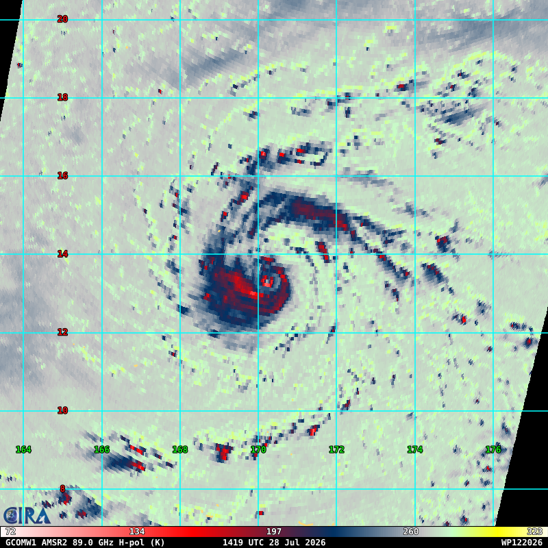
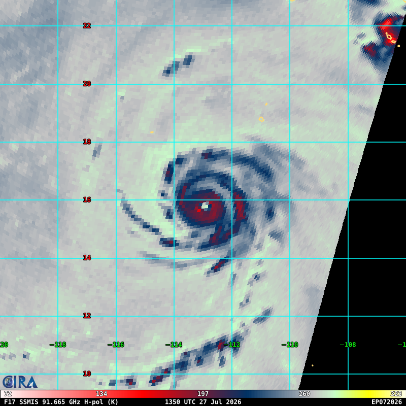
Wow! That has to be near a record max forecast for them at a 3 day lead. Some question marks around intensity for the moment though as it appears to be starting an ERC
-
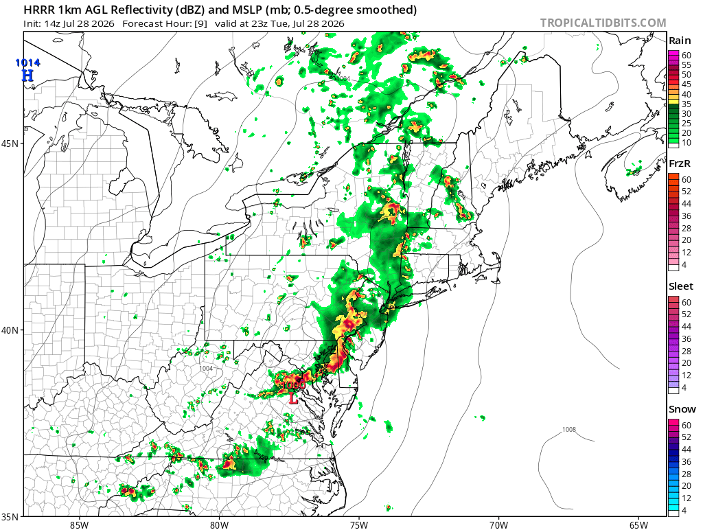
Latest HRRR is much more promising FWIW probably more run of the mill borderline severe but something

-
The HRRR/hires NAM have basically no convection after the MCS rolls through outside of far Eastern NC. It's not looking good TBH
-
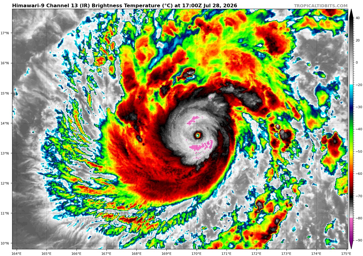
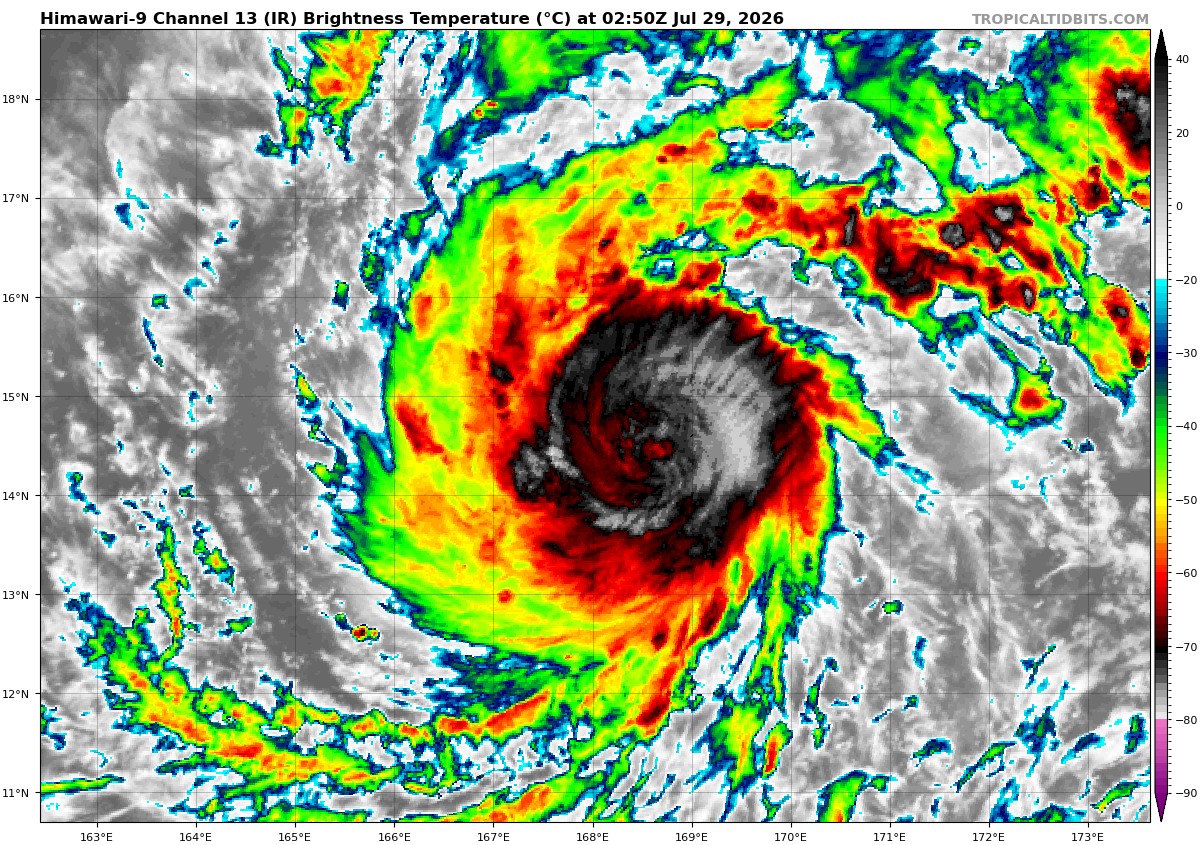
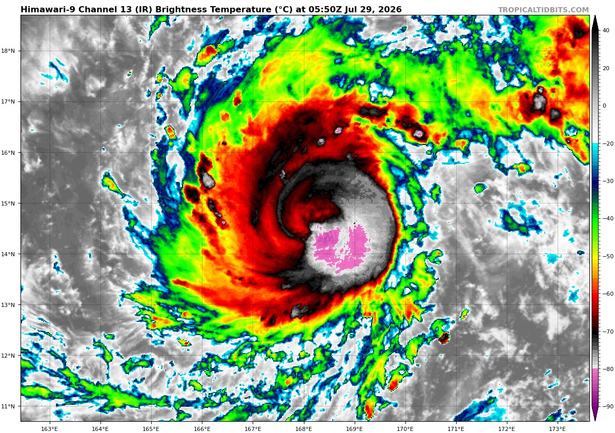
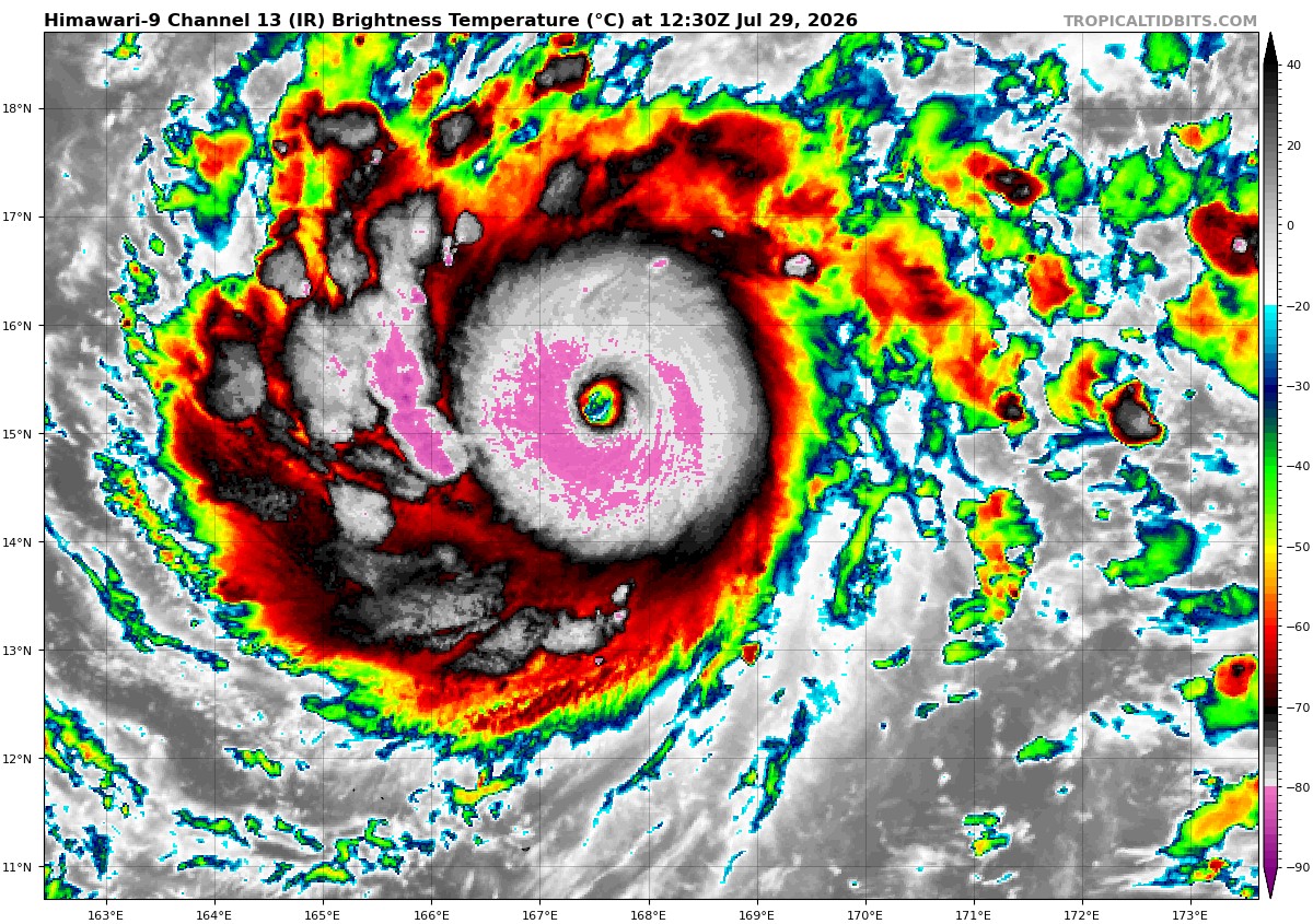
Structure of the year award goes to Genevieve
-
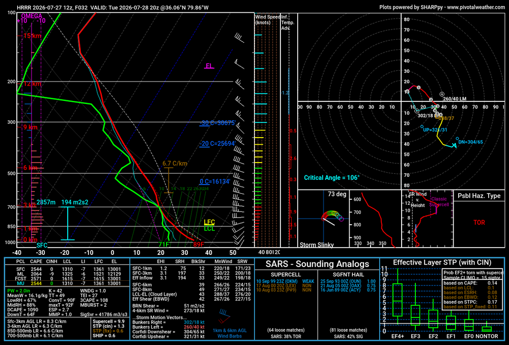
HRRR sounding in the triad Tuesday evening. I do kinda wonder if upper level wildfire smoke will tamp down the potential somewhat
-
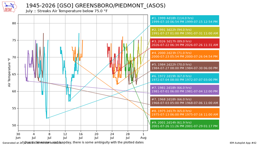
Third longest streak in July of below 75 temp
-
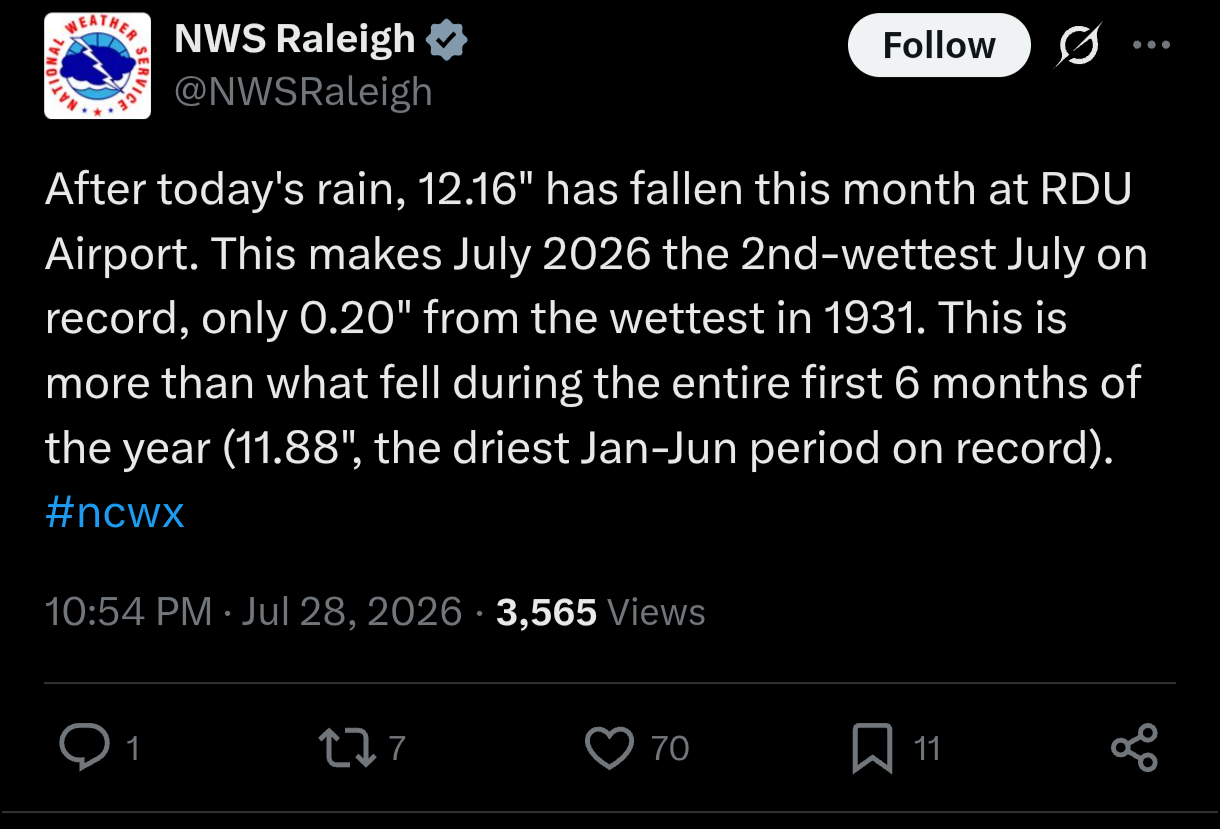
Wow! With the rain this morning, just surpassed the July average at GSO, total MTD 4.93"