stormtracker
-
Posts
64,391 -
Joined
-
Last visited
Content Type
Profiles
Blogs
Forums
American Weather
Media Demo
Store
Gallery
Everything posted by stormtracker
-
Was wrong..it's like 20 hours. Not sure what I was smoking when I typed that
-
Anyway, don't have the snow maps. SV fucking up with that tnt
-
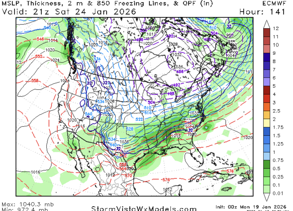
starts at 141, leaving at 162
-
Heaviest panel
-
mod to heavy snow at 150...seems like a quick hitter?
-
-
Tired of typing
-
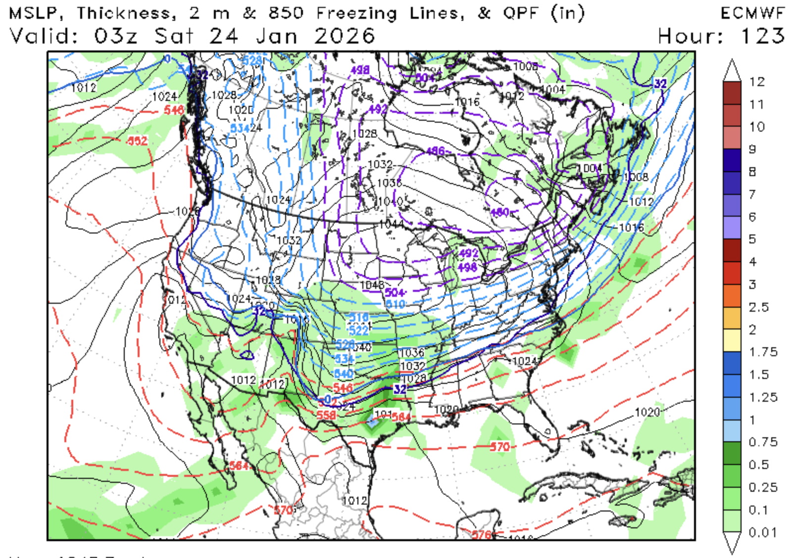
Ok, 111, expansive area of precip blossoming over Tx and the rockies
-
Seeing some slight changes at h5...up top the s/w is a bit more elongated toward the west, slightly higher ridging out west
-
Remarkably consistent so far...just noise level differences...
-
So far, it's early. Euro is almost exactly the same 66 hours. This is precip/surface map only. H5 lags significantly for some reason on sv. will peep that baja wave in a sec
-
lol. We're either 1 or 10 with shit like this. I'm cool with this map tho. Shows all the possibilities and we're still in the game.
-
I know this is a weenie saying and I'm definitely one, but I seriously don't mind not being in the bullseye at this point
-
Nah. You're actually getting better. You've moved from bully status to just trollable
-
CMC/GFS is a NC weenie dream. See yall in an hour for the Euro. Comes out lighting fast for me, so we'll popping champagne by 12:45
-
He always jumps the gun. He's getting better but man....
-
Somebody go drag that High 1000 miles WNW
-
Yeah, that High kills us
-
CMC looked good coming in, but starting to get smooshed
-
That's a wise guess
-
Yeah, Canadian looks better sfc and h5 wise so far
-
Well..that was different
-
It's a lite event. Don't have snowfall maps, but im sure there is some accumulation
-
Yeah, we get more..not heavy..but it does try to turn north...
-
Nah, looks like it's from the nrn stream s/w energy