stormtracker
-
Posts
64,361 -
Joined
-
Last visited
Content Type
Profiles
Blogs
Forums
American Weather
Media Demo
Store
Gallery
Everything posted by stormtracker
-
GFS might try to do something dumb with this last minute shit
-
GFS is trying tho, just gets started too late it seems. Just a wee bit of difference
-
Yeah, Id rather have the Euro/AIs in our camp rather than the other way around. Would be nice if GFS or another model suite confirmed tho, ngl
-
Yeah, so far GFS is much slower getting that s/w to dive and go neg
-
So far, doesnt look like the GFS at H5, so not too hopeful at the moment
-
Ridging oiut west a little flatter so far
-
Nothing noteworthy on the GFS yet...similar to 6z..some noise level changes
-
A man’s gotta sleep! Here’s to good times today!
-
Looks out to sea from what I can tell on pivotal
-
lol...another close one
-
Well fuck
-
Sold. Cold
-
Give us the goods!
-
He's actually been good lately
-
She's a beaut
-
Man. Euro, please be right
-
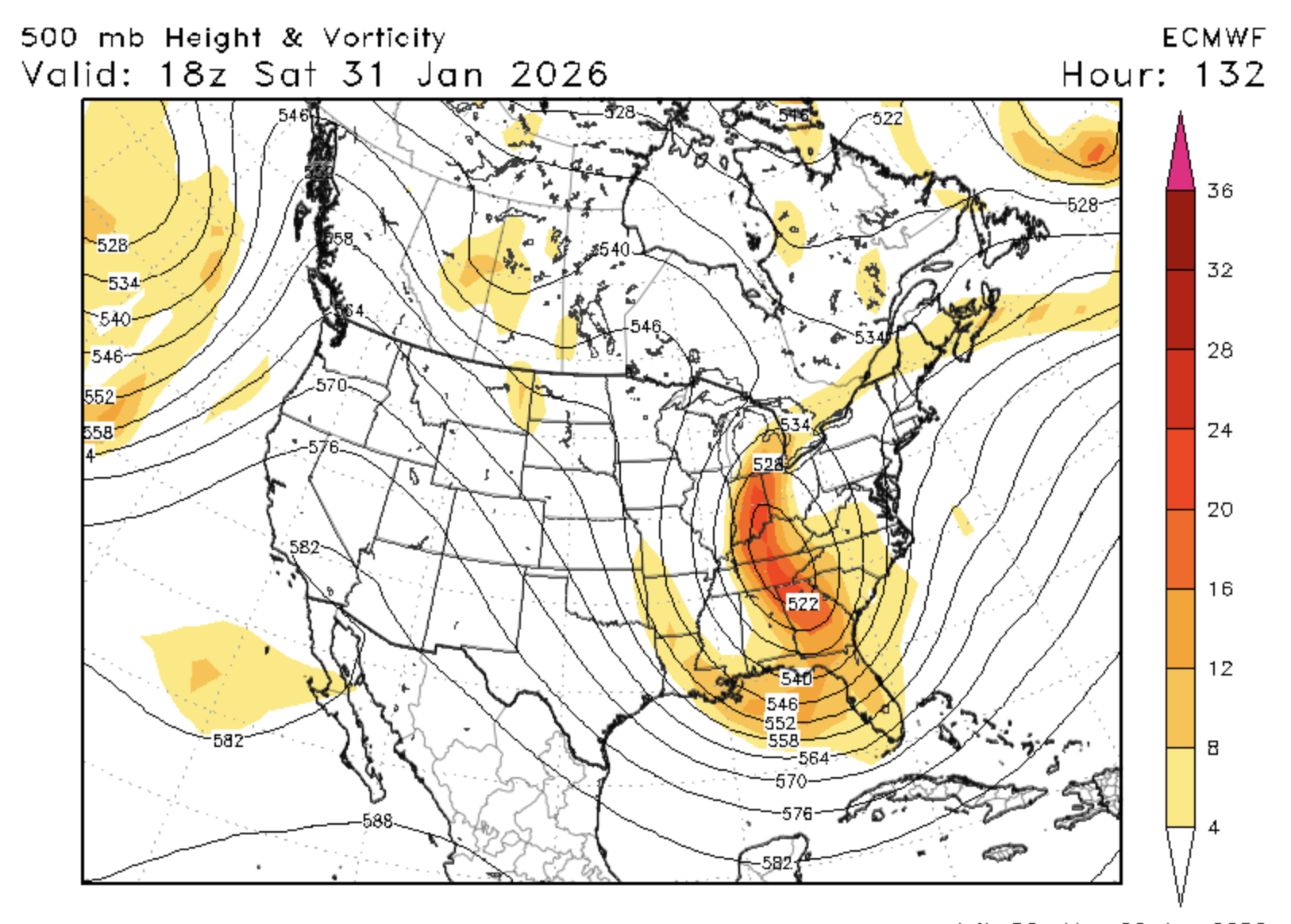
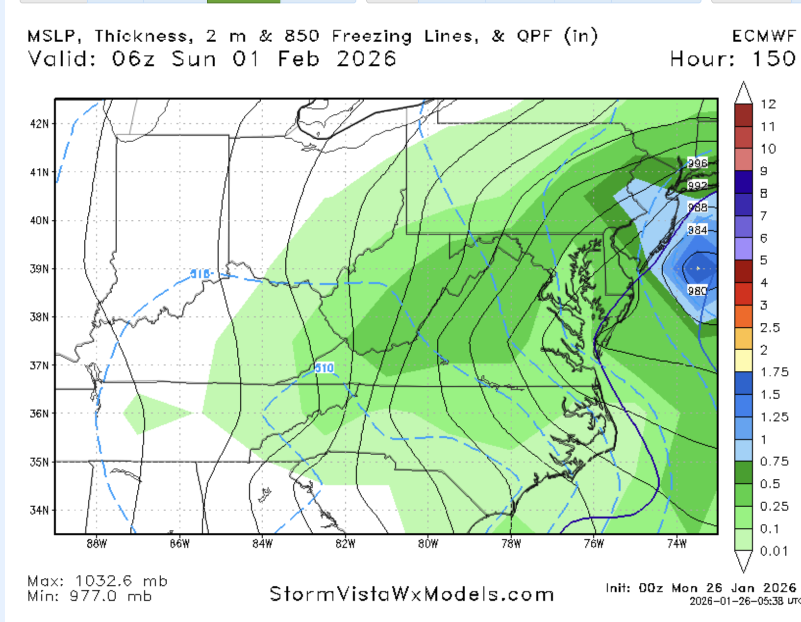
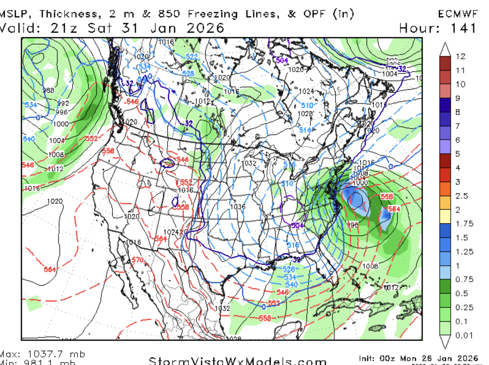
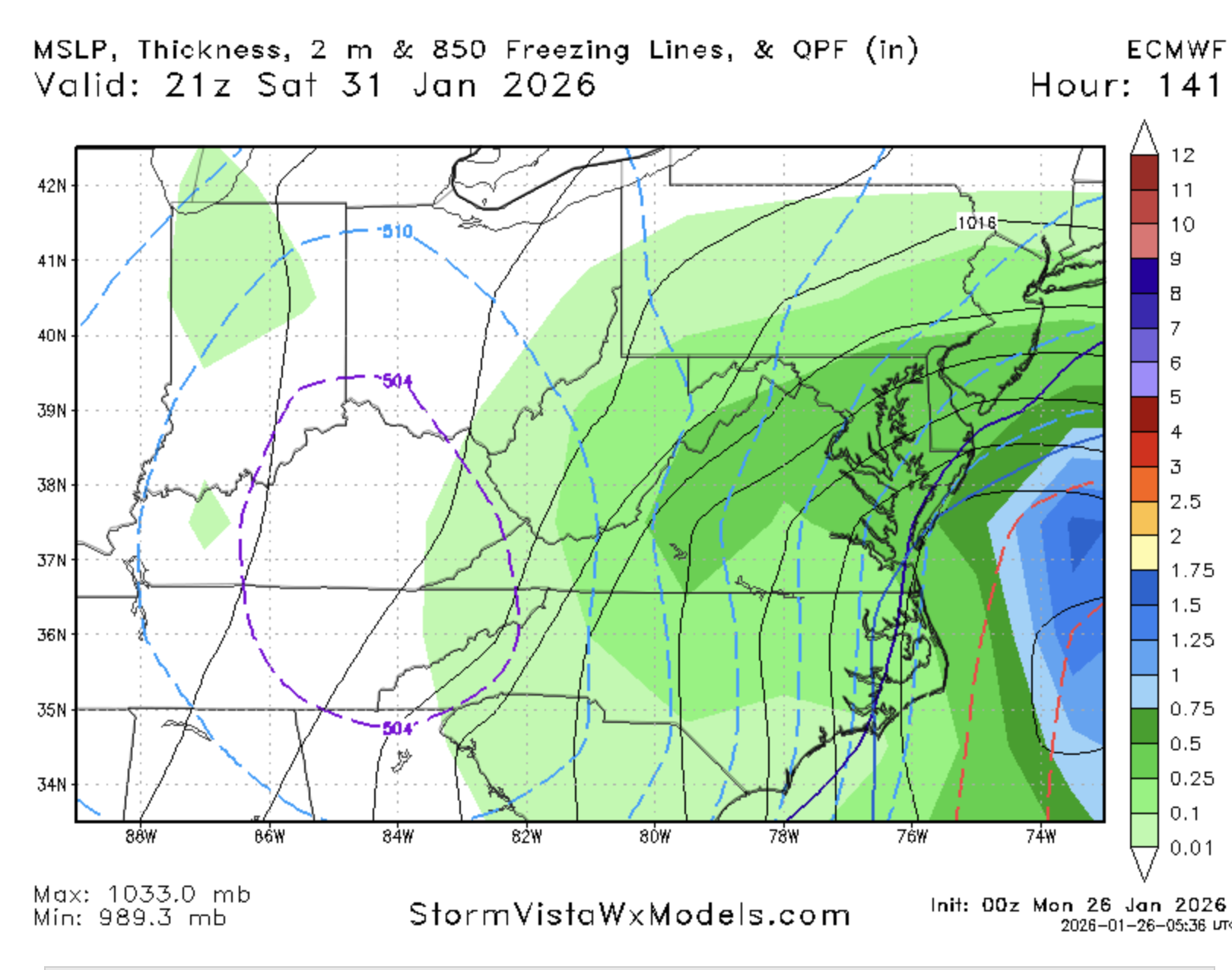
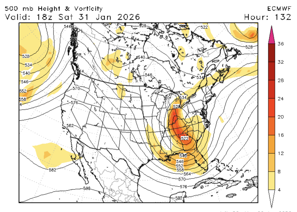
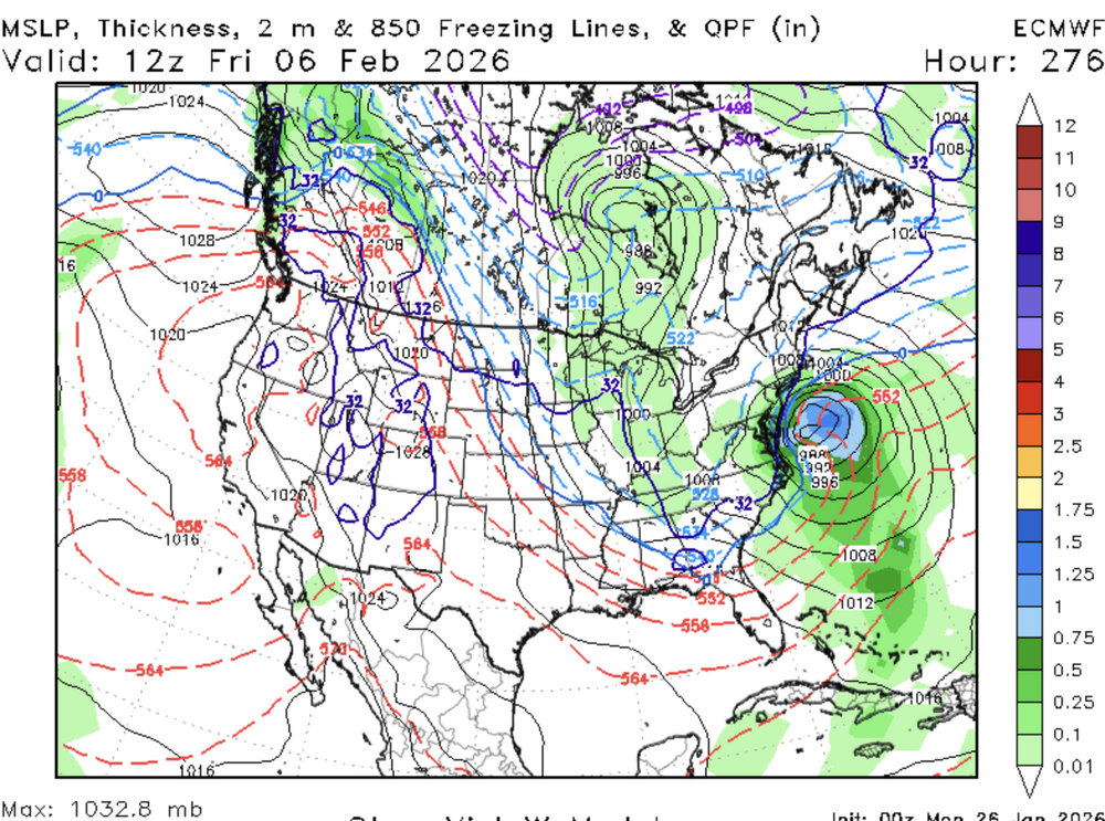
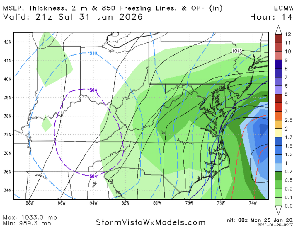
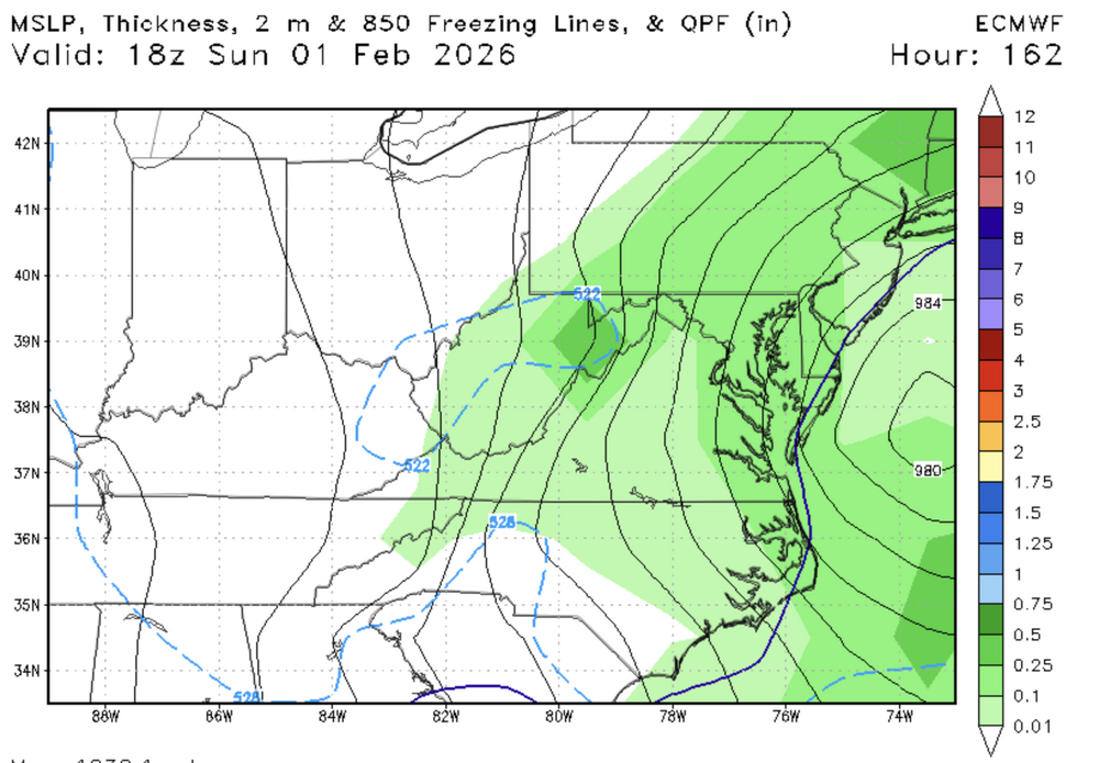
Fucking SV. Can't get snowmaps, but that's a crazy ass storm and progression
-


-
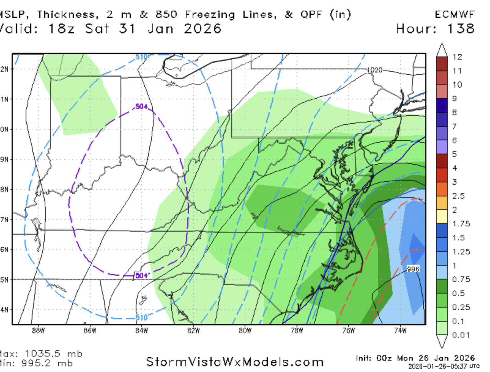
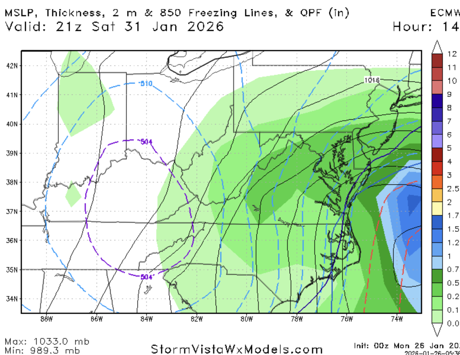
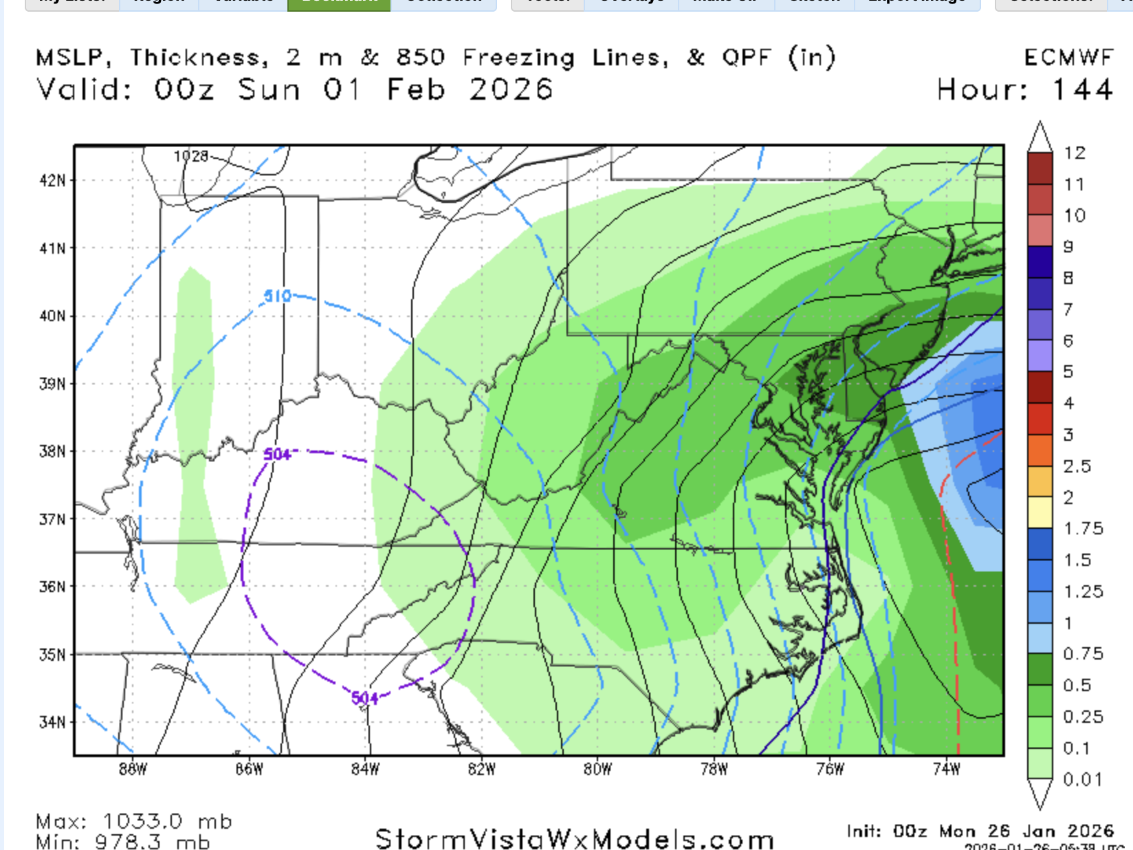
I was right at first...it's a FOLKS
-
Pinwheels...backwards and then forward again..wtf
-
Actually...it's a rather large hit
-
At least I posted the right maps tho....
-
lowercase...kinda jumped the gun...but it's a hit

-
Not quite a folks..but it's a hit

-
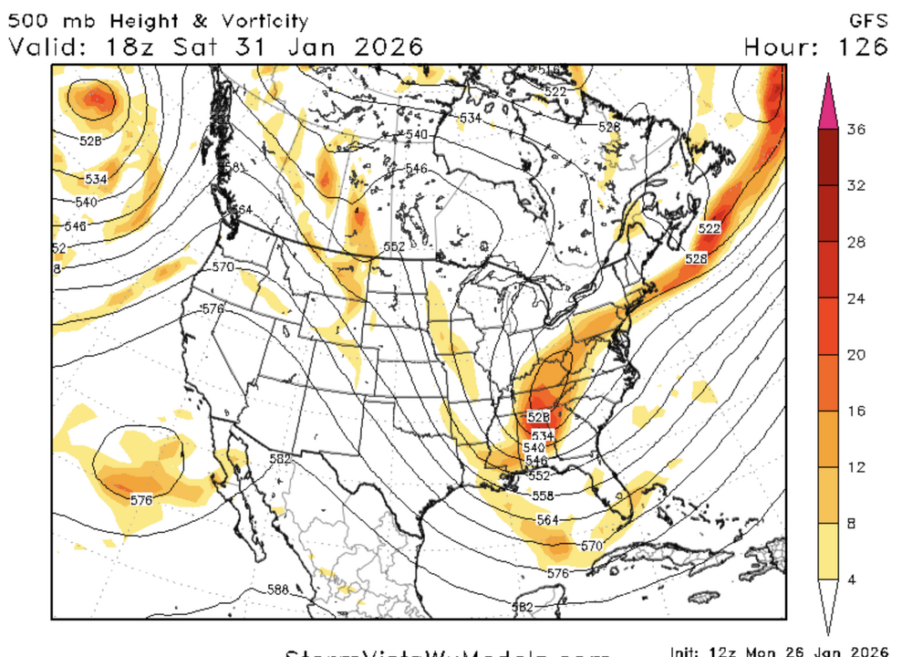
out to 126...very encouraging so far