stormtracker
-
Posts
64,383 -
Joined
-
Last visited
Content Type
Profiles
Blogs
Forums
American Weather
Media Demo
Store
Gallery
Everything posted by stormtracker
-
Yeah, GFS develops something...a bit disorganized but we have snow over the area
-
GFS may be up to something here for the Cape timeframe..
-
Hmmm
-
Just got here yesterday. Heard this was the best forum for snow
-
192 has a broad trof approaching, we need that baddie to sharpen up tho. Let's see...
-
If both of these things end up failing, I think the worst sting is that....we'll have all the cold air we'd need for snow. And wasted.
-
Keep hope alive!
-
lol, pendulum swinging at a 10 day storm.
-
Nah. Well..close but the mighty Potomac stops it
-
Still kinda like this one
-
I thought you were talking about the 18th. 16th has some really light snow..nothing major. Dusting
-
NYC gets it good. Boston, rain.
-

-
It's a nice hit. Looks like 4 - 8 on atari sv maps
-
ok, I got 240..we're getting it, but sfc freezing line is to the NW. So there's a storm!
-
Looking at 228, something is approaching and it skips to 252 with a huge storm off of Cape Cod
-
lol, SV skips form 210 to 256. Somebody post maps!
-
I know right? Like this is some type of forum for such things.
-
only 10-12 days away!
-
Done at 285. We can only hope to be so lucky. That was fun...now let's get out of fantasy land and try to wrangle the first thing.
-
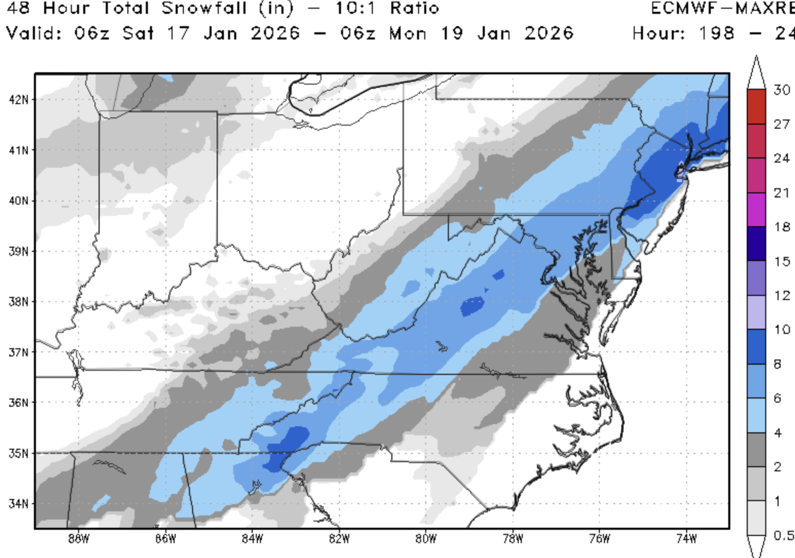
8-10 just south of us includes Fredericksburg
-
So far about 6 -8 and still going
-
Firmly into part 2, altho the heaviest stays south...looks like it's about to scout out
-
Carolinas getting mauled
-
We get into part 2 around 270. Light so far