

sussexcountyobs
-
Posts
1,277 -
Joined
-
Last visited
Content Type
Profiles
Blogs
Forums
American Weather
Media Demo
Store
Gallery
Posts posted by sussexcountyobs
-
-
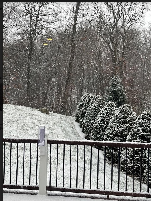
2.75" total at Canistear Reservoir.
-
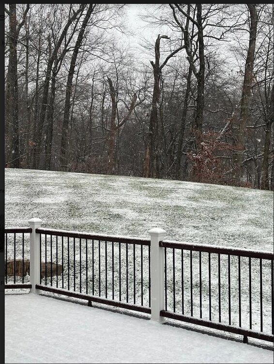
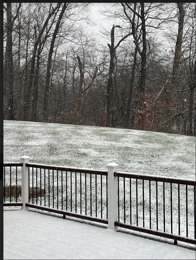
Steady moderate snows continue Just measured 3". 29.1 °
-
Steady moderate snow continues. Just measured 2.5".
29.5°
-
Moderate/heavy snow falling. 30.6° Will measure in a bit.
-
At 5:45 pm. Just measured 1.8". Steady light snow. 30.4°
-
 1
1
-
-
Just measured 1.25".
Moderate snow falling .
30.6°
-
7 minutes ago, MANDA said:
Currently 31.4 degrees. Total snow so far .30" on all but paved/concrete surfaces. Bursts of light snow with large flakes.

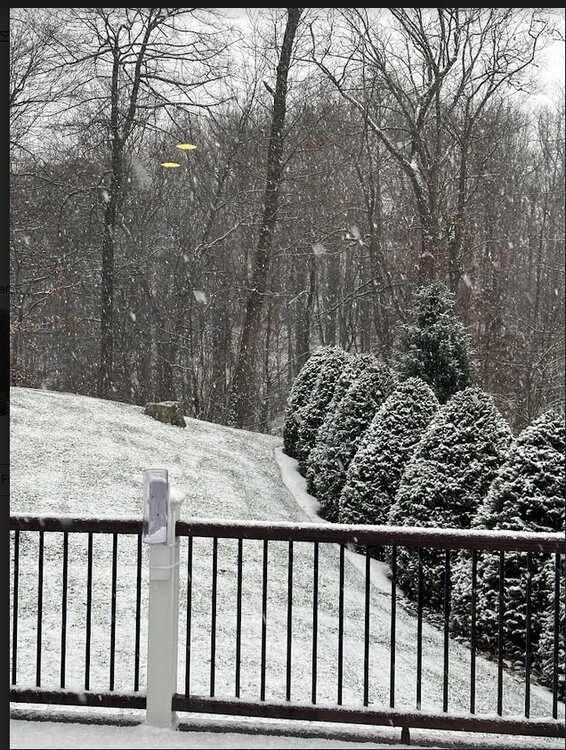
Looks exactly the same here but, the flakes are small. Road getting white now. 30.9
-
Steady light snow continues. Has picked up to moderate in last 5 minutes. Just measured 1/2". Roads are just wet after being treated. 30.9°
-
Steady light snow. All surfaces white except street, as Vernon DPW salted about an hour ago. 30.6°
-
5 minutes ago, MANDA said:
Except maybe the meatballs and sausage browning in the frying pan!
Very true! Damn it I'm hungry now!!
-
2 hours ago, BxEngine said:
Dont even care if the most pessimistic of models end up too high here. Christmas music playing, cookies being decorated, sunday sauce on the stove, and snow is falling.
Few things are more comforting and pleasing than the smell of Sunday sauce/gravy slowly cooking on the stove all day.
-
3
-
-
-
2 hours ago, hudsonvalley21 said:
That's actually bumped up about 1" from earlier today
-
2 minutes ago, IrishRob17 said:
That’s why someone started a separate thread to discuss the next 24 hours
Yup. My bad. Just saw it. Disregard my dumb comment. Lol
-
1
-
-
Maybe we should focus right now on the event that will happen in the next 24 hrs? Then move on to a possible storm 6 days from now.
3 minutes ago, snywx said:Where are you located?
-
5 hours ago, snywx said:
Deep winter incoming for the interior

4-8” looks like a sure bet for Sun-Mon for those along the I-84 corridor
.I agree. Even though I'm only supposed to get 2" maybe 3" tomorrow. Looking at long range forecasts, I can see us getting 15", maybe more from tomorrow thru Christmas day.
-
1
-
-
Light mostly sleet with snow mix now. Measured. 5" (Car top measurement) 31.8°
-
Moderate snow falling. Starting to stick on roads and driveways.
-
All snow now and sticking on all unpaved surfaces. 34°
-
Light snow/sleet mix. 35.4°
-
Sleet falling. 37°
-
23.9° here this morning.
-
Not a drop as of yet. Clear skies. Supposed to be 70% chance of numerous showers and thunderstorms this afternoon. I need a job where I can screw up so often and not be disciplined or fired. Lol!
-
 4
4
-
-
Looks like a blown forecast here in NE Sussex county for this afternoon. Looking at radar, it's slipping southeast of us. Maybe the 2nd line late this evening will produce.

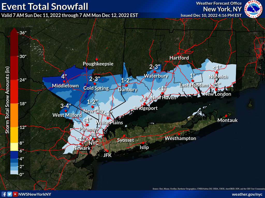
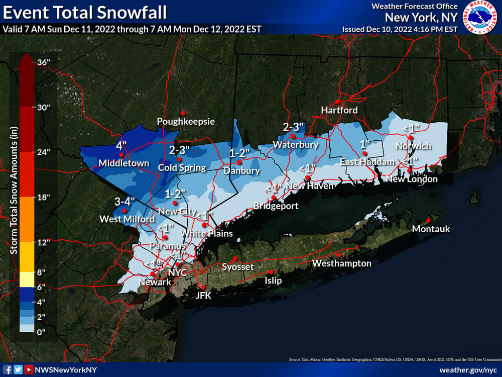
12/15 - 12/16 Coastal/Winter Storm & Observations
in New York City Metro
Posted
Any early thoughts for Vernon, NJ?