wasnow215
-
Posts
1,830 -
Joined
-
Last visited
Content Type
Profiles
Blogs
Forums
American Weather
Media Demo
Store
Gallery
Everything posted by wasnow215
-
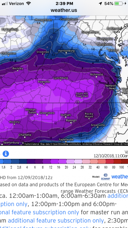
Alright I TOTALLY understand we are “in if” and nowcasting BUTj here’s the LATEST Euro (1pm) w additional snow after 1pm for this storm. Can this be right??
-
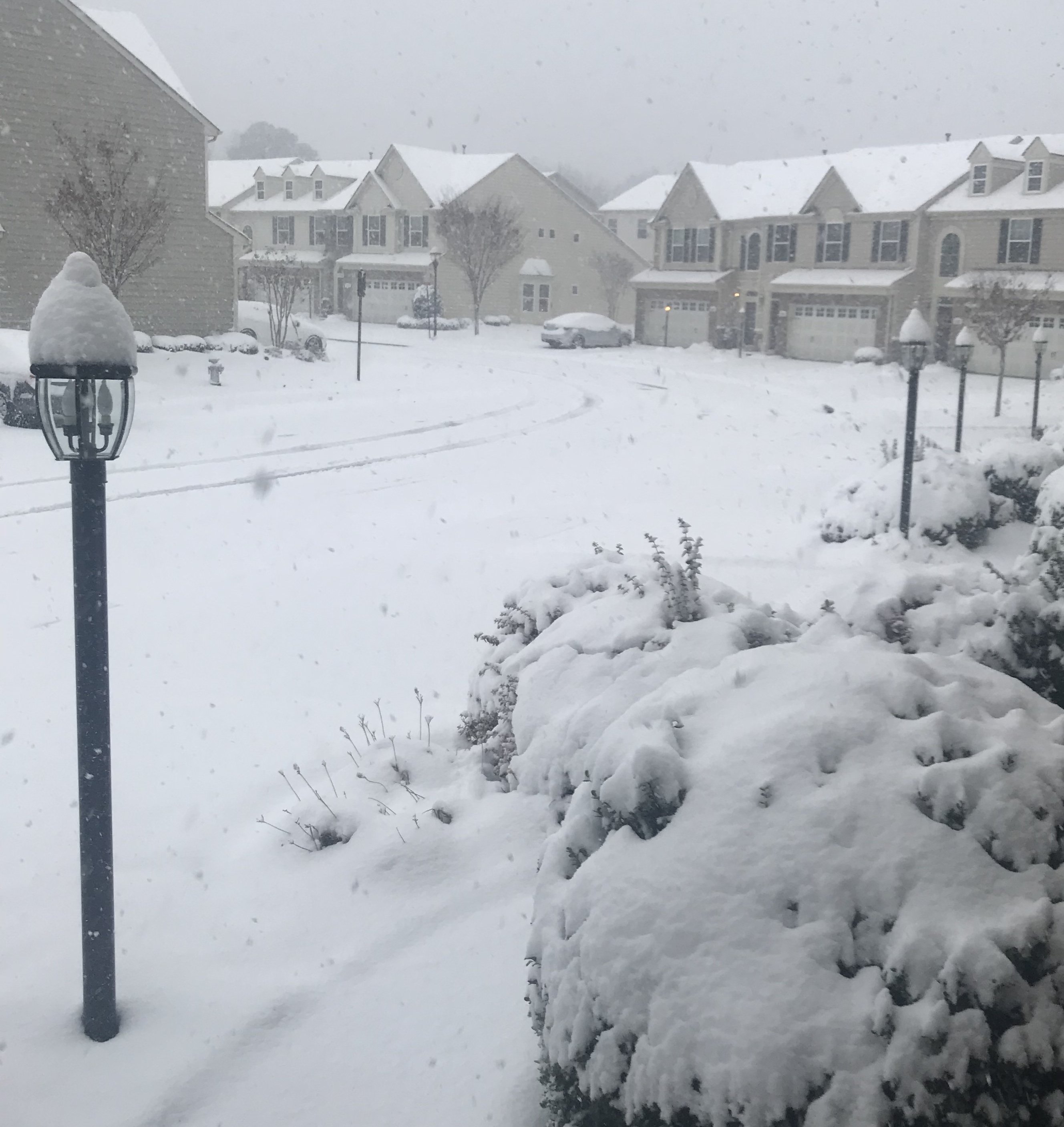
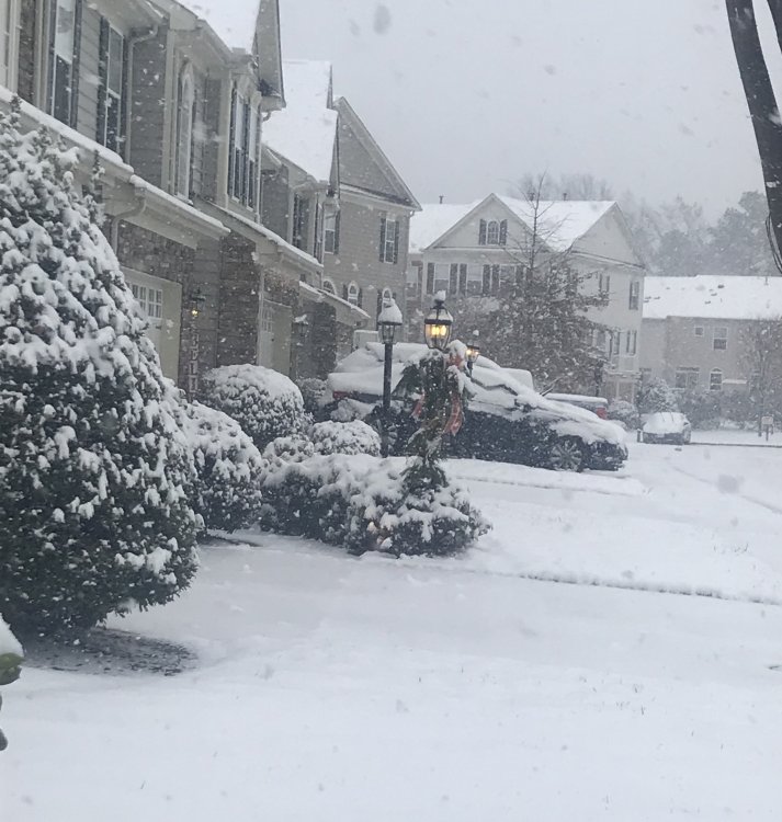
4” at least here in Glen Allen. Heaviest bands so far about to roll through.
-
About a half hour ago. Been coming down to beat the band since. (Whatever that means lol)
-
LOL I just left the Wawa there. The one by Bojangles
-
Euro last 3 runs definitely showed enough that you should have had a WWA. On another note. Got folks texting me in Newport News saying I didn’t call for snow for them lol (I did for Williamsburg tho). Radar echos can be misleading as it is showing heavy rain there. Evaporational cooling with heavy precip I guess.
-
Ty! Makes sense
-
Is there a “better” short term weather model that shows sleet/snow/ice differences well? Or is it all nowcasting now?
-
Alriight!! Let’s do this!
-
Light to moderate snow here in Glen Allen. Montpellier exit off of 295/Staples Mill Rd. This is awesome.
-
Posted 1 hour ago ...WINTER STORM WARNING IN EFFECT FROM 10 AM THIS MORNING TO 4 AM EST MONDAY... * WHAT...Wet snow, moderate to heavy at times will develop late this morning and continue through the day. The snow may mix with rain at times, especially closer to I-95, as temperatures rise above freezing. Total snow accumulations of 3 to 6 inches can be expected. Some light icing is possible tonight, as temperatures drop below freezing. * WHERE...Portions of central Virginia. * WHEN...From 10 AM EST this morning to 4 AM EST Monday. * ADDITIONAL DETAILS...Plan on slippery road conditions and potentially dangerous travel today into tonight. The wet nature of the snow will also allow it to stick to tree limbs which could cause some isolated outages. Recommended actions A Winter Storm Warning for snow means severe winter weather conditions will make travel very hazardous or impossible. If you must travel, keep an extra flashlight, food and water in your vehicle in case of an emergency. For the latest road conditions in Virginia or Maryland, please call 5 1 1. For the latest road information in North Carolina, go to http://DriveNC.gov.
-
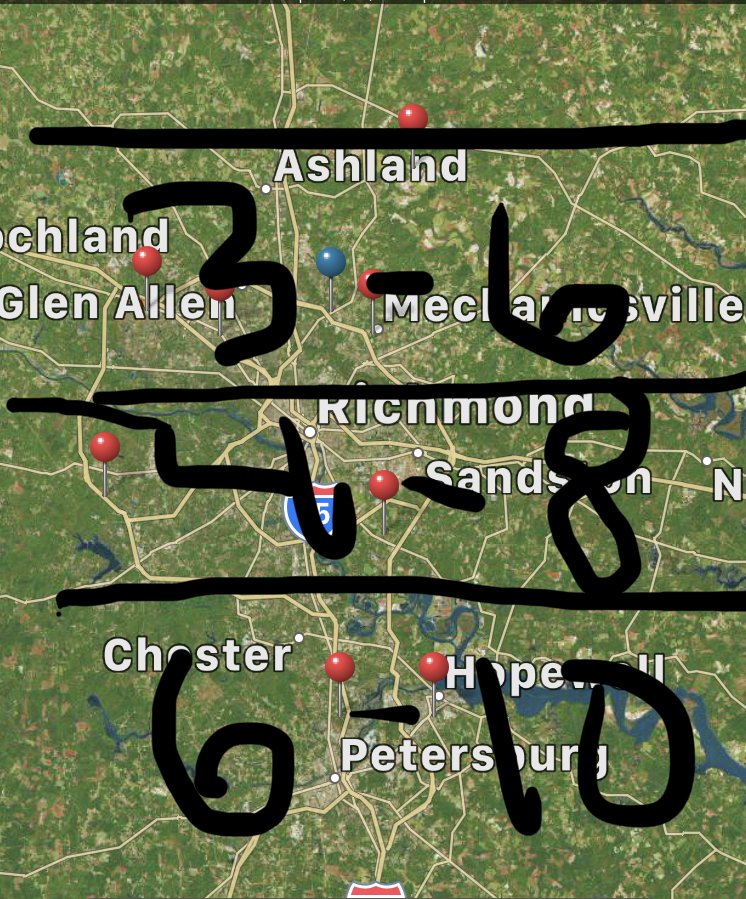
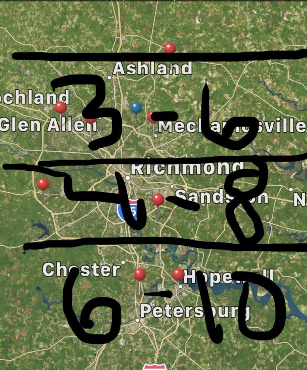
I may need to adjust my crude map higher lol
-
Ridiculous
-
Lol! You didn’t see my crude map??? I’m here!!
-
Crude map I know lol. But here is my prediction.
-
I’m sticking with my prediction from Thursday. 3-6 with some higher pockets. Final call (like anyone cares lol).
-
Yeah I see that. Brine city lol
-
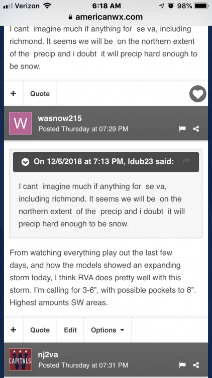
From watching everything play out the last few days, and how the models showed an expanding storm today, I think RVA does pretty well with this storm. I’m calling for 3-6”, with possible pockets to 8”. Highest amounts SW areas.
-
I’m just NW of 95 near Short Pump. So without me looking at a map the trend has been a bit more NW of Richmond Proper right??
-
Yeah. King Euro pretty much stands alone at this point. Ensembles out yet?
-
Crazy run. Lots of model runs left tho
-
True! AND solution will change at least a couple more times before final solution 6 hours out
-
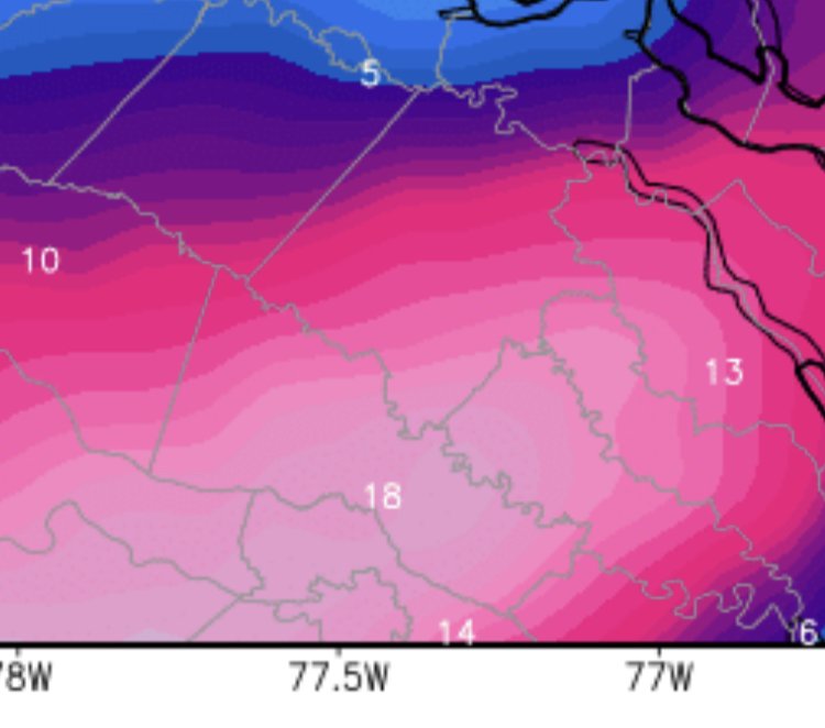
GFS suppressed still. Nothing in Va. FV3 (2019 GFS replacement) a good hit for Southern Va. and 3-6” makes it into RVA. Euro starts soon.
-
12/3 0z Euro RVA love! Shoot cut those numbers in half and it’s still a great early Dec hit!
-
Nothing in 12z runs hurt RVA that’s for sure. Still looking snowy.
-
It’s going to be significant. Just matters where frozen/not frozen line sets up.