SeNJWx
-
Posts
91 -
Joined
-
Last visited
Content Type
Profiles
Blogs
Forums
American Weather
Media Demo
Store
Gallery
Everything posted by SeNJWx
-
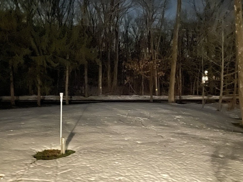
Picked up 2.0” total here in the Sourlands. Changed over to sleet around 4PM, then later to sleet/rain. The rain mix did rapidly change back over to snow a little before 5:30PM- which dropped a quick 1/2”+ accumulating on the roads again. Still a good covering out there now, as the rain later this evening didn’t do much. High was 34.4 just before midnight, and a low of 19.0.
-
Had a low of 13.7, with dense freezing fog this morning. It must not have been around long, because there was no accrual in the trees, unlike an event last week. The fog has since cleared out now, and 38.1 degrees. Some stats to round out January in the Sourlands: Mean Max: 36.8 Mean Min: 16.7 Mean temp: 27.1 Highest temp: 59.0 on 1/2 Lowest temp: 1.0 on 1/31 7 Days with a high below 32 (Lowest high 21.2) 28 Days with a low below 32 (10 in 0s) (8 in 10s) (10 in 20s) One day with a low of 32.1 There were several days where the high/low just missed criteria. Snowfall: 14.9"
-
Hit 1.0 degrees this morning, after clouds cleared some around 2AM. This beat the seasonal record of 1.5 set the morning before. Without the clouds I would have gone well below zero. I did see the Watershed in Hopewell hit -2.
-
It was interesting to see just how fast the snow dropped off north of here. Just a couple miles north it’s noticeable. By the time you’re just above Flemington on the plateau it’s common to see grass poking up, though there is a lot of drifting. Took a measurement in Frenchtown and only had 2.2”.
-
Hit a low of 1.5 overnight, which is the new seasonal low. Had 7.1” of accumulation yesterday, along with 1.0” from the pre-event. Total was 8.1”.
-
Made it to 1.0" here, trees covered nicely, sheltered driveway surfaces are covered. But there has been patchy melting with large areas near the ground now bare again. 32.6 degrees now which is the high.
-
Just measured 0.5" here in the Sourlands, it's been snowing lightly since this early morning. Temp is up to 30.0 after a low of 24.6.
-
Up to 33.6, just plain rain now. Snow is becoming a slushy mess now.
-
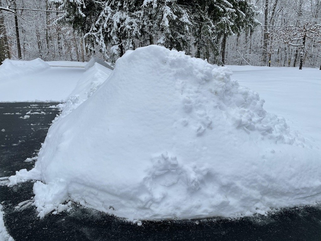
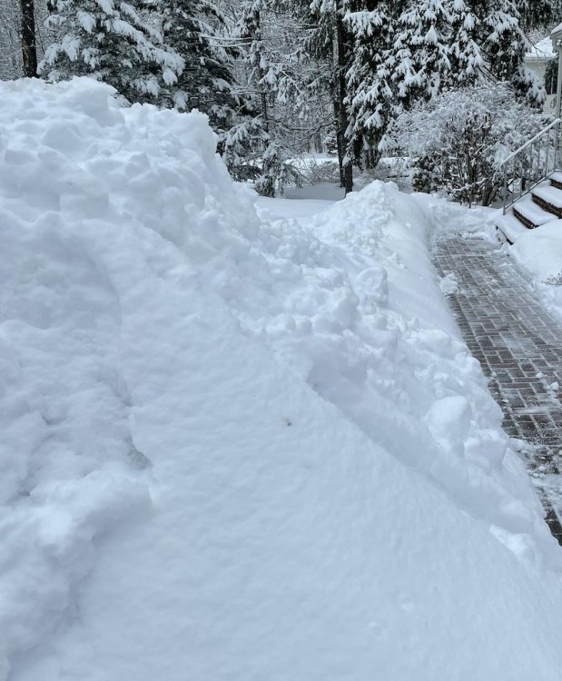
Changed from snow to IP/SN around 9PM and now a ZR mix. Temp up to 32 after a low of 2.1 this morning. Ended up with 1.4”. Made a large pile that should hopefully survive the coming rainstorm .
-
Hit 8.6 overnight, which was shortly after midnight. I was hoping to beat last years low of 7.6, but thanks to a slight breeze that developed my temperature shot up and remained in the low-mid teens the rest of the night. Shortly before midnight I did hit 8.5, which is now the seasonal/yearly low. Snowcover is thin, but patchy. Not far south of here there is nothing left.
-
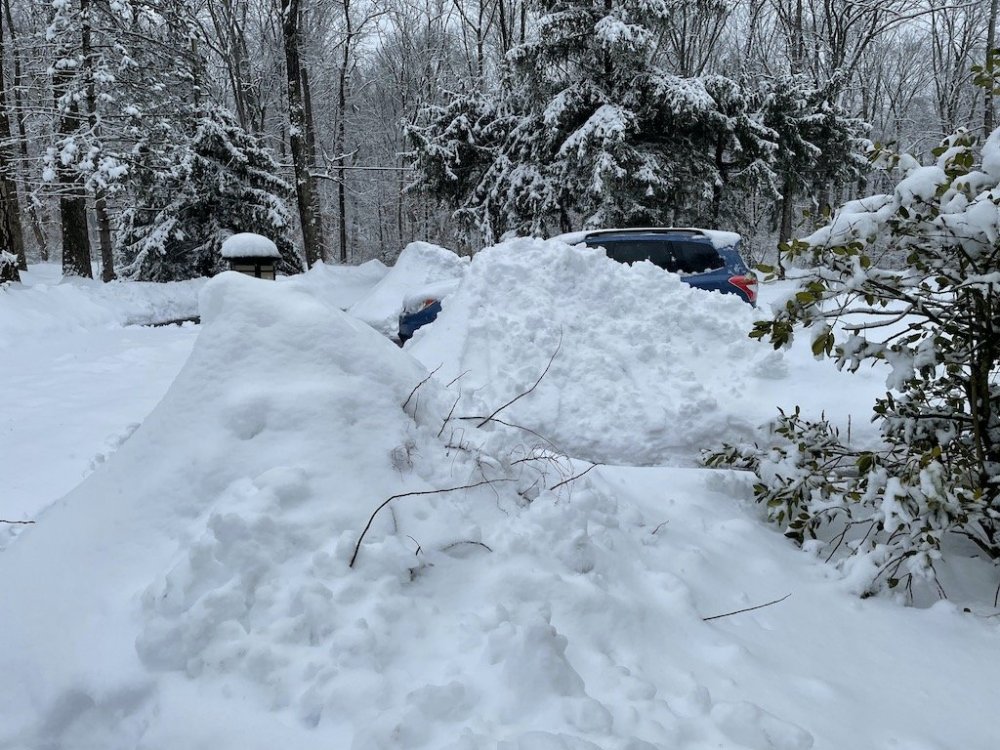
Largest piles still about 2-3' deep, and I even have some very resilient snow patches still hanging on. High yesterday made it to 72.7, with a low this morning of 52.3. Todays high was 67.4.
-
Crossed 70 here, still some large snow patches but the overnight fog did a number on it before the warmth even arrived. Largest snow pile still about 4’ high. Overnight low was 36.9.
-
55.6 at 11:50AM after a low of 27.2 this morning. Yesterday high of 62.6 was the warmest since Nov 30th (65.4), and we're already on track to set a new record today. Still large patches of snowcover hanging on, but definitely getting hit hard. My largest piles are still about 4' deep, with actual snowcover a few icy inches. Yesterday finally saw the last of my driveway (asphalt) snowcover melt, but a neighbor still has a fair amount on theirs. There are spots only a few miles away where there's nothing though.
-
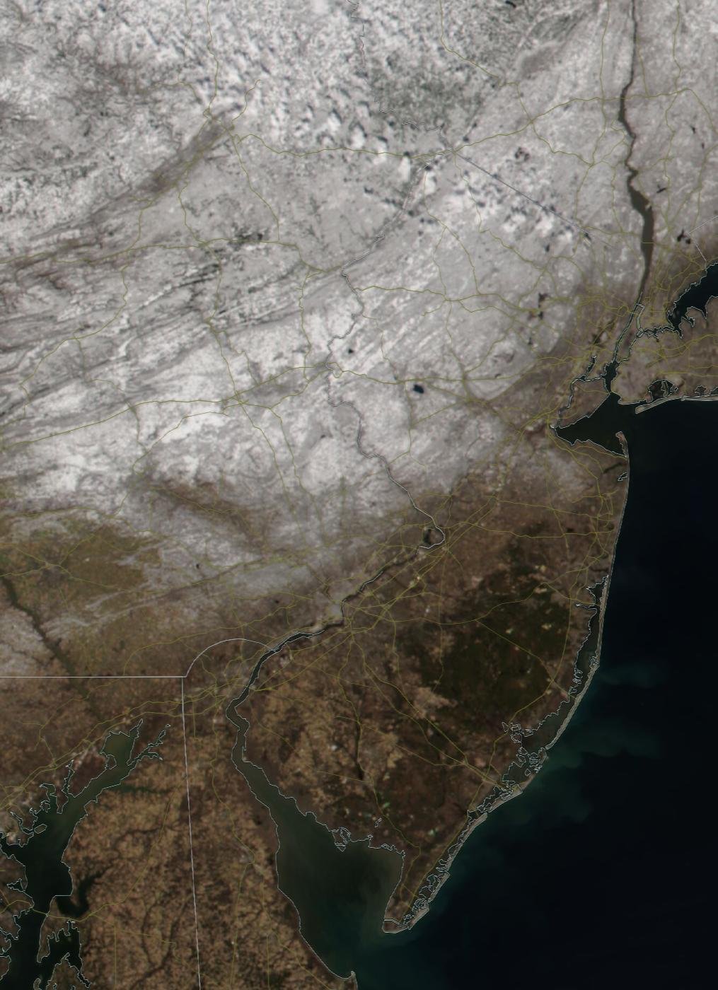
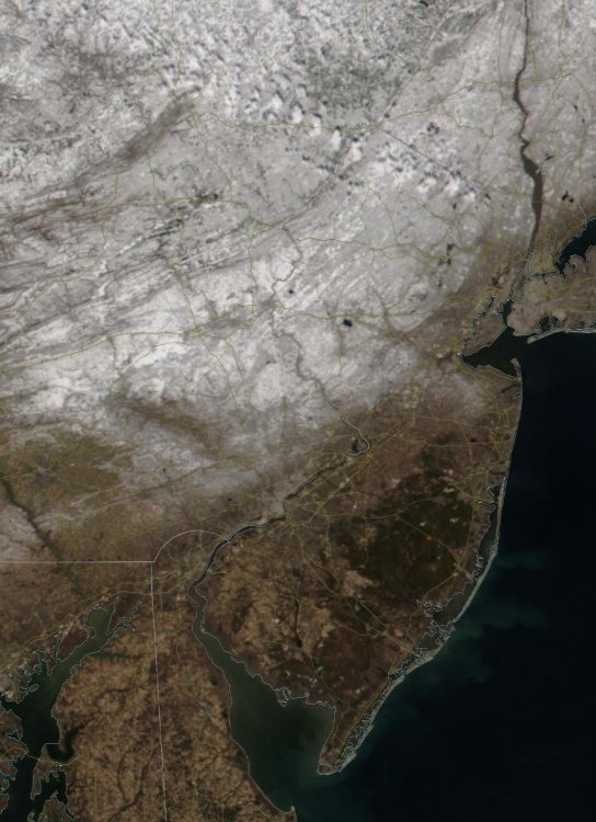
The NASA Worldview Snapshot (NOAA-20 VIIRS) shows the snow-line well from today (3/3)
-
Getting thinner, but overall still solid. Temp 29.6 now, high yesterday was 50.2, low 21.1.
-
Without any major torches, the way it looks now- there should still be some around. Less than when you left, but not all melted. This weekends storm has been more of a soaking cold rain, though there has been a fair amount of dense fog. It also varies where you are, I was in Lambertville (town) earlier where there was significantly less. Coverage even changes over a matter of a few miles. Some mod to even heavy rain just moved through, temp 37.9.
-
Measured an 8" depth as of last night, the only area grass is showing is where water is flowing under the snow as little streams form under the snow. I did take a walk to the back of my property and found myself sinking down quite a bit to 13-14" ... theres still quite a bit out there. The glacier on my driveway still hasn't completely melted either. Hovered around 32 last night, made it up to 41.5 around noon before slowly dropping off again, 37.9 now.
-
Sun finally broke through the clouds and fog, 47.0.
-
Just a little on the car, enough to dust it around 3AM, along with some minor icing- temp hovered around 32 until around 5AM then started climbing. 46 now and its been foggy all day, moderately dense at times too.
-
Snow to mix then back to snow, 32.4 now. Dusting on the car, not much, but more than I was expecting.
-
Some flurries starting in the Sourlands now, temp 35.2/29.
-
Hit a low of 40.1 overnight before the wind shift scoured out the radiational cooling and the temp jumped up to 47.5 by 3AM. Ended up dropping back to 38.8 by sunrise though. Up to 43 now with some gusty winds. Snowpack still holding strong but some definite compaction the past day. Only holes are spots where water/streams are, which were frozen.
-
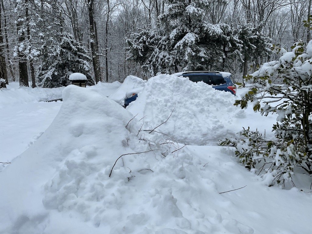
My piles here aren't 8' after this snow lol, but three are higher than the car! This system allowed for a nice addition to the multi-layer snowpack out there before the melt. It'll be interesting to see how long they last, including the deep banks. The last of the Dec storm pile had melted in late January.


-
I have both Mercer and Hunterdon set for my alerts and monitor both (WWA for Hunterdon was issued very early this morning). This part of Mercer is literally surrounded by Hunterdon county to the SW/W/NW/N/NE, so I usually figure on a blend of the two, especially with some elevation at play. The 12/2/19 storm dropped a few inches here, yet as soon as you got out of the elevated areas of Sourlands, even over the course of a few miles dropped to nothing. I've seen the same when I used to commute over the top of the ridge- and on more than one occasion saw snow amounts max out on the ridge, and drop to almost nothing in Hopewell borough and beyond (with similar amounts in the Amwell Valley).
-
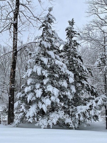
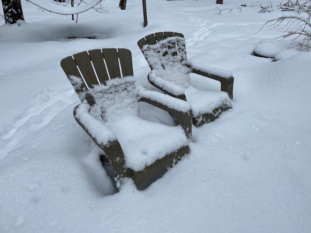
Looks great in the trees, a very wet snow.