timnc910
-
Posts
471 -
Joined
-
Last visited
Content Type
Profiles
Blogs
Forums
American Weather
Media Demo
Store
Gallery
Everything posted by timnc910
-
I find this will be a threading the needle type of event. Going to be a very small window with the cold air moving in and out. Going to keep my expectations low unless the models are showing something come Thursday night into Friday morning
-
January 30th- Feb 1st ULL and coastal storm obs
timnc910 replied to JoshM's topic in Southeastern States
Here just west of Jacksonville Nc not sure of my storm totals. The wind here was very strong blowing it around. I can say this in my time in North Carolina dating back to the 2000's. This is the first time where the ditches around here are full of snow. There are easy 2' snow drift if not even deeper. I am not sure of a correct way to measure because the amount of snow the wind was moving last night. There were spots in the 1' to 2' drifts that were walked in that were filled up within 10 to 30 minutes. Also it was a dense wet snow here not the dry powder type i was expecting. What an incredible storm this was. -
January 30th- Feb 1st ULL and coastal storm obs
timnc910 replied to JoshM's topic in Southeastern States
29/20 Snow has started here in the Jacksonville Nc area -
The “I bring the mojo” Jan 30-Feb 1 potential winter storm
timnc910 replied to lilj4425's topic in Southeastern States
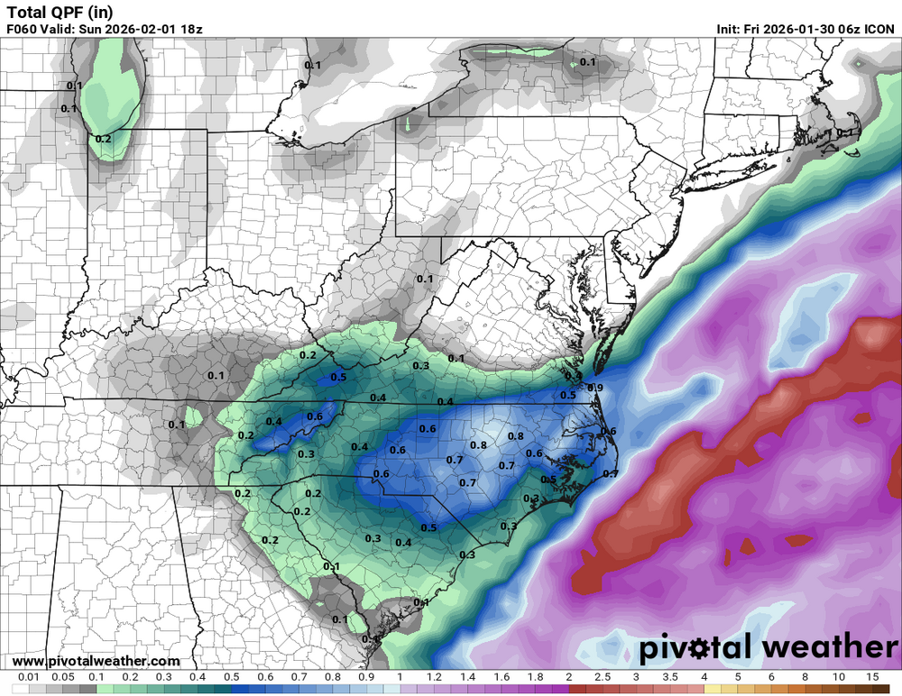
I know we are supposed to be focusing on the CAM models right now. However 0z ICON has accumulating snow statewide. Everyone just BREATHE!! -
The “I bring the mojo” Jan 30-Feb 1 potential winter storm
timnc910 replied to lilj4425's topic in Southeastern States
18z RGEM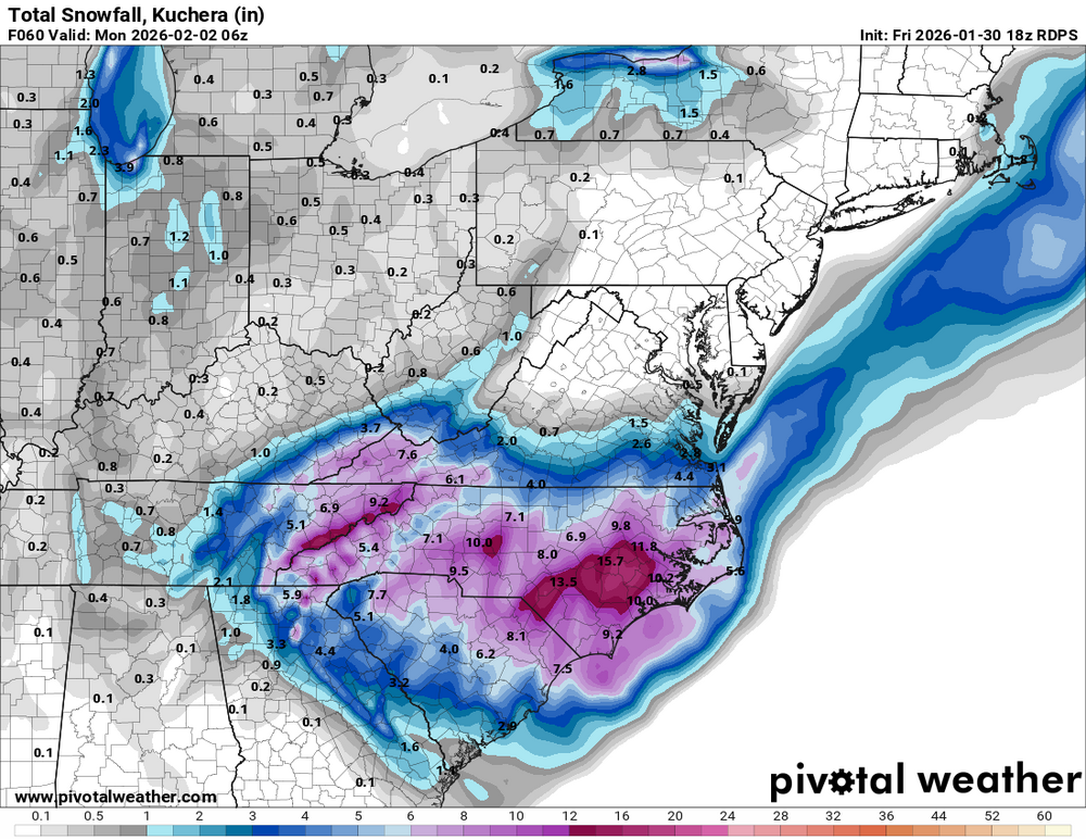
-
The “I bring the mojo” Jan 30-Feb 1 potential winter storm
timnc910 replied to lilj4425's topic in Southeastern States
Can some one elaborate on what this is. Thanks in advance -
The “I bring the mojo” Jan 30-Feb 1 potential winter storm
timnc910 replied to lilj4425's topic in Southeastern States
6z Euro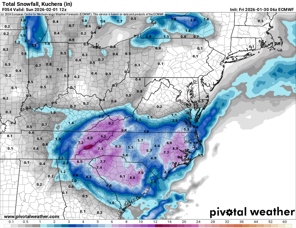

-
The “I bring the mojo” Jan 30-Feb 1 potential winter storm
timnc910 replied to lilj4425's topic in Southeastern States
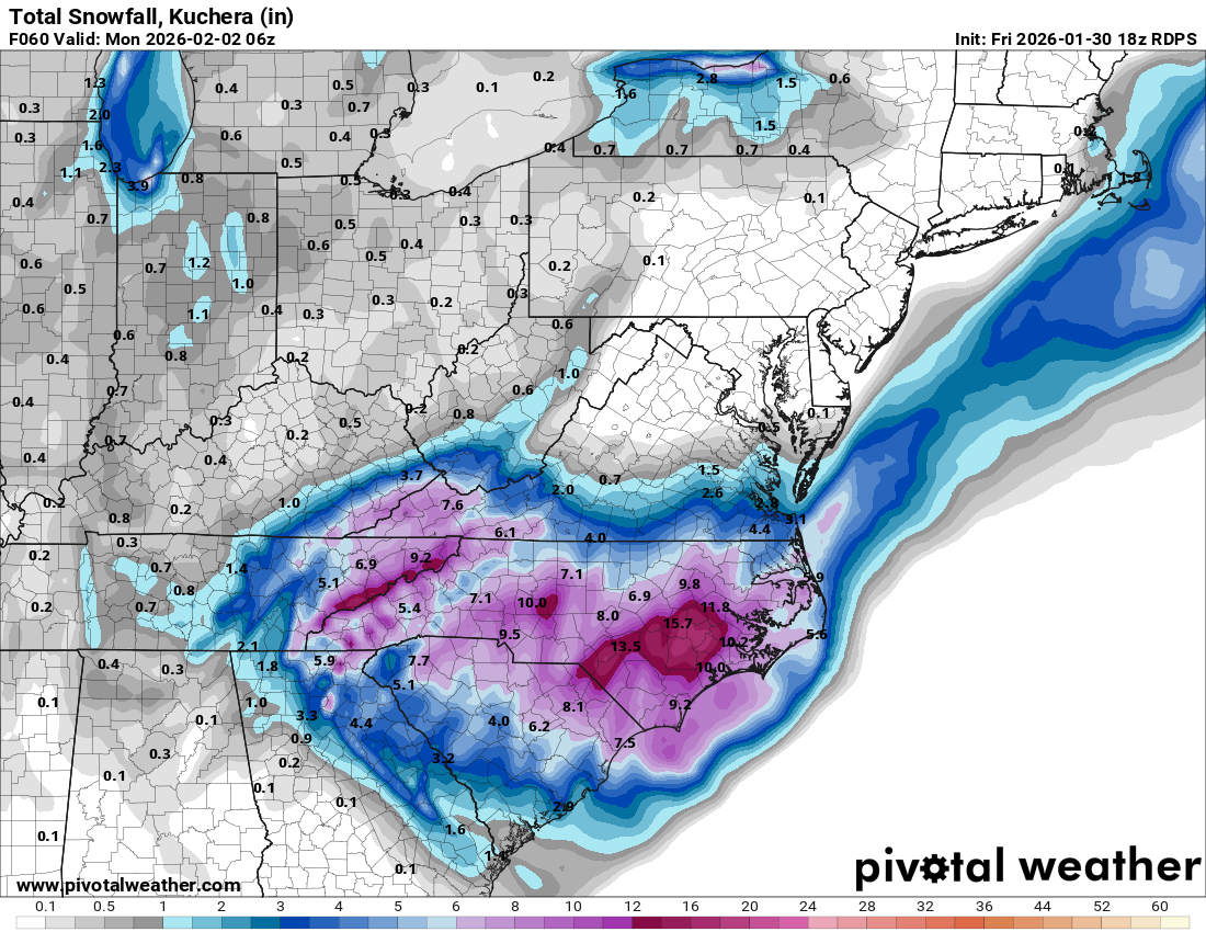
6z RDPS

-
The “I bring the mojo” Jan 30-Feb 1 potential winter storm
timnc910 replied to lilj4425's topic in Southeastern States
6z ICON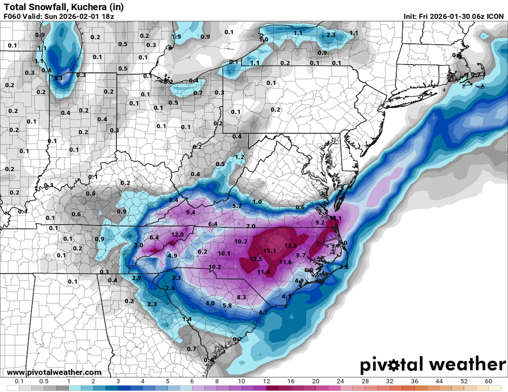
-
The “I bring the mojo” Jan 30-Feb 1 potential winter storm
timnc910 replied to lilj4425's topic in Southeastern States
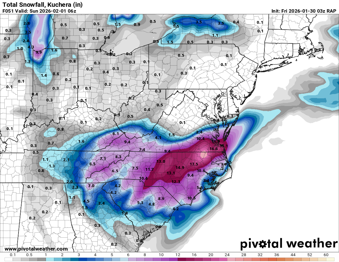
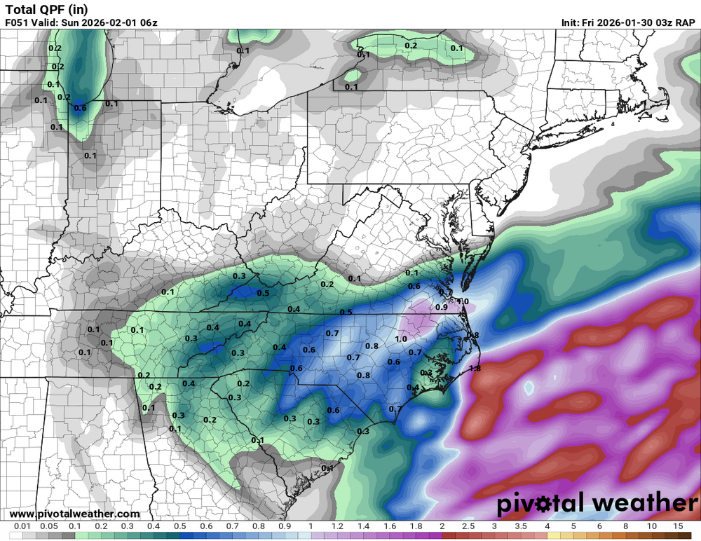
Here is RAP
-
The “I bring the mojo” Jan 30-Feb 1 potential winter storm
timnc910 replied to lilj4425's topic in Southeastern States
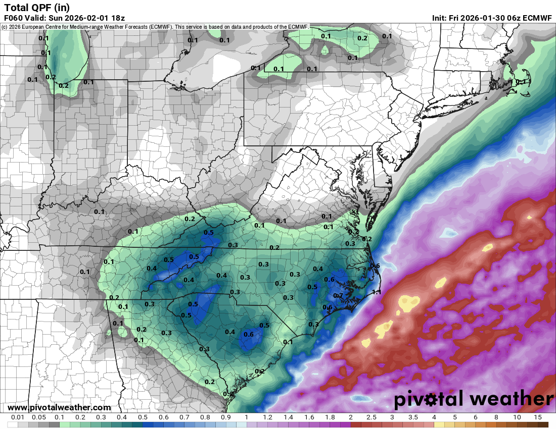
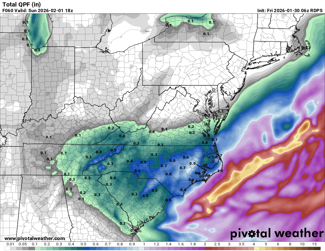
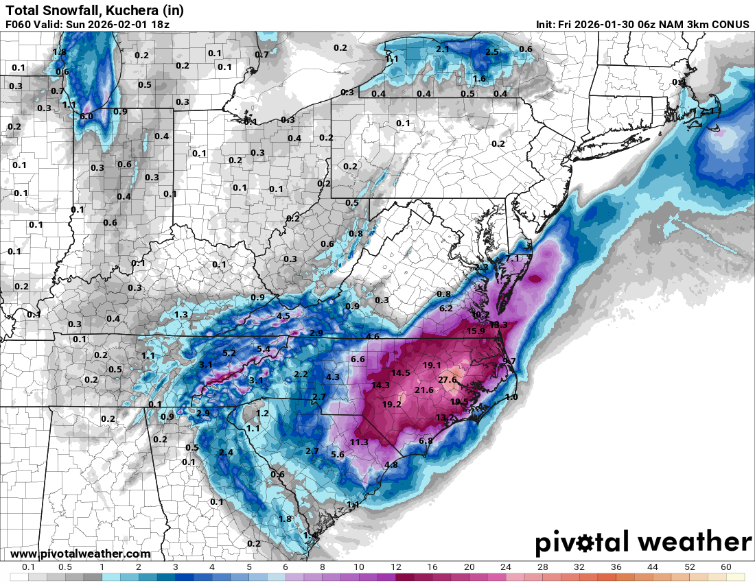
3k NAM QPF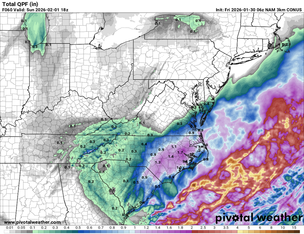
-
The “I bring the mojo” Jan 30-Feb 1 potential winter storm
timnc910 replied to lilj4425's topic in Southeastern States
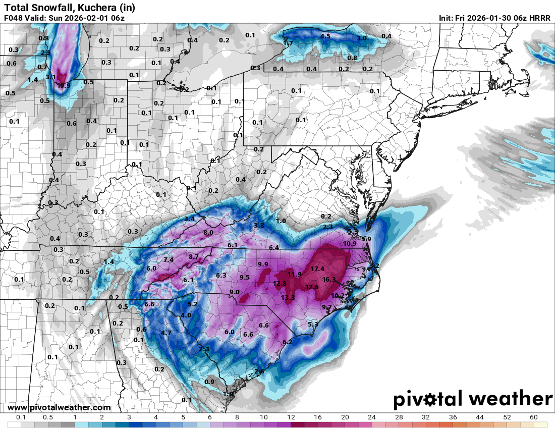
3k NAM 6z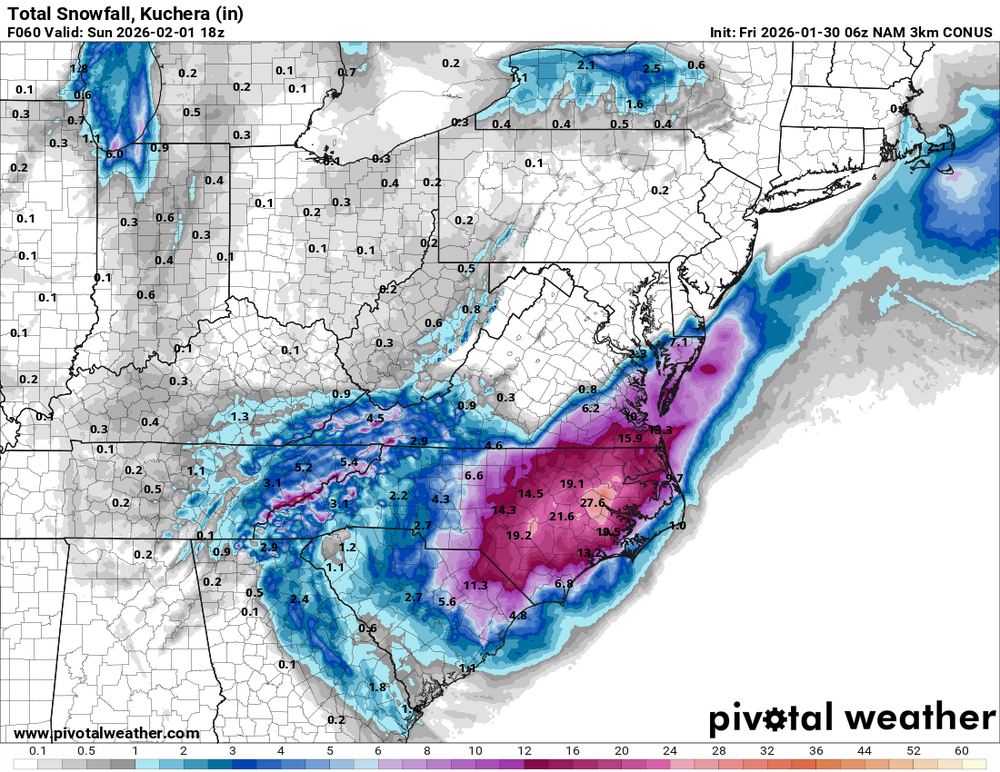
-
The “I bring the mojo” Jan 30-Feb 1 potential winter storm
timnc910 replied to lilj4425's topic in Southeastern States
06z HRRR and its still snowing in ENC
-
The “I bring the mojo” Jan 30-Feb 1 potential winter storm
timnc910 replied to lilj4425's topic in Southeastern States
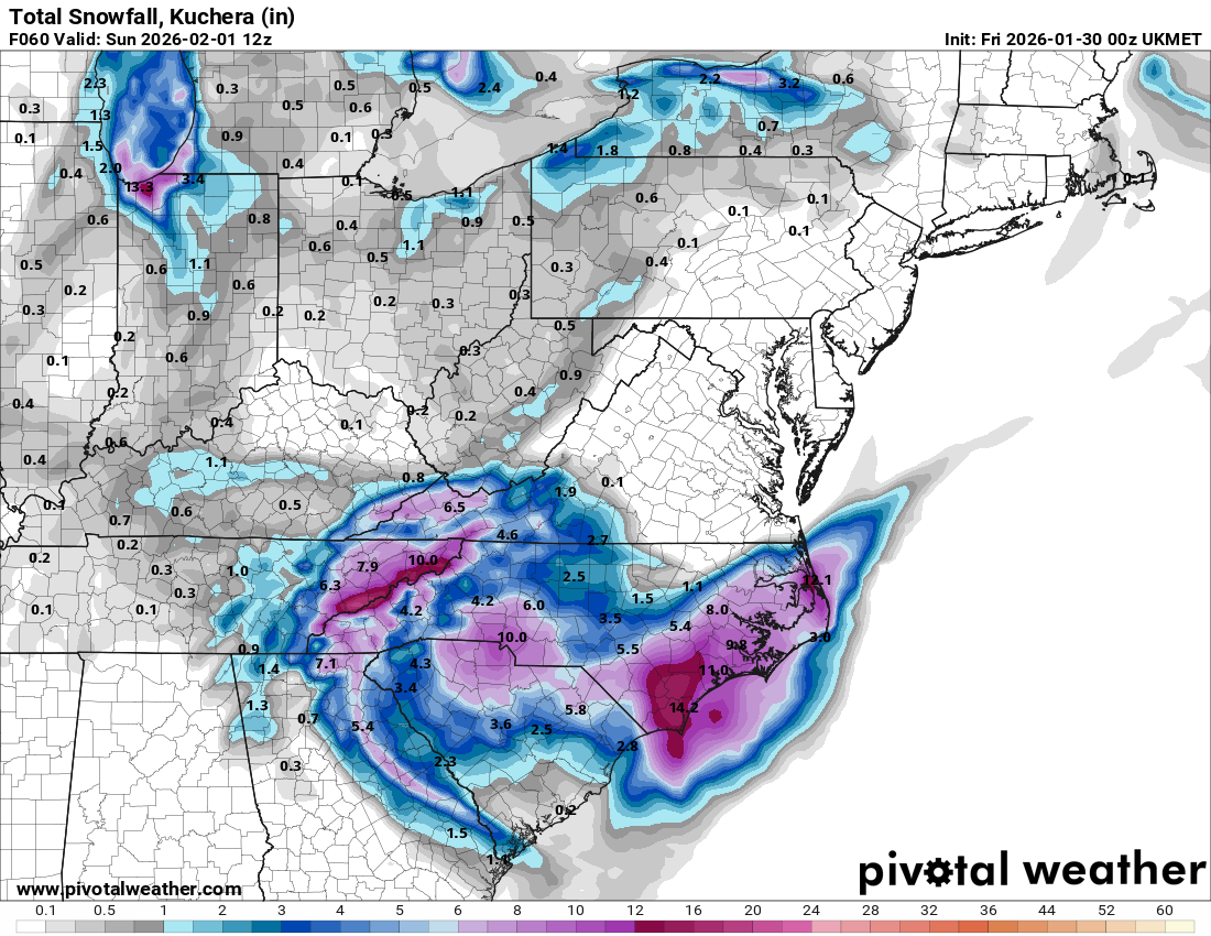
I know its the Ukmet but here it is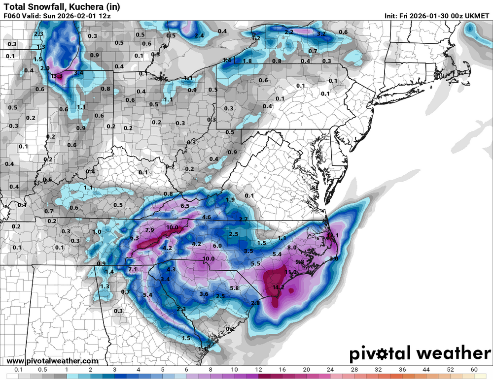
-
The “I bring the mojo” Jan 30-Feb 1 potential winter storm
timnc910 replied to lilj4425's topic in Southeastern States
0z CMC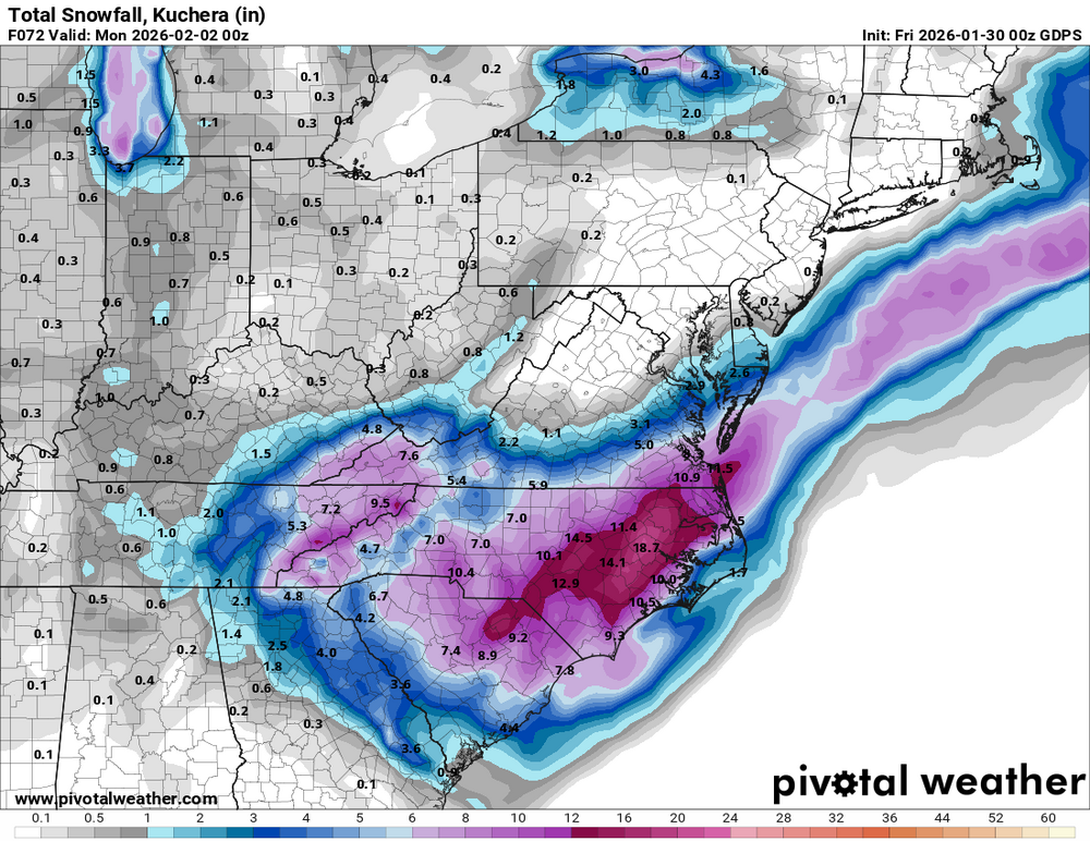
-
The “I bring the mojo” Jan 30-Feb 1 potential winter storm
timnc910 replied to lilj4425's topic in Southeastern States
I am still learning all the models and I am not sure which one this is. Another possible outcome.
-
The “I bring the mojo” Jan 30-Feb 1 potential winter storm
timnc910 replied to lilj4425's topic in Southeastern States
RGEM said here hold my beer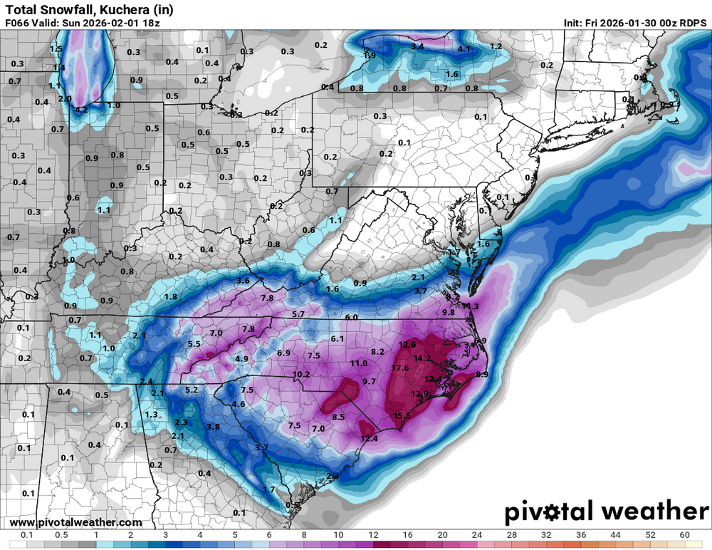
-
The “I bring the mojo” Jan 30-Feb 1 potential winter storm
timnc910 replied to lilj4425's topic in Southeastern States
I could be wrong but this might be it dropping down from Canada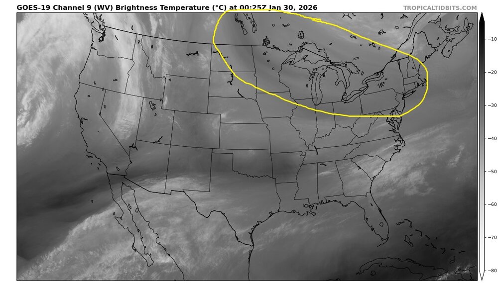
-
The “I bring the mojo” Jan 30-Feb 1 potential winter storm
timnc910 replied to lilj4425's topic in Southeastern States
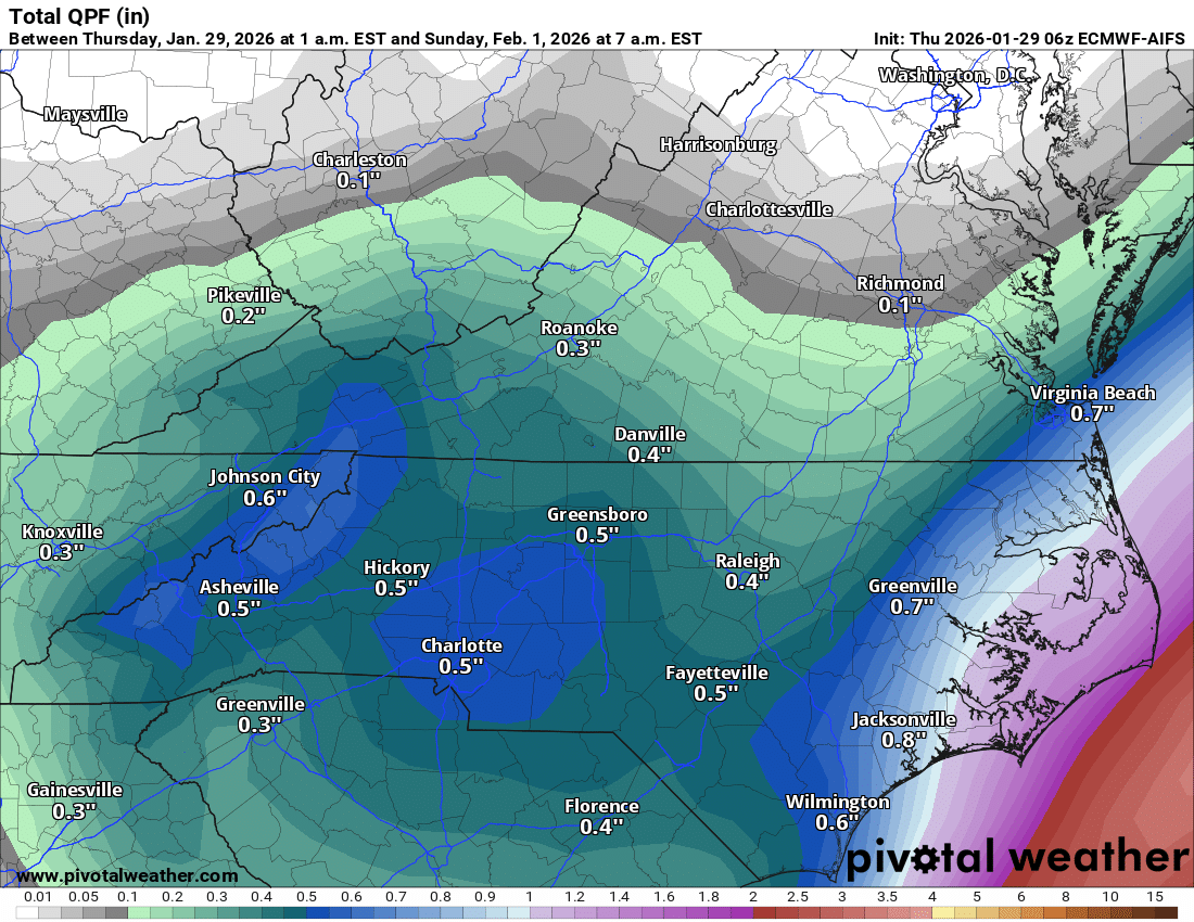
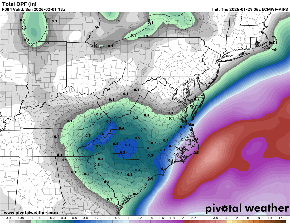
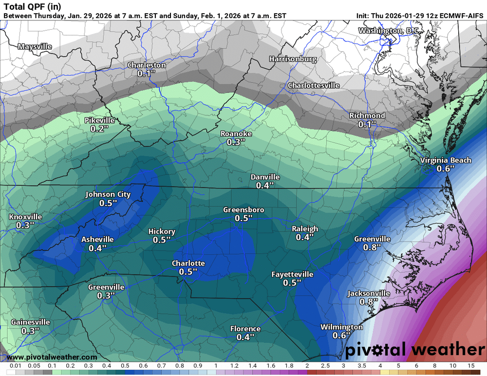
QPF difference between the Euro Op and the Euro AI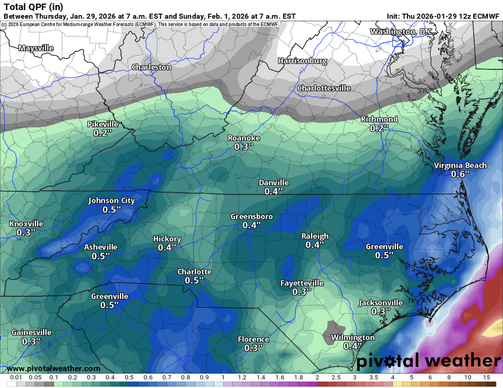
-
The “I bring the mojo” Jan 30-Feb 1 potential winter storm
timnc910 replied to lilj4425's topic in Southeastern States
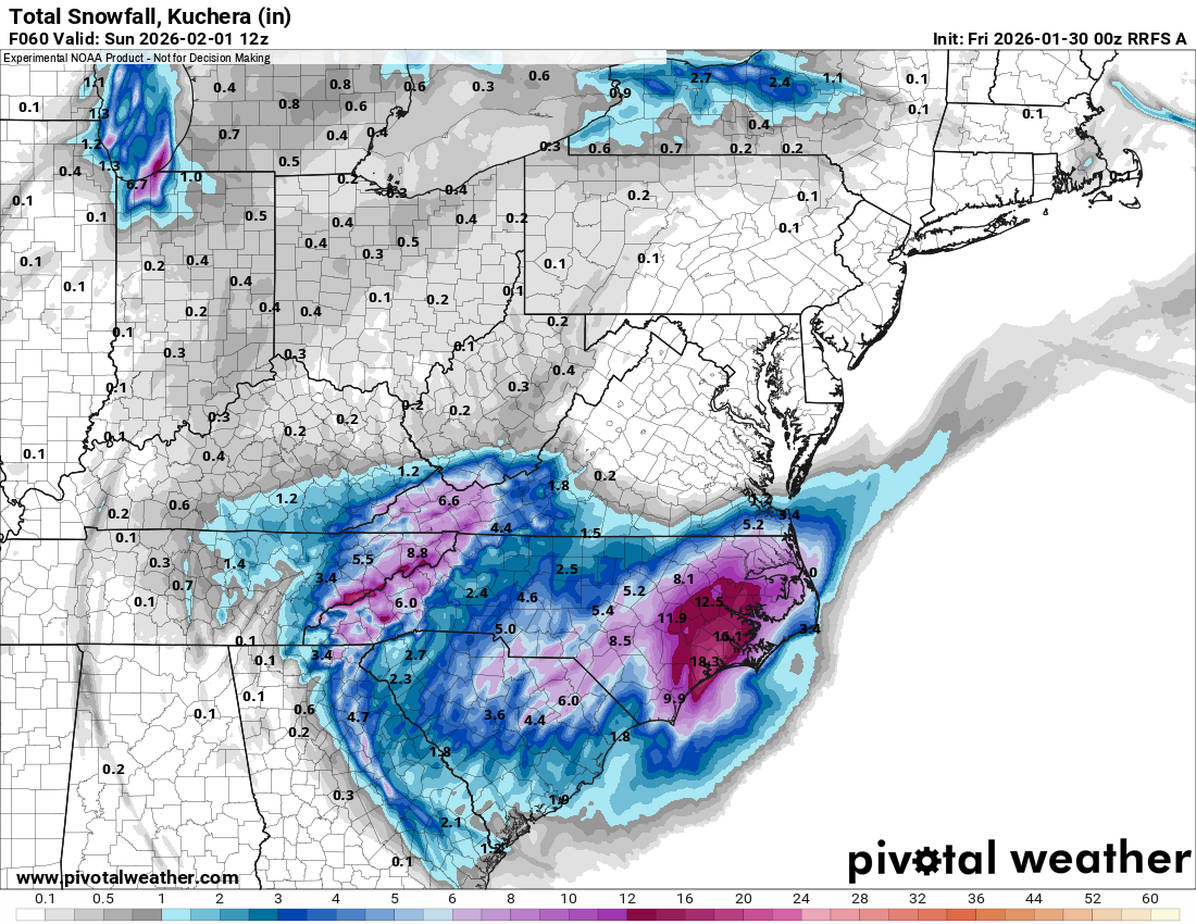
Yes i have the subscription. Anyone that has access to the Kuchera map for the Euro Ai please post it. -
The “I bring the mojo” Jan 30-Feb 1 potential winter storm
timnc910 replied to lilj4425's topic in Southeastern States
I know but the Kuchera is not available on Pivotal weather. -
The “I bring the mojo” Jan 30-Feb 1 potential winter storm
timnc910 replied to lilj4425's topic in Southeastern States
Euro AI has been consistent with the QPF

-
The “I bring the mojo” Jan 30-Feb 1 potential winter storm
timnc910 replied to lilj4425's topic in Southeastern States
AI Euro has a different scenario than the Euro Op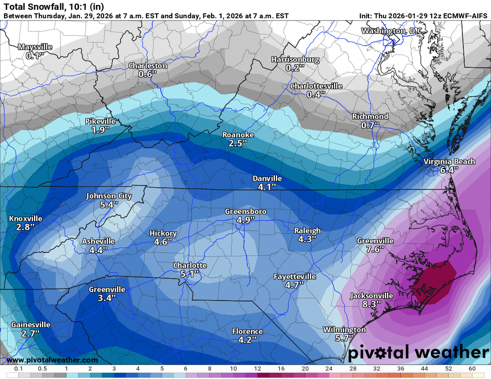
-
The “I bring the mojo” Jan 30-Feb 1 potential winter storm
timnc910 replied to lilj4425's topic in Southeastern States
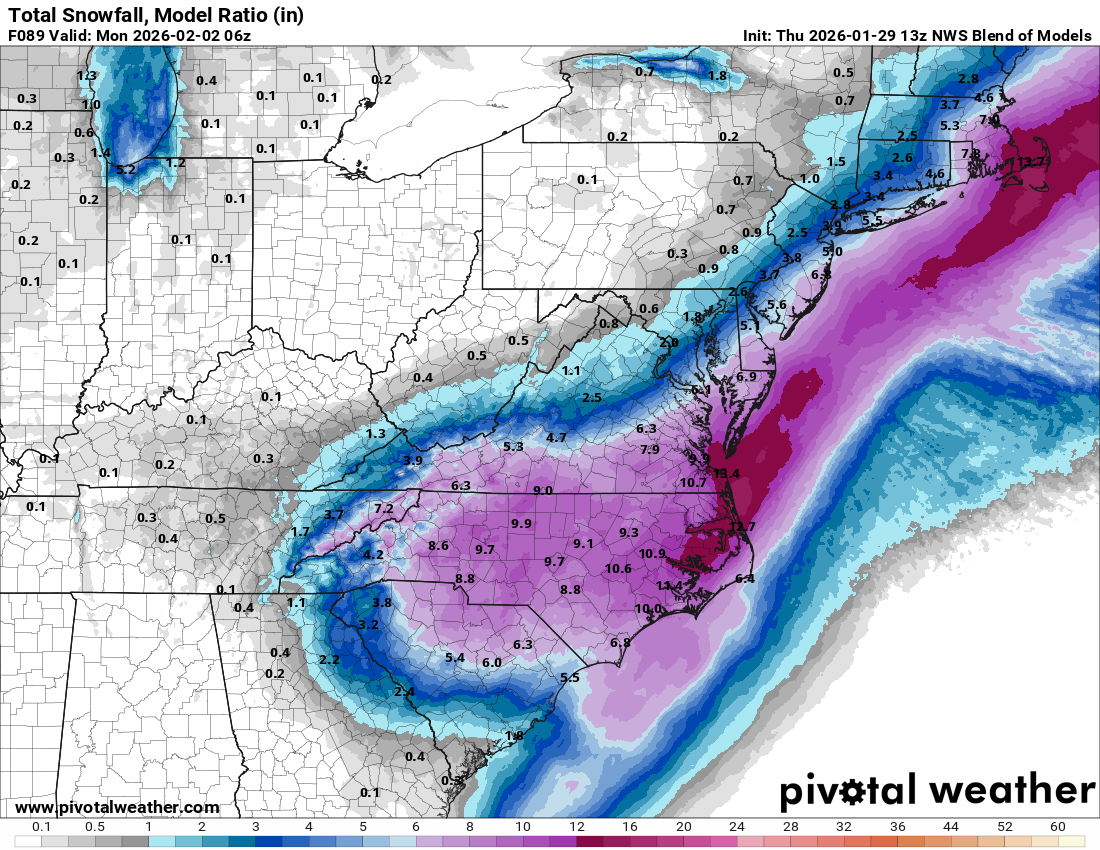
Here is the NWS model blend
-
The “I bring the mojo” Jan 30-Feb 1 potential winter storm
timnc910 replied to lilj4425's topic in Southeastern States
I am not sure the track record of the AI Euro but it doesn't agree