

bkviking
-
Posts
684 -
Joined
-
Last visited
Content Type
Profiles
Blogs
Forums
American Weather
Media Demo
Store
Gallery
Posts posted by bkviking
-
-
From Giacomo:
-
DCA: +2.0
NYC: +2.2
BOS: +2.2
ORD: +1.2
ATL: -0.7
IAH: -0.9
DEN: +1.9
PHX: +0.7
SEA: +3.0
-
 1
1
-
-
Looks like it’s about to pull two straight rain outs in Port Jefferson - tonight I did not expect at all ! Advancing showers heading to Port Jeff Village

-
 2
2
-
-
Heavy rain here in Smithtown. Although I haven’t lacked for rain all summer , hooray for this one!!!!
-
My station in Smithtown
94F/78DP
-
87F/76DP at home in Smithtown
see bubbling cumulus west of me in PJ Harbor - and matched radar .
-
1
-
-
That’s odd - I took video clip of that yesterday - it was a little further south than one above…
-
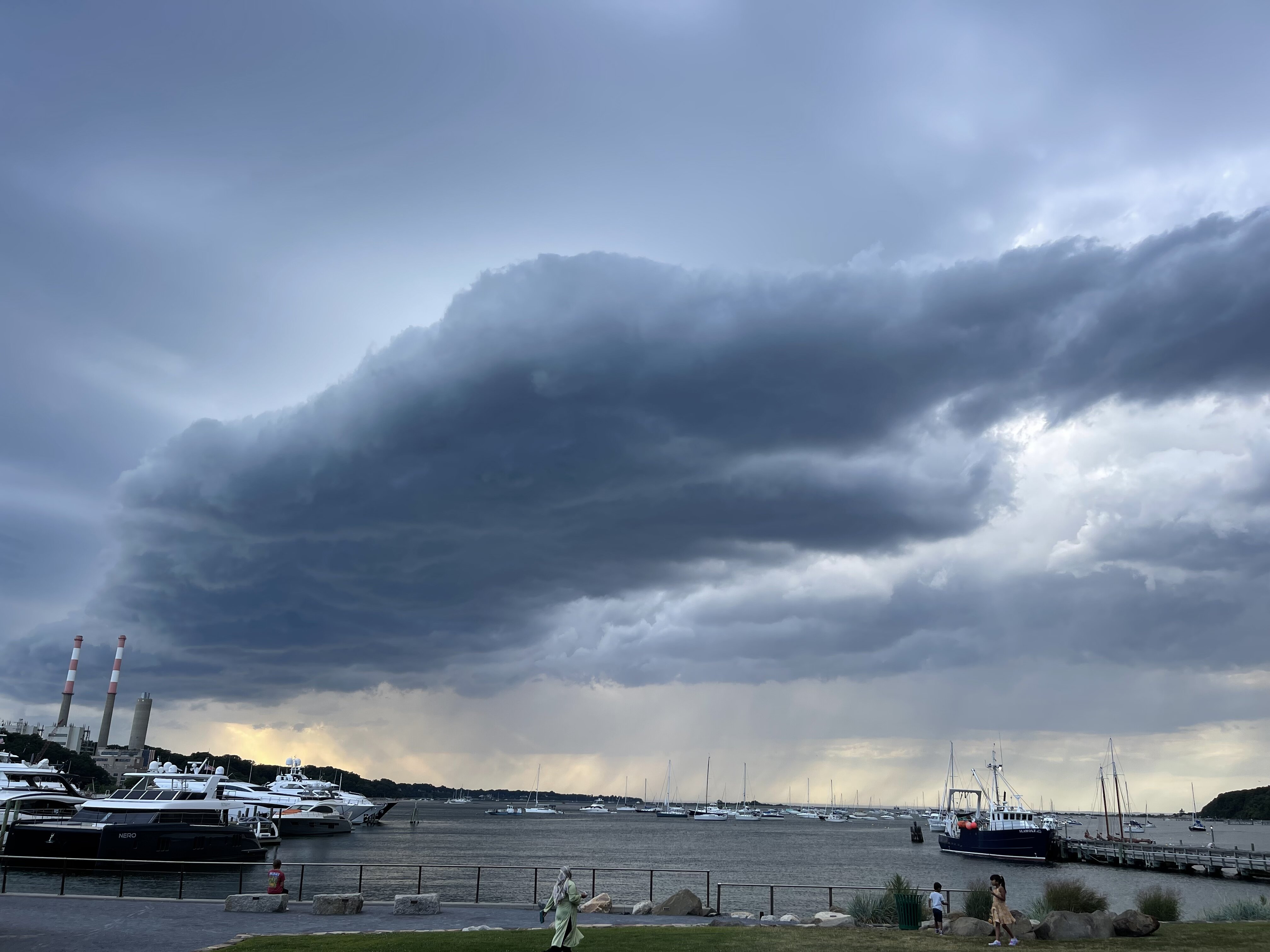
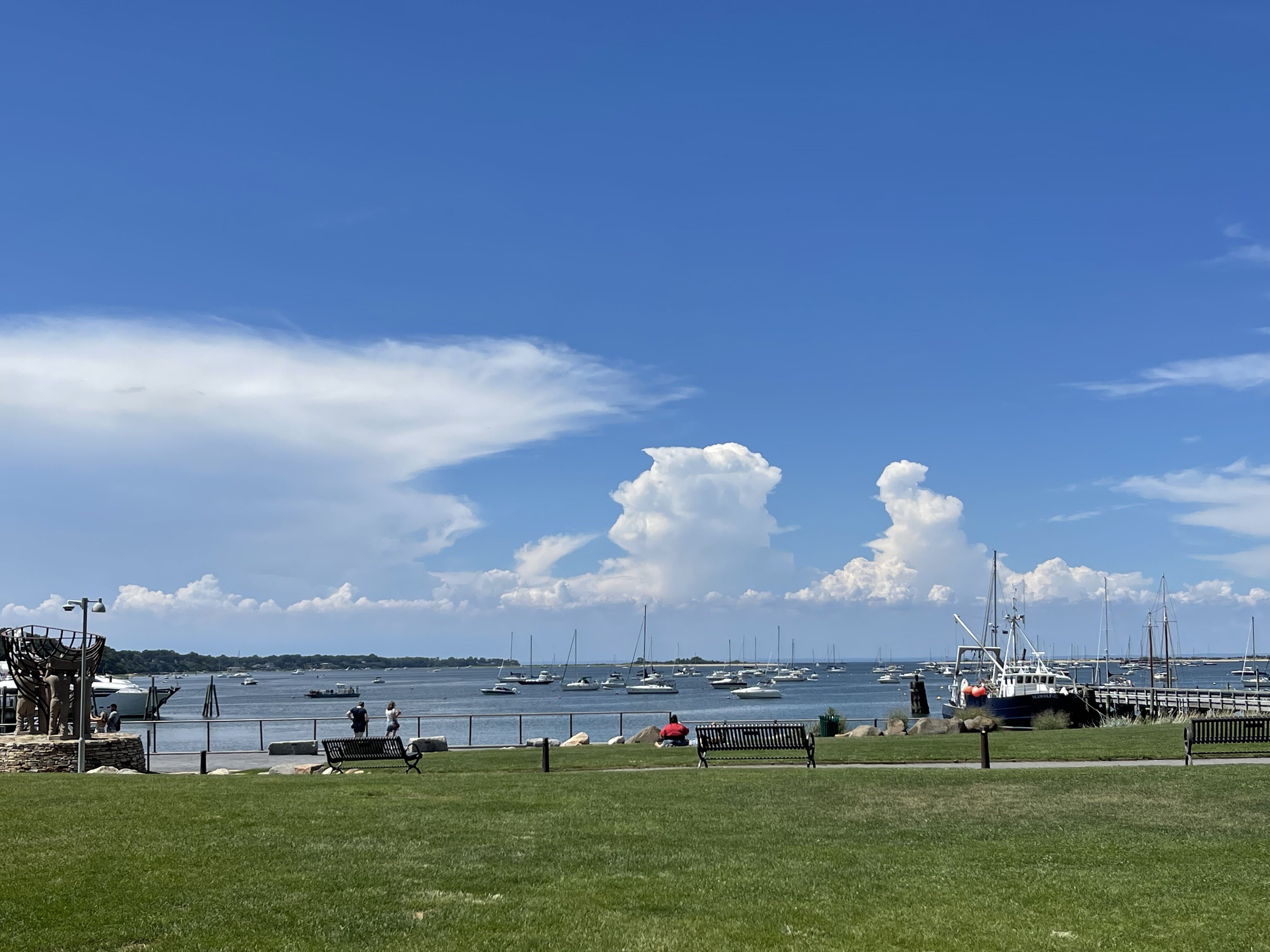
Actually pretty nice out in Port Jefferson like PSV said - pretty nice breeze - tropical but nice in shade especially . Btw, photo below from Port Jeff harbor attest to the tropical Feel - looks more like Florida or islands :

-
9
-
-
My part of Smithtown 12:25pm
88°F /72°DP/95°HI
-
DCA: +2.2
NYC: +2.2
BOS: +2.5
ORD: +2.7
ATL: +2.6
IAH: +2.4
DEN: +2.0
PHX: +2.0
SEA: +1.3
-
1
-
-
Smithtown
93°/74°. Pretty brutal . Worse than yesterday. Didn’t expect this.
-
Smithtown :
92°/69°
-
From Ginx in NE Forum:
-
1
-
-
1 hour ago, winterwarlock said:
How much rain are we getting tomorrow? An inch?
I’m on north shore of Long Island. I’ll wager above 1” based on how things are working this summer.
-
1
-
-
Since Heatwave began my spot In Smithtown
7/23: 97
7/22: 94
7/21: 89 (Severe storm)
7/20: 97
7/19: 93
-
My weatherflow in Smithtown recorded .78” of rain with that cell that came across north shore. My station is near PSV88 so curious if he’s similar
-
I can second PSV on the monsoon here on north shore - storm now over Port Jefferson dumping nicely .
-
1 hour ago, psv88 said:
Flash flood warning for queens and Nassau. Those mostly sunny forecasts from a few days ago not looking great.
Is today the block party ? Storm on north shore is moving kinda slow.
-
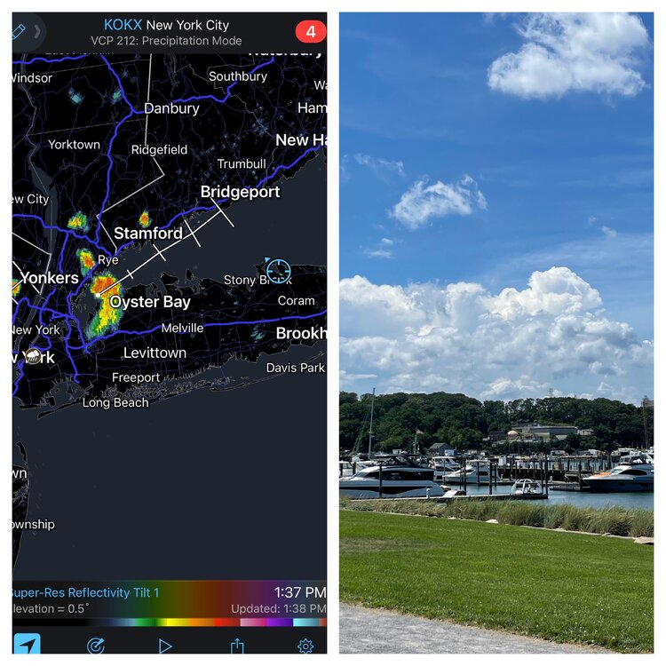
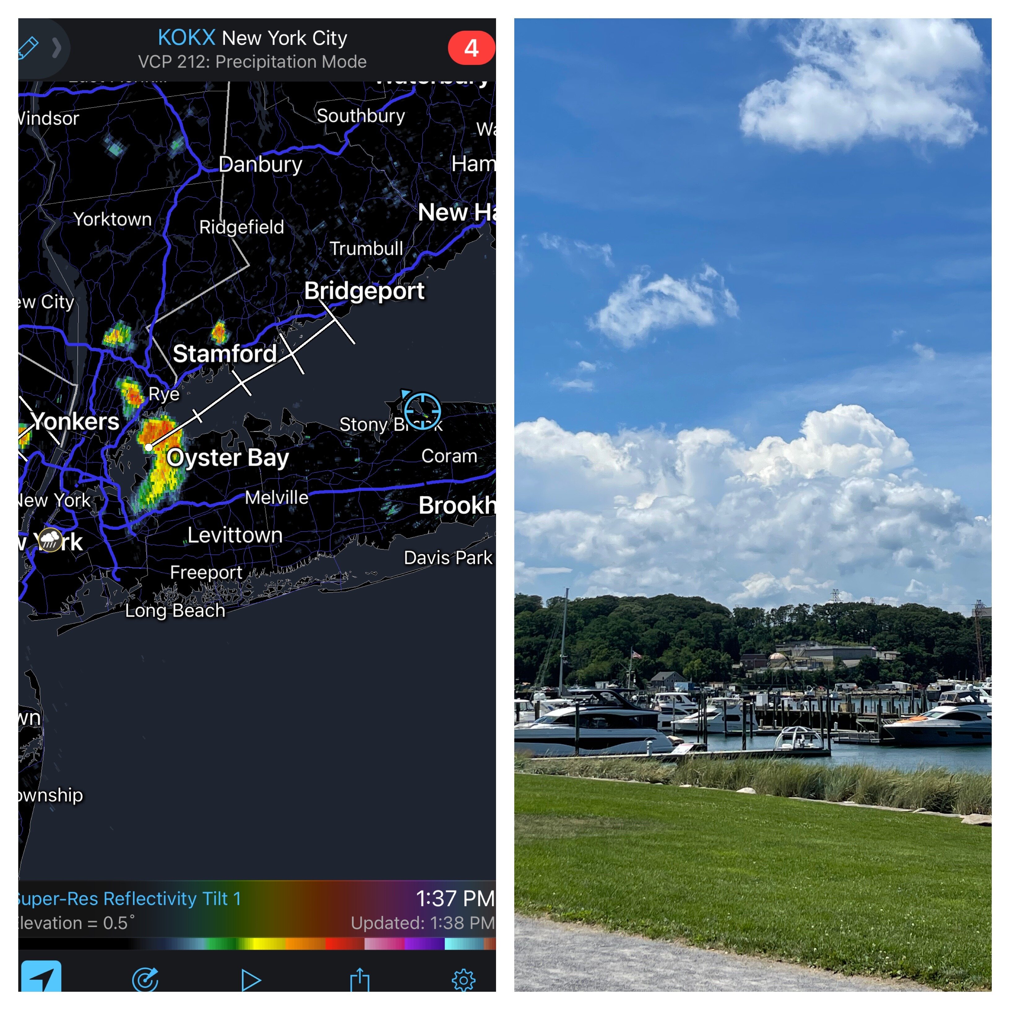
I’m in Port Jefferson by Ferry and it’s dark all points south of me and RadarScope shows training storms. Not getting hit here yet.
-
1
-
-
DCA: +1.3
NYC: +1.0
BOS: +.9
ORD: +2.6
ATL: +2.6
IAH: +2.4
DEN: +2.5
PHX: +2.0
SEA: +0.8
-
1
-
-
DCA: +1.2 100
NYC: +1.0 99
BOS: +1.1 97
ORD: +0.7 99
ATL: +1.0 100
IAH: +1.0 101
DEN: +1.8 100
PHX: +1.8 119
SEA: +1.2 94
-
1
-
-
2 minutes ago, donsutherland1 said:
Tomorrow will be partly sunny and seasonably warm. Much warmer air will move into the region for Monday and Tuesday before another cold front breaks the short warm spell. Much above normal temperatures will likely persist from Philadelphia southward in the Middle Atlantic region through the middle of next week.
Based on sensitivity analysis applied to the latest guidance, Galveston has an implied near 100% probability of recording its warmest May on record. Galveston will likely finish with a monthly mean temperature near 82.7°. The existing record is 80.4°, which was set in 2018. Galveston has already recorded its most 90° high temperatures and 80° low temperatures on record for May.
Some of the guidance has suggested that June could be warmer than normal in the Middle Atlantic and New England areas. The latest EPS weeklies suggest otherwise.
The ECMWF seasonal forecast indicates that the summer will be warmer than normal throughout the region and across much of North America.
The ENSO Region 1+2 anomaly was -1.5°C and the Region 3.4 anomaly was -1.1°C for the week centered around May 18. For the past six weeks, the ENSO Region 1+2 anomaly has averaged -1.65°C and the ENSO Region 3.4 anomaly has averaged -1.07°C. La Niña conditions will likely persist into the start of June.
The SOI was +13.50 today.
The preliminary Arctic Oscillation (AO) was -0.360 today.
On May 26 the MJO was in Phase 5 at an amplitude of 0.805 (RMM). The May 25-adjusted amplitude was 0.187 (RMM).
Based on sensitivity analysis applied to the latest guidance, there is an implied 95% probability that New York City will have a warmer than normal May (1991-2020 normal). May will likely finish with a mean temperature near 64.1° (0.9° above normal).
Don - the SOI has been way above average between moderately strong and extremely above average for seemingly weeks now.
I presume this despite MJO/ CCKW crossing the pacific - nonetheless it is reinforcing a La Niña pattern . Can this lend confidence to at least next 4 months ?
even if things suddenly changed - isn’t this La Niña pattern baked into future at this point ?i am not sure but presume we are safe with La Nina styled pattern for summer at this point .
mot sure where we stand statistically at this point although this is quite anonymous with a third year La Niña . -
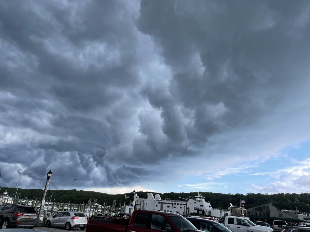
Port Jefferson as storms approach. Buddy on other side about to take ferry in Bridgeport reported hail
-
4
-
-
This from Twitter from Dr Alecia Bentley on severe storms in northeast and why certain o patterns over-perform (maybe explaining tonight’s underperformance)
https://journals.ametsoc.org/view/journals/wefo/32/5/waf-d-17-0044_1.xml
-
1
-


September 2022
in New York City Metro
Posted
.55” from this stationary storm by me in Smithtown (by Sweetbriar). Glad I didn’t water the veggies.