

bkviking
-
Posts
684 -
Joined
-
Last visited
Content Type
Profiles
Blogs
Forums
American Weather
Media Demo
Store
Gallery
Posts posted by bkviking
-
-
Winds cranking here in Miller Place - North Shore of LI. Michael’s last hurrah
-
Late again
DCA: +2.8
NYC: +3.0
BOS: +3.1
ORD: +0.8
ATL: +1.6
IAH: +1.0
DEN +0.3
PHX: -0.7
SEA: -1.5
NYC subforum
-
 2
2
-
-
October 6.
Relying on EPS AO/NAO/PNA sweet spot and cooler air around.
-
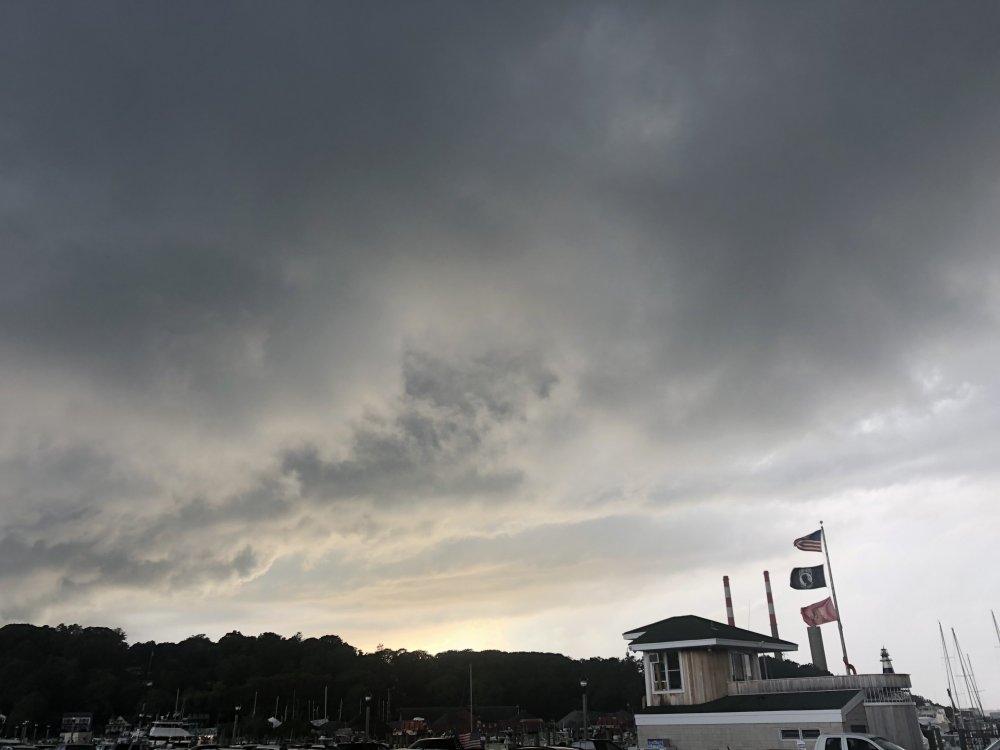
Most intense tstorm of year - and it’s been busy - here in Port Jefferson. Easily busiest CTG stuff we’ve had up here..
-
 1
1
-
-
Late
DCA: +2.4
NYC: +3.0
BOS: +3.1
ORD: +1.8
ATL: +0.3
IAH: +1.2
DEN +0.7
PHX: +0.8
SEA: +1.0
NYC forum
-
1
-
-
1 hour ago, LongBeachSurfFreak said:
Not sure about the monthly total but it’s been a running joke for years in my neighborhood that it never rains in the summer. The new official station has been proving there is some truth to that. We are too far south for the sea breeze convection that seems to form along the southern state. And convection coming from the West seems to die before reaching us. Even further east on the south shore of Suffolk seems to get Into better storms. Of course we have had our moments but that’s usually associated with warm fronts. It must be a combination of the of the ocean and geography.
I have clearly seen your part of LI (southwest corner) miss rains (and snow) often enough. Oddly, I skipped Jones Beach this year bc majors of shoes I’ve gone to past 5 years or so have had rain which to me was unheard of for a long time (90s-like 2012)
I wonder if the North Fork as an area receives less, however. It was my understanding that the north fork received the least precip which is why it’s a suitable area for wineries. Kinda curious as to precip patterns on LI. I know my part of Suffolk (central, North, ~Port Jeff area) clearly gets the most snow the past few decades.
-
1 minute ago, psv88 said:
Soggy block party. 1” of rain so far since noon
Looks mostly over for us.
-
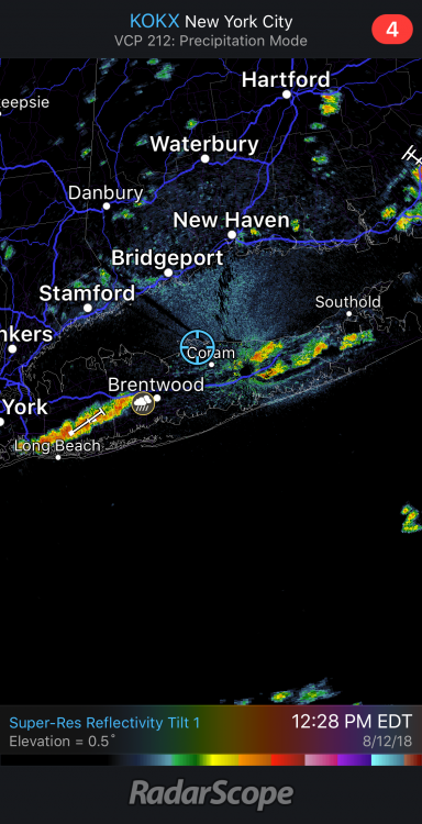
Tstorms rolling off LI Sound into Port Jefferson
-
1
-
-
8 minutes ago, Tatamy said:
There is a history of these convergence zones setting up west to east across LI. There was one a couple of years ago that dumped up to several inches of rain across NW Suffolk Cty.
Figures a fellow weather nut would remember this bc 2016 was notorious for these events. In that year there numerous sea breeze front type boundary events in LI, with radar lit like an Xmas tree through middle and northern parts of LI east to west . That year was also toxic for DewPoint extremes - like this year. I love summer but despise this type of extreme up here.
-
5 minutes ago, 495weatherguy said:
Thunder at the Suffolk/Nassau border. Rain closing in
5 minutes ago, 495weatherguy said:Thunder at the Suffolk/Nassau border. Rain closing in
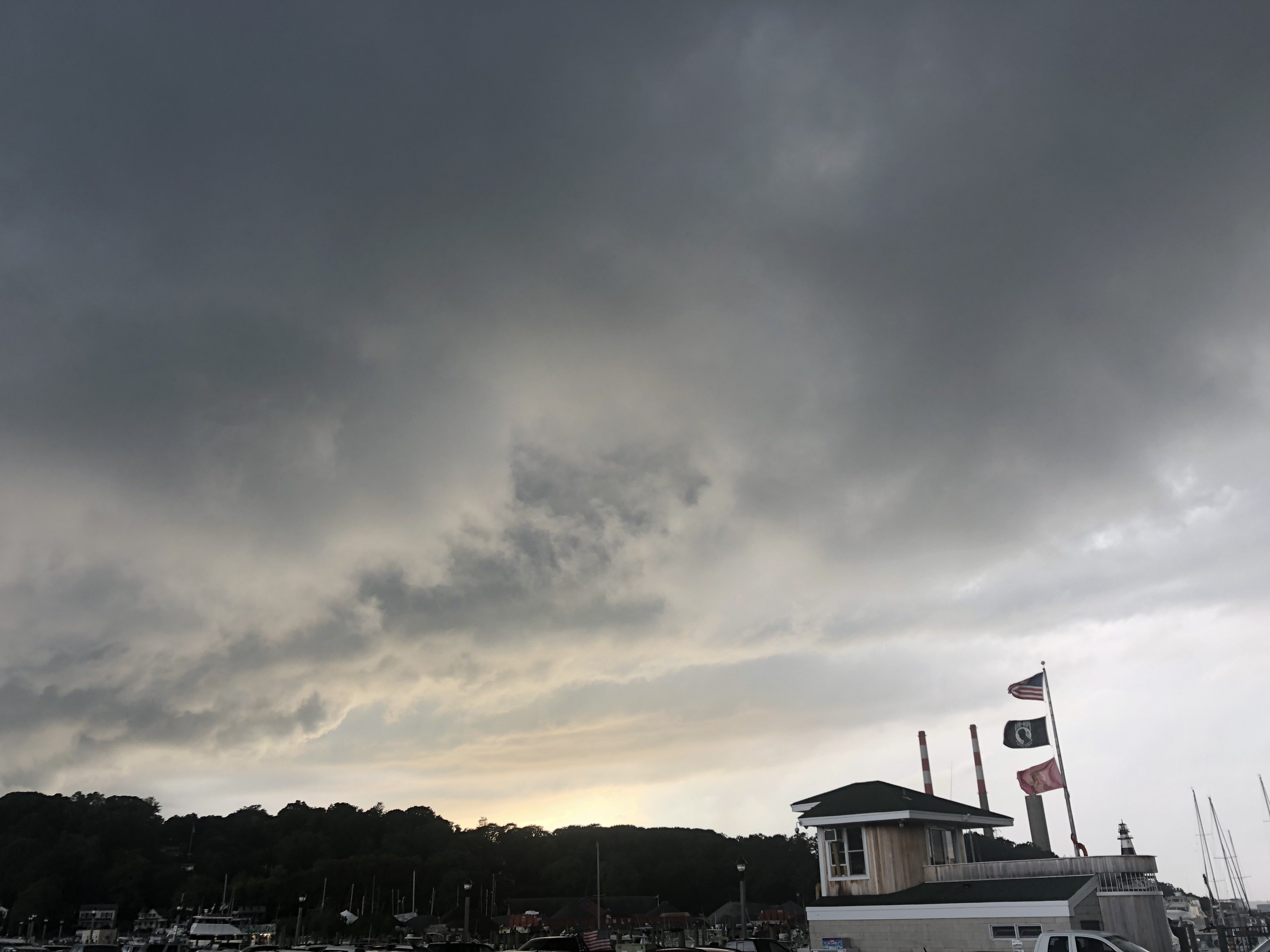
I’m up in Port Jefferson looking south and see plenty of billowing cumulonimbus. V slow moving looking at radar. Tropical weather continues - though I must say the easterly wind feels better.
-
1 hour ago, raindancewx said:
The MJO/SOI are mostly responsible for the pattern now, although the SOI did crash again today.
The problem with a flat ONI for DJF is we're already at ~0.1C, maybe 0.2C, maybe 0.0C for JJA. There is still warm water below the surface, so I think one more good push to the surface is needed and then the warmth becomes self sustaining. It isn't like last year (at least now) where the warm water just vanished fast at the end of July. The Canadian last year went from a Nino to Neutral from its 7/1 to 8/1 update. Not so this year, although it did weaken the onset a bit.
I gotta be honest with you : “Chuck” has spouted some good stuff since his return last year. But I am getting so perplexed by his constant shifting the last several months. This is a good thread and needed across the board as ENSO truly is universal in how it affects the US.
But it’s getting hard to follow Chuck with the swings lately from Niño to Nina to Niño to Nina. Don’t want to say he’s wrong but I just am incredulous about his posts.
Wish some additional heavyweights would join this thread (thanks to Ray, from NE) as it’s mighty crucial for most of us.
-
2
-
-
DCA +2.2
NYC +2.0
BOS +2.0
ORD +0.8
ATL +1.2
IAH +1.4
DEN +3.3
PHX +1.8
SEA +0.2
-
1
-
-
Hurricane Gloria commenced the obsession.
-
2 hours ago, forkyfork said:
supercharged atlantic ridging

Too bad MDR sucks
-
The person that uploaded the video said he/she lived at 27th and Minnesota. The tornado tracked to the north of the persons house and the survey has the center crossing 24th and Minnesota moving east-northeastish. The camera in the front was pointed north, so the back camera was probably pointed south so they sustained EF2-EF3 winds at the location of the camera.
Thanks. This is one of the few Tornadoes that seems to have attained that unique status usually reserved for
Hurricanes or blizzards which impact far larger areas. It's so fascinating--videos and yours and other's write-ups--but more, just a humbling experience from nature.
-
Just re-watched the trampoline video again. Sorry if this has been brought up, I've read so many pages of this thread, but I'm curious about the location of the tornado in that clip. We first see the winds coming almost directly at camera, then it blows away from camera at the end. Is it correct to presume tornado came from the right of the camera and crossed in front heading northeast (typical tornado path)?

October 27 2018 Major East Coast Storm
in New York City Metro
Posted
Lol - this was funny joke (and know you are joking here) . But for uninitiated, Bluewave is one of our Crown Jewels - on the whole board, or Eastern, or WWBB. Anytime the dude has reflected/conjectured/observed on something it is undoubtedly a sign to take it with keen attention and gravitas.