
Thunderblizzard
-
Posts
1,400 -
Joined
-
Last visited
Content Type
Profiles
Blogs
Forums
American Weather
Media Demo
Store
Gallery
Posts posted by Thunderblizzard
-
-
CMC came NE a bit as well.
-
 1
1
-
-
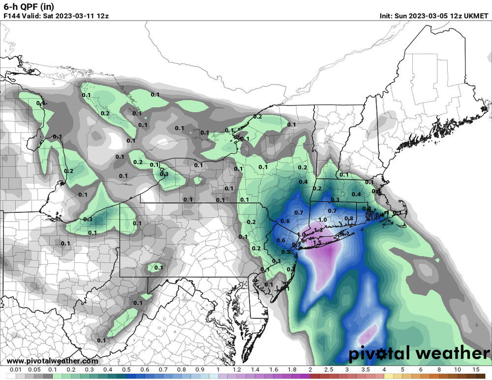
0.5" QPF into SW CT... looks like the 18z Euro.
-
1
-
-
Here comes the GFS... decently north at hour 54.
-
Didn't expect it to look like that after how it was early... big hit.
-
HRRR was getting it pretty far NE at hour 48 if you want to count that... but it's the long range HRRR.
-
1
-
-
RGEM is making a nice bump NE compared to the 18z run.
-
1
-
-
Yeah, NAM isn't buying it. Although it looks like the 3km is bumping NE from 18z.
-
4-5" all the way to here... hard sell but it would be nice if it was onto something.
-
0.5" QPF into SW CT it looks like. That was a decent bump.
-
 1
1
-
-
18z Euro pushing things a bit further NE again.
-
Euro loaded to 120 on some TT maps... not a very promising look there.

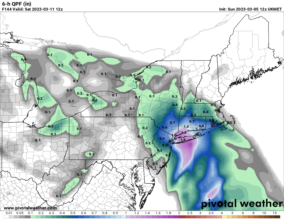
-
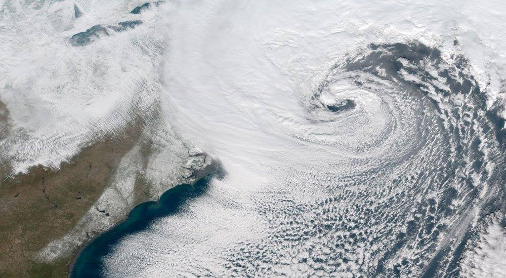
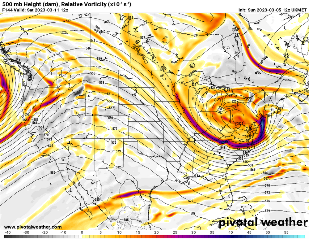
0z UKMET is just north of Bermuda at hour 144.
-
9 minutes ago, Diggiebot said:
Do tell or show please and thank you
Pretty explosive look on the UKMET.
-
1
-
-
Nice 48+ hour event for NNE/CNE there on the GFS.
-
1
-
-
2 hours ago, The 4 Seasons said:
If anyones curious heres what i have so far, i have to wait a bit for more reports to role in and will refine it but this gives you an idea of some of the 30 or so reports that came in.

Had about 0.6" of gunk here.
-
Getting completely scalped. 0.5" and at least half of that is sleet. 32F
-
13 minutes ago, Sn0waddict said:
Just traveled from plainville to Milford myself. Plainville was snow/sleet with accumulation on roads/all surfaces. By the time I was in Southington there was no longer any accumulation. Turned to rain right after the tunnel in Hamden on the Merritt.
Yeah there's only a little on mostly colder surfaces here... a few tenths maybe.
-
Ripping sleet here. 33F
-
Can confirm flakes are flying here a little bit NW of Meriden, but pretty lightly. 34F
-
0z RGEM looks like it actually ticked back south.
-
Just had a burst of graupel here too.
-
0z RGEM looks like it got a little bit colder as well.
-
18z Euro remains pretty firm... a hair colder compared to 12z.
-
2
-
-
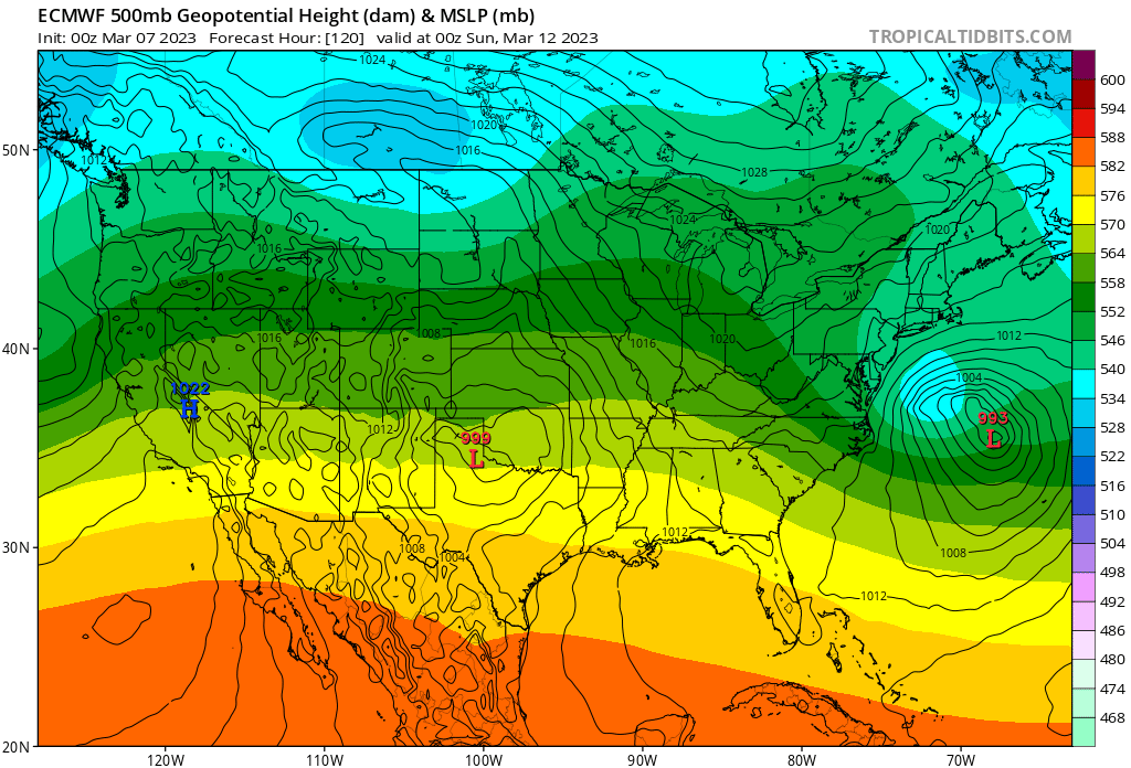
GFS looks south and colder too. Confluence is quite a bit stronger that run.
-
1
-


March 10-11 light snow threat for SW New England.
in New England
Posted
You can add the UKMET to the list too... not as robust as the Euro or the GFS but a solid shift NE.