

Cashtown_Coop
-
Posts
3,380 -
Joined
-
Last visited
Content Type
Profiles
Blogs
Forums
American Weather
Media Demo
Store
Gallery
Everything posted by Cashtown_Coop
-
Central PA - Winter 2020/2021
Cashtown_Coop replied to MAG5035's topic in Upstate New York/Pennsylvania
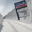
30” for me. Gooood to go -
Central PA - Winter 2020/2021
Cashtown_Coop replied to MAG5035's topic in Upstate New York/Pennsylvania
Yes, but Still trended north at end. So did the dec 2009 storm. That’s what this storm reminds me of. -
Central PA - Winter 2020/2021
Cashtown_Coop replied to MAG5035's topic in Upstate New York/Pennsylvania
My north trend 24 out. Everything going as planned -
Central PA - Winter 2020/2021
Cashtown_Coop replied to MAG5035's topic in Upstate New York/Pennsylvania
Sweet snow on snow -
Central PA - Winter 2020/2021
Cashtown_Coop replied to MAG5035's topic in Upstate New York/Pennsylvania
Adams grid now showing 2-4” tomorrow with snow heavy at times. Advisory coming ? lwx showing 1-3” for Frederick county and 3-5” for Washington county. Good trend -
Central PA - Winter 2020/2021
Cashtown_Coop replied to MAG5035's topic in Upstate New York/Pennsylvania
Regarding the Wed system, I’m thinking models continue a se trend through the next 24 hours before the Inevitable north trend starts Monday into Tuesday. If the euro continues to remain steady then bow to the king. -
Central PA - Winter 2020/2021
Cashtown_Coop replied to MAG5035's topic in Upstate New York/Pennsylvania
I received a text from one of my CTP met friends that made the Feb 5-6 2010 comparison last eve. I ended up with 27” from that one. Hard to believe this is real. -
Central PA - Winter 2020/2021
Cashtown_Coop replied to MAG5035's topic in Upstate New York/Pennsylvania
I approve -
Central PA - Winter 2020/2021
Cashtown_Coop replied to MAG5035's topic in Upstate New York/Pennsylvania
That will do. If only. -
Central PA - Winter 2020/2021
Cashtown_Coop replied to MAG5035's topic in Upstate New York/Pennsylvania
Is Cashtown jackpot yet? Asking for a friend -
Central PA 2020 Fall - The Hope begins
Cashtown_Coop replied to paweather's topic in Upstate New York/Pennsylvania
Took a drive this morn and ran into snow at 1400ft. Pics taken in western Adams county -
Central PA 2020 Fall - The Hope begins
Cashtown_Coop replied to paweather's topic in Upstate New York/Pennsylvania
Creeks and ponds were dried up going into this. Even with the rain today, the creek running through the course barely had any increase -
Central PA 2020 Fall - The Hope begins
Cashtown_Coop replied to paweather's topic in Upstate New York/Pennsylvania
1.26” house 1.33” course. Mod rain continues -
Central PA 2020 Fall - The Hope begins
Cashtown_Coop replied to paweather's topic in Upstate New York/Pennsylvania
.40” for me. -
Central PA 2020 Fall - The Hope begins
Cashtown_Coop replied to paweather's topic in Upstate New York/Pennsylvania
My fantasy team is hurting. Dallas better get it in gear. I have Prescott, Copper ,and Lamb all on my team. -
Central PA 2020 Fall - The Hope begins
Cashtown_Coop replied to paweather's topic in Upstate New York/Pennsylvania
I’m in. Can’t build it right over me or I’d be in a dead spot. Too bad wgal doesn’t have their Doppler Radar still online. It would suck living out west where there’s so many radar gaps. -
Central PA 2020 Fall - The Hope begins
Cashtown_Coop replied to paweather's topic in Upstate New York/Pennsylvania
As Mag stated, with both local radars down we are going to have a hard time seeing anything on radar. I’ve managed a whooping 0.02” from drizzle so far. -
Central PA 2020 Fall - The Hope begins
Cashtown_Coop replied to paweather's topic in Upstate New York/Pennsylvania
@Eskimo Joejust bought this station. Might want to hit him up. -
Central PA 2020 Fall - The Hope begins
Cashtown_Coop replied to paweather's topic in Upstate New York/Pennsylvania
4/4 at the course -
Central PA 2020 Fall - The Hope begins
Cashtown_Coop replied to paweather's topic in Upstate New York/Pennsylvania
Crush job. Snow on Snow all winter long. -
Central PA 2020 Fall - The Hope begins
Cashtown_Coop replied to paweather's topic in Upstate New York/Pennsylvania
3 frosts in a row at golf course. That’s impressive as it wasn’t just a fluke event. Possibly one more tomorrow. -
Central PA 2020 Fall - The Hope begins
Cashtown_Coop replied to paweather's topic in Upstate New York/Pennsylvania
With the lack of preseason I believe this will be the year of the injury. -
Central PA 2020 Fall - The Hope begins
Cashtown_Coop replied to paweather's topic in Upstate New York/Pennsylvania
I have Prescott on my fantasy team. Man he went off with almost 50 points -
Central PA 2020 Fall - The Hope begins
Cashtown_Coop replied to paweather's topic in Upstate New York/Pennsylvania
Had 32 at the house and heavy frost. -
Central PA 2020 Fall - The Hope begins
Cashtown_Coop replied to paweather's topic in Upstate New York/Pennsylvania
Yeah had a 40 min frost delay at the course. I’m still warming up

