
Deck Pic
-
Posts
27,095 -
Joined
Content Type
Profiles
Blogs
Forums
American Weather
Media Demo
Store
Gallery
Posts posted by Deck Pic
-
-
1 minute ago, nj2va said:
We need the Ellinwood ‘grey’d’ map.
There's not a lot of time left. If we're going to see a shift south I'd love to see the GFS/Euro show it tonight
-
 1
1
-
-
The latest NBM looks about right to me right now. This would be my forecast right now

-
The 3k NAM is a horror show
-
4
-
-
3 minutes ago, nj2va said:
Looks like Deep creek/Canaan are the places to be this weekend. Wisp will probably be 100% open after this next storm and could top 60” on the year so far. Mountains have had a great January for the ski resorts.
yeah.hopefully keeps up and Garrett/Tucker can have big winters. Canaan is up to 82" and has had measurable in 10 out of the last 11 days.
-
4
-
-
23 minutes ago, Ji said:
No matter what happens Friday. This winter is heading into February with D- grade
Since 2009, I've received a TOTAL of 7.5" in 10 accumulating snow events over the last 14 Decembers (incl this winter)
In the same period I've received a total of 32" in 13 accumulating snow events over the last 13 March's
December isn't a winter month. March is. We're only 2 weeks into winter.
-
4
-
-
9 minutes ago, psuhoffman said:
I put something out there a while ago and no one answered.... let's say we do finish this winter below avg snowfall... gun to your heads how many years would you predict go by before a season where IAD, BWI, and DCA all record 20" of snow in a season? LOL
If we go back 50 years, I believe the longest gap is from 1987-88 to 1994-95. So we'd have to fall short this winter and next winter to break the 50 year record.
-
1
-
-
2 minutes ago, WinterWxLuvr said:
It worked last time. Maybe with you suggesting it, it will happen.
This one might be unsalvageable

-
 1
1
-
-
New thread?
-
1
-
 1
1
-
-
Other than as a cautionary tale, I wouldn't take the NAM over the globals at this range
-
1
-
1
-
-
-
42 minutes ago, jayyy said:

Called that HoCo jackpot. Happy for my former county-mates!lol..there's actually a white spot over Georgetown...no shit
-
4
-
 14
14
-
-
15 minutes ago, Demeter said:
It definitely happened this last storm. I am in the Spotsylvania area and we had a bullseye for a while. The final 24 hours of modeling moved it north a ways and final results were north getting more. (It’s the same with most storms). I only remember a handful where I got more than the north crew in the last 15 years.
These storms that have to cross the mountains are so precarious from DC south. Our snow gets eaten
-
1
-
-
25 minutes ago, WEATHER53 said:
I’ve dropped from 30.5 to 28 in 60 minutes, occasional significant blowing snow. Gonna be a cold night
I'm at 29/18 here in uhi hell. Cold day. I think the crust of zr I got will help preserve the snow pack
-
12 minutes ago, stormtracker said:
Solution Man or whoever, you must carry the gauntlet for the 18z GFS. I'll be heading home from work and stopping to get materials for Taco Tuesday. Godspeed.
If they're old school tacos I might come over.
Not too worried about the RGEM

-
13 minutes ago, Ji said:
too early. PD3
Has Jay's Wintry Mix highlighted that period yet?
-
11
-
-
3 minutes ago, Ji said:
what are you going to do the week of Jan 25-30?
Probably follow our Feb 2nd HECS
-
5
-
-
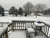
If anyone has a really good deck pic they took in this latest storm, lemme know and I'll avatar it...
-
2 minutes ago, DDweatherman said:
Although this is scientifically proven to be true & successful, I wouldn’t mind us to keep going straight upward with this one like 12z did
It's never failed. Sample Size: 1
-
4
-
4
-
-
Smart idea starting a thread knowing if the models start going belly up, we can just start another thread.
-
6
-
8
-
-
DCA: 4.1"
IAD: 4.4'"
BWI: 4.9"
-
3
-
 1
1
-
1
-
-
1/15-16: 4.0"
Season Total: 4.0"
-
18 minutes ago, Deck Pic said:
I'm getting the goods again. Interesting storm. LWX did well with the upgrade.
Ended up becoming sleet/snow pellets. ETA: There's an ever so slight warm nose at 875mb. I don't see it affecting people when there are good rates. If you go to Precip Depiction/Correlation Coefficient you can see the mix line just into DC
Final Ob of night
28/27, -SN/IP, 4"
-
2
-
-
I'm getting the goods again. Interesting storm. LWX did well with the upgrade.
-
4
-
-
Nice band earlier. The Cleveland Park/Tenleytown crew got shellacked
-
3
-
Jan 19th Snow on Snow: the this always works until it doesn't thread
in Mid Atlantic
Posted