

forkyfork
-
Posts
26,332 -
Joined
-
Last visited
Content Type
Profiles
Blogs
Forums
American Weather
Media Demo
Store
Gallery
Posts posted by forkyfork
-
-
5 minutes ago, Stormlover74 said:
For one or two runs I believe. I don't remember the gfs or Canadians getting on board
its most aggressive run was the 18z run before the storm started
-
 2
2
-
-
Just now, Allsnow said:
I still blame you
okx was calling for 20-30" as the storm started
-
 2
2
-
 1
1
-
-
there was one night where all the 0z models were hits except for the nam and that's what made me say that
-
2
-
-
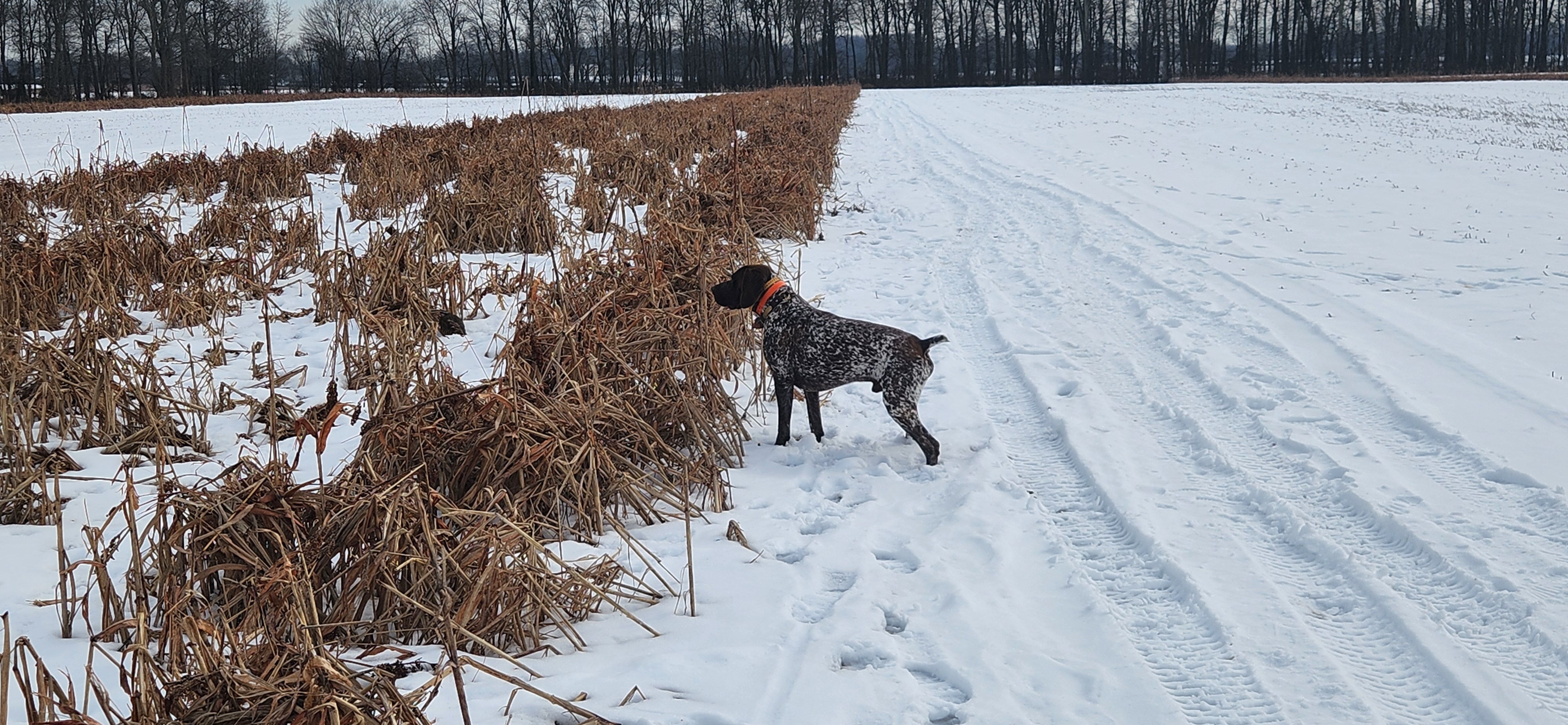
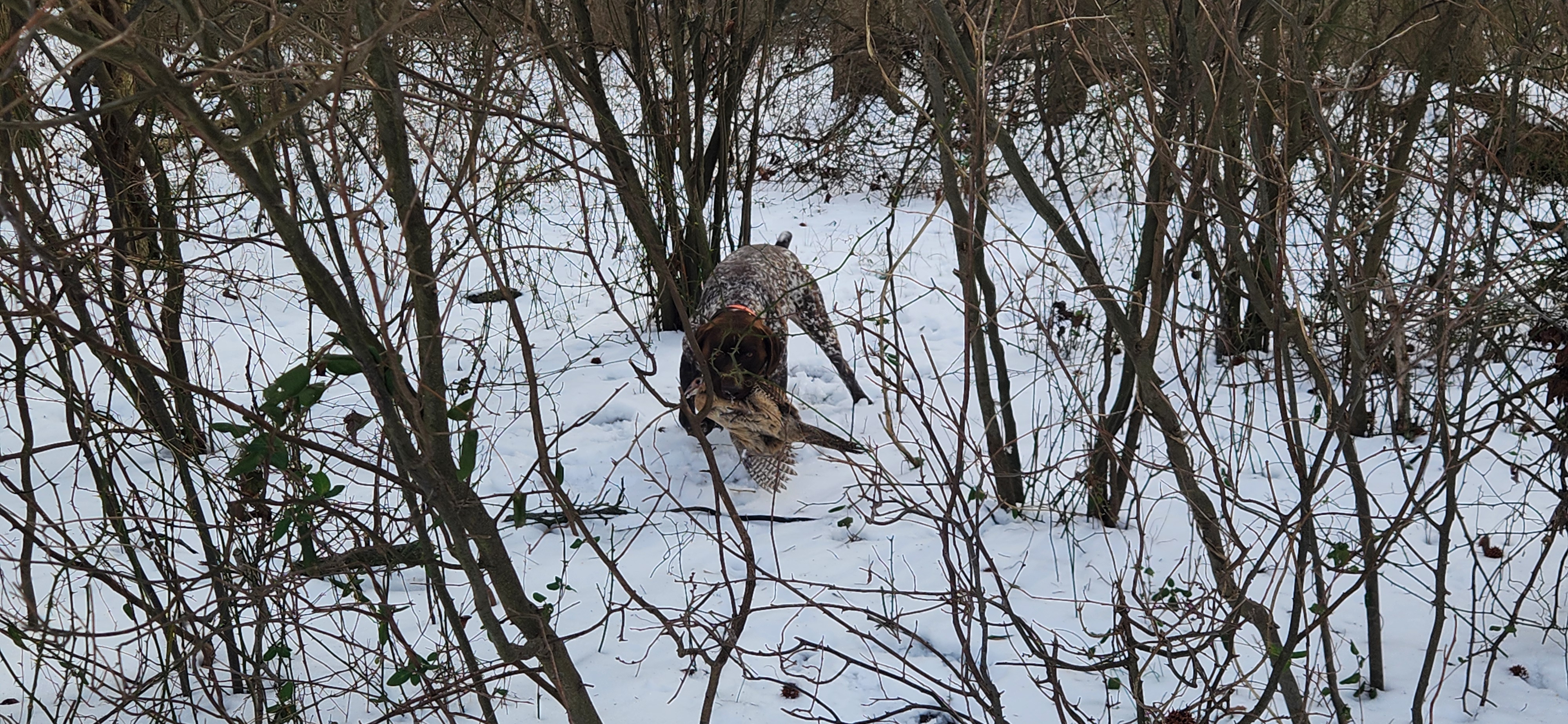
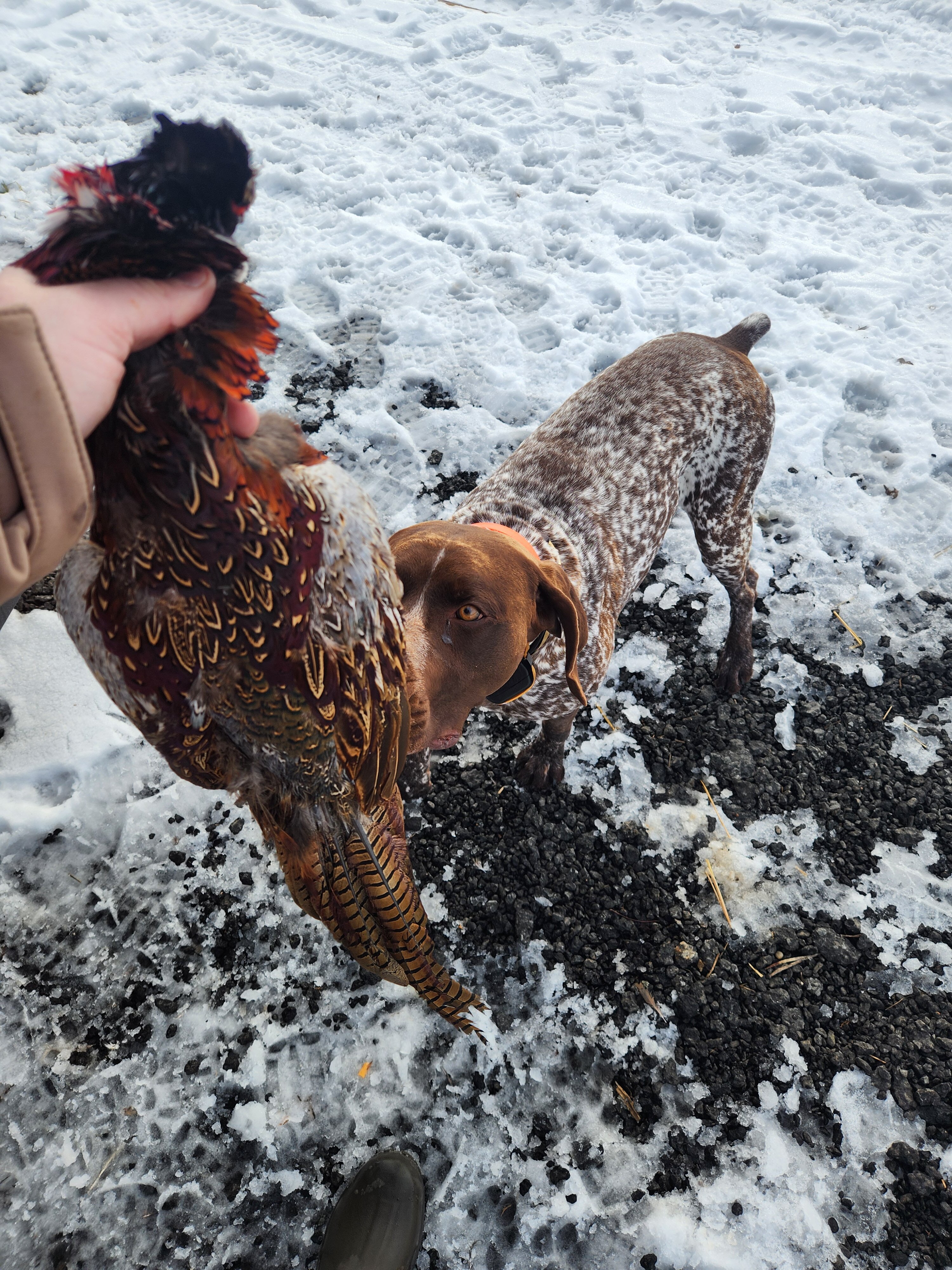
13 hours ago, dseagull said:
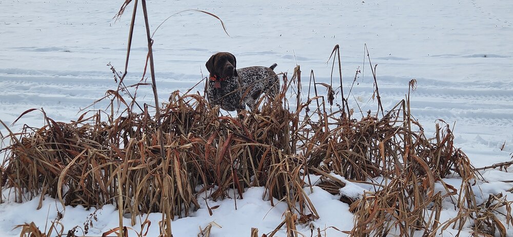
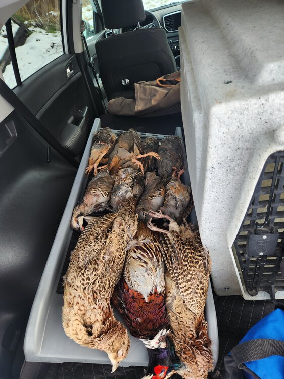
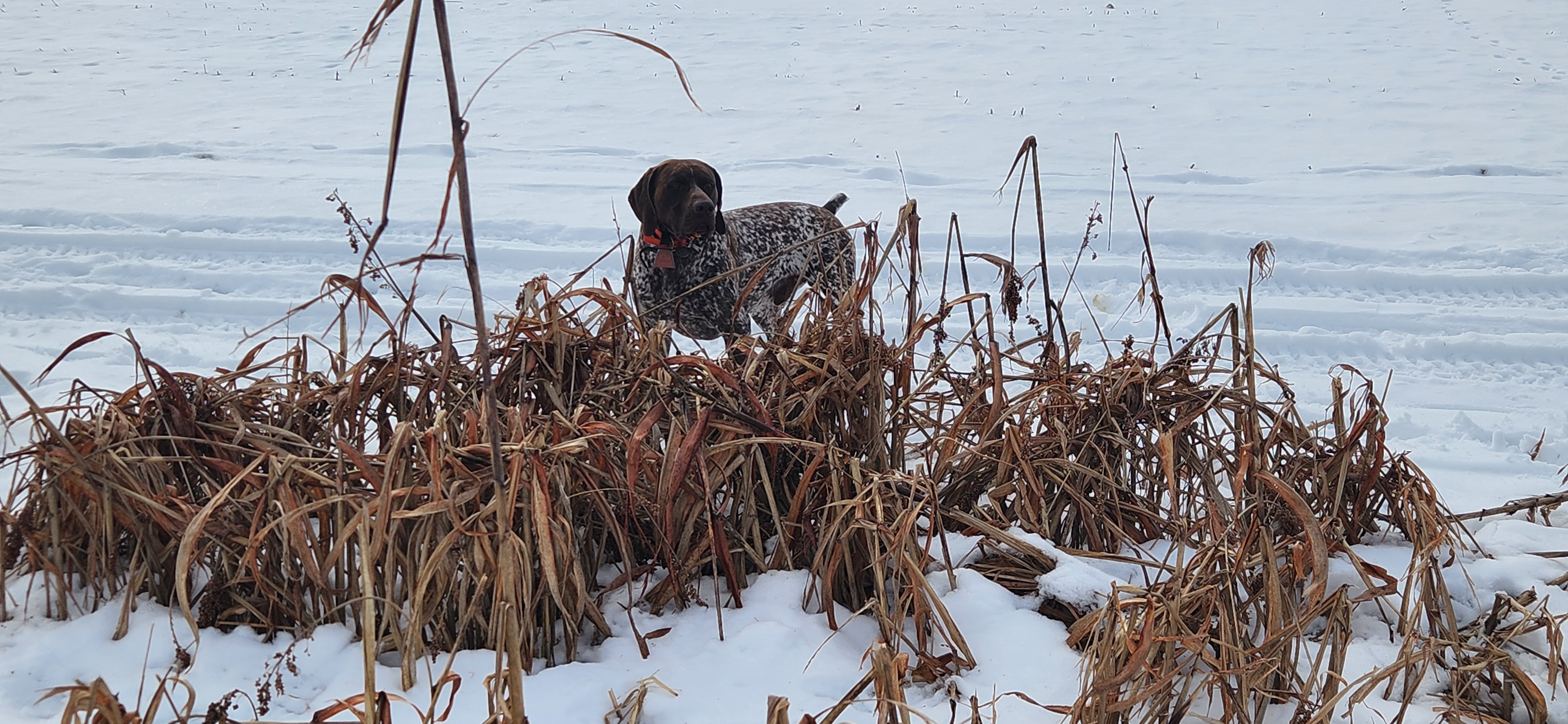
Given the fact that we may not see another snow event in awhile, I decided to take advantage of the remaining snow cover in Pemberton, NJ today. I had a phenomenal day hunting Partridge and Pheasant with my four-legged hunting buddy and best pal. Lots of great memories made in a wintry setting and some of my favorite table fare outside of seafood. It's an amazing thing being able to enjoy a snowfall for several days after an event.
Also, does anybody know why my notifications are constantly filled with "reactions," that are of a hot dog? I assume this is the weenie thing? Someone either doesn't like me much or is hitting on me? Strange stuff.


sometimes i'll see pheasant or partridge when birding before a hawk wipes them out because they're farm raised and have no survival instinct and hang out in the open
-
2
-
-
even i thought february would be good. that idea is falling apart
-
1
-
-
4 minutes ago, Torch Tiger said:
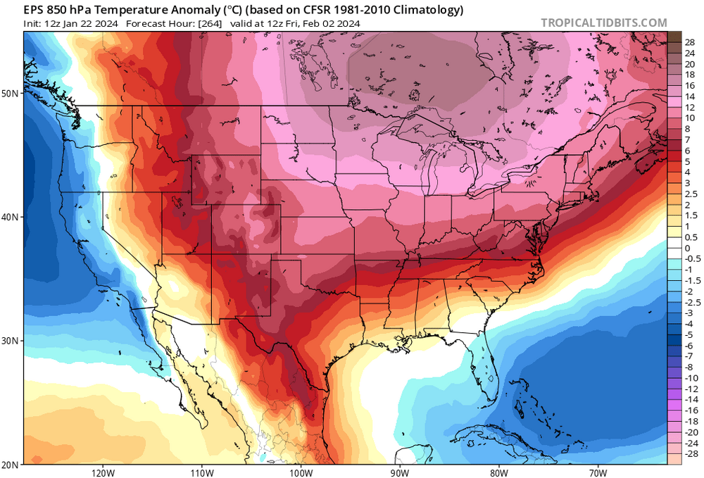
thats a torch relative to normal lol
when the anomalies get too high just forget about the concept of average

-
1
-
1
-
-
7 minutes ago, mahk_webstah said:
It’s gonna get warmer for a few days pumpkin. Especially down by you.
the highest anomalies are north of me tho
-
1
-
-
lol
-
4
-
 1
1
-
-
winter ends next week
-
2
-
1
-
3
-
-
remember when everyone wished for this nino to be atypical like that would be a good thing
-
 1
1
-
2
-
-
what is this next el nino step up going to do to our climate?
-
1
-
-
the 80s didn't have a huge area of near 90 degree water in the driver's seat

-
5
-
 1
1
-
1
-
-
well this raises my eyebrows

-
10
-
2
-
2
-
-
4 hours ago, North and West said:

.no
-
2
-
-
34 minutes ago, Stormlover74 said:
I can ask for the nam to stop giving me sleet
the euro is pretty locked. enjoy your 2-3
-
3
-
2
-
-
3 minutes ago, bluewave said:
We have much higher forecast skill with cutters beyond 3-5 days like the two we just had. Since NYC will usually get mostly rain whether the low cuts 50 miles or 500 miles to the west. But a storm tracking within 50 miles east to 500 miles east of NYC will have a much different outcome. Anything from mixing, perfect benchmark snowstorm track, or complete suppression. I would love it if all the global and meso modeling centers kept specific model skill scores for East Coast storm tracks. Unfortunately, these hemispheric skill scores don’t always tell the story about how good the model is doing on East Coast storm tracks. We have seen periods when the CMC nailed a snowstorm forecast beyond 5 days like 1-31-21. Other times when the UKMET did great like the follow up storm after the January the 2016 blizzard. Then we have the Euro which was too far west with the January 2015 blizzard. And too suppressed with the 2016 blizzard. The Euro did a amazing with NEMO. Often times we have to wait until we get to within the NAM and RGEMs range to figure out the exact track and rain-snow line for NYC.
people also got spoiled by 2010 when we had extreme blocking and an stj dominated pattern which helped the models nail everything a week out
-
1
-
-
1 hour ago, BxEngine said:
So, the same as what you do in summer when you root for heat?
heat you can go out and experience. snow you can just look at
-
1
-
4
-
-
wow an inch of snow in january that's incredible i might look out the window once or twice
-
3
-
2
-
-
2 hours ago, Rjay said:
Feet are always the worst. Giants/Green Bay playoff game in GB , Jets/Steelers snowstorm changing to 33 and rain game and Islanders/Rangers at Yankee Stadium were the 3 most uncomfortably cold experiences of my life.
you're too smart to be into sports
-
1
-
4
-
-
this is the kind of wave that can easily ramp up at the last minute so i wouldn't want to see any good hits right now imo
-
9
-
-
radar looks pretty good for 2+ for the whole region
-
1
-
-
the king screamer
-
-


January 2024
in New York City Metro
Posted
because they have a sea breeze right now lol. iad set a monthly record of 76