

scope1
-
Posts
126 -
Joined
-
Last visited
About scope1

-
Heavy rain
-
It's time to grade Winter 2025-26(now that it's actually over)
scope1 replied to CAPE's topic in Mid Atlantic
B+ especially when compared to the past several years. If the snowcrete storm had stayed more snow instead of sleet it would’ve been better, since the daytime part was just sleet, didn’t have a good view of the snow part since it fell mostly before dawn. -
Distant smoky wildfire smell out here today. Edit: just saw there are wildfires down in NC
-
Bright lightning and thunder
-
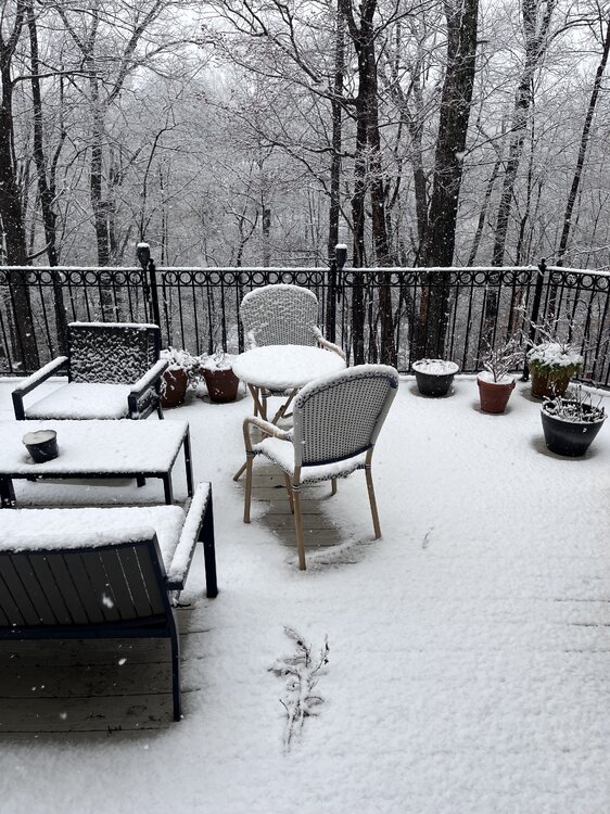
deck pic
- 680 replies
-
- 10
-

-
sleet changing to mostly snow
-
Sleet mixing in now
-
52 and rain
-
Miss for the most part in northern McLean. Some rumbles of thunder and a quick shower. No heavy rain or high winds either.
-
Outta gas and Outta Time: Early March Winter Storm finale
scope1 replied to Ji's topic in Mid Atlantic
best rates of the day -
Outta gas and Outta Time: Early March Winter Storm finale
scope1 replied to Ji's topic in Mid Atlantic
Coming down good in northern McLean. Cartopper achieved. Just got back from a short drive from Tyson’s and there was not a flake In sight there. -
Outta gas and Outta Time: Early March Winter Storm finale
scope1 replied to Ji's topic in Mid Atlantic
The cutoff is wild with this one. 1-2 miles south or north you can go from mdt-hvy snow to just cloudy skies -
Outta gas and Outta Time: Early March Winter Storm finale
scope1 replied to Ji's topic in Mid Atlantic
Light flurries just started -
Outta gas and Outta Time: Early March Winter Storm finale
scope1 replied to Ji's topic in Mid Atlantic
06Z GFS looks better
-
Eyeballing around 3.5" inches here, still light snow falling.


