

ouamber
-
Posts
663 -
Joined
-
Last visited
Content Type
Profiles
Blogs
Forums
American Weather
Media Demo
Store
Gallery
Everything posted by ouamber
-
MO/KS/AR/OK 2019-2020 Winter Wonderland Discussion
ouamber replied to JoMo's topic in Central/Western States
This is my last hope for this year...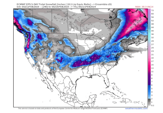
-
MO/KS/AR/OK 2019-2020 Winter Wonderland Discussion
ouamber replied to JoMo's topic in Central/Western States
*sitting here enjoying my mood flakes! This pretty much sums up the "Winter" of 2018-2019 for me! -
MO/KS/AR/OK 2019-2020 Winter Wonderland Discussion
ouamber replied to JoMo's topic in Central/Western States
ugh...boooooooo!!!! Can the Euro ever be wrong? -
MO/KS/AR/OK 2019-2020 Winter Wonderland Discussion
ouamber replied to JoMo's topic in Central/Western States
....and how much of that is actual snow? Cause...if that's ice.... -
MO/KS/AR/OK 2019-2020 Winter Wonderland Discussion
ouamber replied to JoMo's topic in Central/Western States
Sooooo....we just gonna act like we didn't see that FV3-GFS run?? k...cool! -
MO/KS/AR/OK 2019-2020 Winter Wonderland Discussion
ouamber replied to JoMo's topic in Central/Western States
It's snowing in Tulsa!! Oh how I wish we could get a long event like this! It makes me so happy! -
MO/KS/AR/OK 2019-2020 Winter Wonderland Discussion
ouamber replied to JoMo's topic in Central/Western States
Well, yikes at the current pattern. Looks like glancing blows at storms out of the NW. When we had precip, it wasn't cold enough. Now we have cold, and can't buy a decent storm. I'm not ready to call it yet, but wow..the torch is coming in February. -
MO/KS/AR/OK 2019-2020 Winter Wonderland Discussion
ouamber replied to JoMo's topic in Central/Western States
I'm so jealous! I've only had 2 dustings this year! You are on a roll! LOL -
MO/KS/AR/OK 2019-2020 Winter Wonderland Discussion
ouamber replied to JoMo's topic in Central/Western States
lol I see white dusting on rooftops and a few patches on grass! Zzzzzzzzz maybe Tulsa can get a WSW before we hit 1500 days! Not holding my breathe! This is by far the worst stretch of non-winter! Sorry to be a Debbie downer... -
MO/KS/AR/OK 2019-2020 Winter Wonderland Discussion
ouamber replied to JoMo's topic in Central/Western States
Aaaannnddd 18zGFS is taking a north jog too. I've never seen a more unlucky pattern for Tulsa and NE OK in my life! Storms go west, north, south, east..... unbelievable! -
MO/KS/AR/OK 2019-2020 Winter Wonderland Discussion
ouamber replied to JoMo's topic in Central/Western States
AFD TUL Attention then turns to the wintry weather potential on Saturday. Model solutions change the track of the upper storm system with each run. One of the extended models brings the upper low well south of its previous track, while another model brings the upper low over Tulsa. This solution would keep the heaviest snow within the deformation band north of Tulsa. For now, we have high confidence that temperatures will be warm enough for all rain Friday night, with the cold air moving into northeast Oklahoma early Saturday morning. If the system is a bit slower, with more of a closed low, there could be a 2-4 hour period of moderate snow Saturday morning, across portions of northeast Oklahoma. There will likely be a transition zone of a rain/snow mix, or snow with sleet mixing in. By Saturday afternoon, it should be cold enough for all snow, but the forcing for ascent will also be departing the area, which will limit the time for accumulating snow given current forecast data. This airmass will be the coldest of the season, and combined with strong northwest winds of 20 to 30 miles per hour, wind chill values in the single digits are likely by Saturday night and Sunday morning. In areas where we get accumulating snow, the wind could cause blowing and drifting. Precipitation moves out quickly on Saturday night, but Sunday will be cold with highs in the 20s and 30s. Another chance for wintry precipitation arrives by Tuesday into Wednesday of next week, just beyond this forecast. -
MO/KS/AR/OK 2019-2020 Winter Wonderland Discussion
ouamber replied to JoMo's topic in Central/Western States
We lived in Tulsa and had to walk a mile to the Walgreens for milk and bread! I lived in an apartment complex and my car was buried for two weeks! Good times! I ate so much snow ice cream! -
MO/KS/AR/OK 2019-2020 Winter Wonderland Discussion
ouamber replied to JoMo's topic in Central/Western States
No worries! I think it's one of the newer ones on tropical tidbits, but I know nothing about it, lol. -
MO/KS/AR/OK 2019-2020 Winter Wonderland Discussion
ouamber replied to JoMo's topic in Central/Western States
ICON is a model, and Groundhog Day storm from 2011. -
MO/KS/AR/OK 2019-2020 Winter Wonderland Discussion
ouamber replied to JoMo's topic in Central/Western States
hmmmm..wondering how much the weekend storm can dig and how low is the HP above it going to be? 18Z ICON looks similar to the GHD storm of 2011. -
MO/KS/AR/OK 2019-2020 Winter Wonderland Discussion
ouamber replied to JoMo's topic in Central/Western States
Good luck to all you MO folks!! The excessive cold rain and days without a WSW here is Tulsa is over 1400 days now. It's an absolute joke! I see nothing on the horizon to get even remotely excited about. All this talk about "this will be the year to break the snow drought" LIES! (Yes, I'm pouting.... #SorryNotSorry #This"winter"sucks! -
MO/KS/AR/OK 2019-2020 Winter Wonderland Discussion
ouamber replied to JoMo's topic in Central/Western States
What a waste of all this water in January! Freezing rain blows! -
MO/KS/AR/OK 2019-2020 Winter Wonderland Discussion
ouamber replied to JoMo's topic in Central/Western States
Here is the video from the 21 car pile up in Tulsa! Absolutely insane!! That I-244/I-44 fork split is always dangerous...even when it's dry! -
MO/KS/AR/OK 2019-2020 Winter Wonderland Discussion
ouamber replied to JoMo's topic in Central/Western States
Just watched the news say the City of Tulsa officials commenting that they weren't prepared for the storm! They said they didn't even start sand and salting the roads till after 7:30pm! -
MO/KS/AR/OK 2019-2020 Winter Wonderland Discussion
ouamber replied to JoMo's topic in Central/Western States
Spitting Sleet/freezing Rain on the SW side of Tulsa in between Sapulpa and Jenks. -
MO/KS/AR/OK 2019-2020 Winter Wonderland Discussion
ouamber replied to JoMo's topic in Central/Western States
I'm on the SW side of Tulsa, right on the Creek County/Tulsa County line....hoping it travels further NE! Wishing we could all cash in on this! -
MO/KS/AR/OK 2019-2020 Winter Wonderland Discussion
ouamber replied to JoMo's topic in Central/Western States
It's gonna come down to when this system kicks out. If it comes later on Friday, the cold air has retreated. We almost need it to be faster...and come Wednesday into Thursday. -
MO/KS/AR/OK 2019-2020 Winter Wonderland Discussion
ouamber replied to JoMo's topic in Central/Western States
If only we were 10 degrees colder today..this storm could've been real interesting! Cold Rain Sucks! -
MO/KS/AR/OK 2019-2020 Winter Wonderland Discussion
ouamber replied to JoMo's topic in Central/Western States
I personally will not be giving an apology. It still sucks! -
MO/KS/AR/OK 2019-2020 Winter Wonderland Discussion
ouamber replied to JoMo's topic in Central/Western States
For Fallin to declare a state of emergency for this is just about the biggest bust for Oklahoma!

