BlizzardWx
-
Posts
429 -
Joined
-
Last visited
Content Type
Profiles
Blogs
Forums
American Weather
Media Demo
Store
Gallery
Everything posted by BlizzardWx
-
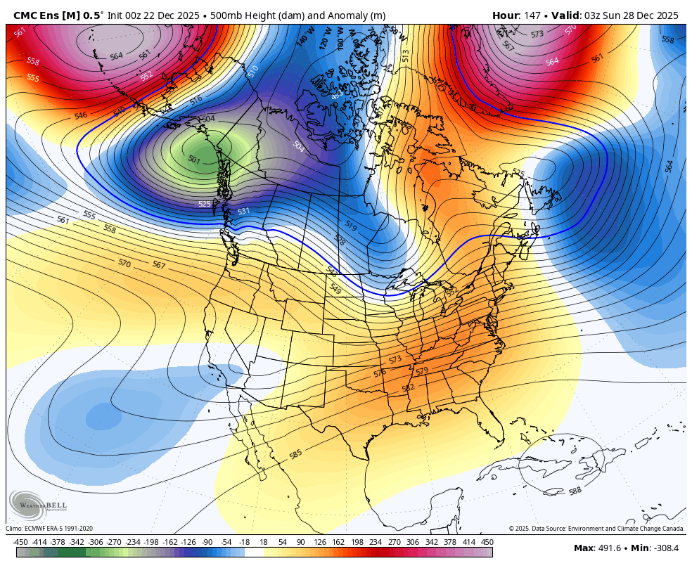
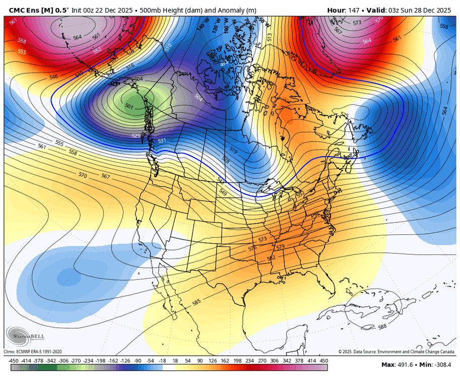
Definitely some large and important trends. On the first trough I think its the more SW -NAO high that helps the trough dig into the Plains more effectively. The forecast is trending colder quickly here for next next week. Moving towards +PNA near days 8-10 as well. If that west coast ridge can merge with the WPO high I bet a lot of cold air dumps south in a hurry. Obviously trends can reverse, but it looks more promising than I've seen in a while.
-
The warmth continues to look impressive here, with mid 70s to low 80s for several days before and after Christmas. Likely a few record highs and max mins. The overall pattern continues to look messy to me and out of phase, perhaps from multiple competing factors. That tends to make it hard to secure anything really great in terms of winter weather down south. So for now I see nothing positive, but obviously that could change in a few weeks.
-
I guess we will have to wait and see if this actually develops. The way I tend to look at this is that models even today cannot see pattern changes coming until they are within the medium range. It's fun to look at the weeklies, but there really is very little skill past 10-15 days. So maybe we do get a +PNA flip, maybe we don't, but I am confident that models don't know either
-
This would be a pretty major reversal from the current pattern. Definitely would get a more active storm track so theoretically higher snow chances for many.
-
I've been trying to think about what is "going wrong" with such a prolific -WPO to be talking about record warmth down my way. Do you know if a -WPO is typically good for the southern Plains? Is it perhaps atypical to have a -WPO paired with a -PNA or is that typical? I know when I look at the current pattern it seems reasonable to have a west coast trough downstream of that high but maybe sometimes ridging extends further southeast? Mostly just trying to build my understanding for this index.
-
Assuming no shallow cold air sneaks down my way (certainly possible) we are probably going to have a good shot of record heat on Christmas. It's a surprisingly low record at 73 F in Tulsa, very doable given the pattern.
-
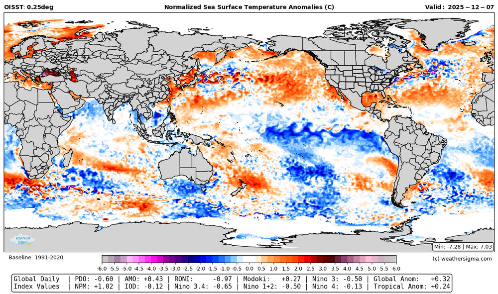
That's fair. I think the tri-monthly is around -0.9 eyeballing it.
-
Thanks for the comments. I do think we will get our turn down here in January or early February.
-
As of the 7th I had the RONI at -0.97.
-
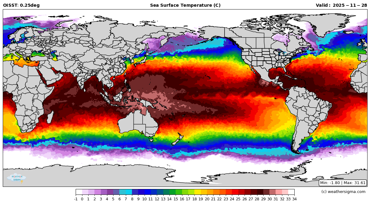
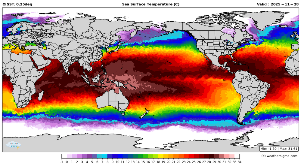
Per Roundy the warm pool near the MC continues to move east. One would think, especially if this continues, the default forcing may shift east as well.
-
Do you see any decent winter weather opportunities for the southern plains moving forward?
-
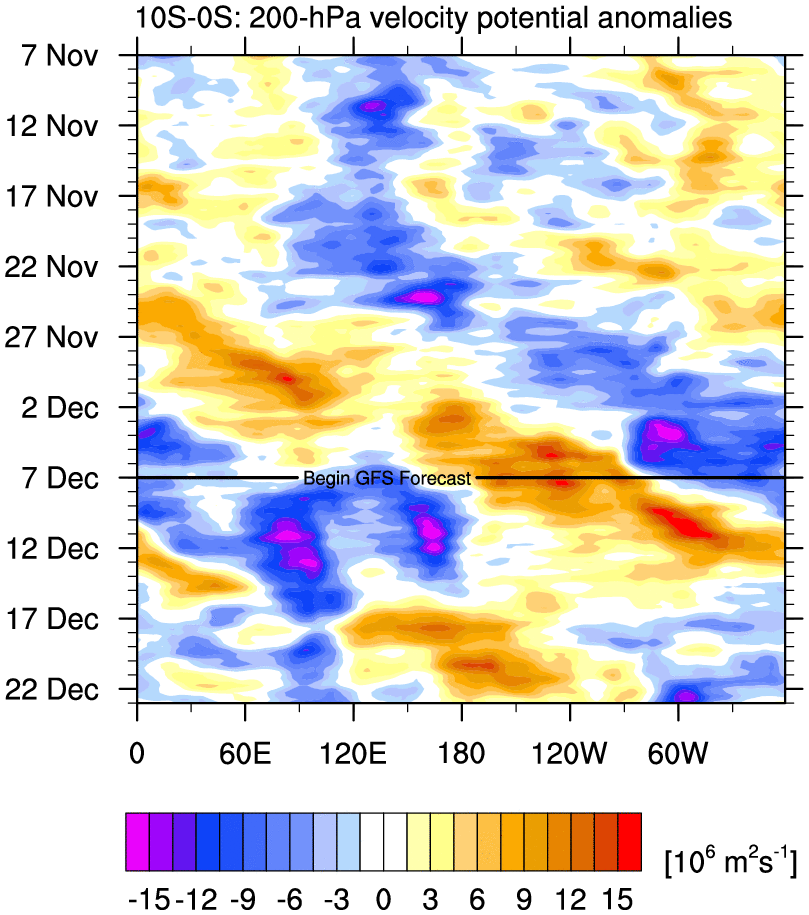
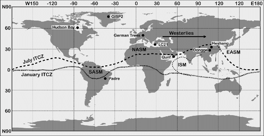
I was thinking some more about the question of where do you want to focus on for the VP. I assume the ITCZ location is the main driver of that, which obviously varies a lot and isn't always +/- 5 degrees. The map I posted earlier kind of shows this too with much of the stronger forcing south of the equator near the MC. I'm also thinking more about the idea of the raw VP vs anomalies. Since the water is always warmest near the MC isn't having a standing wave there in the raw the climatology we would always expect? Like doesn't that almost always exist? And anomalies might be more useful because they show the deviations from that standing wave? I don't know, just thinking a lot this morning If you use the equator to 10S band it looks MC focused the next week, then becoming more incoherent.

-
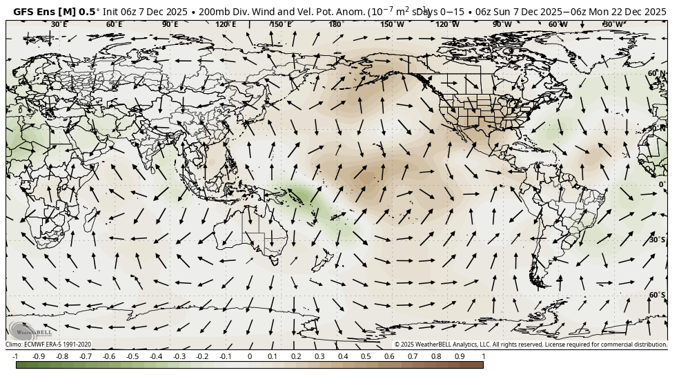
I see you used the +/- 5 latitude VP. I know some sites use a broader area like +/- 15 degrees and with anomalies. Do you find this selection to be the most relevant? I'm still wading my way into understanding the MJO better. I attached some GEFS plots for the current precip and VP anomalies. I think a good chunk of what might be more 7-8 forcing is below 5 S with the record warm temperatures off of Australia. But I definitely see the 4-6 forcing within the +/- 5 latitude band too.
-
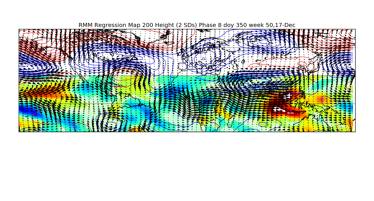
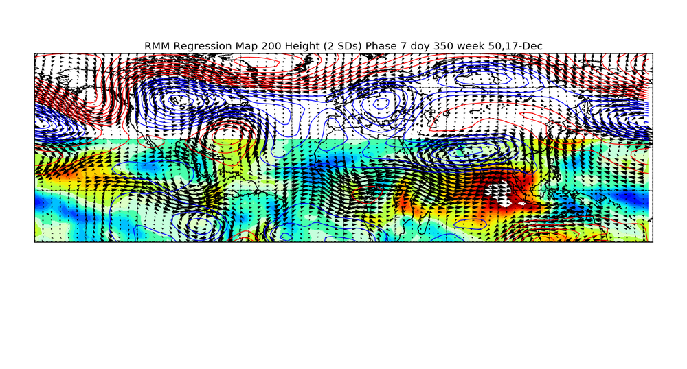
I know MJO 7 is supposed to become more favorable later in December compared to early in the month or November, but I am worried that the extended jet (relating to what you were mentioning in the west Pacific) will continue to keep things out of phase with expectations. I guess we will see.
-
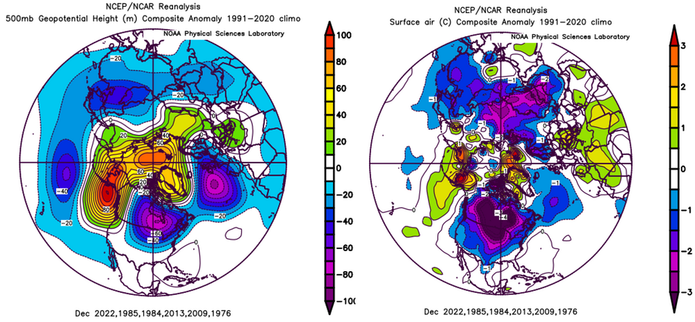
The pattern we have coming up does not have many historical matches comparing it to past Decembers. I'm not exactly sure how to generalize it, but to me it almost appears that the lower latitudes portion of the pattern (say 25-40 N) is shifted east of where you would expect it given the polar configuration. It's a strange to, for example, have robust ridging for 2/3 of the country downstream of the -WPO block like we see days 10-15 in current guidance. I think this may be related to the strong Pacific jet disrupting what would otherwise be a better pattern.
-
I can't disagree with you there. But if we could push the trough west a bit and allow for just a hint of offshore ridging (off the east coast) like the MJO map shows, it would slow the storm track down and give a better chance of snow for many. So impressively cold for some yes, but we have got to get some moisture with an improved storm track or it hardly matters.
-
Really makes you wonder if the extended range guidance is going to be doing some hard corrections in the next week or two. Clearly at least somewhat at odds with what the MJO would say for that time of year.

-
That is interesting for sure! In my area its the first part of the month that has been warmer with a flat temperature trend for the 2nd half of the month. This may be the coldest first half of December here in some time.
-
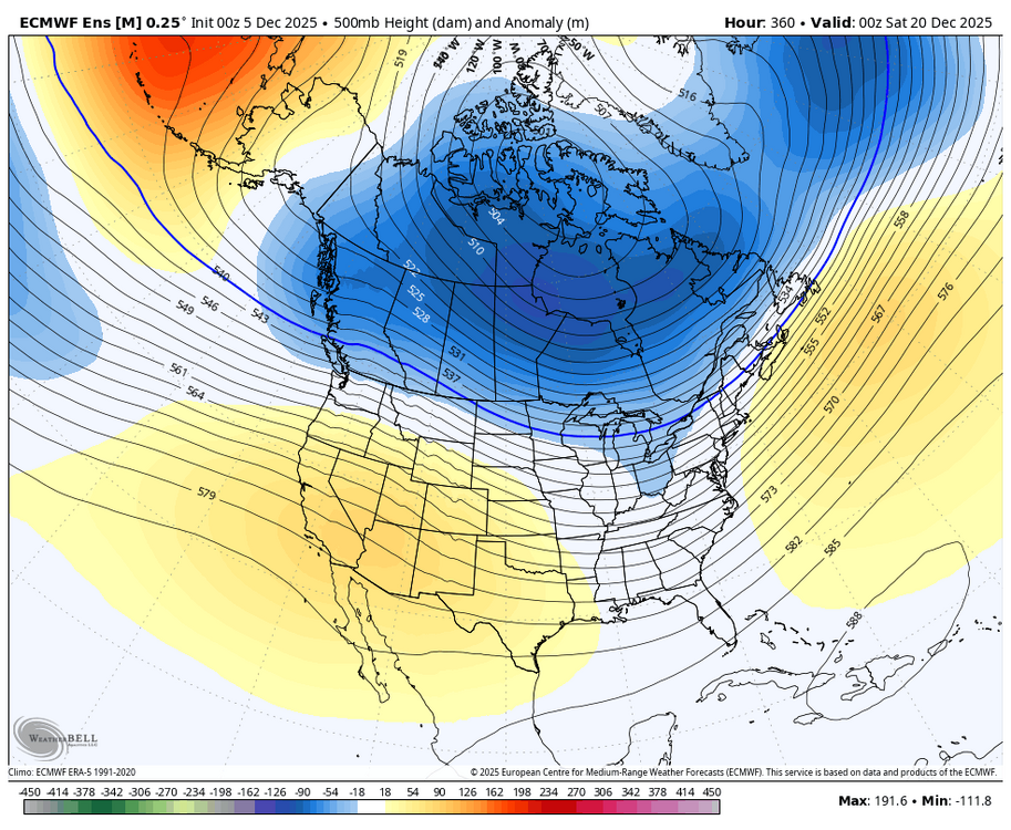
The pattern in place is becoming deeply entrenched with the widespread deep snow cover across Canada and the tendency for the PV (or at least a piece of it) to want to sit over Hudson Bay. For a variety of reasons I think the general pattern in place now will want to stick around in some form for a while. I know the EPS weeklies have been insistent on shifting things west late in the month but I have my doubts, and even then the cold doesn't really go south it's mostly just in Canada. I certainly wish we could change some aspect of the pattern because otherwise my area stays dry. For me I need some help from the subtropical jet or for the polar jet to pull in a cutoff low when it breaks south. In ninas, I climatologically do better in January and February anyway so I guess we will see.
-
Dry with lots of up and down cold my way with that pattern. I'd like to see even some rain at this point.
-
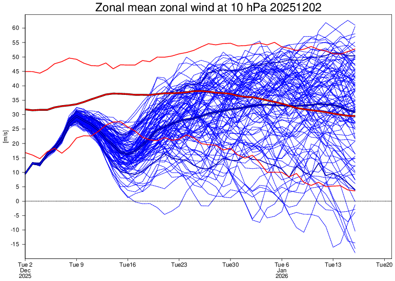
Increasing support for a temporary weakening of the PV mid month. At least enough to keep it from being too strong for now but its still going for near normal strength by January.
-
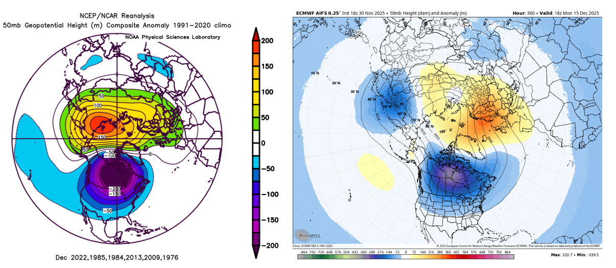
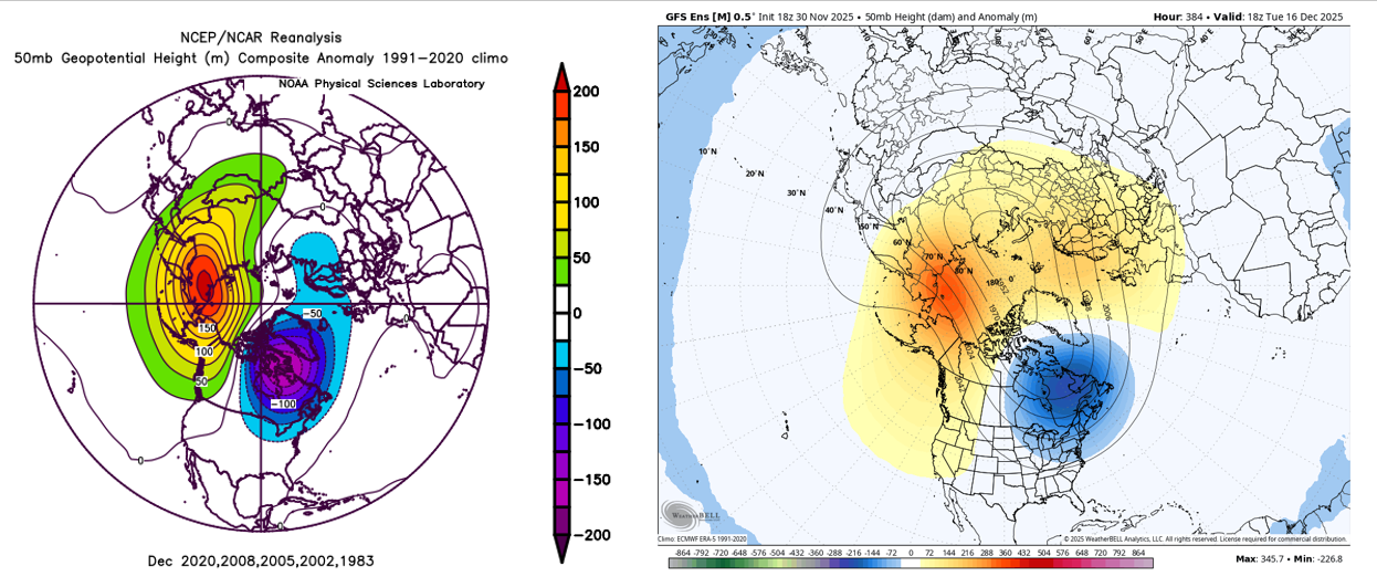
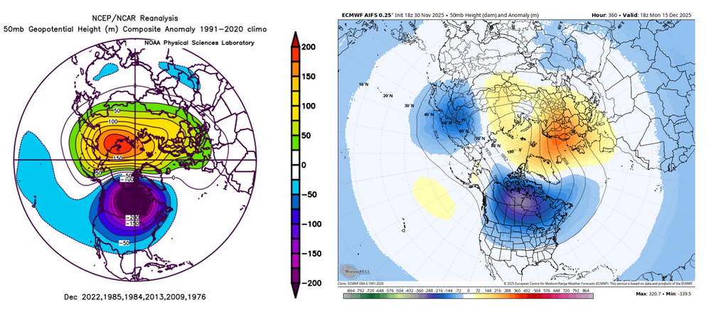
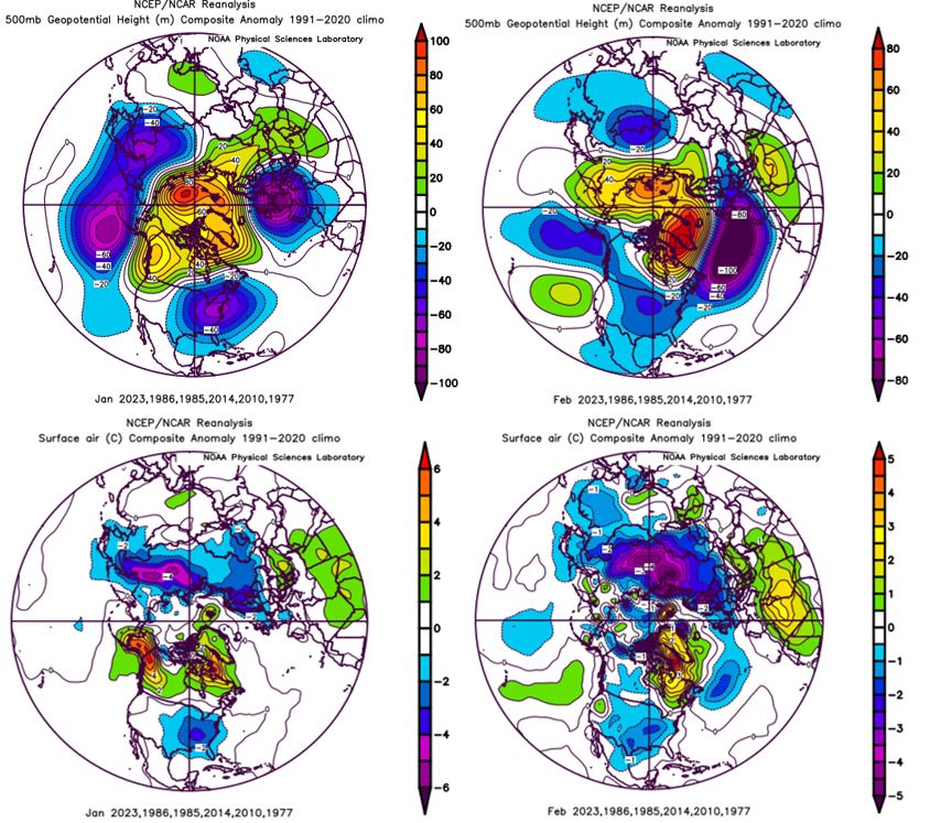
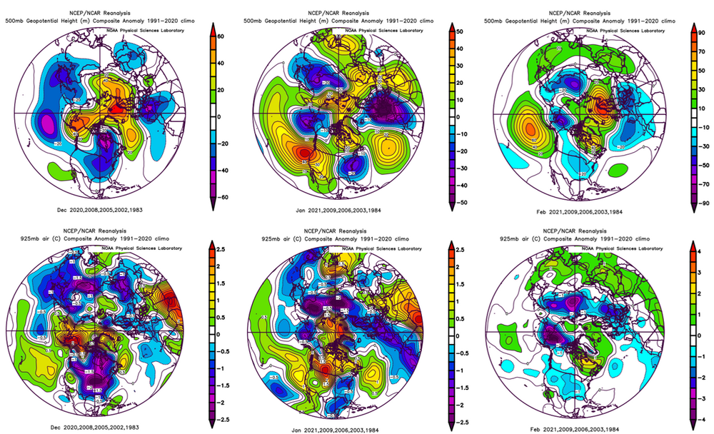
I don't know if others feel this way, but I get really sick of the PSL interface and just making one map at a time. So I made some code that you can put into google colab. It allows you to set up your parameters via function arguments and you can select a range of years and get individual plots for all those years. It lets you do composite plots too but what I really had in mind was if you wanted to say, look at 50 hPa heights for December for the last 50 years. You can do it quickly. It will just get you 50 maps in like 45 seconds. It's just for Anomaly plots. I can't guarantee it won't break. But it seemed to work for what I tested. Anyway, I know a lot of you make these plots so maybe this helps somebody. There are some commented out examples at the bottom. psl_code.txt With that said, the reason why I made that is I wanted to look at the polar vortex position in relation to the winter. I see two current paths in model guidance. The AIFS camp that wants to keep the PV over Canada and the GEFS camp that moves it further east. Here are some matches I found. With that said, the group I grabbed for 50 hPa look colder than current guidance for mid month. So maybe my composite wasn't so great or maybe it'll trend colder at some point. Not sure. Looking ahead, the central Canada centered PV case rolls forward to a cold eastern half of the country in Jan-Feb. Not surprising given the analog years I found. It's similar in the PV-east case, but January is warmer. Maybe this is all garbage. But the thing that has caught my attention is the PV being displaced south over Canada. It just makes the cold more available and its probably why so many of the similar PV years were cold. I am not sure I buy it being as cold as these show to be honest and maybe by late December it'll be different enough that this analysis didn't mean anything. Time will tell of course.

-
SST changes are pushing the warm pool east. This may help to favor MJO waves pushing into our more favorable phases through the winter, at least to some degree.
-
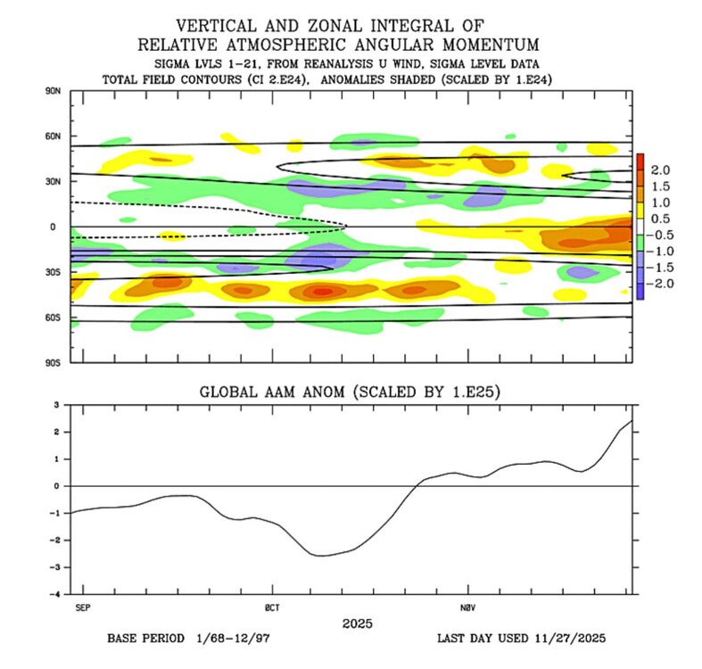
Pretty strong momentum build up in the tropics ongoing with the MJO wave. I saw Webb saying that he thinks this will help keep the -PNA at bay for a while longer.
-
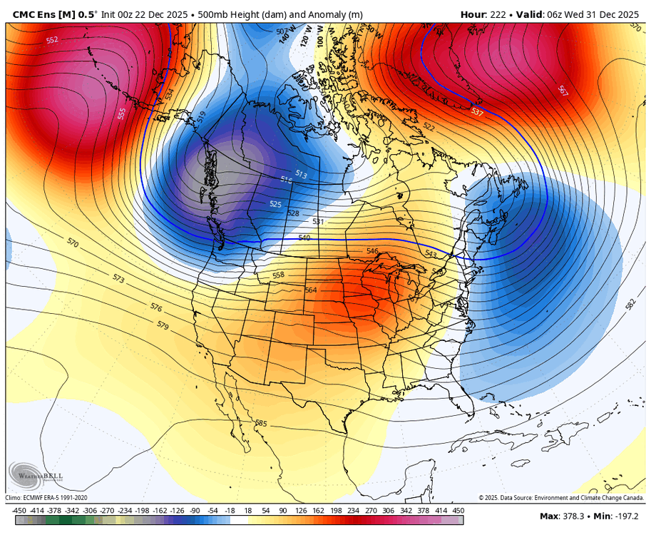
And the guidance seems to want to put the restrengthening vortex over Canada for much of the next few weeks so we keep the cold close even with it strengthening. People need to realize how some of our best cold can happen this way.