

Damage In Tolland
-
Posts
115,426 -
Joined
Content Type
Profiles
Blogs
Forums
American Weather
Media Demo
Store
Gallery
Posts posted by Damage In Tolland
-
-
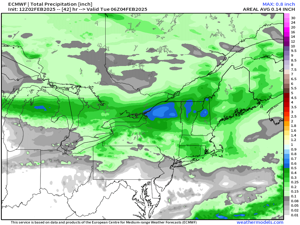
18z Euro somewhat colder for Wed Nite event. Stays snow longer before mixing
-
 1
1
-
 1
1
-
-
These are the tiniest most weenie flakes that you have to be outside to see
-
Flurries flying here. Overperformer?
-
1
-
1
-
 3
3
-
 1
1
-
-
1 hour ago, Ginx snewx said:
It's looking dick as in a great jerk

Can you explain exactly what you mean by that ?
-
 1
1
-
1
-
-
1 minute ago, CoastalWx said:
Nam juicy
Like dis?
-
1
-
-
Looks good to stay mainly frozen away from coast
-
2
-
-
Hrrr has Shat bed all winter on temps and snow
-
15 minutes ago, ORH_wxman said:
Euro looks like it had a little jackpot near Kevin…maybe just east
These SW flow events sometimes upslope here
-
3-5 here
-
3
-
-
Why the piss and vinegar Tippy?
-
Would be a bonus to score 3-6 if we can pull it
-
1
-
-
Just now, CoastalWx said:
GFS inching north
So is this
 up your fanny
-
4
-
-
Just now, CoastalWx said:
This one is for CNE.
Euro is alone
-
Nice 2-4” event. Looking forward to it

-
1
-
1
-
-
1 minute ago, CoastalWx said:
Dews low 40s too.
If we go the progged 38/37.. some damage will be done
-
1 minute ago, CoastalWx said:
Hrrr which has been good has 40s. Just accept it. No big deal losing a 2” event.
With 2-4” new and a cloudy day of 38.. all won’t go unless dews come up that high overnight
-
6 minutes ago, CoastalWx said:
Mid 40s even for you. It’s gone.
Lol. Mid 40’s
-
South and East areas near 95 may go above 32
-
17 minutes ago, CoastalWx said:
Looks warm
Doesn’t hit 40. But perhaps dews come up
-
52 minutes ago, Sey-Mour Snow said:
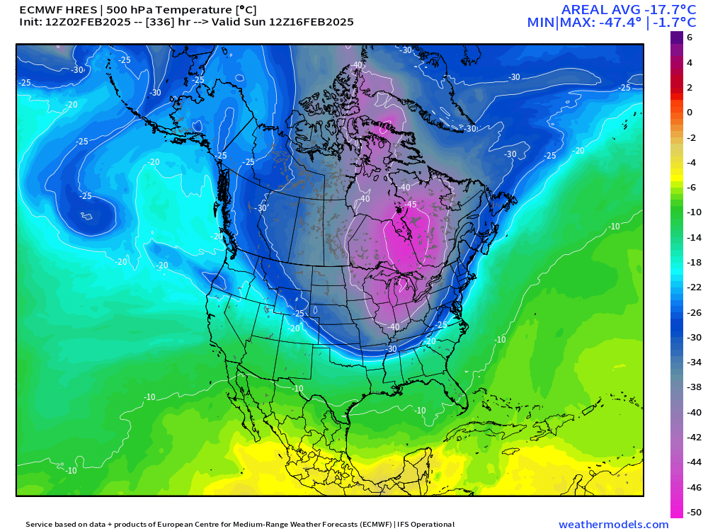
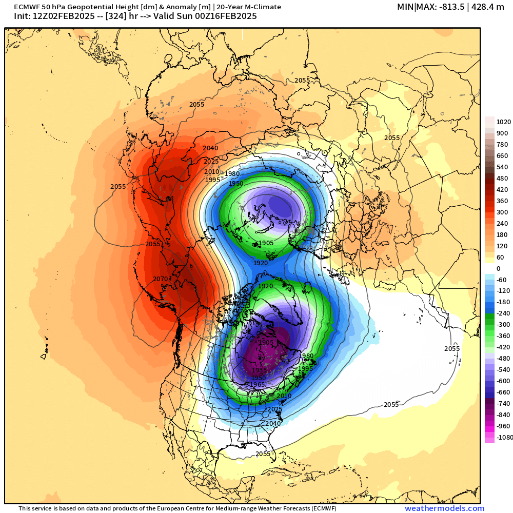
00z gfs and 00z eps wow.. what’s crazy about this pattern is we have a mean snowfall distribution with the 3 overrunning events on and before superbowl of 15-20” through the region on EPS then the pattern goes nuts for Valentines and beyond.. could be some extreme snow for some. Hopefully many.
If roofs don’t collapse, it ain’t happen
-
-
Monday looks to stay cloudy and in the 30’s now, so we won’t melt it all away
-
1
-
-
14 minutes ago, ORH_wxman said:
18z euro did cool a bit for midweek…still warmer than GFS but more sleet and ice on the front end (after pretty brief snow in SNE)…18z EPS does have some snowier members in there too so while my bet is GFS is too cold, we may see the OP euro cool at least a bit in the future.
Maybe this is the icer
-
Lot of rain on that run
-
1
-
Tracking February 6. Light to moderate event potential
in New England
Posted
You can kind of envision what may happen. 1-3 to start then few hours of sleet to zr inland and probably rot at 32 ish and places SE of a HVN to IJD to PVD line warm up above to plain rain for a bit . Being such a weak system that triple points with solid pack on ground from tonight and first part of that storm doesn’t scream warmth getting very far NW. GFS too cold probably