
bearman
-
Posts
512 -
Joined
-
Last visited
Content Type
Profiles
Blogs
Forums
American Weather
Media Demo
Store
Gallery
Posts posted by bearman
-
-
The ground is starting to turn white in the Knoxville Ceader Bluff area.
-
 3
3
-
 1
1
-
-
All snow in Knoxville Cedar Bluff area big flakes coming down.
-
1
-
-
I noticed mixed radar returns were already showing up on MRX radar, using Radarscope, near Gainesboro. Is this not very early compared to predictions.
-
2
-
-
It is already late for some locations. We are very close to an inch in west Knox but only on grassy and elevated surfaces.
-
1
-
-
Coming down good in West Knoxville around the Cedar Bluff area. Ground is white about half inch on roofs.
-
2
-
-
27 minutes ago, AMZ8990 said:
I’m anxious to see how the models do in northwestern ARkansas and southwestern MO, their under a winter wether advisory now. Once they start to get affected we can have a better idea how this system is tracking towards us, and if certain models were/are correct.
Snow is showing up already in extreme north western Arkansas and Thunder snow is being reported just along the Kanas and Arkansas border.
-
2
-
 1
1
-
-
T
3 minutes ago, ShawnEastTN said:I think the models are anticipating the cold air to advect faster than we normally see and catching up to the heavier precip before it's done not just the super light stuff that would normally just be sprinkles behind the front. What MRX is counting on is that the cold air doesn't advect fast which is typical climo for these.
Sent from my SM-G965U using Tapatalk
This is most likely the explanation. I remember back in the 80's a similar setup when I lived in Cleveland. MRX had us set to pick up their usual little or no accumulation. The Arctic front roared in around midnight with high winds and 50 mph gusts. The cold air caught up with the remaining moisture. Cleveland ended up with almost 4 inches of snow and Chattanooga got nothing. This is what makes it so hard to forecast snow totals around our area with so many micro climates.
-
3
-
-
IF what
6 minutes ago, PowellVolz said:I think everyone is having the same doubts because there’s nothing to account for the extra precip in the valley and mods don’t handle micro climate enhancement all that well. Unless the environment post front is really unstable, I’m having a hard time seeing more than the typical 1” max on the ridge tops in the valley.
.What you are saying is true if there is nothing to account for the extra precipitation in the Valley. I was hoping that someone with more knowledge could explain what the models were seeing for the central Valley but if their is no explanation then MRX is making a good call.
-
2 hours ago, John1122 said:
Kind of surprised, MRX went with a WWA for the Plateau, SWVA, and the mountains. I didn't think all those areas would land one and am surprised Knox to Tri didn't if the other areas were getting one.
They seem to be living off history on this one. Most of the time that is a good move but every once and a while different happens.
-
1
-
-
Looks like it should be snowing out in West TN. Let us know what is happening and send us some Pictures.
-
1
-
-
1 minute ago, BlunderStorm said:
Hey, good news the snow panned out. Snow flakes the size of small cotton balls are falling without any mix. Accumulation is starting to occur.
Send pics.
-
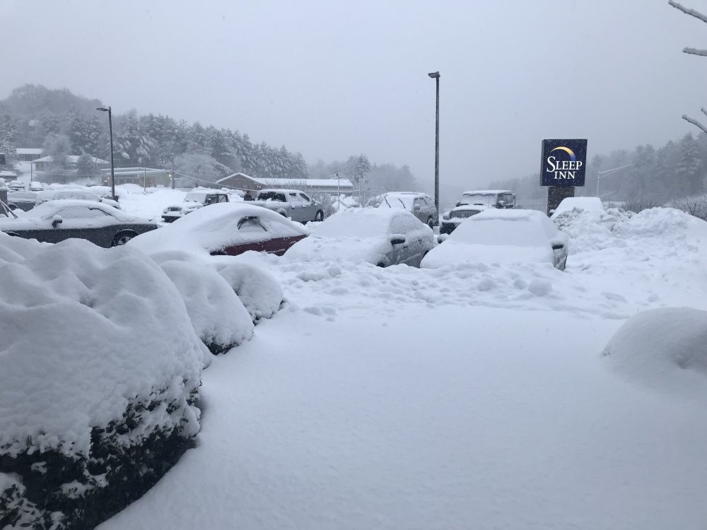
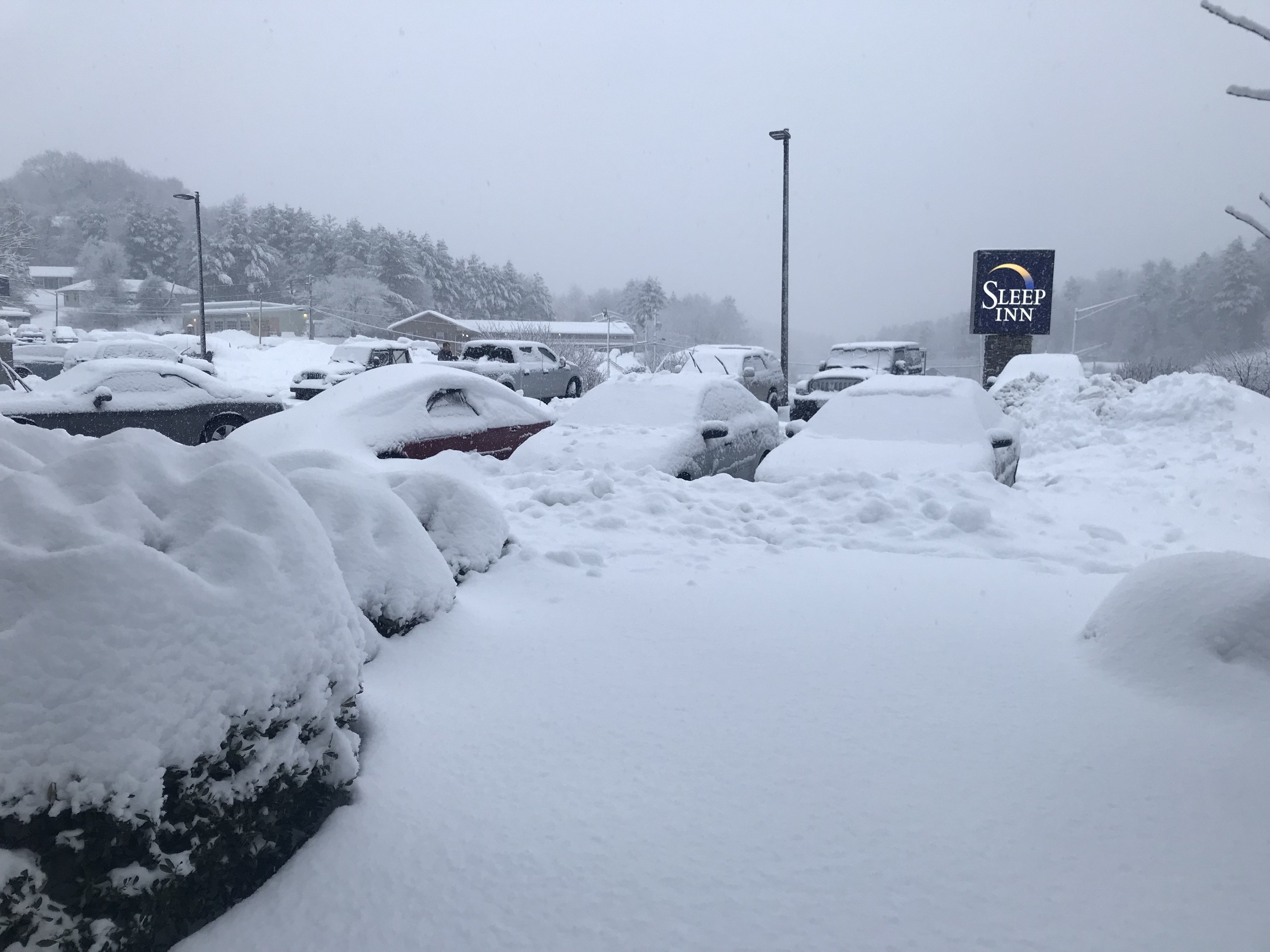
This is a picture out our window at the Hotel in Boone. The total is near 2 feet. It is still snowing moderately.
-
9
-
1
-
-
Hear is a pic of the storm in Boone from about 3 hours ago. It has put down another Half a foot since then with the heaviest rates so far. It has been a crazy storm.

-
1
-
-
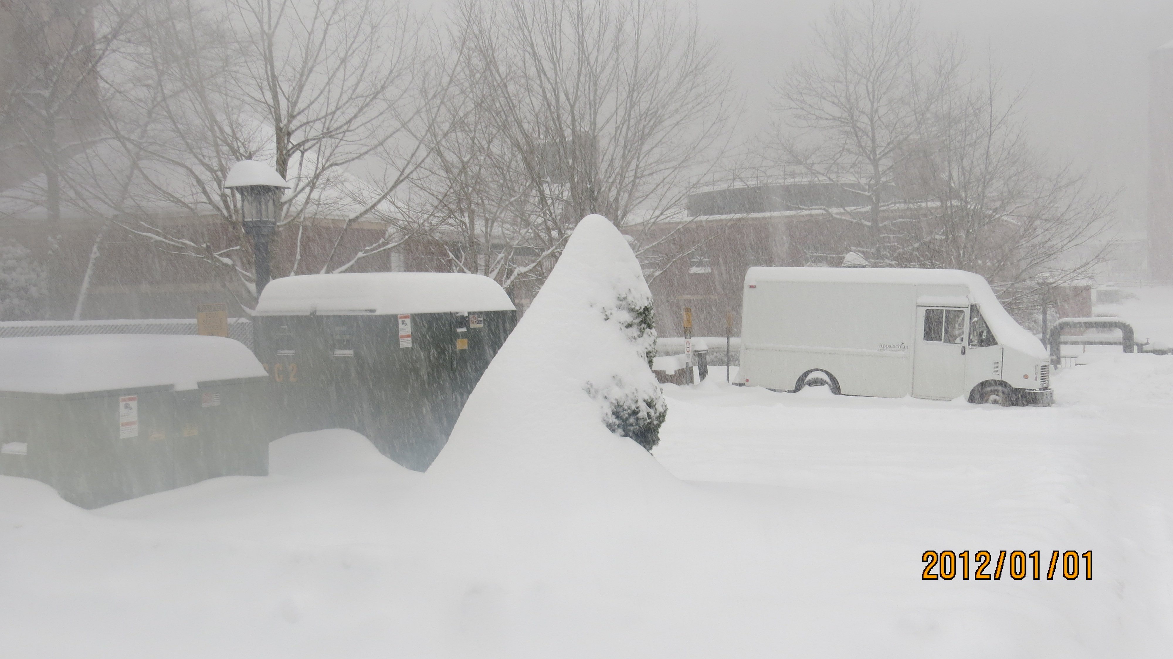
I noticed it had turned to all snow at Ober Gatlinburg Maybe knoxville can get in on the action. I am going out now to do a little walk up here in Boone. we have about a foot as of now and expecting about another 12 inches.
-
Just noticed MRX lowered snow totals for Knoxville area to less than one half inch. Hope they are wrong.
-
3 minutes ago, PowellVolz said:
Gonna be beautiful up there. Will need some pics.
.Will do.
-
3
-
-
Up in Boone this evening and it has just started. Going to be a crazy night up here. Sorry thought I was in the orbs thread.
-
2
-
-
49 minutes ago, Stovepipe said:
Lots of trees and limbs down in west Knox. Power has been out for about 7 hours now at my house. I'm wondering how this might affect voting today.
Just went down Cedar Bluff Rd Power was still out at businesses and there were several trees down across the roads in the adjacent subdivisions. Power is out all around the large Catholic Church and High School. Straight line winds must have been brutal. Our power came on about 30 Minutes ago. Yea!
-
4
-
-
It is rocking at snowshoe tonight. https://www.snowshoemtn.com/the-mountain/mountain-report/#/all-trails
-
2
-
-
https://obergatlinburg.com/webcam/ Ober Gatlinburg is just now starting to transition to snow.scroll down to second cam.
-
1
-
-
I have lived in West Knoxville all my 56 years and I would be very surprised if, even in the lower elevations, snow does not fall on and off late tonight and most a of tomorrow. Their should be some heavy bursts that whitens the ground at times. Hear is hoping for a surprise that brings us more, then bring on Spring!
-
1
-
12/10-11/19 Potential Valley Wide Snow Event.
in Tennessee Valley
Posted
That heavy band that is running up the plateau seems to be breaking up to the south if it gets into Knoxville it will be by the skin of our teeth. Right now we have had enough snow to whiten the roof tops that is it.